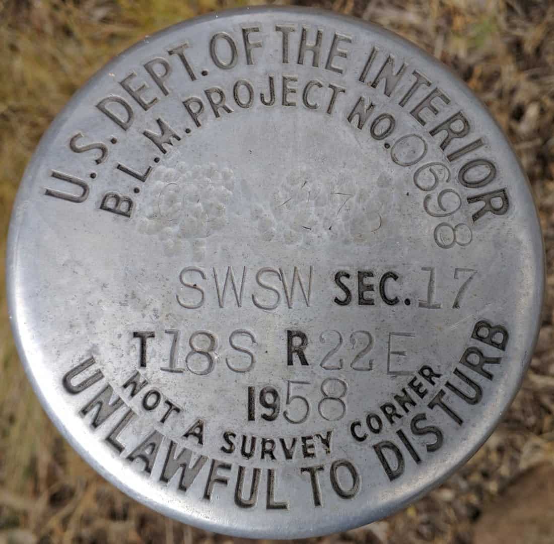
I'm glad we got that settled! I assume that it is customary practice in your state to set markers with the understanding that they "aren't survey corners"? Or was the real issue that the cap did NOT have a punchmark? I can see how that could go either way.
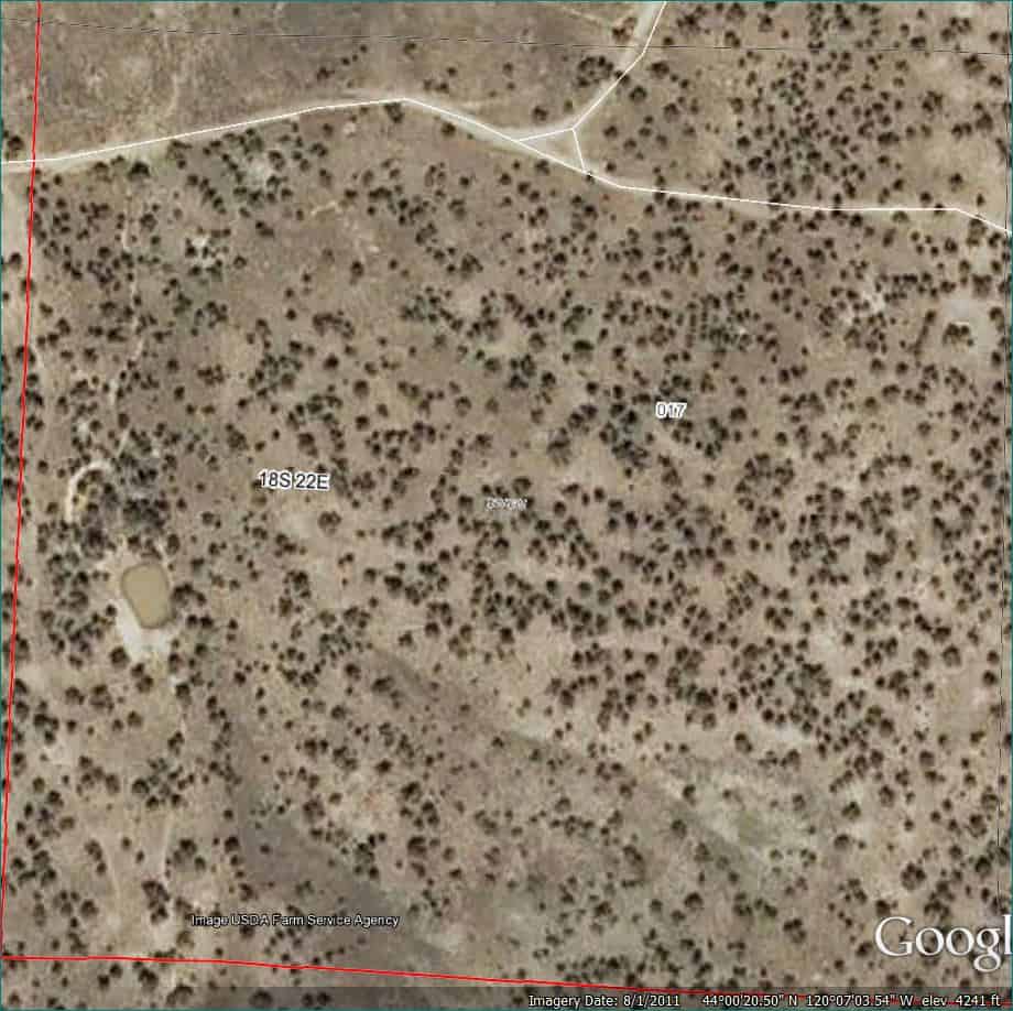
That's about as far from nowhere that you can get in Oregon. This location is a mile and a half from the Crooked River, more miles from the nearest road. One really has to wonder what was up with breaking up a section into 16ths.
I see these quite often, and it's amazing how often they are USED as "corners."
Loyal
Is this some sort of a traverse point that happens to be in that specific quarter-quarter?
It probably has to do with this little mud puddle pond. The friend that found this happens to have a brother who is a surveyor who worked for the BLM. He said these were set in conjunction with improvement projects, such as reservoirs and the like. I'm not sure if they are similar to USFS photo points you sometimes come across out in the woods (for taking periodic photos though the years of a timber stand... not aerial photo points). In the BLM historical index for 18S 22E there was a 2400+ acre 1955 Oil and Gas lease in multiple sections including 17 that was then terminated in 1959. No mention of project 698.
SW 1/4 SW 1/4
Holy Cow, post: 389778, member: 50 wrote: Is this some sort of a traverse point that happens to be in that specific quarter-quarter?
The ones that I have seen relate to BLM "range management," fencing projects, spring development, and other such Projects. They sometimes have a "project number" or other identifying data on them.
Loyal
I wonder why the obliterated figures. Possibly a monument number?
In 1968-1969 the Bureau of Reclamation was responsible for the construction of our local water supply reservoir, Lake Thunderbird (Lake Dirtybird to those of us that drink from it). Originally contract survey crews set bronze "Bureau of Reclamation" tablets at the section and quarter corners. In my memory they were similar to the photo, stamped B.O.R. with no mention of the BLM. A few years later the BOR monuments were replaced with BLM monuments and subsequent "Dependent Resurveys" were drafted, approved and made of record.
The story I remember was that the BOR actually didn't have 'authority' to perform the surveys so the BLM trotted back in there and made everything "official". Technicalities...always technicalities when dealing with the feds.
Kent McMillan, post: 389775, member: 3 wrote: I'm glad we got that settled! I assume that it is customary practice in your state to set markers with the understanding that they "aren't survey corners"? Or was the real issue that the cap did NOT have a punchmark? I can see how that could go either way.
I am sure the magic survey cookbook has an answer to that question.
Kent McMillan, post: 389775, member: 3 wrote: the cap did NOT have a punchmark
You beat me to the punch.
Looks more like about 100 punch marks. Pick one.
Have never seen anything like that. How many Surveyors would mistake this (whatever it is) for the SW cor of Sec 17?
They are trying to be SURE no one uses it as some type of corner monument, it isn't marked as anything so I can't see what it would be used for.
But, setting out a monument for control often gets it confused as a monument for a corner.
I know of two that were set with NOT A PROPERTY CORNER stamped on them that got used as a property corner anyway......
I personally set around 100 of those when I worked at the BLM in the 70's. Every time we installed a cattle guard, a reservoir, a range fence, a spring. Anything that had a specific project ID and was budgeted for got one.
Except for signs. They had another method of keeping track of those.
Since GPS control is generally scattered, I started to mark them using a similar system.
That would become CP 18-22-17-13.
Township, Range, Section and 1/4. I has allowed me to put GPS control in a file and know what 1/4 1/4 it's in.
MightyMoe, post: 389813, member: 700 wrote: They are trying to be SURE no one uses it as some type of corner monument, it isn't marked as anything so I can't see what it would be used for.
But, setting out a monument for control often gets it confused as a monument for a corner.
I know of two that were set with NOT A PROPERTY CORNER stamped on them that got used as a property corner anyway......
............ says right on it ..................
If you're not going to believe "NOT A PROPERTY CORNER", why would you believe it IS one? 🙂
wfwenzel, post: 390054, member: 7180 wrote: ............ says right on it ..................
If you're not going to believe "NOT A PROPERTY CORNER", why would you believe it IS one? 🙂
Because someone else came along and stamped "IT IS NOW" on it. That changes everything.
Mike Berry, post: 389774, member: 123 wrote: A friend sent me this photo
In the late '50's a big timber company built a lake in my neighborhood. They ran a contour around the lake and established benchmarks very near the section & 1/4 corners. Problem is they sold the lake off with no record of the original survey. They set 2" pipes with a cap and some of the section & 1/4 corners were also 2" pipes with no caps. Over time the caps have disappeared. Now it's a best guess which are BM's & which are boundary.
MightyMoe, post: 389837, member: 700 wrote: That would become CP 18-22-17-13.
How do you interpret the number code for quarter and q-q?


