
I am looking for ideas on how to get some tree heights across about 5 acres of land.?ÿ For those that are familiar, this is for a small airport obstruction survey.?ÿ I need tree location and heights on about 30 trees, and then "any others that are possible obstructions"?ÿ I have done these surveys for years, usually 1 or 2 a year, and I usually use 1 of 2 methods:?ÿ I will setup some distance away and shoot reflectorless either the top, or offset and angle to the tree-tops.?ÿ Or if the forest is sparse, I have located the tree bottom, and used an inclinometer.
Neither of these methods will work on this parcel, as there are some trees on a ridge that obscure many of the target trees behind them which are the same or nearly the same height.?ÿ The forest is all conifer, way too dense to get inside it and measure up, and I would have a hell of a time traversing to where I think the obstruction trees are.?ÿ On top of that the landowner is not jazzed about losing trees on their property, so cutting a bunch of traverse lines isn't desirable.
So, my current available tools are total station (robot) w long-range reflectorless, Static and RTK GPS.?ÿ I also have?ÿa DJI phantom 3 pro drone, however I have never used it to survey with, only pictures and hobby videos.?ÿ Not sure the available applications could help me with tree heights and location or not, and ground control (targets) could be an issue.
There is a small, overgrown 2-track that cuts through the property.?ÿ It is not really useful to get tree heights from, but I can use it for access.?ÿ Right now, the only thing I can think of to do is to get high enough near the parcel to see those tree-tops.?ÿ I was thinking about renting some construction scaffold, putting up a 20' high tower, taking an RTK shot on the top platform, set of the robot, backsight some distant powerpole, and shoot what I need to.?ÿ Stability will be a little bit of an issue, but I hope that it would be good enough to just keep the robot level to take shots.
So, am I crazy??ÿ Anyone else have a suggestion?

Depending on where this is, might the information already be available in a LIDAR database? Airborne LIDAR supposedly simultaneously discerns ground and canopy elevation, with fine spatial resolution. In some parts of the US, there's free online access to LIDAR data from Federal or state agencies.
Rent the geoslam and scan it and then fly it with the phantom. Marry up the two datasets with the same control and there you have it?ÿ ??ÿ
LiDAR the heck out of it and be done in 20 seconds. ?ÿGive me a buzz on the cell if you have any questions. I own several LiDAR systems and do this all the time. 405-923-0044
Depending on where this is, might the information already be available in a LIDAR database? Airborne LIDAR supposedly simultaneously discerns ground and canopy elevation, with fine spatial resolution. In some parts of the US, there's free online access to LIDAR data from Federal or state agencies.
We are outside metro areas so don't get alot of the cool stuff for around here.?ÿ I am pretty sure any available data is going to be too old.
?ÿ
I am going to discuss a LIDAR flight with the engineer, but I am guessing it isn't going to be in the budget for this small remote job.
Even LiDAR flown in town will not be dense enough to do what you're needing.?ÿ You need a dense point cloud in order to ascertain the tops and bottoms.?ÿ Shoot me a KML of the location and I'll get you a price.?ÿ We are flying a site in Mt. Pleasant Michigan in the next week or two....this would save you mob cost.?ÿ [email protected]

Tie a 100' tape to your belt loop, and climb those trees. Once the tree gets too small to climb, then measure with a disto, to the TOP leaf...
then, tell the guy on the ground the plus, while he reads the tape.
Write it on a cardboard sign, at the base of the tree. This will be the description for the tree, while you tie it with total station, and data collector.
🙂 (Grin)

Depending on where this is, might the information already be available in a LIDAR database? Airborne LIDAR supposedly simultaneously discerns ground and canopy elevation, with fine spatial resolution. In some parts of the US, there's free online access to LIDAR data from Federal or state agencies.
I sure hope the Feds aren't "LIDaring" tree canopy heights with my tax money!!
Does it have to be tree heights, or can it be just tree top elevations ?
?ÿ
"So, my current available tools are total station (robot) w long-range reflectorless, Static and RTK GPS.?ÿ I also have?ÿa DJI phantom 3 pro drone"
?ÿ
Small 360?ø reflector attached to the drone, let the robot track the prism while you maneuver the drone over the tree top .. ???ÿ
Could you set 2 points far away and observe angles from both points on the taller trees and run intersections.?ÿ

Cut the trees down. From there is should be easy to tape 'em off.
Seriously, LIDAR is the way to go here. Both states I'm currently practicing in have freely available resources of that sort online.?ÿ I expect that most states do. The only question will be how recent the data is.?ÿ And if it isn't freely available for the area in question, it can be obtained via your friendly neighborhood aerial mapping service.?ÿ As a matter of fact, given the purpose, it would be a good idea to go the latter route.?ÿ
I wonder. .......if there is a drone with a mapping grade gps built into it where you fly it to the tree and hover over the tallest branch and record an observation. Seems like that should be available.?ÿ
Even mapping grade should be plenty accurate for your needs.?ÿ
Given that for an obstruction survey you don't need tree "heights", just the canopy elevation then drone photography processed without any filtering should give something close to the upper leaf surface, probably around 1 foot below. Any of the regular software packages should give you this (and nobody is going to climb up and find out you have missed the odd leaf!).

I've done several hundred obstruction surveys to FAA standards. Both height and elevation were required on every one.

I've done several hundred obstruction surveys to FAA standards. Both height and elevation were required on every one.
What accuracy is required?
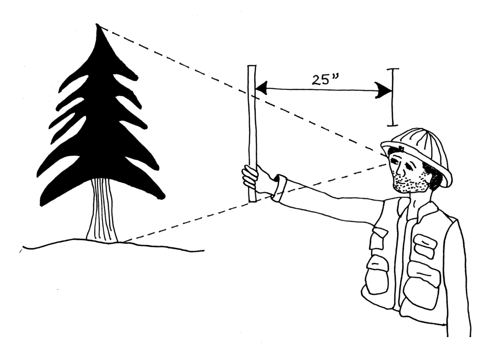
If accuracy isn't critical just use a simple Biltmore stick.
It turns out there is an App for that.
?ÿ
https://gabrielhemery.com/forest-mensuration-on-a-smartphone/

One of the suggestions referred to ??intersecting? the trees of interest. I suggest triangulation.
Move to an area where the tree/s are visible. Set up a baseline perpendicular to the area of interest and set two additional points either on the same line or offset (on the same line simplifies computation. The length of the baseline should be sufficient to insure the angle at the tree (computed) is at least three degrees. The longer the baseline the more robust the determination will be. ?ÿ
Determine the positionsof the baseline points with respect to the airport??s ?ÿPACS and SACS. Observe horizontal and vertical angles to the treetops from each base point with respect to the baseline.?ÿ
For each treetop you will have two triangles. Numbering them clockwise with the tree as point 1, you will have a common distance in both triangles.
baseline length (2 to 3)
Angle 1 - computed angle at treetop (180 - (sum of angle 2 and angle 3)
Angle 2 - angle from baseline to treetop at point 2
Angle 3 -angle from baseline to treetop at point 3
distance 1-3
distance 1-2
Solve by law of sines
As for the accuracy requirement, I saw this at the NGS site
?ÿ
?ÿ
I just learned of a cool device called a Relascope, it is very expensive but it would do the trick also. Maybe there is anot her manufacturer of these tools.