Put me out of my misery. All afternoon I've been trying to make sense out of a plat done for the State in 1971 and I cannot for the life of me get anything to close or add up. I have to leave first thing early in the morning to survey a route through this ... I've done some limited work in the area but none near here. It's a 4 hour drive to get up there and I'm beginning to get the feeling I'm just going to have to scale the bloody thing and pray I can find enough evidence on the ground I'll have something to hang my hat on, but right now I have that sinking feeling. I have to nail down Fox Drive, Lynx Drive and Reindeer Ave. Reindeer should be cake as it parallels the AK RR ROW which was survey in 1989 as USS 9051. I have one dimension off the section line to the ROW of Fox Drive.
Some days you're the windshield, some days you're the bug.
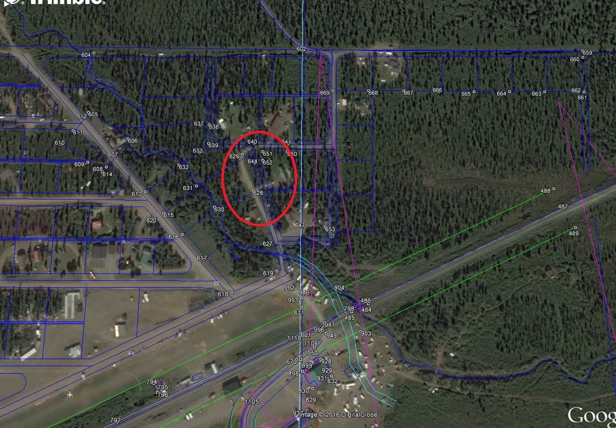
If anyone cares to have a look, here I it is.
GE coordinates N 63 23 32 W 148 57 05
O, its probably gonna just work itself out!
(My dad used to tell me that and it always left me stewing and unhappy!)
Williwaw, post: 382714, member: 7066 wrote: ... It's a 4 hour drive to get up there and I'm beginning to get the feeling I'm just going to have to scale the bloody thing and pray I can find enough evidence on the ground I'll have something to hang my hat on...
Actually sounds like a solid plan. Don't predispose yourself to misery. Get up there and do what you can by doing what you do.
And do it well. 😉
ps - take some pics for us!
paden cash, post: 382722, member: 20 wrote: Actually sounds like a solid plan. Don't predispose yourself to misery. Get up there and do what you can by doing what you do.
And do it well. 😉
ps - take some pics for us!
Roger that. Here is a preliminary picture taken from orbit combined with some line work. The circled area is what's giving me some heart burn. What gives me some cheer is the micro brewery 45 minutes up the road in Healy, AK. 49th. State Brewery makes some mighty fine IPAs and the food isn't bad either.
Fox Dr. is platted parallel to section line and 104.35' distant. Good luck.
Let's hope you can find some good monuments.
I pondered a while and came up with these comments. I see now that I don't address what you were looking at, but will go ahead and post.
An obvious mislabeling is Lot 7 on the west side of Fox Dr says 146.53, but should probably be 116.53. That makes it about right compared to the 110 on the south side of Beaver Ave. You probably caught that. SImilarly, Lot 1 on the west side of Fox Drive which should be 155+ and not 195+ to the PC.
Then both sides of Fox Drive add up ok. Watch out for that kind of mistake other places.
Being picky, it wouldn't be a hair off 155.65 because the curve is 89 52 and not 90 00, but that's trivia. In general, that small difference seems to have been ignored in the lengths of most of the lots which have a curve, which is a little sloppy of them. It's a little strange that Beaver Ave is labeled exactly perpendicular to Fox and Beaver Pl (I don't believe it), but yet some of the lines are due east and the curves calculate out as 90 08 and 89 52. The 8 minutes would make a difference in the lot lines that doesn't show up in the labeled lengths.
Lot 10 on the west side of Fox Dr. is indeed weird. It has two almost perpendicular sides of 208.71, which would be the sides of a square acre, but the trapezoidal lot is obviously somewhat larger than an acre. I suppose that's why it's noted as "Deeded 1 acre" to call attention to the discrepancy.
It would have been nice of them to give the distance between the creek and Fox Pl. It scales to about 66 ft, and calculates to be about 58.6 to make things add up to 1300.16.
One big loop that should add up in this neighborhood would run from the RR across Reindeer Ave. up the west side of Lynx Dr, across Beaver Ave, through those lots and back down the 1300.16 dimension. I don't see much other way to tie down the lots along Fox.
Another case of table survey? Or some lots trying to gain more land by moving frontage road a bit further out?
Closer to the area of your concern, Lynx Drive scales far from what is labeled at about N 14 or 15 degrees W, not N 23 21 W. However, the aerial view looks closer to 23.
And the line line between lots 11 and 12 is nearer S 75 W. It looks like it was intended to be perpendicular to the street, but the angles computes 80 00 not 90 degrees suggesting a calculation blunder.
The first step is obviously to draw the westerly line of Lynx Drive to that dot in the creek instead of having the center of the drive there and the straight line across lots 10 and 11. The distance across the northerly side of lot 10 scales to that dot. That's a little closer to where the aerial view has the road, and helps with the bearings, although Lynx is still far off the labeled bearing.
As much as I hate to say it, this plat is an argument for official checking of submitted drawings. Obvious mislabeled distances to PC points. Lines lacking dimensions and bearings. At best there is no redundancy in some areas and in others It leaves things to the imagination.
Bill93, post: 382933, member: 87 wrote: ...As much as I hate to say it, this plat is an argument for official checking of submitted drawings. Obvious mislabeled distances to PC points. Lines lacking dimensions and bearings. At best there is no redundancy in some areas and in others It leaves things to the imagination.
Sadly it is a good example of what a lot of us work with everyday. Submitting, checking and recording these things will probably help the next generation, but some of us here are stuck with what we are surrounded with today....
Williwaw, post: 382728, member: 7066 wrote: What gives me some cheer is the micro brewery 45 minutes up the road in Healy, AK...
That only seems close in AK.
All in all this has turned out to be a rather fun survey. Lynx is indeed built far off the platted ROW and that portion is giving me a fit how to deal with. All I can do is prepare a drawing showing where the existing road is in relation to the platted ROW. We've recovered a number of corners which fit the over all scheme but none are original but many have been in existence a considerable time. The very first thing I did yesterday was sit down with a couple of the old timers in the 'hood' and pump them for information, which indeed paid off in spades. I got first hand who to avoid and memories of where there might be evidence to recover.
Williwaw, post: 382996, member: 7066 wrote: .. The very first thing I did yesterday was sit down with a couple of the old timers in the 'hood' and pump them for information, which indeed paid off in spades. I got first hand who to avoid and memories of where there might be evidence to recover.
Doing what we do...;)
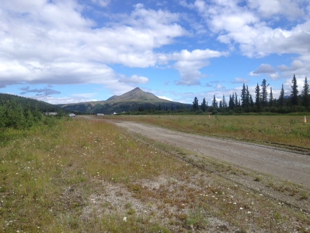
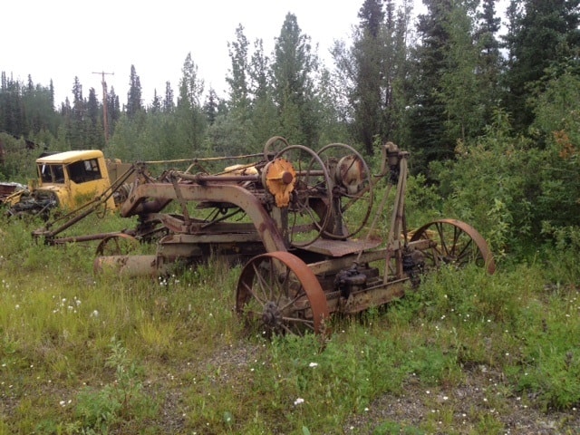
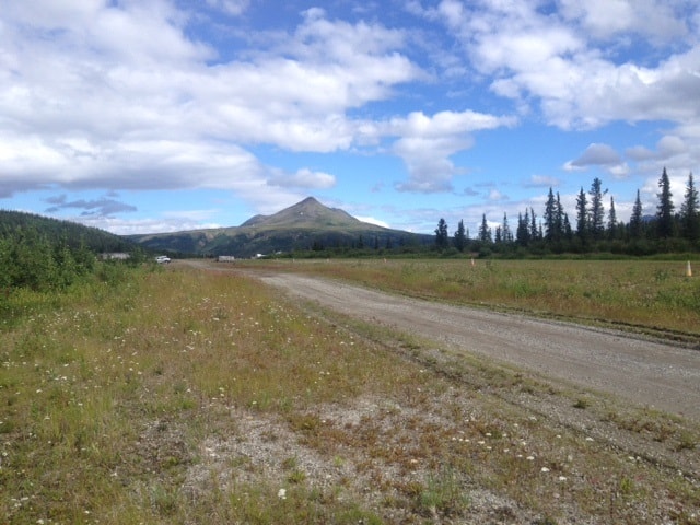
Few pics from the field from lovely Cantwell Alaska. Actually pics don't do justice to this area. Denali National Park is just up the highway, home to the tallest peak in North America, now officially called 'Denali', or 'The great one'.
Boy did I open a can of worms on this job, but that is altogether another story.
Williwaw, post: 383321, member: 7066 wrote: Few pics from the field. Denali National Park is about 40 minutes up the highway, home to tallest peak in North America.
Boy, did I open a can of worms on this job, but that's another story.
The plat of Cantwell Heights seems to have been prepared in somewhat of a hurry. There are some missing dimensions, which suggests that the surveyor either didn't have time to calculate them, or didn't make a thorough enough check to notice they were missing. Not that there's anything unusual about that in an older plat.
In 1971 the surveyor was probably working with a 4-function mechanical desktop calculator. Perhaps it was electrically powered, or perhaps it was operated with a crank (I remember both kinds). And he would have had a book of trig tables.
He could have set up a manual coordinate system, writing down all the northings and eastings as they were comped and punching them into the calculator again as needed. But it would have been a very tedious job, and it doesn't look as though he did that. And there was no way to do COGO in the modern sense.
Areas where the lots could be comped and checked by simple arithmetic are less likely to contain errors, and such errors as do exist can most likely be found by arithmetic. Areas where COGO would be used nowadays probably all contain large errors. I tried closing the stream meanders against Lots 1, 2, 14 and 15 in Block 6, and came out with a closure error of about 30 feet by 60.
Original field notes, if they could be found, would of course be a big help. Many of the existing monuments are probably wrong, though people may have accepted them.
This area seems too messed up and complicated for your clients to have to bear the entire cost of straightening it out. There are large errors affecting many parcels, particularly in Blocks 6 and 10 by the looks of it, and there will be legal issues growing out of those errors.
Could the DNR or another agency be persuaded to take a hand? A few calls to state legislators might help get some action.
1971 is an older plat? I guess depends on the area. Here that's not old.
RPlumb314, post: 383396, member: 6313 wrote: The plat of Cantwell Heights seems to have been prepared in somewhat of a hurry. There are some missing dimensions, which suggests that the surveyor either didn't have time to calculate them, or didn't make a thorough enough check to notice they were missing. Not that there's anything unusual about that in an older plat.
In 1971 the surveyor was probably working with a 4-function mechanical desktop calculator. Perhaps it was electrically powered, or perhaps it was operated with a crank (I remember both kinds). And he would have had a book of trig tables.
He could have set up a manual coordinate system, writing down all the northings and eastings as they were comped and punching them into the calculator again as needed. But it would have been a very tedious job, and it doesn't look as though he did that. And there was no way to do COGO in the modern sense.
Areas where the lots could be comped and checked by simple arithmetic are less likely to contain errors, and such errors as do exist can most likely be found by arithmetic. Areas where COGO would be used nowadays probably all contain large errors. I tried closing the stream meanders against Lots 1, 2, 14 and 15 in Block 6, and came out with a closure error of about 30 feet by 60.
Original field notes, if they could be found, would of course be a big help. Many of the existing monuments are probably wrong, though people may have accepted them.
This area seems too messed up and complicated for your clients to have to bear the entire cost of straightening it out. There are large errors affecting many parcels, particularly in Blocks 6 and 10 by the looks of it, and there will be legal issues growing out of those errors.
Could the DNR or another agency be persuaded to take a hand? A few calls to state legislators might help get some action.
Thank you for those insights. Most helpful.
I've had to take a different approach with this survey than I would most by reverting to a more basic system of adding up dimension in northings and eastings and disregarding bearings for the most part, more in line with the way the original plat was drafted. I hesitate to use the word computed because it appears that little was computed in a COGO sense. The one saving grace is the tie to the section line which has been really the only way to get on to what the surveyor intended to create.
I spoke at length yesterday after returning with another surveyor that has done work in there in the past. He informed me that the original surveyor did actually set hubs for corners, but only West of Toklat Dr. and that he had recovered a number of them that fit within a foot or so of plat dimensions. However .... before completing the subdivision the developer ran out of money and nothing was set East of Toklat and there in is the rub of Lynx Dr. being as messed up as it is. Residents were forced to more or less guess at the limits of their property. More than one resident expressed dismay at the prospect of a surveyor coming in and setting property corners that would reveal the extent of the encroachments that have taken place over the years. As it stand the majority of residents are living in harmony and I don't want to be the one that comes in and disrupts that harmony, however residents are a volatile mix of miners and tourist industry environmentalist types that mix like oil and water. I'll do everything in my power to avoid that prospect, but in the case of Lynx Dr., it may be impossible to avoid. There have been many heated arguments over the location of the road so I'm told. Subsequent mapping done by the housing authority for community mapping purposes has conveniently shifted the ROW to fit the road on their maps, but not taken any steps to legally address the problem. This mapping was done by a respected surveying outfit by an RLS who will go unnamed. His note on the mapping absolves him of any responsibility for the misrepresentation of surveyed lines. Just the same that mapping has been used by some to support their argument for the location of the ROW.
So in I step to do a design route survey for my client and wind up pulling the lid off the mess that it is. No doubt my survey will fall into the hands of the dueling residents on both sides of Lynx Dr. and used as an Exhibit A in their arguments. I did not create this mess nor is it my mission to resolve it. The simplest solution is for my client to acquire private easements along the existing road, but that will also go some distance in validating the existing prescriptive rights associated with road in it's current location. I can assure you that DNR will loudly deny any responsibility for this and with the State's financial problems proclaim they have no money. Calls to legislators would be their only recourse and chance if something could be budgeted in the future. However, this may well be an instance of where the cure is more disruptive than the disease.
Fortunately for me the residents don't appear to have money to hire attorneys and drag me into their disputes.
Williwaw, post: 383413, member: 7066 wrote: Fortunately for me the residents don't appear to have money to hire attorneys and drag me into their disputes.
Wow. Looks as though you're doing as well as anyone could under the circumstances.
Um, I know 1971 seems like the Stone Age to some of you, but I started using COGO in 1965 on an IBM360, and I was certainly using COGO on the Wang 360KT in 1970. I still have the program card holder one of the drafters made for me (bless him, it was a brilliant idea). One for traverse, one for inverse, one for areas, etc. Ah, the good old days certainly fostered creativity.
