Holy Cow, post: 445136, member: 50 wrote: OK. I got confused. The jog in the New Mexico border starts 3 miles further to the west. Right?
Who cares SSDP.
Interesting...
I'd be curious to see what the Patents in that Section "say."
I would be surprised if those "extra" Lots show up in the patents (but then again...)
Loyal
"J. Penry, post: 445190,
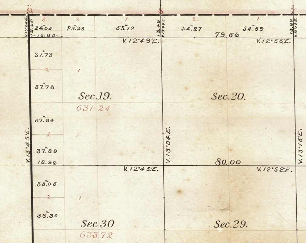
[QUOTE=J. Penry, post: 445190, member: 321 wrote: Here's a good one. There are three Lot 1's and three Lot 2's in Section 19. The date is 1859.
Hard to tell without the full plat, but it looks like there is only two lot ones, the northern teir of lots are in different sections. The repeated lots were standard procedure for a while. A patent would have read "Lot 2 of the NW1/4". The lots usually were not broken up, but if they were it would habe been "S1/2 Lot 2 of the NW1/4". This is an example of where a fraction of a lot is correct.
The word "fraction" should be used here to distinguish from an aliquot part of the lot.
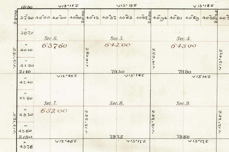
Here are examples from 1858 and 1863. Other surveyors working during the same era were going with the 1-4 or 1-7 numbering system. Still other surveyors, simply just left them all blank. It appears that the numbering system in fractional sections, when not being disrupted by lakes or rivers, was more at the discretion of the surveyor when he made his plats.
Some modern-day surveyors will insist that the designation on their survey has to reflect what is shown on the plat. In the absence of any numbers on the plat, there are also those who claim the 1855 Manual implied that the lots be numbered 1-4 or 1-7. So, calling something "Lot 1" (NE1/4, NE 1/4) even though it was not designated on the plat as such is technically correct.
A search of the deed records in these areas might reveal some interesting items. In my immediate area, we routinely have fractional lots labeled as aliquot parts by the assessor, attorneys, and others writing the deeds.
I began this inquiry for a short article, but now have enough for an entire seminar.
J. Penry, post: 446592, member: 321 wrote: Here are examples from 1858 and 1863. Other surveyors working during the same era were going with the 1-4 or 1-7 numbering system. Still other surveyors, simply just left them all blank. It appears that the numbering system in fractional sections, when not being disrupted by lakes or rivers, was more at the discretion of the surveyor when he made his plats.
Some modern-day surveyors will insist that the designation on their survey has to reflect what is shown on the plat. In the absence of any numbers on the plat, there are also those who claim the 1855 Manual implied that the lots be numbered 1-4 or 1-7. So, calling something "Lot 1" (NE1/4, NE 1/4) even though it was not designated on the plat as such is technically correct.
A search of the deed records in these areas might reveal some interesting items. In my immediate area, we routinely have fractional lots labeled as aliquot parts by the assessor, attorneys, and others writing the deeds.
I began this inquiry for a short article, but now have enough for an entire seminar.
The surveyors at this time had nothing to do with the drafting or the lot numbers. The surveyor's responsibility ended with the field notes. Some BLM offices still operate like this.
aliquot, post: 446627, member: 2486 wrote: The surveyors at this time had nothing to do with the drafting or the lot numbers. The surveyor's responsibility ended with the field notes. Some BLM offices still operate like this.
Roger that!
I have seen GLO Plats (1856) where the "draftsman" Lotted the West Tier of Sections, BUT the Surveyor Lotted the East Tier of Sections.
The E/W ?¬ Corners between 6/7/18/19/30/31 were all mid-pointed on the ground (and in the Notes), and the E/W ?¬ Corners between several Sections (not all reached the Range line due to Mountains), were set @ 40 chains, and whatever was left (40.x or 39.x) was along the East Range Lines.
I have seen other MUCH later GLO Townships that were also Subdivided that way, but in those cases, the "draftsman" drew the Plat that way too.
Loyal
The plat is a big deal, even to the point of overriding the field notes.
So the draftsman held a lot of authority in the process.
aliquot, post: 446627, member: 2486 wrote: The surveyors at this time had nothing to do with the drafting or the lot numbers. The surveyor's responsibility ended with the field notes. Some BLM offices still operate like this.
I disagree. I have seen GLO plats that I know were drawn by the surveyor due to the handwriting on the plats matching his rewritten notes. Robert Harvey of Nebraska is a good example where there are non-GLO plats when he was county surveyor that match in handwriting and style to his GLO plats. When you look at surveyors who were all working in the same area, all of their plats are distinctly different in appearance. I know this is true for Nebraska. I'm not saying all deputy surveyors drew their own plats, but many who were talented did the drafting after returning from the field. I'll put together some examples.


