Hello from a first time poster but a long time lurker.
I wanted to get an opinion on how you all would resolve the following:
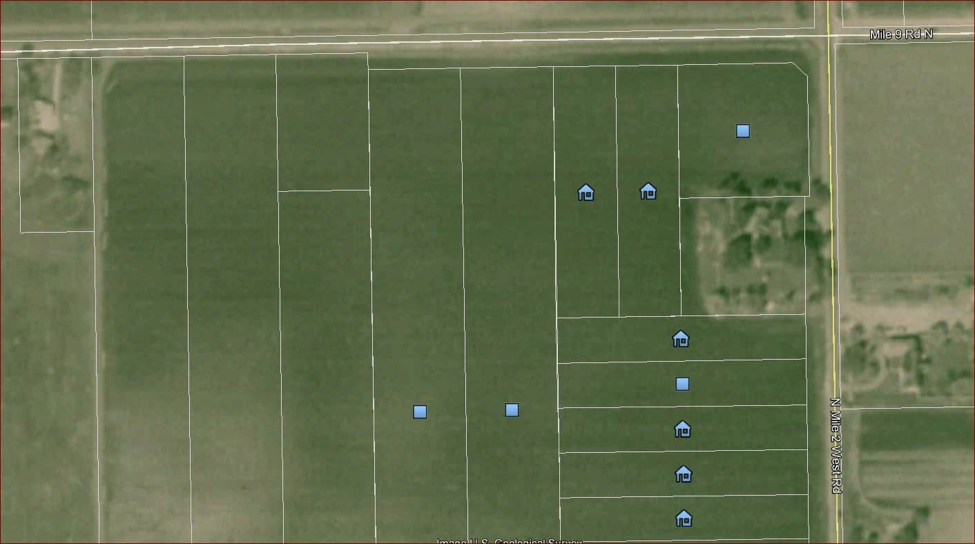
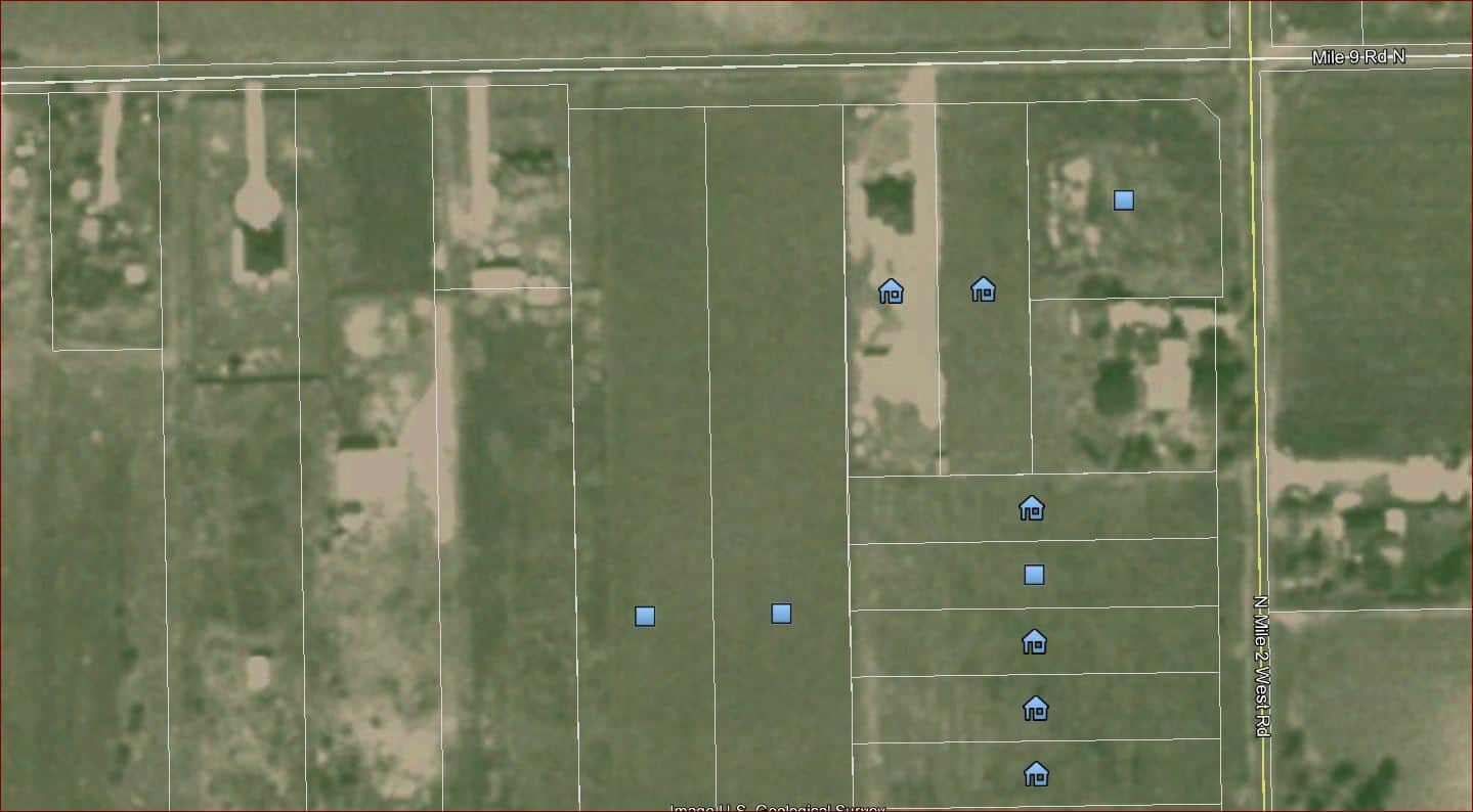
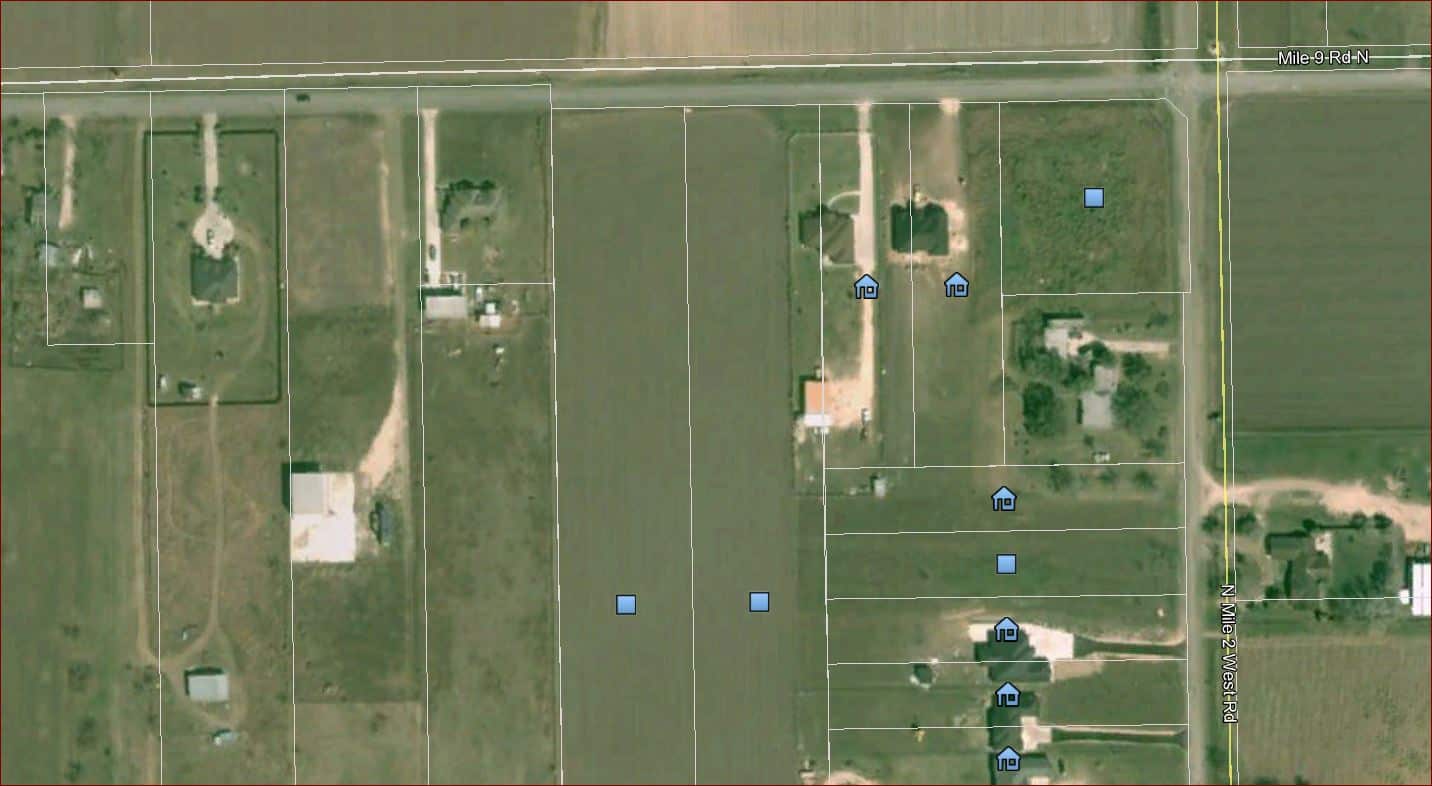
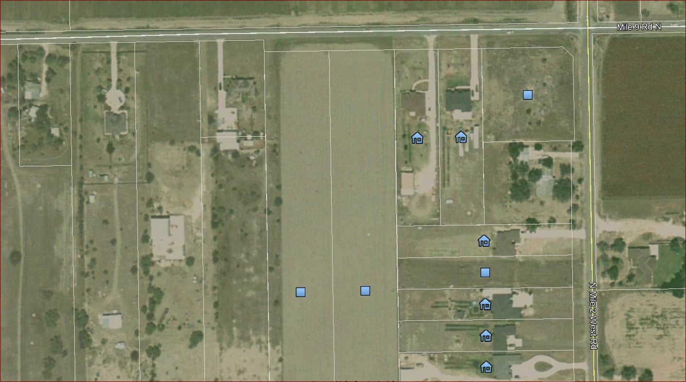
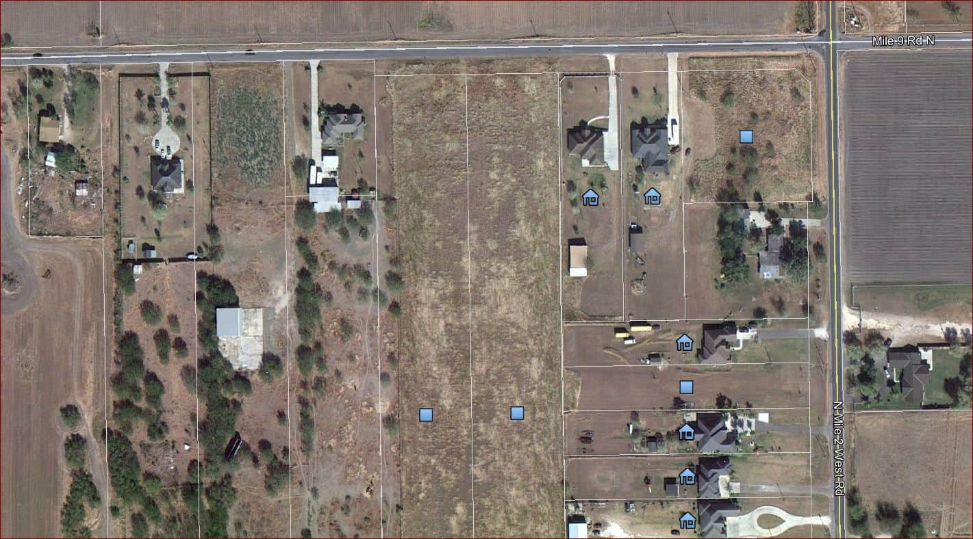
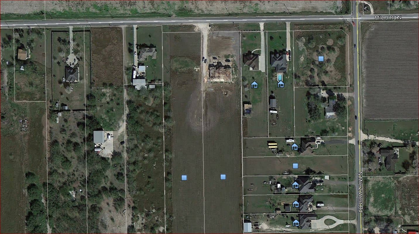
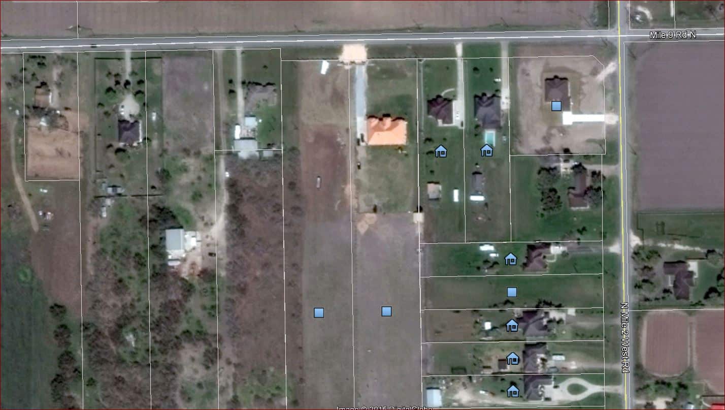
Surveyor ÛÏAÛ surveyed the three five acre tracts shown and subsequently, all improvements and occupation lines were built off the iron rods that Surveyor ÛÏAÛ had set. I have never actually seen the surveys nor do I know who the surveyor is. The deed for these three 5 acre tracts all tie to the northeast block corner. The line work shown in the sketch below is drawn from deeds and are at the deed distances from the northeast block corner.
Owner 3 hires Surveyor ÛÏBÛ and it seems he proceeds to set his iron rods on the actual deed distances from the northeast block corner. Surveyor ÛÏBÛ proceeds to advise his client that Owner 2Ûªs asphalt driveway was actually on his property. Surveyor ÛÏBÛ is also the original surveyor of Campacuas Estates which was platted in 1999.
First thing you do is ask Surveyor A to explain why he did what he did assuming this is a recent faux paux.
If it is not recent then it could be those Surveyor A monuments are established and B should not stir up the hornet's nest.
It looks like Lot 3 is occupying its record lot but 4 is encroaching over into 5 but maybe just lawn.
First guess is that Surveyor B screwed up the plat because the trees on Owner 3 shown to be encroaching into Lot 1 should have existed in 1999. Also noted the odd line location between Lots 4 & 5.
I agree there needs to be some discussion among the surveyors. The three 5-acre tracts were deeded first. Why didn't Surveyor "B" hold those corners when he created the subdivision, and why was there no question about it then?
Establishing the parent tract for the three lot S/D would be the first order of business. If Surveyor A did this correctly, The S/D corner as he set them would control. Surveyor A's lines appear to fit the physical possession better. However, much more research would need to be done to verify this. You think Surveyor B started from where the right of way intersection is now?
For a start, I'd review this case: McGee v Young, 606 So.2d 1215 (1992) (Go to scholar.google.com and search)
In the event of a discrepancy as to subdivided land lot lines, do you go with what the original surveyor intended to do as shown by the plat or do you go with what the original surveyor did by way of laying out and monumenting his survey on the ground?
"In resolving this question Judge Cowart noted the distinction between the role and practice of the surveyor and that of the lawyer, architect, or design engineer. The latter group is accustomed to reducing abstract ideas to paper and then relying upon the written document to achieve the original goal as written. In this case the written document is always considered authoritative and any deviation or discrepancy between this written document and what is actually done, is resolved in favor of "changing the physical to conform to the intention evidenced by the writing." Id. The surveyor, however, plays a different role and has a different practice with respect to his profession. While the original surveyor has a right or responsibility to establish new boundaries when he surveys previously unplatted land or subdivides a new tract, the sole duty of all subsequent or following surveyors is to locate the points and lines of the original survey by locating existing boundaries. Id. No following surveyor may establish a new corner or line, or correct erroneous surveys of earlier surveyors, when they track the original survey in locating existing boundaries. This is so because "man set monuments as landmarks before he invented paper and still today the true survey is what the original surveyor did on the ground by way of fixing boundaries by setting monuments and by running lines (`metes and bounds'), and the paper `survey' or plat of survey is intended only as a map of what is on the ground." Id."
"The court concluded that the monuments on the ground controlled the dispute, noting:
The surveying method is to establish boundaries by running lines and fixing monuments on the ground while making field notes of such acts. From the field notes, plats of survey or "maps" are later drawn to depict that which was done on the ground. In establishing the original boundary on the ground the original surveyor is conclusively presumed to have been correct and if later surveyors find there is error in the locations, measurements or otherwise, such error is the error of the last surveyor. Likewise, boundaries originally located and set (right, wrong, good or bad) are primary and controlling when inconsistent with plats purporting to portray the survey and later notions as to what the original subdivider or surveyor intended to be doing or as to where later surveyors, working, perhaps, under better conditions and more accurately with better equipment, would locate the boundary solely by using the plat as a guide or plan. "
"Applying Tyson to the instant case leads to the conclusion that the monuments, as located on the ground, control over the written descriptions of what the surveyor intended to do, that intention being evidenced in the deeds to the parcels as well as the later recorded minor plat of Rustic Hills. The correctness of this position is strengthened by a consideration of the ramifications of the alternative position. As Judge Cowart noted:
Even if it were true [that application of this rule of law would require the redrawing of several lot lines], it is far better to redraw lines on a piece of paper to make them consistent with occupancy on the ground than to uproot and move all of the property owners who have in good faith erected homes, fences and other improvements in conformity with monuments on the ground, in order to make their actual occupancy and possession conform to what is erroneously shown on a piece of paper recorded in the courthouse."
Which survey does the westerly abutter to Owner 1's deed/plat agree with? What about other abutting deeds/plats to the south?
I'd be trying my best to find out what Surveyor A did, and why he placed his lines where he did, as it looks like those are the lines that everyone's using.
Seems to me you would have to find out where the parent tracts were and who has senor rights. However it seems pretty clear as well that unwritten rights are also at play, although they may not have ripened yet depending on your state's laws.
Also has the NE corner changed? Has that road been redone/improved? Guessing not as it seems you are looking for way more than something like 5 feet....
I agree you must call the other surveyors to resolve and try not to disturb the land as much as possible.
Sent from my SM-G925V using Tapatalk
Michael W, post: 348417, member: 381 wrote: I have never actually seen the surveys nor do I know who the surveyor is.
First thing to do is get a good look at these surveys.
Obviously surveyor A's points have been relied on, even if they are "wrong" in surveyor B's opinion.
First thing I would say is do you really, really, really want to get involved...........
This might be the time to run, fast and far, two guys disagree and you in the middle..............
But if you do then it's tough to go over occupation, there looks to be something going on that's been missed, almost like 1/2 a road
Michael W, post: 348417, member: 381 wrote: Hello from a first time poster but a long time lurker.
I wanted to get an opinion on how you all would resolve the following:
Surveyor ÛÏAÛ surveyed the three five acre tracts shown and subsequently, all improvements and occupation lines were built off the iron rods that Surveyor ÛÏAÛ had set. I have never actually seen the surveys nor do I know who the surveyor is. The deed for these three 5 acre tracts all tie to the northeast block corner. The line work shown in the sketch below is drawn from deeds and are at the deed distances from the northeast block corner.
Owner 3 hires Surveyor ÛÏBÛ and it seems he proceeds to set his iron rods on the actual deed distances from the northeast block corner. Surveyor ÛÏBÛ proceeds to advise his client that Owner 2Ûªs asphalt driveway was actually on his property. Surveyor ÛÏBÛ is also the original surveyor of Campacuas Estates which was platted in 1999.
I would hold the 96 monuments; lot 1 campaucus estates has less frontage than shown. Might change my mind if more evidence. But it looks like either a mistaken tie distance or not using the same block corner. Let me guess, deed says 825' from the road. One survey uses center and the other the right of way of a 50' road.
Ewww...It looks like the damage has been done if the sketch reflects the actual ground conditions.
I say lot line agreements for everyone!!!
Michael W, post: 348417, member: 381 wrote: .....I wanted to get an opinion on how you all would resolve the following:.......
Hi Michael, Welcome. Just out of curiosity, what is your involvement in this issue? Are you a land surveyor? Are you "tasked" with resolving the issue, or do you have a survey to do in the area? And/or is this an intellectual exercise?
Not being critical, just wondering. It might affect how some guys want to answer. Some of the "handling" of this issue might take an attorney, but if you are doing a resurvey, I would probably be talking to both surveyors. Seeing their survey plats, talking to them, and etc. would definitely need to be a part of the resurvey. The second surveyor should have been calling up the first in my opinion, but I know a lot of surveyors don't like doing that.
If you are advising one of the property owners on how to proceed, that might invoke a whole different approach on what to do.
Duane Frymire, post: 348455, member: 110 wrote: I would hold the 96 monuments; lot 1 campaucus estates has less frontage than shown. Might change my mind if more evidence. But it looks like either a mistaken tie distance or not using the same block corner. Let me guess, deed says 825' from the road. One survey uses center and the other the right of way of a 50' road.
Owner 3's deed begins 825.00 feet west of the NE Block Corner which is in the centerline intersection of the roads. Owner 2's deed begins 990 feet west of the same block corner and Owner 1's deed begins 1,155 feet west of the same block corner. It all works on paper, it just doesn't fit occupation or 1996 mounumentation
Tom Adams, post: 348459, member: 7285 wrote: Hi Michael, Welcome. Just out of curiosity, what is your involvement in this issue? Are you a land surveyor? Are you "tasked" with resolving the issue, or do you have a survey to do in the area? And/or is this an intellectual exercise?
Not being critical, just wondering. It might affect how some guys want to answer. Some of the "handling" of this issue might take an attorney, but if you are doing a resurvey, I would probably be talking to both surveyors. Seeing their survey plats, talking to them, and etc. would definitely need to be a part of the resurvey. The second surveyor should have been calling up the first in my opinion, but I know a lot of surveyors don't like doing that.
If you are advising one of the property owners on how to proceed, that might invoke a whole different approach on what to do.
I am a surveyor, however this is for an acquaintance of mine. I am just looking at this as a favor to her and I do not plan on getting involved with the survey. I have already advised her to contact Surveyor B and his response was "your driveway is on my clients property".
What is the discrepancy difference? Looks to me that someone perhaps started measuring from the ROW line instead of centerline or vice versa.
Rich., post: 348441, member: 10450 wrote: Seems to me you would have to find out where the parent tracts were and who has senor rights. However it seems pretty clear as well that unwritten rights are also at play, although they may not have ripened yet depending on your state's laws.
Also has the NE corner changed? Has that road been redone/improved? Guessing not as it seems you are looking for way more than something like 5 feet....
I agree you must call the other surveyors to resolve and try not to disturb the land as much as possible.
Sent from my SM-G925V using Tapatalk
The NE Corner has not changed. The difference between occupation and deed is around 35 feet. I advised owner 2 to contact surveyor B. His response was that her driveway was on his client's (owner 3) property.
Tom Adams, post: 348459, member: 7285 wrote: The second surveyor should have been calling up the first in my opinion, but I know a lot of surveyors don't like doing that.
Call me 'new age' or young or inexperienced but I always call or email local surveyors when I'm in a pinch or if I find some pins they set that I'm not getting in the right spot.
I never contact them without doing my due diligence first though. If I've spent a lot of time, not getting a resolution, then I contact them to see if they can shed some insight. And I always hope they will do the same.
Sent from my SM-G925V using Tapatalk
I'd want to know who Surveyor A was working for. It appears that all these parcel (lots) came from a common grantor. So if the grantor hired Surveyor A to mark off these parcels and then sold them Surveyors A's markers are the grantors original markers (monuments). If that where the case then the grantees took possession in good faith and the lines are established. If Surveyor A marked into land not owned by the grantor then that part wouldn't hold, at least not in the beginning.
I agree with others that there may be a shift in the POB between the two surveys. In a case like this the grantees shouldn't pay for the mistake.
There is a history and story here that needs to be researched and sorted out.

