Reading RPLS is free for the whole profession. Members post, reply, and get the members-only rooms.

Notifications
Clear all
Strictly Surveying
29
Posts
13
Users
0
Reactions
2,146
Views

Topic starter
Translate
▼
English
Spanish
French
German
Italian
Portuguese
Russian
Chinese
Japanese
Korean
Arabic
Hindi
Dutch
Polish
Turkish
Vietnamese
Thai
Swedish
Danish
Finnish
Norwegian
Czech
Hungarian
Romanian
Greek
Hebrew
Indonesian
Malay
Ukrainian
Bulgarian
Croatian
Slovak
Slovenian
Serbian
Lithuanian
Latvian
Estonian
[Trigger Alert: This post contains material related to the adjustment of survey measurements by least squares.]
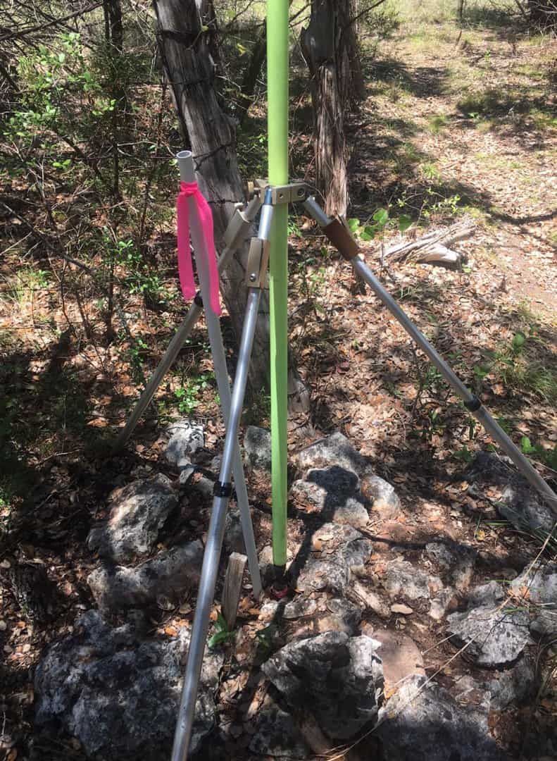
So I'm working on a survey of a ranch in the Hill Country and the land is valuable enough that one of the objects of the work is to get essentially the final answer for the shape and location of the land, i.e. determine the positions of all of the corners and other points positioned by the survey as well as can be done. The question is how to accomplish that as efficiently as possible.
The entire project is connected to NAD83 via a control point less than about half a mile away from all of the points positioned on the survey seen in the photo below:
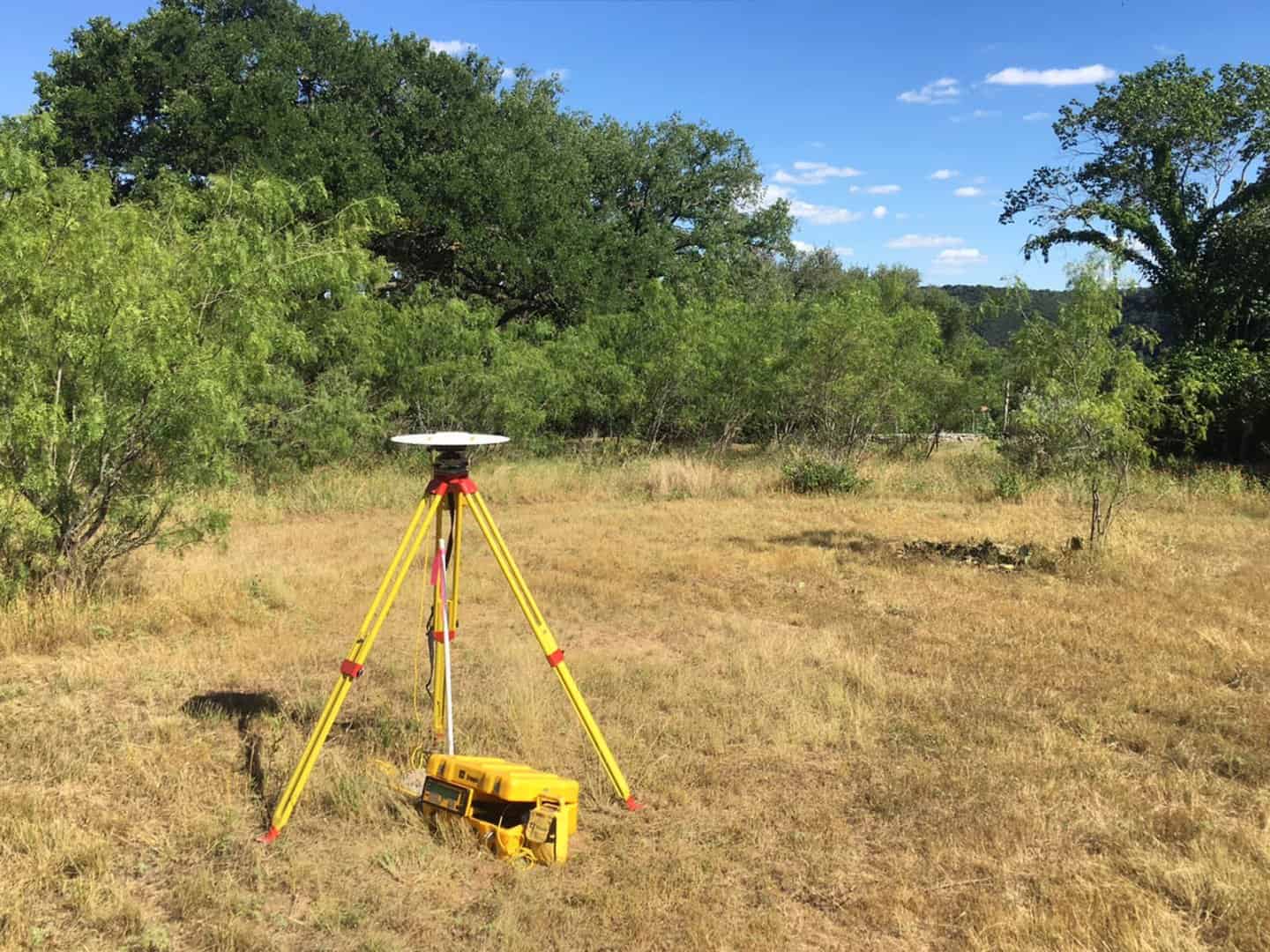
I've previously described how that control point was connected to the Central Texas segment of the National CORS network with the result that analysis of variance indicates that the project control point has an uncertainty of 0.010 ft. and 0.007 ft. in N and E, respectively. What that means is that the expectation is that there is about a 68% chance that the errors in the N and E components of that control point adopted for the project are less than those uncertainties. I consider both to be Alex Trebek territory.
From that fundamental control point, I surveyed GPS vectors to a whole slew of project control points that fall along the routes of some proposed access easements that are to be described as one part of the work.

Those control points were generally surveyed via PPK methods that yielded the following uncertainties:
[PRE]
Error Propagation
=================
Station Coordinate Standard Deviations (FeetUS)
Station N E Elev
1 0.010 0.007 0.024
2 0.024 0.021 0.104
3 0.015 0.011 0.045
4 0.020 0.016 0.088
5 0.023 0.020 0.088
6 0.016 0.013 0.052
7 0.015 0.012 0.055
8 0.020 0.020 0.082
9 0.020 0.018 0.083
10 0.013 0.010 0.046
11 0.017 0.015 0.065
14 0.016 0.015 0.058
15 0.019 0.016 0.082
18 0.028 0.023 0.144
19 0.027 0.024 0.135
20 0.025 0.023 0.109
21 0.029 0.023 0.114
22 0.019 0.016 0.072
23 0.022 0.017 0.092
24 0.017 0.014 0.056
[/PRE]
All of the uncertainties are under 1cm in N and E components, but when you examine the relative uncertainties between adjacent points, the picture is a bit less rosey:
[PRE]Relative uncertainties of control points from GPS vectors along
(before addition of conventional measurements connecting them)
Adjusted Bearings (DMS) and Horizontal Distances (FeetUS)
=========================================================
(Relative Confidence of Bearing is in Seconds)
From To Grid Bearing Grid Dist 95% RelConfidence
Grnd Dist Brg Dist PPM
2 3 S14-45-02W 157.833 74 0.056 360
157.846
3 4 S05-27-36W 232.034 37 0.049 214
232.053
4 5 S18-47-40W 328.084 29 0.051 158
328.110
5 6 S02-53-34E 185.395 44 0.043 233
185.410
6 7 S20-49-10E 284.948 26 0.042 148
284.970
7 8 S32-15-04W 129.963 89 0.047 367
129.973
8 9 S54-30-57W 139.724 95 0.058 421
139.735
10 9 N17-20-54E 140.576 68 0.046 333
140.587
10 11 S30-17-06W 241.559 33 0.038 161
241.578
11 14 S06-37-55W 365.746 26 0.046 125
365.774
14 15 S51-18-51W 286.210 34 0.051 179
286.232
15 18 S76-18-15W 448.203 34 0.066 148
448.237
18 19 N77-11-03W 59.046 303 0.081 1372
59.051
19 20 N87-54-30W 97.163 176 0.078 809
97.170
20 21 S59-16-57W 77.607 232 0.076 987
77.613
21 22 S72-46-46W 119.647 134 0.066 552
119.656
22 23 N65-40-10W 102.878 123 0.056 550
102.886
23 24 N21-58-46E 160.922 67 0.057 355
160.935
[/PRE]
The above relative uncertainties are sloppy, but were easily improved just by running a conventional traverse through the Control Points 2 through 24 in the course of locating about 80 points on the proposed easement centerline and adjusting both the GPS vectors and the conventional angle and distance measurements in one combined Least Squares adjustment.
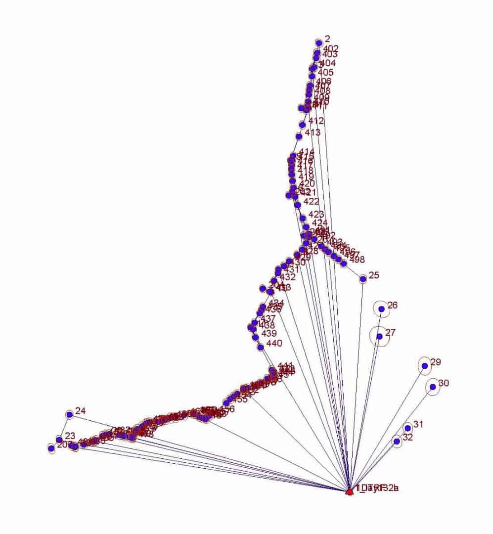
The improvements are significant:
[PRE] Error Propagation
=================
Station Coordinate Standard Deviations (FeetUS)
Station N E Elev
1 0.010 0.007 0.024
2 0.012 0.011 0.028
3 0.011 0.010 0.028
4 0.011 0.009 0.028
5 0.011 0.009 0.028
6 0.011 0.009 0.028
7 0.011 0.009 0.028
8 0.011 0.009 0.028
9 0.011 0.009 0.028
10 0.011 0.008 0.028
11 0.011 0.008 0.028
12 0.011 0.009 0.028
13 0.011 0.010 0.028
14 0.011 0.009 0.028
15 0.012 0.009 0.028
16 0.013 0.009 0.028
17 0.013 0.009 0.028
18 0.013 0.009 0.028
19 0.013 0.009 0.028
20 0.013 0.009 0.028
21 0.013 0.009 0.029
22 0.013 0.009 0.029
23 0.014 0.009 0.029
24 0.013 0.011 0.029
25 0.013 0.010 0.029
[/PRE]
Relative uncertainties of control points from a combination of GPS vectors
and conventional measurements simultaneously adjusted by Least Squares
[PRE]Adjusted Bearings (DMS) and Horizontal Distances (FeetUS)
=========================================================
(Relative Confidence of Bearing is in Seconds)
From To Grid Bearing Grid Dist 95% RelConfidence
Grnd Dist Brg Dist PPM
2 3 S14-45-06W 157.853 12 0.006 43
157.866
3 4 S05-27-43W 232.005 7 0.004 21
232.024
4 5 S18-47-45W 328.101 5 0.006 20
328.127
5 6 S02-53-38E 185.386 6 0.005 28
185.401
6 7 S20-49-25E 284.990 5 0.005 19
285.013
7 8 S32-15-16W 129.959 8 0.006 48
129.969
8 9 S54-31-57W 139.771 9 0.006 45
139.782
10 9 N17-19-51E 140.558 8 0.006 44
140.569
10 11 S30-17-17W 241.583 7 0.005 23
241.601
11 12 S27-32-54E 299.573 7 0.005 19
299.596
11 14 S06-37-46W 365.730 6 0.010 29
365.758
12 13 S48-42-47W 97.472 11 0.005 55
97.479
13 14 S72-45-47W 112.590 12 0.005 48
112.599
14 15 S51-19-07W 286.208 11 0.005 20
286.230
15 16 N66-35-06W 79.062 13 0.006 83
79.068
16 17 S78-51-40W 183.949 11 0.006 37
183.963
17 18 S60-47-02W 208.952 12 0.006 32
208.968
18 19 N77-15-59W 59.115 18 0.006 109
59.120
19 20 N87-52-51W 97.100 20 0.006 67
97.108
20 21 S59-18-11W 77.614 21 0.006 84
77.620
21 22 S72-46-00W 119.657 21 0.006 55
119.666
22 23 N65-40-03W 102.889 23 0.005 52
102.897
23 24 N21-59-07E 160.912 25 0.009 59
160.924
[/PRE]
Oh, the axle in the rock mound in the first photo? That came along for the ride. The center of the axle at the center of the mound is Point No. 200 with estimated uncertainties (standard errors, in Feet) of its position of:
[PRE]
Station N E Elev
200 0.015 0.010 0.029
[/PRE]
Posted : June 8, 2017 9:25 pm

Translate
▼
English
Spanish
French
German
Italian
Portuguese
Russian
Chinese
Japanese
Korean
Arabic
Hindi
Dutch
Polish
Turkish
Vietnamese
Thai
Swedish
Danish
Finnish
Norwegian
Czech
Hungarian
Romanian
Greek
Hebrew
Indonesian
Malay
Ukrainian
Bulgarian
Croatian
Slovak
Slovenian
Serbian
Lithuanian
Latvian
Estonian
Only one question here Kent; is the grass always that green in early June down there?
Posted : June 8, 2017 9:56 pm
Topic starter
Translate
▼
English
Spanish
French
German
Italian
Portuguese
Russian
Chinese
Japanese
Korean
Arabic
Hindi
Dutch
Polish
Turkish
Vietnamese
Thai
Swedish
Danish
Finnish
Norwegian
Czech
Hungarian
Romanian
Greek
Hebrew
Indonesian
Malay
Ukrainian
Bulgarian
Croatian
Slovak
Slovenian
Serbian
Lithuanian
Latvian
Estonian
paden cash, post: 431799, member: 20 wrote: Only one question here Kent; is the grass always that green in early June down there?
Actually, we've had enough rain recently that it does look greener right about now. The rain brought the wild flowers, too, so things are looking good.
Posted : June 8, 2017 10:07 pm

Translate
▼
English
Spanish
French
German
Italian
Portuguese
Russian
Chinese
Japanese
Korean
Arabic
Hindi
Dutch
Polish
Turkish
Vietnamese
Thai
Swedish
Danish
Finnish
Norwegian
Czech
Hungarian
Romanian
Greek
Hebrew
Indonesian
Malay
Ukrainian
Bulgarian
Croatian
Slovak
Slovenian
Serbian
Lithuanian
Latvian
Estonian
Cool. Why were the PPK measurements so sloppy between points?
Posted : June 9, 2017 12:25 am

Translate
▼
English
Spanish
French
German
Italian
Portuguese
Russian
Chinese
Japanese
Korean
Arabic
Hindi
Dutch
Polish
Turkish
Vietnamese
Thai
Swedish
Danish
Finnish
Norwegian
Czech
Hungarian
Romanian
Greek
Hebrew
Indonesian
Malay
Ukrainian
Bulgarian
Croatian
Slovak
Slovenian
Serbian
Lithuanian
Latvian
Estonian
Kent McMillan, post: 431796, member: 3 wrote: [Trigger Alert: This post contains material related to the adjustment of survey measurements by least squares.]
From To Grid Bearing Grid Dist 95% RelConfidence
Grnd Dist Brg Dist PPM
2 3 S14-45-02W 157.833 74 0.056 360
157.846
3 4 S05-27-36W 232.034 37 0.049 214
232.053
Hello Kent. Nice analysis.
In the Adjusted Grid Bearing and Distance output, how do the PPM calculations work? They're not related to the PPM values that are set in Project Settings for the instrument are they? Are they evaluating the total standard error as a proportion of the distance measured?
Posted : June 9, 2017 4:40 am
Topic starter
Translate
▼
English
Spanish
French
German
Italian
Portuguese
Russian
Chinese
Japanese
Korean
Arabic
Hindi
Dutch
Polish
Turkish
Vietnamese
Thai
Swedish
Danish
Finnish
Norwegian
Czech
Hungarian
Romanian
Greek
Hebrew
Indonesian
Malay
Ukrainian
Bulgarian
Croatian
Slovak
Slovenian
Serbian
Lithuanian
Latvian
Estonian
naw054, post: 431804, member: 10013 wrote: Cool. Why were the PPK measurements so sloppy between points?
As the standard errors indicate, the PPK accuracy was not unusually bad. It is probably what you'd expect from RTK in that setting. The situation is that the sloppy relative accuracy directly follows from that level of uncertainty when you evaluate the point-to-point uncertainty at 95% confidence.
Posted : June 9, 2017 5:37 am
Topic starter
Translate
▼
English
Spanish
French
German
Italian
Portuguese
Russian
Chinese
Japanese
Korean
Arabic
Hindi
Dutch
Polish
Turkish
Vietnamese
Thai
Swedish
Danish
Finnish
Norwegian
Czech
Hungarian
Romanian
Greek
Hebrew
Indonesian
Malay
Ukrainian
Bulgarian
Croatian
Slovak
Slovenian
Serbian
Lithuanian
Latvian
Estonian
rfc, post: 431807, member: 8882 wrote: In the Adjusted Grid Bearing and Distance output, how do the PPM calculations work? They're not related to the PPM values that are set in Project Settings for the instrument are they? Are they evaluating the total standard error as a proportion of the distance measured?
Yes, the distance uncertainties are expressed as a fraction of the distance between the specific pair of points in Parts Per Million or PPM.
Posted : June 9, 2017 5:38 am
Topic starter
Translate
▼
English
Spanish
French
German
Italian
Portuguese
Russian
Chinese
Japanese
Korean
Arabic
Hindi
Dutch
Polish
Turkish
Vietnamese
Thai
Swedish
Danish
Finnish
Norwegian
Czech
Hungarian
Romanian
Greek
Hebrew
Indonesian
Malay
Ukrainian
Bulgarian
Croatian
Slovak
Slovenian
Serbian
Lithuanian
Latvian
Estonian
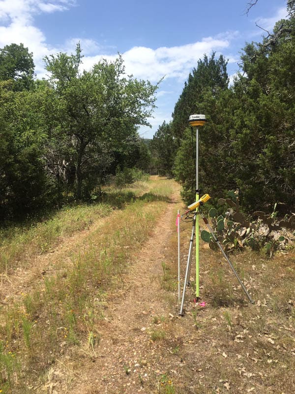
The routes of the proposed easements follow existing roads and jeep trails. Here is what the vicinity of Point 14 looks like as a fairly typical example:
Posted : June 9, 2017 6:10 am

Translate
▼
English
Spanish
French
German
Italian
Portuguese
Russian
Chinese
Japanese
Korean
Arabic
Hindi
Dutch
Polish
Turkish
Vietnamese
Thai
Swedish
Danish
Finnish
Norwegian
Czech
Hungarian
Romanian
Greek
Hebrew
Indonesian
Malay
Ukrainian
Bulgarian
Croatian
Slovak
Slovenian
Serbian
Lithuanian
Latvian
Estonian
PPK is probably the most underutilized GPS tool.
Posted : June 9, 2017 6:40 am
Topic starter
Translate
▼
English
Spanish
French
German
Italian
Portuguese
Russian
Chinese
Japanese
Korean
Arabic
Hindi
Dutch
Polish
Turkish
Vietnamese
Thai
Swedish
Danish
Finnish
Norwegian
Czech
Hungarian
Romanian
Greek
Hebrew
Indonesian
Malay
Ukrainian
Bulgarian
Croatian
Slovak
Slovenian
Serbian
Lithuanian
Latvian
Estonian
MightyMoe, post: 431816, member: 700 wrote: PPK is probably the most underutilized GPS tool.
I use it extensively to boost productivity with my vintage L1 GPS equipment (the rover is a Trimble 4600LS unit) that just keeps going and going. Obviously, one critical element is examining the uncertainties in points positioned and identifying weak points that need some additional work, but generally it's extremely useful.
Posted : June 9, 2017 7:18 am

Translate
▼
English
Spanish
French
German
Italian
Portuguese
Russian
Chinese
Japanese
Korean
Arabic
Hindi
Dutch
Polish
Turkish
Vietnamese
Thai
Swedish
Danish
Finnish
Norwegian
Czech
Hungarian
Romanian
Greek
Hebrew
Indonesian
Malay
Ukrainian
Bulgarian
Croatian
Slovak
Slovenian
Serbian
Lithuanian
Latvian
Estonian
MightyMoe, post: 431816, member: 700 wrote: PPK is probably the most underutilized GPS tool.
It's underutilized for a reason: you don't know what you've got until you're no longer on site. I agree that it's a good alternative to RTK if you don't have RTK, but having real-time quality indicators that can save a return trip is worth a lot.
Posted : June 9, 2017 7:20 am
Topic starter
Translate
▼
English
Spanish
French
German
Italian
Portuguese
Russian
Chinese
Japanese
Korean
Arabic
Hindi
Dutch
Polish
Turkish
Vietnamese
Thai
Swedish
Danish
Finnish
Norwegian
Czech
Hungarian
Romanian
Greek
Hebrew
Indonesian
Malay
Ukrainian
Bulgarian
Croatian
Slovak
Slovenian
Serbian
Lithuanian
Latvian
Estonian
Combining GPS and conventional measurements is also a very good way to test the estimated uncertainties of each. For example, when the point-to-point distance uncertainty of EDM measurements is on the order of about 1mm, that is a fairly strong condition that the adjusted GPS vectors must meet.
Just the simple expedient of measuring the distances back and forward is an easy way to demonstrate the absence of blunders (as well as to test the estimates of instrument and prism centering errors and the EDM range uncertaintes).
For example, here are the adjusted back and forward EDM slope distances after adjustment. The "Residual" column lists the corrections that were applied in the adjustment to the measured distances.
[PRE]
Adjusted Measured Distance Observations (FeetUS)
Slope
From To Distance Residual StdErr StdRes
3 2 158.4866 0.0016 0.0040 0.4
3 2 158.4479 -0.0021 0.0040 0.5
3 4 233.5401 0.0001 0.0041 0.0
4 3 233.4770 -0.0005 0.0041 0.1
4 5 331.1106 0.0006 0.0043 0.1
5 4 331.0473 -0.0035 0.0043 0.8
5 6 187.5061 0.0011 0.0041 0.3
6 5 187.3890 -0.0010 0.0041 0.3
6 5 187.3890 -0.0022 0.0041 0.6
6 7 285.8459 -0.0041 0.0042 1.0
7 6 285.7725 -0.0006 0.0042 0.1
7 8 130.4199 0.0012 0.0040 0.3
8 7 130.4555 -0.0045 0.0040 1.1
8 9 140.0298 -0.0015 0.0040 0.4
9 8 140.0585 -0.0015 0.0040 0.4
9 10 140.5712 -0.0025 0.0040 0.6
10 9 140.5774 0.0024 0.0040 0.6
10 11 241.8861 0.0011 0.0041 0.3
11 10 241.8496 -0.0004 0.0041 0.1
11 12 299.8987 -0.0013 0.0042 0.3
12 11 299.8672 0.0009 0.0042 0.2
12 13 97.4800 0.0050 0.0039 1.3
13 12 97.4820 -0.0030 0.0039 0.8
13 14 112.8102 0.0002 0.0039 0.1
14 13 112.8643 -0.0007 0.0039 0.2
14 15 286.2996 -0.0004 0.0042 0.1
15 14 286.2967 0.0042 0.0042 1.0
15 16 79.0719 0.0019 0.0039 0.5
16 15 79.0683 -0.0017 0.0039 0.4
16 17 184.2305 -0.0008 0.0040 0.2
17 16 184.1853 0.0003 0.0040 0.1
17 18 209.0029 0.0004 0.0041 0.1
18 17 209.0146 -0.0012 0.0041 0.3
18 19 59.2530 0.0030 0.0038 0.8
19 18 59.2811 -0.0039 0.0038 1.0
19 20 97.2095 -0.0043 0.0039 1.1
20 19 97.2467 0.0042 0.0039 1.1
20 21 77.6272 -0.0028 0.0039 0.7
21 20 77.6492 0.0017 0.0039 0.4
21 22 119.7134 0.0034 0.0039 0.9
22 21 119.7405 -0.0045 0.0039 1.2
22 23 102.9445 -0.0005 0.0039 0.1
23 22 102.9701 0.0001 0.0039 0.0
23 22 102.9701 0.0001 0.0039 0.0
23 24 161.4059 0.0009 0.0040 0.2
[/PRE]
Posted : June 9, 2017 7:37 am
Topic starter
Translate
▼
English
Spanish
French
German
Italian
Portuguese
Russian
Chinese
Japanese
Korean
Arabic
Hindi
Dutch
Polish
Turkish
Vietnamese
Thai
Swedish
Danish
Finnish
Norwegian
Czech
Hungarian
Romanian
Greek
Hebrew
Indonesian
Malay
Ukrainian
Bulgarian
Croatian
Slovak
Slovenian
Serbian
Lithuanian
Latvian
Estonian
Jim Frame, post: 431818, member: 10 wrote: It's underutilized for a reason: you don't know what you've got until you're no longer on site. I agree that it's a good alternative to RTK if you don't have RTK, but having real-time quality indicators that can save a return trip is worth a lot.
In my experience, PPK results are fairly predictable. The exceptions tend to be in locations where GPS positioning probably shouldn't be used anyway, such as in highly obstructed environments, and at times when the surveyor isn't paying attention to the quality of satellite geometry. Avoiding those pitfalls should not be a major problem.
The question that I'd have is: how many RTK users are simply relying upon the uncertainty estimates generated by the RTK controller, with no further validation or assessment of the actual results?
Posted : June 9, 2017 7:44 am
Translate
▼
English
Spanish
French
German
Italian
Portuguese
Russian
Chinese
Japanese
Korean
Arabic
Hindi
Dutch
Polish
Turkish
Vietnamese
Thai
Swedish
Danish
Finnish
Norwegian
Czech
Hungarian
Romanian
Greek
Hebrew
Indonesian
Malay
Ukrainian
Bulgarian
Croatian
Slovak
Slovenian
Serbian
Lithuanian
Latvian
Estonian
Jim Frame, post: 431818, member: 10 wrote: It's underutilized for a reason: you don't know what you've got until you're no longer on site. I agree that it's a good alternative to RTK if you don't have RTK, but having real-time quality indicators that can save a return trip is worth a lot.
That's always been the major complaint for PPK but there are ways to control for that real time, it can be a huge time saver when done correctly and it can also allow for a increase in your project's accuracy.
I've not had the issue of missing data for PPK locations for a long time, but then I was lucky to jump into it very early and learned the pitfalls. Now with so many extra satellites that issue has waned, and if you want static locations on your rover points (after all PPK is actually a static session) then I always use my PPK style on the rover for that. Plus you can tie into whatever broadcasting station is in the area to firm up your project using the PPK sessions. Also PPK will work with very short sessions and very long vectors which is another big plus.
Posted : June 9, 2017 7:46 am

Translate
▼
English
Spanish
French
German
Italian
Portuguese
Russian
Chinese
Japanese
Korean
Arabic
Hindi
Dutch
Polish
Turkish
Vietnamese
Thai
Swedish
Danish
Finnish
Norwegian
Czech
Hungarian
Romanian
Greek
Hebrew
Indonesian
Malay
Ukrainian
Bulgarian
Croatian
Slovak
Slovenian
Serbian
Lithuanian
Latvian
Estonian
Nice work! do you do your traverses solo??
Posted : June 9, 2017 9:16 am
Topic starter
Translate
▼
English
Spanish
French
German
Italian
Portuguese
Russian
Chinese
Japanese
Korean
Arabic
Hindi
Dutch
Polish
Turkish
Vietnamese
Thai
Swedish
Danish
Finnish
Norwegian
Czech
Hungarian
Romanian
Greek
Hebrew
Indonesian
Malay
Ukrainian
Bulgarian
Croatian
Slovak
Slovenian
Serbian
Lithuanian
Latvian
Estonian
Andy J, post: 431836, member: 44 wrote: Nice work! do you do your traverses solo??
Yes, that was just me and some prism pole tripods. That and 8-minute vials on the prism poles did the trick.
Posted : June 9, 2017 9:32 am

Translate
▼
English
Spanish
French
German
Italian
Portuguese
Russian
Chinese
Japanese
Korean
Arabic
Hindi
Dutch
Polish
Turkish
Vietnamese
Thai
Swedish
Danish
Finnish
Norwegian
Czech
Hungarian
Romanian
Greek
Hebrew
Indonesian
Malay
Ukrainian
Bulgarian
Croatian
Slovak
Slovenian
Serbian
Lithuanian
Latvian
Estonian
You mentioned doing this as efficiently as possible. Is it possible that hitting all the control points 2 - 24 with the PPK GPS is overly redundant? Would your results be sufficiently good if you had only observed say 1, 5, 10, 19, & 24? How long did you spend observing each point?
Posted : June 9, 2017 10:06 am
Topic starter
Translate
▼
English
Spanish
French
German
Italian
Portuguese
Russian
Chinese
Japanese
Korean
Arabic
Hindi
Dutch
Polish
Turkish
Vietnamese
Thai
Swedish
Danish
Finnish
Norwegian
Czech
Hungarian
Romanian
Greek
Hebrew
Indonesian
Malay
Ukrainian
Bulgarian
Croatian
Slovak
Slovenian
Serbian
Lithuanian
Latvian
Estonian
Peter Lothian - MA ME, post: 431844, member: 4512 wrote: You mentioned doing this as efficiently as possible. Is it possible that hitting all the control points 2 - 24 with the PPK GPS is overly redundant? Would your results be sufficiently good if you had only observed say 1, 5, 10, 19, & 24? How long did you spend observing each point?
The observation times were five minutes on each point, which didn't seem like much of an investment of time to me. That particular series of control points has the feature of mixing legs of different lengths, the short legs making weak points in the conventional connections which the GPS vectors strengthened.
I suppose that I could demonstrate this, but I think its fairly straight-forward that as the spacing of the GPS-derived positions gets wider, the quality of the combination of conventional and GPS drops off significantly in a way that does not happen with a tighter spacing of GPS-derived positions. That is, if you have GPS-derived positions on 2, 3 and 4 that are directly connected by conventional angles, distances and elevation differences with an uncertainty on the order of about 2mm, the adjusted results of 2, 3, and 4 approach what three occupations of all would yield. I may work the numbers on this example just to demonstrate the drop in quality with a sparser set of GPS vectors.
Posted : June 9, 2017 8:06 pm
Topic starter
Translate
▼
English
Spanish
French
German
Italian
Portuguese
Russian
Chinese
Japanese
Korean
Arabic
Hindi
Dutch
Polish
Turkish
Vietnamese
Thai
Swedish
Danish
Finnish
Norwegian
Czech
Hungarian
Romanian
Greek
Hebrew
Indonesian
Malay
Ukrainian
Bulgarian
Croatian
Slovak
Slovenian
Serbian
Lithuanian
Latvian
Estonian
Peter Lothian - MA ME, post: 431844, member: 4512 wrote: You mentioned doing this as efficiently as possible. Is it possible that hitting all the control points 2 - 24 with the PPK GPS is overly redundant? Would your results be sufficiently good if you had only observed say 1, 5, 10, 19, & 24? How long did you spend observing each point?
Here's the first answer. This set of standard errors of control points is what the network would yield if only roughly every other one had a GPS vector to it. There is an increase in uncertainty, but it isn't much. These are the sparser set of GPS vectors used in the adjustment of the same conventional traverse through the entire set of control points:
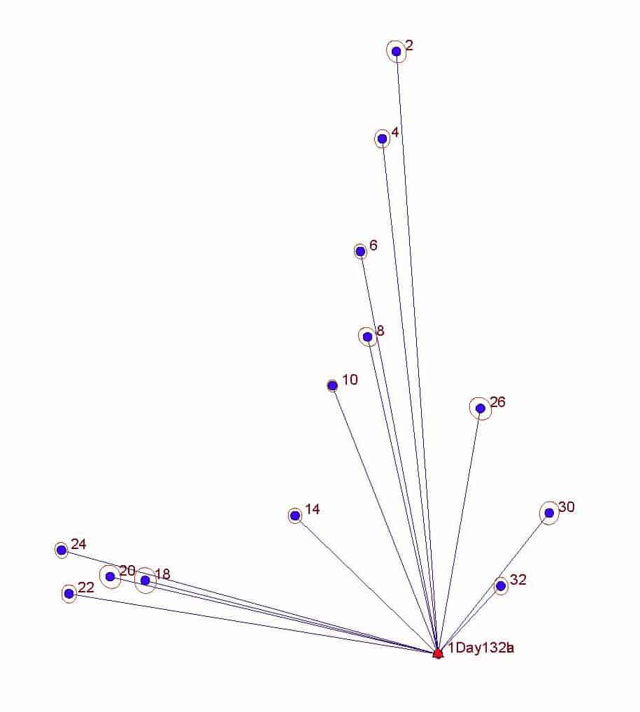
And the resulting uncertainties of the control points to compare to those listed in my post above:
[PRE]
Error Propagation
=================
Station Coordinate Standard Deviations (FeetUS)
Station N E Elev
1 0.010 0.007 0.024
2 0.013 0.015 0.031
3 0.012 0.013 0.031
4 0.012 0.011 0.030
5 0.012 0.010 0.030
6 0.012 0.010 0.030
7 0.012 0.009 0.030
8 0.011 0.009 0.030
9 0.011 0.009 0.030
10 0.011 0.009 0.030
11 0.012 0.009 0.030
12 0.012 0.010 0.030
13 0.012 0.010 0.030
14 0.012 0.010 0.030
15 0.014 0.011 0.030
16 0.014 0.011 0.030
17 0.014 0.010 0.030
18 0.015 0.010 0.030
19 0.014 0.010 0.030
20 0.014 0.010 0.030
21 0.014 0.010 0.030
22 0.014 0.010 0.030
23 0.015 0.010 0.031
24 0.014 0.011 0.031
[/PRE]
I think it would be fair to say that locating every other control point is a relatively efficient scheme since the effort is roughly half and the increase in uncertainty is only about 10% or less.
Posted : June 9, 2017 9:28 pm

Translate
▼
English
Spanish
French
German
Italian
Portuguese
Russian
Chinese
Japanese
Korean
Arabic
Hindi
Dutch
Polish
Turkish
Vietnamese
Thai
Swedish
Danish
Finnish
Norwegian
Czech
Hungarian
Romanian
Greek
Hebrew
Indonesian
Malay
Ukrainian
Bulgarian
Croatian
Slovak
Slovenian
Serbian
Lithuanian
Latvian
Estonian
[SARCASM]I used to use old receivers like that..... until my dad got a job.....[/SARCASM] - ( actually, thanks for the info- Definitely something to consider in our networks here)
Posted : June 12, 2017 9:54 am
Page 1 / 2
Next