I have surveyed approximately 180 miles of the international border with Mexico in Texas, New Mexico and Arizona. There Rio Grande is the border in Texas however, the line isn't always the thalwag. In New Mexico and Arizona, they have obelisks of varying sizes, at the angle points of the border. Each Obelisk had 2 plaques (1 in English, 1 in Spanish) with the date of the Treaty of Guadalupe Hildalgo (1848) and the year the obelisk was set (1851 mostly). I have photos in a box somewhere. I'll see if I can find them and post a few.
We were required to have a Border Patrol Agent with us at all times. South of Sells, Arizona, we had to have an Indian Guide as well.
The most difficult obelisk to locate was in a notch blasted out of the top of a mountain on the Tohono O'odham Nation. We hired a professional climber to make sure we reached the top, and returned safely.
I witnessed some dangerous $#@t down there, not to mention witnessing the mules running back & forth over the barbed wire fences.
The National Guard was constructing the fences and permanent vehicle barriers near Columbus, New Mexico when we finished our work. They were being built 5' north of the actual international border.
Kevin Hines, post: 373177, member: 8489 wrote: have an Indian Guide as well.
cool
Working the Line by David Taylor
2010 article with some great photos http://www.fractionmagazine.com/david-taylor/
one of my favorites is Border Monument No.258 - N 32å¡ 32.072' W 117å¡ 07.36
it looks much different now (the fence is now a wall) but it is easily accessible... not too sure if Border Field State Park is still easy or even open, but it was 10 years ago. The Mx side is not restricted.
https://en.wikipedia.org/wiki/Initial_Point_of_Boundary_Between_U.S._and_Mexico
Jim in AZ, post: 372975, member: 249 wrote: "...we were requested to re-establish the location of the international boundary based on the location of the international monuments"
Its been my understanding that this can only be done upon agreement by both Nations. Were you with the BLM at the time?
By law, if a survey point is set on the line between two nations, it must be independently laid by survey methods from either nations. What is then supposed to happen is the survey general (or equivalent) from each country are supposed to meet at the point and come to an agreement on the position.
Mike Marks, post: 372636, member: 1108 wrote: ??? From watching some Border Patrol reality TV series I thought the Border Patrol is banned from crossing into Mexico, even in hot pursuit. Their extraordinary rights extend 100 miles *north* of the border only. To claim dominion of Mexican soil would create an international backlash. (wiki):
"Regulations establishing the 100 mile zone were adopted by the U.S. Department of Justice as the result of an interpretation of the Immigration and Nationality Act in 1953. Customs and Border ProtectionÛªs (CBP) officials have authority for stop and search within this 100 miles (160 km) from any external boundary. This allows for CBP officials to enter private property without a warrant within 25 miles (40 km) of the border as well as the operation of checkpoints."
And that's it; they're not Navy Seals.
Especially in Texas a taking by Homeland Security for a wall or other facilities apparently requires an eminent domain process. The California-Arizona-New Mexico span is mostly desert and mostly still in Federal hands so the wall (and an electronic wall) has been built within a few feet of the border, which has been proven quite effective and not disgruntled landowners. The Texas span is defined by the Rio Grande, creating topographical and legal problems because treaties with Mexico prevent either country from constructing within the river's flood plains, so any rational barrier could be up to a mile or more upland of the river and disenfranchise owners of their riparian rights and property.
The Rio Grande has become the route of choice for wetbacks since the desert crossings to the west have been secured. It's prime because the river is tough country to patrol because of its riparian nature, heavy urbanization, weather. It's the last big hole in the Mexican border and even Donald Trump will have difficulty securing it.
May we as surveyors protect the rights of Texas landowners as this process unfolds.
Really, wetbacks, really?
D
Erik Myers, post: 372204, member: 11705 wrote: I have done a lot of work on the border of Az. Here is a pic of one of the many monuments we located. This one is east of Yuma.
Did you take the 3:10 to Yuma?
Touch of Evil (1958)
Starring Charlton Heston, Janet Leigh, and Orson Welles.
About a cross border crime in a small town on the border.
It is a real classic.
http://www.imdb.com/title/tt0052311/?ref_=nm_flmg_act_90
summerprophet, post: 373344, member: 8874 wrote: By law, if a survey point is set on the line between two nations, it must be independently laid by survey methods from either nations. What is then supposed to happen is the survey general (or equivalent) from each country are supposed to meet at the point and come to an agreement on the position.
That is my understanding... I believe it applies to State lines also, and possibly even County lines - representatives from both entities must concur.
Hello J,
I've surveyed in parts along the border from Douglas to Yuma. We had a contract with the USACE for the Border Patrol who was putting in cameras in remote mountainous areas and congested urban border towns. It is as previous contributors have mentioned with regards to monumentation and original surveys. With respect to your question as to what type of barrier would be needed, think big, because your not dealing with helpless dehydrated souls you see on tv. It is more like a war zone, while we were there we observed border patrol agents hiking, on horseback, dirt bikes, trucks, helicopters, motorcycles....at night its intensified....Tunnels being professionally engineered complete with ventilation/transportation systems, creative folks making catapults, trebuchets and hydraulic lifts similar if you will to the way back of amphibious ships have ramps.....a lot of the border away from the more congested towns is open flat desert restricted by what looks like D Day welded steel obstructions on the beach, some places have nothing more than a wire fence...In short there's nothing nice about it. My son served with the National Guard on the border outside Tucson on a two year long deployment. He said they had advanced weaponry and were well organized.
All in all its interesting to see the International Monuments and solving the PLSS monumentation....In Nogales you pass through a mountain pass that leads to a vast open prairie where John Wayne had a ranch. You also go through a place called Lochiel, AZ.. https://www.google.com/search?q=lochiel+az&espv=2&biw=1920&bih=1139&tbm=isch&tbo=u&source=univ&sa=X&sqi=2&ved=0ahUKEwjx29CutfbMAhVBElIKHb4YB7IQsAQIKA Its where Coronado first entered into the US. Montezumas Pass in Sierra Vista is a beautiful place.
Always enjoy your posts about monument reconstruction...See You
I have never surveyed the border, only read about it in old journals.
I'm surprised no one has mentioned the US Mexican Boundary Survey. The Treaty of Hildalgo (1848) was mentioned and I believe is the basis for the present boundary. Surveys commenced thereafter and was recorded in the US Mexican Boundary Survey narrative and atlas' in the volumes that were later printed and distributed.
How many of you who have surveyed that line have referred back to the published boundary survey for the precise location of the line ?
How would you know the monuments you used for your survey were the line and not a reference/offset to the line?
I'm envious for those of you who have had the opportunity to resurvey the line. I would like to have the task and challenges in the big bend area.
Hamilton
Only the International Boundary and Water Commission has the authority to determine the location of the US-Mexico border. No surveying along the border should be done without consulting with them. Although the border was monumented in the 1800's US boundary law does not apply. The border is located with reference to the monuments in a manner that the US and Mexican sections of the IBWC agree on. The US section is usually very helpful and will give advice or actual assistance in the field if required.
A state licence or BLM federal authority is not sufficent authorization to locate the border.
hpalmer, post: 373926, member: 336 wrote: I have never surveyed the border, only read about it in old journals.
I'm surprised no one has mentioned the US Mexican Boundary Survey. The Treaty of Hildalgo (1848) was mentioned and I believe is the basis for the present boundary. Surveys commenced thereafter and was recorded in the US Mexican Boundary Survey narrative and atlas' in the volumes that were later printed and distributed.
How many of you who have surveyed that line have referred back to the published boundary survey for the precise location of the line ?
How would you know the monuments you used for your survey were the line and not a reference/offset to the line?I'm envious for those of you who have had the opportunity to resurvey the line. I would like to have the task and challenges in the big bend area.
Hamilton
Hello h, please see attached...if you search in Santa Cruz, Pinal,Cochise and Yuma counties....under registrants name, G.Thompson you should find our surveys...we collected all monumentation and evidence but not on the actual dividing line...in some places you can see the international monuments but can't get to them due to border restrictive facilities while in others you can walk up to them. Hope this helps to illustrate...Paul
Paul,
glad to know you recovered the original monuments referenced in the mid 1800 survey. Would liked to have been on the field crew for the survey.
Hamilton
rlshound, post: 374150, member: 6800 wrote: Hello h, please see attached...if you search in Santa Cruz, Pinal,Cochise and Yuma counties....under registrants name, G.Thompson you should find our surveys...we collected all monumentation and evidence but not on the actual dividing line...in some places you can see the international monuments but can't get to them due to border restrictive facilities while in others you can walk up to them. Hope this helps to illustrate...Paul
In the 1991-1993 time period we did some work NE of Nogales in the Buena Vista Ranch, which is a portion of the Buena Vista Land Grant, that at one time was owned by Stewart Granger. We utilized two Border Monuments, Numbers 117 and 118 in this survey. This was before the time of the border fence that was constructed later in the decade or new Century. Never saw an illegal all the time we were there. Later in the 90's the fella that I worked for and I were doing a survey in Nogales right on the border after some of the fence had been put up, and we heard a noise and looked back at the fence just in time to see an illegal jump from the top, hit the ground running and race up the street. Also between Nogales and Patagonia, Guy Williams (Zorro) had a ranch. The iron gate at the highway has a big "Z" in the middle of it.
We also did work on the border around Naco and Douglas that had to be tied into the border. The Border Patrol was pretty active in those areas and would check us out sometimes. On one job near Douglas there was an old auto junkyard that they had put up a spotter scope base on an old moving van box that they would set their scope on to scan the area as well as drive through the brush. We would see a lot of footprints in the road along the border, but never saw any illegals.
sorry to sidetrack, I know this thread is kinda about monuments and the border, but this is interesting and there are a bunch of great photos: http://www.nytimes.com/2016/05/28/upshot/what-history-teaches-us-about-walls.html?_r=0
Peter Ehlert, post: 374342, member: 60 wrote: sorry to sidetrack, I know this thread is kinda about monuments and the border, but this is interesting and there are a bunch of great photos: http://www.nytimes.com/2016/05/28/upshot/what-history-teaches-us-about-walls.html?_r=0
What this says is "If you want to build a wall, hire overseas designers and labor"! 😀
In March 2006, I was working on a project near Blaine, Washington and went to the International Peace Park on the Canadian border. I had no problem taking photos of border monuments 5a, b, c and a couple others. The very next week, I flew into El Paso, Texas to take a GCDB class from Kurt Wurm in Las Cruces. I decided I was too close to US/Mexico monument #1, not to ignore a few no trespassing signs and get a few photos. I did get my photos after a lengthy explanation and ID check to the border patrol agents about why I was there. They can be seen sitting in their vehicle watching me; I believe for my own safety, since there was a fairly large group of young Mexican kids hanging out nearby.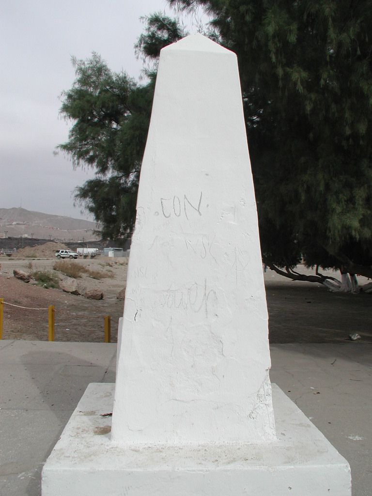
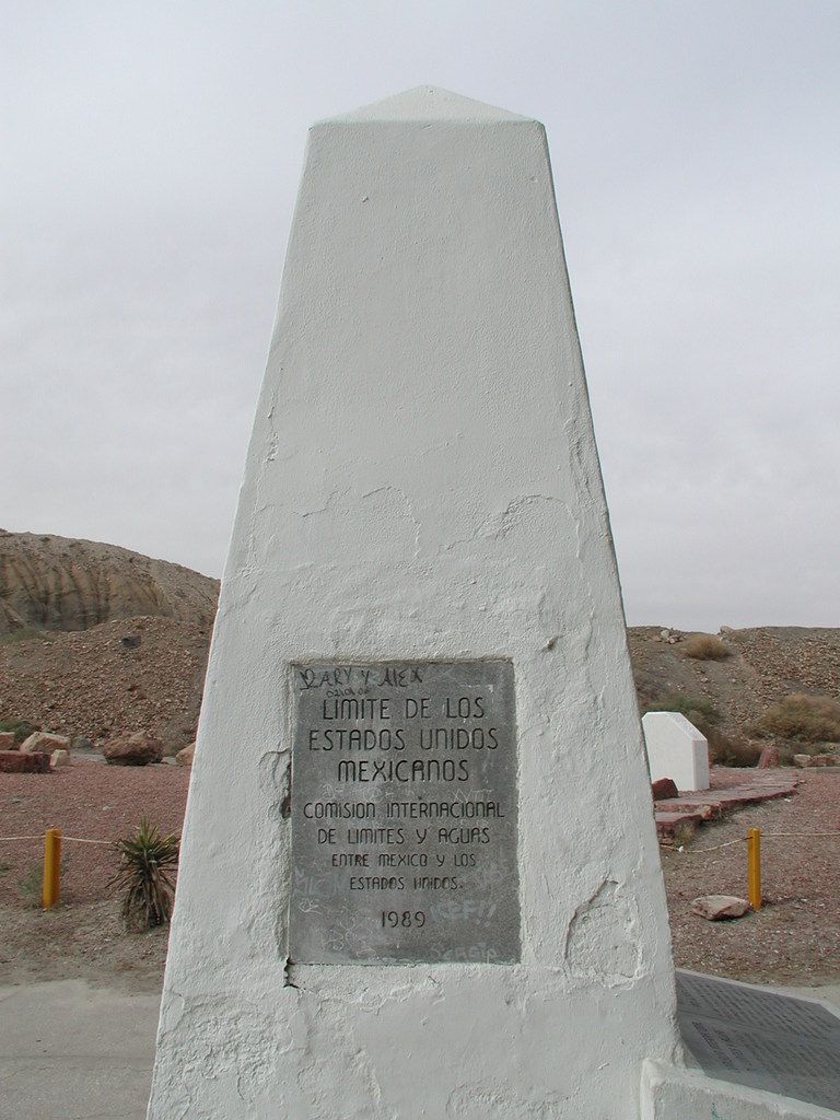
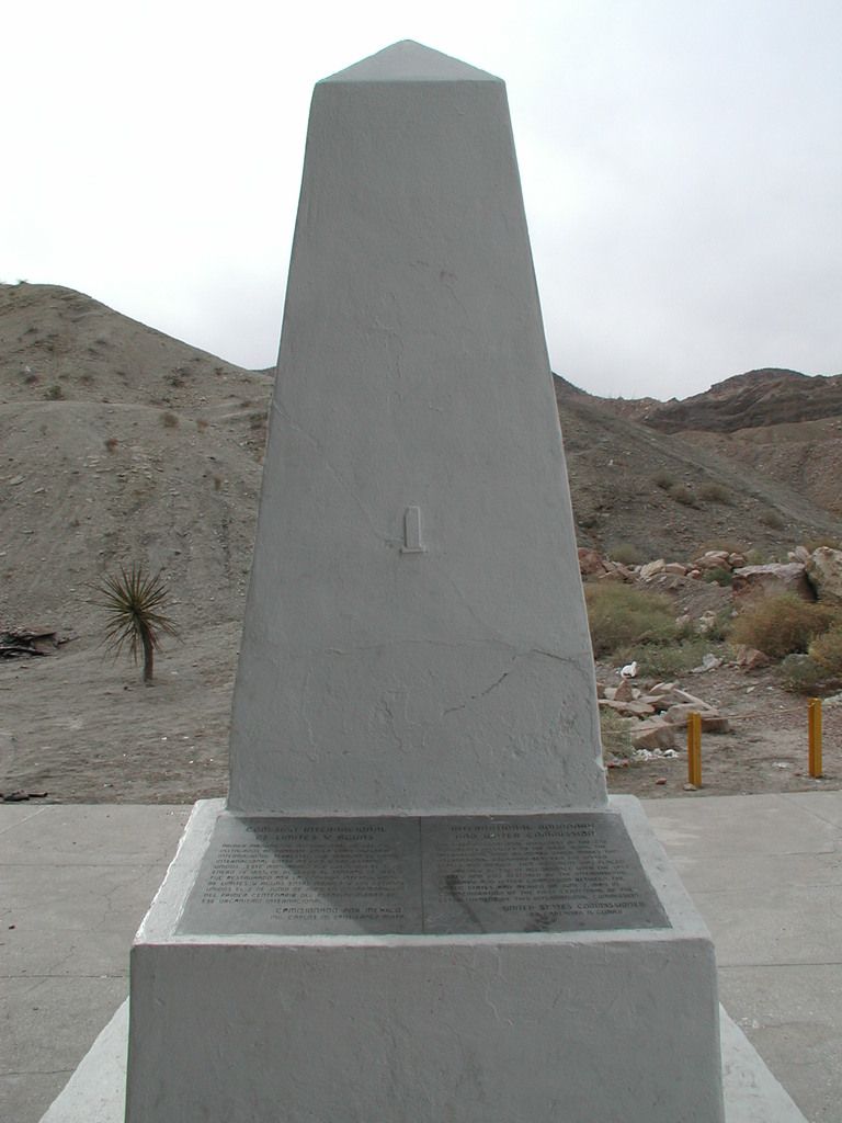
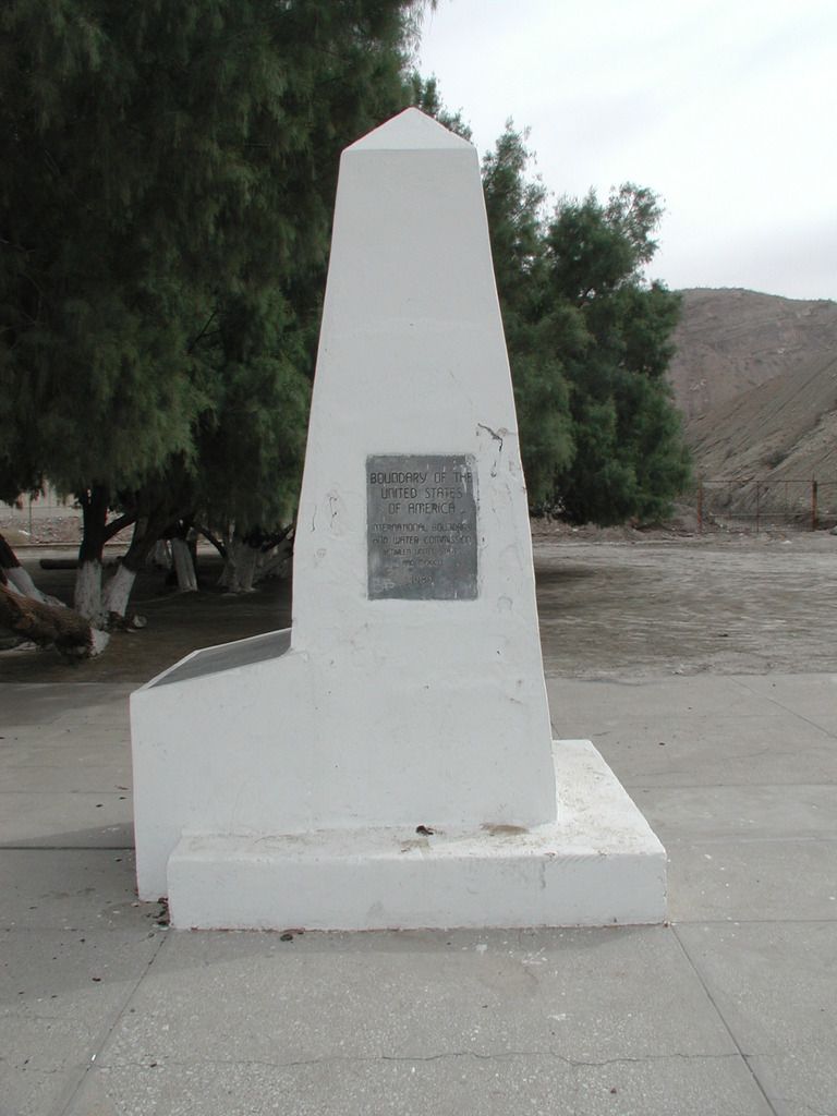
CANADA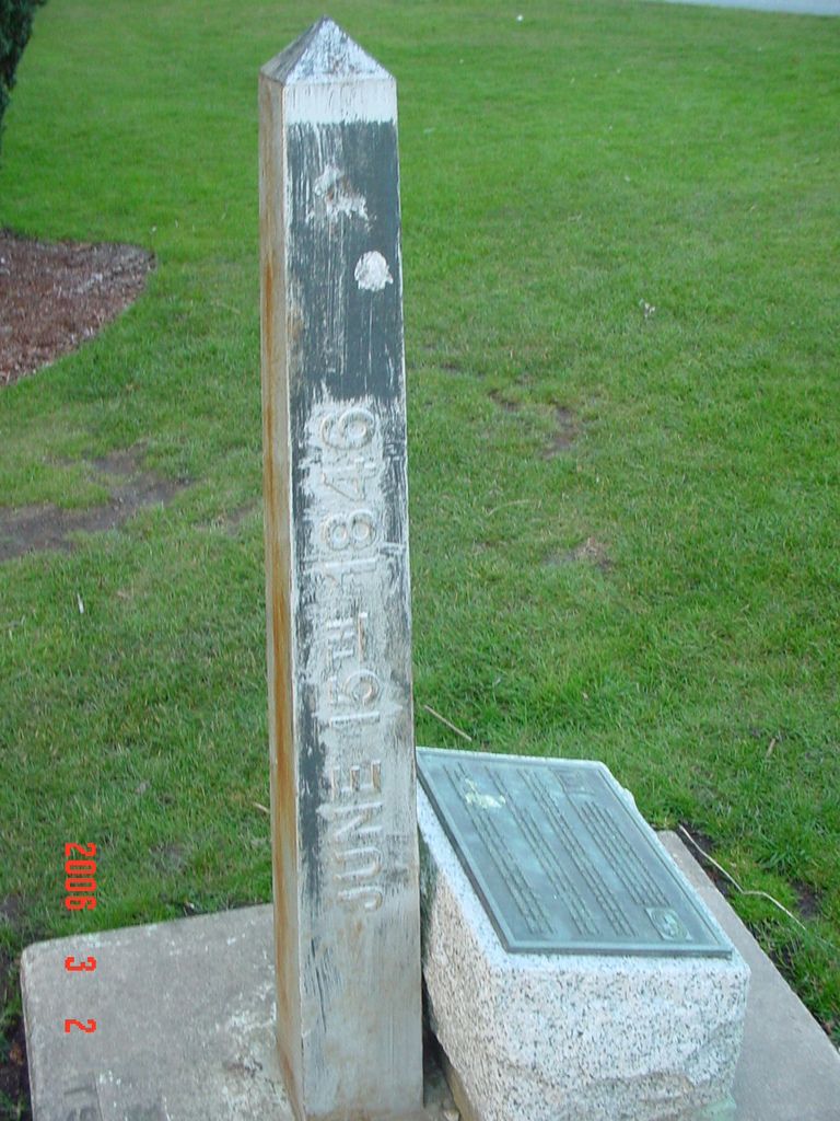
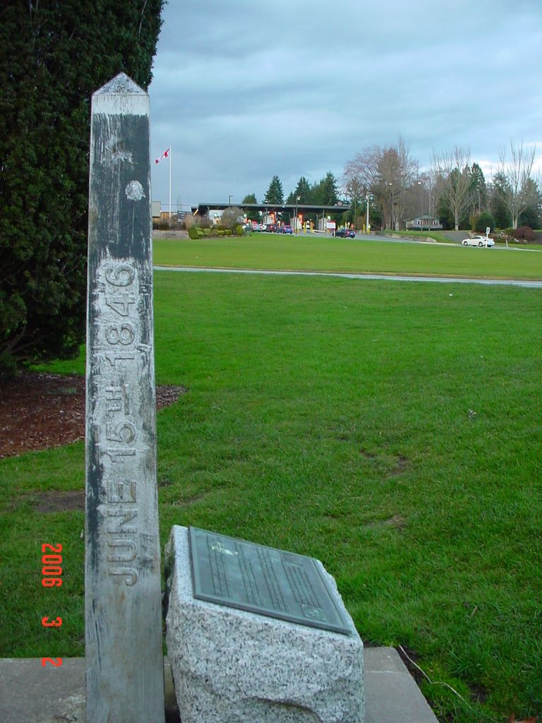
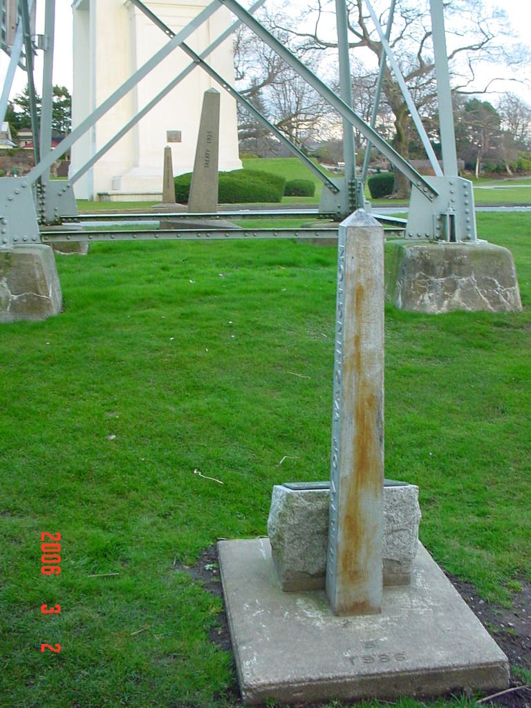
Here's one Jerry will like with a train and monuments.
Kurt Luebke, post: 374436, member: 681 wrote: In March 2006, I was working on a project near Blaine, Washington and went to the International Peace Park on the Canadian border. I had no problem taking photos of border monuments 5a, b, c and a couple others. The very next week, I flew into El Paso, Texas to take a GCDB class from Kurt Wurm in Las Cruces. I decided I was too close to US/Mexico monument #1, not to ignore a few no trespassing signs and get a few photos. I did get my photos after a lengthy explanation and ID check to the border patrol agents about why I was there. They can be seen sitting in their vehicle watching me; I believe for my own safety, since there was a fairly large group of young Mexican kids hanging out nearby.
CANADAHere's one Jerry will like with a train and monuments.
great photos, thanks


