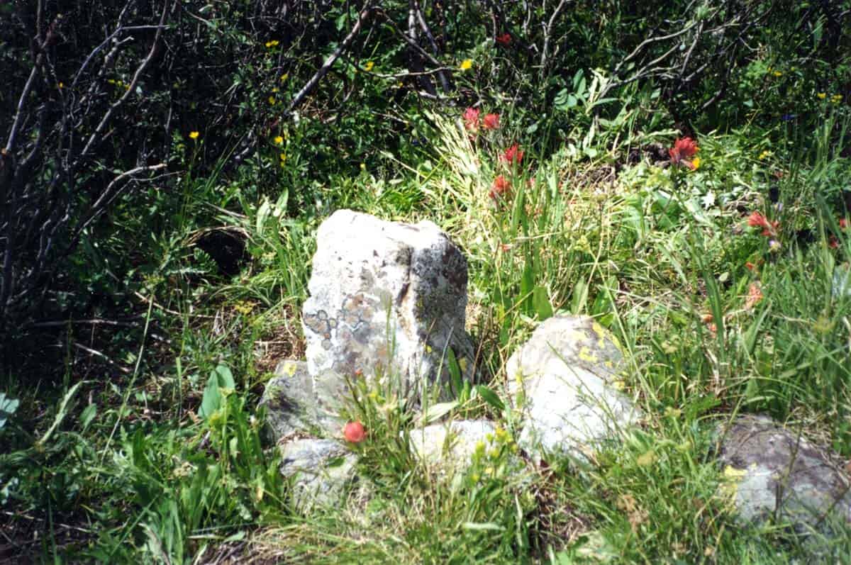
My impression from the first photo is that the "pin and cap" surveyor rolled the stone out of the way so he/she could set the pin. At least I see a gap between the stone and the rock on the right side of the stone mound.
Yes he did, the stone is just sitting there loose. The rebar/cap was set in 2008. The corner record mentions the stone but not the notches, it also mentions the original bearing trees which are still there (1 living, 1 snag, and 1 down).
Are you talking about notches on the corner of the stone? Never seen that before - all of ours are grooves on the flat face(s).
Jim in AZ, post: 426955, member: 249 wrote: Are you talking about notches on the corner of the stone? Never seen that before - all of ours are grooves on the flat face(s).
That's interesting Jim.
In my travels "edge-Notches" and "face-Grooves" are about equally represented. There is a suite of stones along the East side of the Oquirrh Mountains that are Notched on East Corner, and Grooved on the South face (ol' Groove n Notch).
Loyal
Loyal, post: 426958, member: 228 wrote: That's interesting Jim.
In my travels "edge-Notches" and "face-Grooves" are about equally represented. There is a suite of stones along the East side of the Oquirrh Mountains that are Notched on East Corner, and Grooved on the South face (ol' Groove n Notch).
Loyal
Very interesting - all the GLO/BLM notes I've read state "set stone ...X notches on south face, Y notches on east face", and the stones are marked that way. Our stones are oriented with the flat faces in the cardinal directions. Stones with :edge-notches" must be oriented at a 45å¡ angle to that , so that the edges face cardinal directions. Is that correct?
I just looked at "Restoration of Lost or Obliterated Corners..." and see a sketch that shows both types. I've never seen edge-notches...
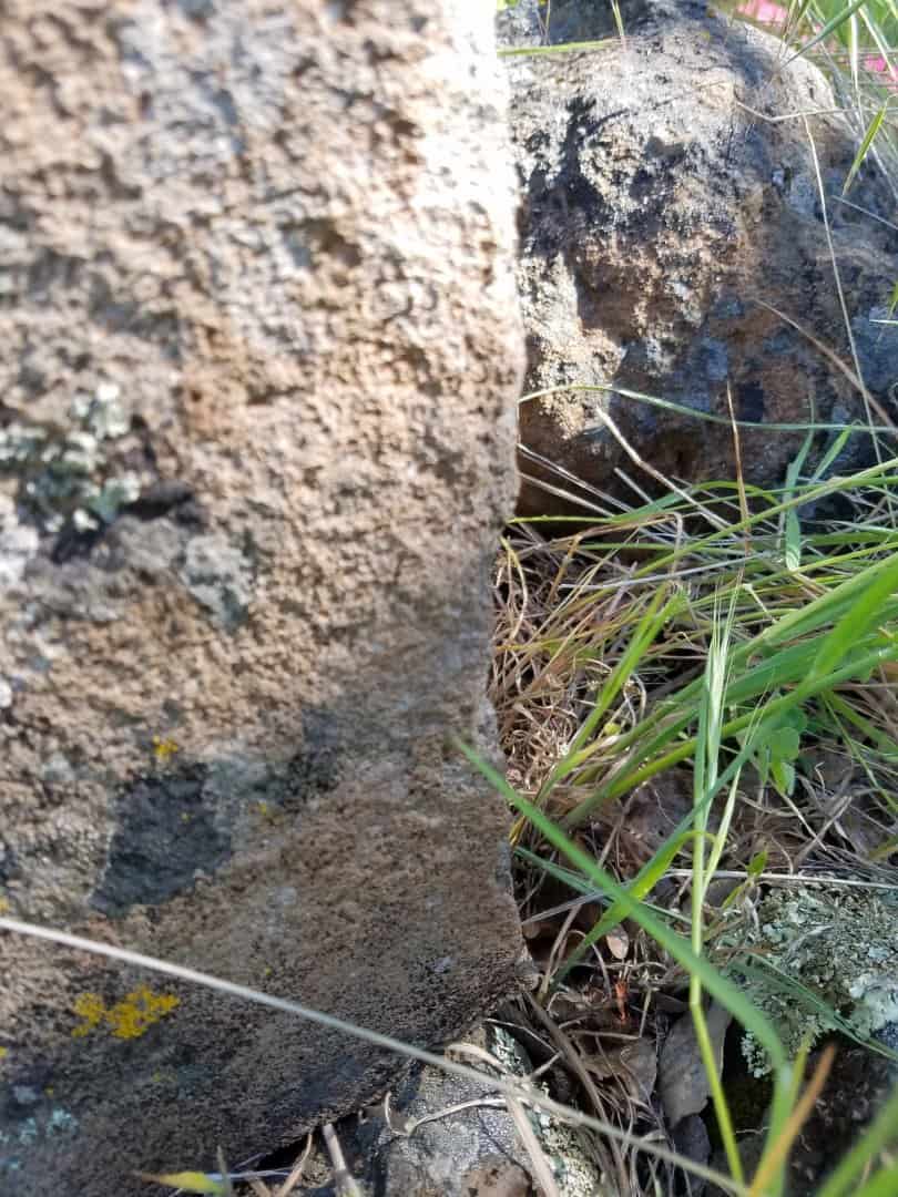
The photo doesn't do them justice, in person they look and feel more like deliberately chipped notches.
There is also a stone at the quarter section corner 46 chains south which I looked at briefly, it has one original BT. There is also a non-original BT with healed line hacks on it but they mark the east-west centerline of section. It's a big lava stone shaped more like an egg, I didn't see a 1/4S but there is dirt on the face which is currently down. It also has a rod/cap. I'm tempted to replace them with monuments properly stamped. The other thought is Drive one of my aluminum monuments over it with a window cut out so you can see the rod/cap under my cap. Or set an RM with a big arrow but most non-surveyor monument users don't see the giant arrow on it or they think it's some kind of Surveyor hyrogliphic mark.
I went to the west quarter, there is a candidate stone mound there but it is a much smaller stone mound. Need to get the field notes. Most of the work this week didn't involve retracing GLO corners, these two are just obvious.
Actually the whole job is simple, so simple because it's not in Texas. And I used RTK which works great in the oak woodland. Oak trees don't grow very high over the lava cap (Mount Lassen).
That's interesting, almost all NE Section 6 corners I've ever seen were 5 and 1. 5 notches on the east side and one on the west side since it's along the north township line.
We get both, notches and grooves, but the notes always call them notches.
MightyMoe, post: 426965, member: 700 wrote: That's interesting, almost all NE Section 6 corners I've ever seen were 5 and 1. 5 notches on the east side and one on the west side since it's along the north township line.
We get both, notches and grooves, but the notes always call them notches.
I'll be back out there in a couple of weeks, I'll look at it more closely.
The big find was three (smaller than 60d but bigger than 16d) traverse nails set by my predecessor in 1988 which I used to position the metes and bounds described "transfer of jurisdiction" parcel (a transfer from one State agency to another, not a Deed because title stays in the State). Using 16d nails for traverse points is really old school, my first boss did that. We prefer 80d nails (8" usually but an occasional 12" for a better, more permanent control point). We use 60d spikes in road traverses where the ground is harder or one time use traverses.
Dave Karoly, post: 426964, member: 94 wrote:
Actually the whole job is simple, so simple because it's not in Texas. And I used RTK which works great in the oak woodland. Oak trees don't grow very high over the lava cap (Mount Lassen).
If you had been in Texas you would have had to recover all the corners on the outside of the township and applied a least square adjustment, and then replace all the intwrior corners where the math tells you to, because the GLO set the interior corners after the exterior was already surveyed.
aliquot, post: 426974, member: 2486 wrote: If you had been in Texas you would have had to recover all the corners on the outside of the township and applied a least square adjustment, and then replace all the intwrior corners where the math tells you to, because the GLO set the interior corners after the exterior was already surveyed.
...and charge by the hour. Don't forget that!
When the gov stopped using stones and went to brass caps, some old timers couldn't give up the notching habit and were notching the sides of the brass caps. The SE of 6 would have 5 on the south, 5 on the east, it's cool to find those. I think it would be cool to continue the practice, but probably just a bit over the top.
This is the NW Cor. of Sec. 33, T. 8 S., R. 78 W., 6th PM. We visited this stone, Dave when you were out in 2009. It is in the alpine valley below Mt. Democrat. The sun obscures the 4 grooves on the east face, but the notch on the south edge is clearly visible.

Here's a close-up that shows the four grooves (upper right) and notch better (sorry for the soft focus, glamor shot; i.e. slightly out of focus)
A footnote regarding the above stone. The photos were taken with a cheap compact film camera in 2001. The stone was leaning to the left a little, but I didn't see the need to stand it upright at the time. Last summer I revisited the stone to find that someone in the interim had stood it upright. The only problem is that the nitwit that "rehabbed" it rotated the stone 180å¡ so that the notch now faces north and the grooves are on the "west face". ARRRGGGGHHHH!
I plan to do a professional rehabilitation of the stone this summer and will take several photos with a Nikon S6900 camera.
Dave Karoly, post: 426895, member: 94 wrote: The stone has been replaced with a 5/8" rebar & aluminum cap. This is the northeast corner of Section 6, T28N, R1E, M.D.M.:
I see 6 notches or I should say I felt 6 notches, they are more impressive in person:
Awesome pictures, thanks for sharing.
If you have the stone, then why would disturb it to set your pipe and cap? Why not bury it along side your pipe and cap and file some kind of record stating what you did? Some are likely to still measure to the stone(now out of position) and to reject the pipe and cap....
Gene Kooper, post: 427047, member: 9850 wrote: .....The only problem is that the nitwit that "rehabbed" it rotated the stone 180å¡......
Once, a long time ago, I was told that it is appropriate to rotate such a monument 180å¡ when you "rehab" it to alert the next guy to the fact that it has been rehabbed.
Dave Karoly, post: 426898, member: 94 wrote: This is the other edge, I found 3, there should be 5.
Original surveyor probable moved to California from Texas
Surveyor: "Carve three notches in the stone"
Crew Member 1: "But chief, shouldn't there be five?"
Surveyor: "Down in West Texas where I come from we deliberately obfuscate our boundary evidence. This will provide a delicious puzzle for a future surveyor to solve and prove his intellectual superiority to mere public lands sureyors."
Crew Member 2 (quietly to Crew Member 1): "I spent a year down Austin way, they're all asshats down there"
I suddenly feel the need to change my profile name...


