Im new to surveying.
In Canada a license/education is not required to survey.
Im a driller by trade and since work is slow, ive been switched over to surveying. Currently doing a road rebuild and water diversion.
Problem is, I have almost no experience. I did use trimble equipment to RTK cylindrical piles on a solar farm build, but thats it.
Now Im using TopCon and I didnt even get trained at all.
This is a great profession, I really like doing this work. But without training and guidance its been one frustrating week.
I did however learn alot on my own. I managed to do the topo properly and all my measurements were within the 3mm allowance.
Now, starting tomorrow, we start digging and im pretty intimidated.
I hope you dont mind but im going to be asking alot of silly questions.
Thanks in advance
Rick Christiansen
The first 3 days were highly unproductive.
I managed to set up base, establish a test point, and topo'd the road, centerline, toe, creek edges, high points...
But I also fought the data collector. Batteries failing, cant establish a signal to do the treeline etc
This upcoming week is gonna be hell as digging starts
Good luck. It sounds like you are diving in at the deep end. A lot of potential to make mistakes (possibly serious).
It think one of the best things I was told starting out was that nothing is right unless it is checked.
Totalsurv, post: 401158, member: 8202 wrote: Good luck. It sounds like you are diving in at the deep end. A lot of potential to make mistakes (possibly serious).
It think one of the best things I was told starting out was that nothing is right unless it is checked.
Thanks for the reply!
Honestly Im in over my head. ive asked for support from company surveyors everyday at work and my supervisor looks at me like im an idiot.
Surveying is not easy, nore is learning the equipment in a whim.
On friday I was asked to topo the "stations" at 20 meter intervals as shown on the map and I cant do it.
Maybe if the starting point had a GPS co-ordinate but it does not.
I tried to explain this to my supervisor and hes no help.
How can I survey without an established point?
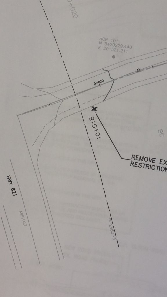
Here is a pic of the entry of the road. see the 0-20? thats 20 meter intervals im asked to topo for "stations"(no clue what that means?) and they continue up to about 160m
How do I establish that first point? it has no gps co-ordinate???
Sorry if I sound silly, but im literally left to hang on this project
Most everyone here has walked in your shoes at some point in time. For some of us the Earth was still cooling and the dinosaurs were annoying, but we survived whether we did things correctly on the first try or not.
Looking at your plans. You definitely need more information than what we can see. It appears that the supervision doesn't know what they are doing so they can't tell you what you must know. That's a rough way to start anything.
Agreed!
I like this work alot!(im an outdoors kinda guy and I like precision)
Im ready to confront my supervisor tomorrow about training. at least 1 day with an experienced surveyor to start. ultimitely this project is on my head and to add to it the ministry of transportation is following my every move.
I kinda feel like im a scapegoat in a sense. but like I said I really enjoy this work. so I want to learn and succeed.
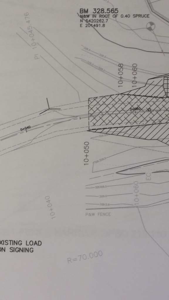
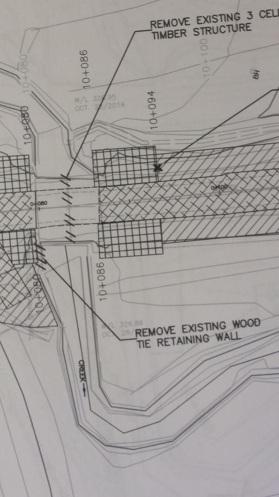
Ill add a few more pics of the map.
Please provide insight if you can, or ask question(anyone)
I would assume you mean a license is not needed to be a field technician. I would have a hard time believing anyone can be a professional land surveyor without some sort of training/license. Someone in your office must be licensed.
That being said, someone in your office must be able to help you out, unless they were under the impression that you were hired with enough experience already to know how to do what you are being asked. If not, that's their problem as they are asking you to do something they shouldn't.
I'm a surveyor, if you asked me to rebuild the engine of your car, it would be your own fault the car won't work when I'm finished with it.
Totalsurv, post: 401158, member: 8202 wrote: nothing is right unless it is checked
Rich., post: 401170, member: 10450 wrote: I would assume you mean a license is not needed to be a field technician. I would have a hard time believing anyone can be a professional land surveyor without some sort of training/license. Someone in your office must be licensed.
That being said, someone in your office must be able to help you out, unless they were under the impression that you were hired with enough experience already to know how to do what you are being asked. If not, that's their problem as they are asking you to do something they shouldn't.
I'm a surveyor, if you asked me to rebuild the engine of your car, it would be your own fault the car won't work when I'm finished with it.
Well put!!! we do have surveyors that have experience. but it seems the new gold project trumps everything else.
Its poor management and supervision really.
Our head surveyor cam in for 3 hours to show me some things but we had equipent issues and he basically spent that time with the equipment, not me.
Im not impressed
Manitoubass2, post: 401154, member: 12278 wrote: In Canada a license/education is not required to survey.
That may be true of construction layout in Manitoba but you very definitely do need a license to perform boundary surveys in Canada.
Unless there is more to that plan you have shown us there isn't really enough to do any meaningful staking.
Manitoubass2, post: 401154, member: 12278 wrote: Im new to surveying.
In Canada a license/education is not required to survey.
Im a driller by trade and since work is slow, ive been switched over to surveying. Currently doing a road rebuild and water diversion.
Problem is, I have almost no experience. I did use trimble equipment to RTK cylindrical piles on a solar farm build, but thats it.
Now Im using TopCon and I didnt even get trained at all.
This is a great profession, I really like doing this work. But without training and guidance its been one frustrating week.
I did however learn alot on my own. I managed to do the topo properly and all my measurements were within the 3mm allowance.
Now, starting tomorrow, we start digging and im pretty intimidated.
I hope you dont mind but im going to be asking alot of silly questions.
Thanks in advance
Rick Christiansen
Rick-
- Are you near Storkson's Corner ?
- Can you look into the particular instrument's manual on line ?
- Are you near enough to Fort Frances or Dryden to call the Ontario Land Surveyors there ?
- This seems like a late time in NW Ontario for a construction project.
Cheers.
Derek
It looks like there are some control points shown with coordinates, whatever they are based on. I would hope there's a sheet somewhere in the plans with the centerline geometry. From that you can establish the alignment and do the 20m xsections.
Mark Mayer, post: 401181, member: 424 wrote: Unless there is more to that plan you have shown us there isn't really enough to do any meaningful staking.
There is nothing else.
So would it all be topo?
Only stakes ive put in were where the culverts go across the road
DEREK G. GRAHAM OLS OLIP, post: 401183, member: 285 wrote: Rick-
- Are you near Storkson's Corner ?
- Can you look into the particular instrument's manual on line ?
- Are you near enough to Fort Frances or Dryden to call the Ontario Land Surveyors there ?
- This seems like a late time in NW Ontario for a construction project.Cheers.
Derek
Wow! yep thats exactly where I am, pretty much.
20km north up towards morson ontario
Yeah it seems late but this goes on all winter, especially with the new gold mine in boom.
Im from fort frances so I suppose I can look into that.
I downloaded the manual for the topcon 500 (might be wrong on the model #) but its not much help in reality
Manitoubass2, post: 401186, member: 12278 wrote: Wow! yep thats exactly where I am, pretty much.
20km north up towards morson ontario
Yeah it seems late but this goes on all winter, especially with the new gold mine in boom.
Im from fort frances so I suppose I can look into that.
I downloaded the manual for the topcon 500 (might be wrong on the model #) but its not much help in reality
________________________________________________________
Rick- There are surveyors in Dryden and Kenora.
(I almost ended up in Dryden in the mid 70s when Robert Brandon passed away. My wife SWMBO ~ She Who Must Be Obeyed) found it too nippy in February so we are here in the Fergus/Elora area. )
Where is the new gold mine site ?
Derek
Rick ,
Is your company willing to pay a consulting to come onsite and teach you?
All the Canadian provinces have licensure requirements as stringent or more stringent the most stringent states. Like here a licence is not required to do technician work like the OP is attempting .
What you are trying to do is not rocket science, but there are more ways to screw it up than you can imagine . A screwup could be a very expensive problem. This forum will be very helpful, but you really need someone on the ground with you to get you started. I would also check your provincial regulag ions to make sure a licenced surveyor does not need to be involved with construction surveying. All the construction projects I am aware of in Canada utilize the services of a proffesional surveyor . I don't know if it is required .
Do you have the CAD files? I can help you to solve your "problem".


