Can any of you guys out west give me an example of a Playa that was meandered by GLO and has held its status a state or federal land as a result?
The Great Salt Lake comes to mind although it's not necessarily a playa per se (except when and where it IS).
The Great Salt Lake Lake has not dried up entirely within modern (or even historic) times, but it is believed to have come very close during the Holocene.
It has however expanded and contracted SIGNIFICANTLY since the original meandering by the GLO (beginning in about 1856 and continuing through the remainder of the 19th and early 20th Centuries).
This issue went to the U.S. Supreme court several times in the 1960s, and there is quite a bit of information out there concerning the particulars. A reasonably good (but very brief) overview is contained in UGMS Bulletin 116, “Great Salt Lake, a Scientific, Historical, and Economic Overview,” June 1980, pages. 15-18.
Loyal
Manny of Utah's valleys bottom out with a playa, some of which were meandered. The ownership of the bed by the state, however, isn't determined by whether or not the lake was meandered, but by its navigability. There are two navigable playas (to my knowledge) in Utah: Utah Lake and the Great Salt Lake. Utah Lake, technically, has an outlet to the Great Salt Lake, so likely doesn't fall within the definition of a playa.
There is one case that I'm aware of, MONROE V. STATE, 111 Utah 1, 175 P.2d 759 (Utah 1946), where the state claimed ownership of the bed of Scipio Lake (a meandered playa) and leased the exposed bed for grazing. The court determined that the lake was easier to circumnavigate than it was to attempt a crossing by boat for commercial purposes, therefore, the lake was non-navigable and the state had no ownership.
Like Loyal said, the state has been arguing with upland owners about the boundaries of their ownership along the shores of both Utah Lake and the Great Salt Lake for over a century. The appellate court consistently tells them that the boundary is the ordinary high water mark, not the meander line. Problem is, it's pretty difficult to find a high water mark in a playa. After all, it is a lake in the bottom of an ancient lake.
JBS
Hmm. Maybe Mono Lake in Mono County, CA? I don't know the history of the breakdowns of this area, just a guess.
As JB indicated, there are any number of endorheic basins (systems) within the Great Basin, and there are also a number of pluvial and MANY ephemeral lakes associated with these basins.
MOST of these lakes are not (and never have been) navigable in any legal sense (a few were and are), and many of these basins also contain playas and/or ephemeral lakes.
There are few cases (Rush Lake in Utah comes to mind) that were meandered by the GLO in the past (1886 in the case of Rush Lake) during a rather wet period, which were later “subdivided” by the GLO (1904 for Rush Lake) during a dry period (and [in part] conveyed by Federal Patent). Then in 1983 Rush Lake came back to a level greater than it had been in 1886. It is now dry again (for a while anyway).
The Great Salt Lake situation may be somewhat unique in the fact that there is (as JB and I alluded to above) a U.S. Supreme Court Decision (actually several of them) that pertains to the Federal v. State Boundaries around the Lake [the meander line], but that doesn't necessarily affect the State v. Private boundaries around the lake (sometimes it does, most times it doesn't, depending on the Federal Patent date). At least that's my take on it.
There really isn't any hard and fast rules when it comes to this stuff, but that can be said of MOST (if not all) boundary questions.
It depends,
Loyal
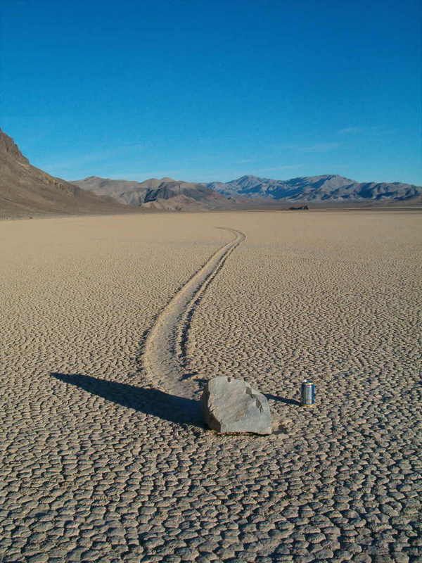
so you want to be a Playa?
This line is curved.

Ah... the roving rocks
of the Death Valley Racetrack!
Loyal
Owens Lake is drained by the L.A. Aquaduct so I guess that doesn't count.
There's Rogers Dry Lake at Edwards and there's another one down there too. I haven't looked at the Plats though.


