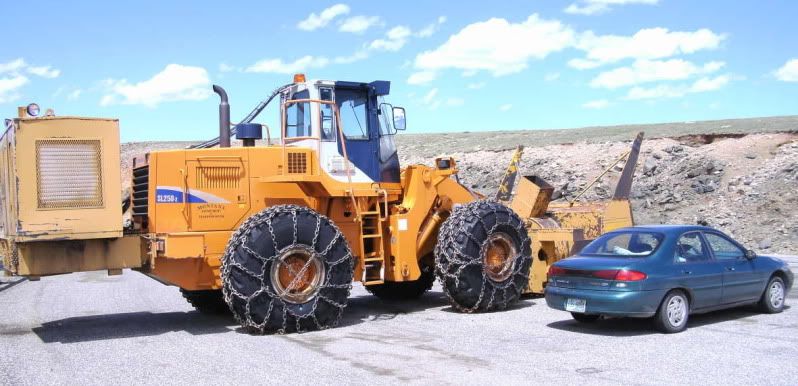
Crews have been attempting to open the highway from Bear Lodge to the Big Horn River in the Big Horn Mountains. This is a picture from last Friday.

There were as much as 14 feet of snow still on the ground in places. Then it started snowing! Reports from the mountain yesterday were that it was snowing so hard visibility was reduced to arm's length.
Good thing I moved to Alaska to avoid that kind of stuff;-)
Haven't seen that kind of cut since I went over Lolo pass one winter.
jud
Can't you people read the calendar?
> Can't you people read the calendar?
What has the Calender to do with it?
Quite a few miles southeast of there, in NE Wyoming, just west of the Black Hills and Devil's Tower, I have seen it snow and sleet on the 17th of July. No mountains and avg elevation of about 4,000 feet ASL.
:coffee:
What Highway is that? For some reason I can't find Bear Lodge.
It's 14A. A portion of US 14 only open part of the year.
Send me
some of that moisture and I'll send you some 90 degree weather.
Andy
Send me
I think I'll pass on the 90deg. heat. I'd rather have snow.;-)
Send me
Current Temp: 93°F
Current Humidity: 8%
Feels Like: 88°F
Nice breeze. Great day to be outside. It'll be worse this weekend. 106°F forecast for Saturday.
The location is between Burgess Junction and Lovell
but the old timers would say between Burgess Junction and Kane. Kane was a small town near the Bighorn River that was abandoned before they closed Yellowtail Dam back in the early 1960s and formed Bighorn Lake.
Bear Lodge in this case is a long-established privately operated resort with motel and cabins as well as restaurant, bar, and those things usually found at such a place.
The Wyoming DoT has a year-around maintenance camp at Burgess Junction. That and a couple of lodges and a trailer court or two are all the civilization at Burgess Junction.
The Bearlodge Mountains are in the Wyoming portion of the Black Hills, 150 miles farther east and around Sundance.
I was a lift operator at Mammoth Mountain in 1982.
We received a foot of snow in June (don't remember the exact date).
The job finally ended on July 5, 1982.
The location is between Burgess Junction and Lovell
We really enjoyed our time in the Bighorns the summer before last. We stayed in the Porcipine CG just west of Burgess Junction and visited Porcupine Falls, The medicine wheel, hiked Bald Peak and even did some glissading in the snow in July.


The location is between Burgess Junction and Lovell
> We really enjoyed our time in the Bighorns the summer before last. We stayed in the Porcipine CG just west of Burgess Junction and visited Porcupine Falls, The medicine wheel, hiked Bald Peak and even did some glissading in the snow in July.
>
> 
>
> 
>
> 
Perry,
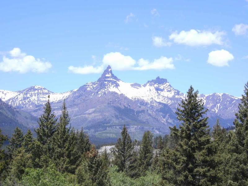
Those are not mountains. Those are just some medium size hills.
Where are the pictures of the mountains?
🙂
> It's 14A. A portion of US 14 only open part of the year.
I wasn't even looking in Wyoming. I was thinking Montana. :coffee:
The location is between Burgess Junction and Lovell
> but the old timers would say between Burgess Junction and Kane. Kane was a small town near the Bighorn River that was abandoned before they closed Yellowtail Dam back in the early 1960s and formed Bighorn Lake.
>
> Bear Lodge in this case is a long-established privately operated resort with motel and cabins as well as restaurant, bar, and those things usually found at such a place.
>
> The Wyoming DoT has a year-around maintenance camp at Burgess Junction. That and a couple of lodges and a trailer court or two are all the civilization at Burgess Junction.
>
> The Bearlodge Mountains are in the Wyoming portion of the Black Hills, 150 miles farther east and around Sundance.
I worked over off of the D Road in Crook County doing soil survey work in 1969. Any time you could get on top of a good size hill, you could look east and see Devil's Tower.
That was the second time I was in that area. The first was in 65. We went fishing over on the Powder back then.
Send me
Oh, please, please, keep those temps in Texas! I want nothing to do with those sauna like temps!:-P
Bighorn Mountain Picture for Stephen
this picture is from a hike into the Cloud Peak Wilderness in the southern Bighorns on June 29. 2009. It was about a 6 mile hike (one way) up to Twin Lost Lakes where this pic was taken. lots of river crossings with no bridges, but beautiful scenery and lots of wildlife.

Montana sized snow blower

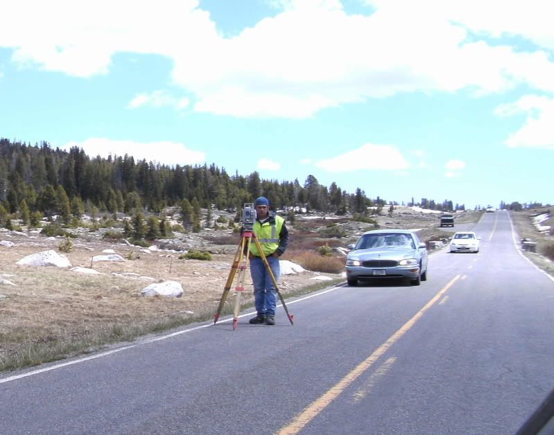
beartooth pass WY surveyors:


Calendar?
A few years ago, four hikers got lost in a snowstorm on Mount Washington in NH on August 23.


