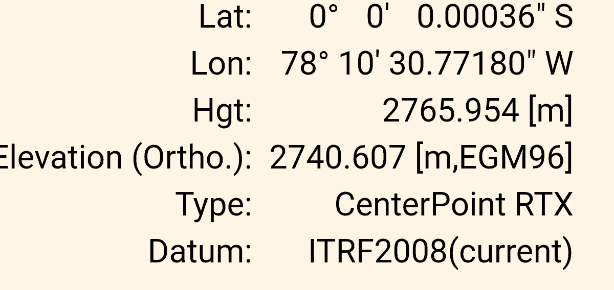
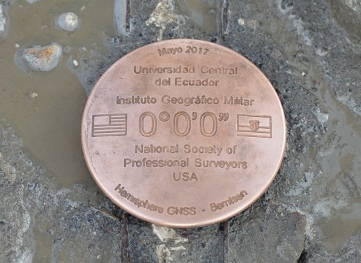
Went to the equator today, and checked their marking of the line. There was an IGM disk on the line, determined by GNSS (stamped 2005, probably SIRGAS reference frame, which is ~ITRF). I used Trimble Centerpoint RTX (R10). It put me on the ITRF 2008 current epoch equator about 29 cm south of where it was marked. Here is a screenshot of when i was close (turns out to be 0.011 m from the 0 degree line), and the estimated error in the north component was 0.009 m. So I figure I was within about 0.01 to 0.02 m from the actual line.
There are several "monuments" at varying distances from the actual equator, set in the pre-GNSS days and probably referenced to either PSAD56 or SAD69. Or maybe even astronomical. The largest one is about 8" south of the equator (about 800 feet), another well known line is about 4" south. I checked the Z (ECEF Z, not Zenith Z) velocity at a nearby CORS, it was 0.0114 m/year, with an uncertainty of 0.0004 m/year, so that does not account for the 29 cm (going north at the equator is entirely along the Z axis, as the X-Y plane IS the equator). Next I checked the EGM08 deflections of the vertical, and came up with ~1.6" N-S and 10.8" E-W. That makes sense, it is in a valley between N-S trending mountain ridges of the Andes. That would put the astronomic equator about 48 meters north of the geodetic equator (if I did my math correctly).
Pin cushion, pin cushion, pin cushion...
Sorry John, somebody was going to say it sooner or later.
But seriously, NICE!
We need to get together for a cold one or two sometime, it's been quite a while since we did that last.
Loyal
Here is where my data was telling me the equator is located, you can see their line to the left (south).
Today we are going to walk through Quito to have Guinea Pig for lunch in Mariscal Sucre, stopping on the way at the Quito Astronomical Observatory, which has a museum and was the origin for their datum until Army Map Service came along around 1947.
I would have collected some static data there yesterday, but the day before I had to go to the IGM office and pay $51.30 (cash) to get data from a CORS from April when I was in the country surveying for a water system in a small village. Not an easy process, as far as i can tell you have to go in person and pay cash. They have a pretty dense network of CORS, but the data is not readily available. This map is dated, because it does not have the station I am using...
There was also a field support engineer from Hemisphere GNSS there with two of their receivers. They have their own correction service (Atlas) delivered via satellite, his data pretty much agreed with my data as to where the actual zero degree line was located.
Shouldn't you have set a new disk? Can you say pin cushion!! Lol
Very cool !!!!
Stamp the disc as a WC. Pincushion would just be wrong...
Existing Monuments control, duh....... 🙂


