Reading RPLS is free for the whole profession. Members post, reply, and get the members-only rooms.

Notifications
Clear all

Topic starter
Translate
▼
English
Spanish
French
German
Italian
Portuguese
Russian
Chinese
Japanese
Korean
Arabic
Hindi
Dutch
Polish
Turkish
Vietnamese
Thai
Swedish
Danish
Finnish
Norwegian
Czech
Hungarian
Romanian
Greek
Hebrew
Indonesian
Malay
Ukrainian
Bulgarian
Croatian
Slovak
Slovenian
Serbian
Lithuanian
Latvian
Estonian
I got a call to do some work in Section 27, it was not a Section I had needed when I was in the area this summer, I did have the SE, NE and NW corners because of some other work in surrounding sections. This left the SW corner to be found, but when looking for these old surveys there can easily be a 50' radius to search, with much snow it can be very frustrating to say the least.
Were my office is there is a good 1' of hard packed snow, but I was told it was mostly open ground on the job site. As I was driving there, there was deep snow almost the entire way until just before I got to the site and sure enough it was mostly bare ground, so I lucked out. Sure enough with some scrapping, some poking I hit the monument:
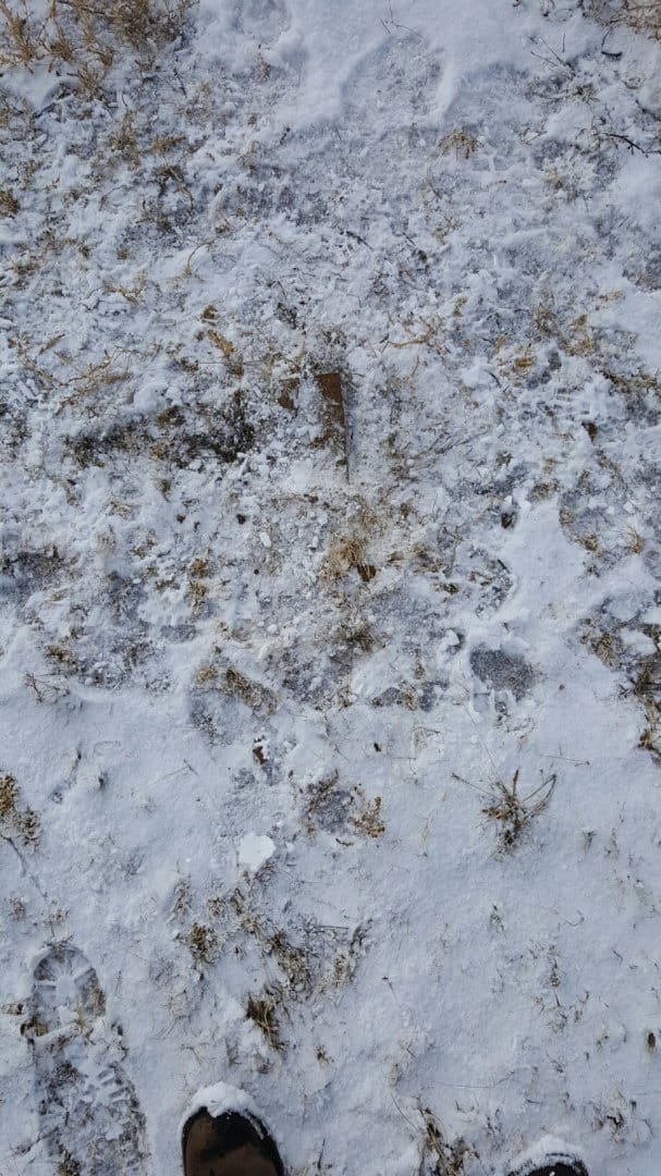
This one even has a remnant of a pit 5.5' northeast of the corner, it's filled with ice now, it even shows up on the newest google photo
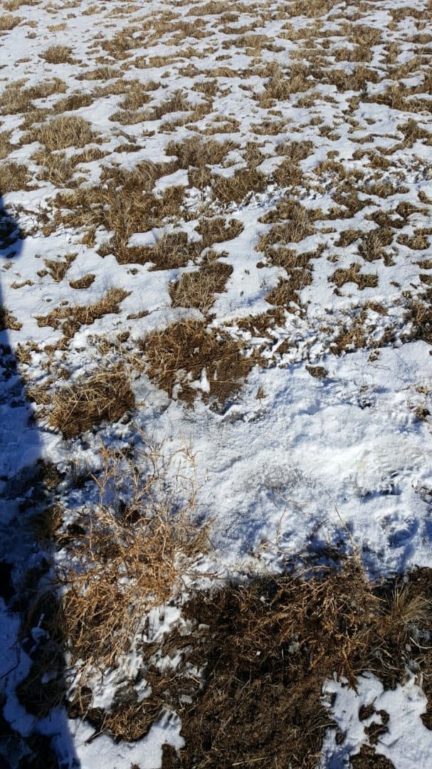
the ice filled circle is the old pit
Posted : January 25, 2017 10:33 am

Translate
▼
English
Spanish
French
German
Italian
Portuguese
Russian
Chinese
Japanese
Korean
Arabic
Hindi
Dutch
Polish
Turkish
Vietnamese
Thai
Swedish
Danish
Finnish
Norwegian
Czech
Hungarian
Romanian
Greek
Hebrew
Indonesian
Malay
Ukrainian
Bulgarian
Croatian
Slovak
Slovenian
Serbian
Lithuanian
Latvian
Estonian
You are saying that the pit itself is visible in Google Earth?!
Posted : January 25, 2017 11:04 am
Topic starter
Translate
▼
English
Spanish
French
German
Italian
Portuguese
Russian
Chinese
Japanese
Korean
Arabic
Hindi
Dutch
Polish
Turkish
Vietnamese
Thai
Swedish
Danish
Finnish
Norwegian
Czech
Hungarian
Romanian
Greek
Hebrew
Indonesian
Malay
Ukrainian
Bulgarian
Croatian
Slovak
Slovenian
Serbian
Lithuanian
Latvian
Estonian
Jim in AZ, post: 410794, member: 249 wrote: You are saying that the pit itself is visible in Google Earth?!
yes, it's very visible, the photo is 2014, the pit is a nice looking circle.
Posted : January 25, 2017 11:30 am
Topic starter
Translate
▼
English
Spanish
French
German
Italian
Portuguese
Russian
Chinese
Japanese
Korean
Arabic
Hindi
Dutch
Polish
Turkish
Vietnamese
Thai
Swedish
Danish
Finnish
Norwegian
Czech
Hungarian
Romanian
Greek
Hebrew
Indonesian
Malay
Ukrainian
Bulgarian
Croatian
Slovak
Slovenian
Serbian
Lithuanian
Latvian
Estonian
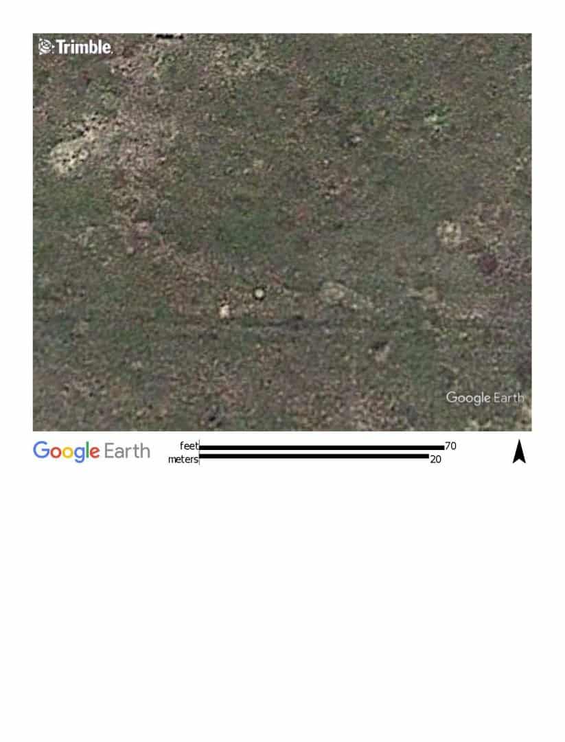
here is the google photo, the pit is the little white circle, the white irregular shape to the southwest of the circle may have also been a pit, but it is a prairie dog hole now. They are 11' apart and the stone sits on line and midpoint between them.
Posted : January 25, 2017 11:38 am

Translate
▼
English
Spanish
French
German
Italian
Portuguese
Russian
Chinese
Japanese
Korean
Arabic
Hindi
Dutch
Polish
Turkish
Vietnamese
Thai
Swedish
Danish
Finnish
Norwegian
Czech
Hungarian
Romanian
Greek
Hebrew
Indonesian
Malay
Ukrainian
Bulgarian
Croatian
Slovak
Slovenian
Serbian
Lithuanian
Latvian
Estonian
MightyMoe, post: 410787, member: 700 wrote: I got a call to do some work in Section 27, it was not a Section I had needed when I was in the area this summer, I did have the SE, NE and NW corners because of some other work in surrounding sections. This left the SW corner to be found, but when looking for these old surveys there can easily be a 50' radius to search, with much snow it can be very frustrating to say the least.
Were my office is there is a good 1' of hard packed snow, but I was told it was mostly open ground on the job site. As I was driving there, there was deep snow almost the entire way until just before I got to the site and sure enough it was mostly bare ground, so I lucked out. Sure enough with some scrapping, some poking I hit the monument:
This one even has a remnant of a pit 5.5' northeast of the corner, it's filled with ice now, it even shows up on the newest google photo
the ice filled circle is the old pit
Looks like you had a pretty good location for starting your search. Nice that you were on a location that actually had exposure to the winter sun.
Posted : January 25, 2017 2:18 pm
Topic starter
Translate
▼
English
Spanish
French
German
Italian
Portuguese
Russian
Chinese
Japanese
Korean
Arabic
Hindi
Dutch
Polish
Turkish
Vietnamese
Thai
Swedish
Danish
Finnish
Norwegian
Czech
Hungarian
Romanian
Greek
Hebrew
Indonesian
Malay
Ukrainian
Bulgarian
Croatian
Slovak
Slovenian
Serbian
Lithuanian
Latvian
Estonian
I lucked out, it was an area that got missed when everyone else was getting snow, the night after I left it got 8" of blowing and drifting snow from what I hear. Hard to say if I would have found it under those conditions, like to think I would have 😉
Posted : January 25, 2017 3:02 pm
Topic starter
Translate
▼
English
Spanish
French
German
Italian
Portuguese
Russian
Chinese
Japanese
Korean
Arabic
Hindi
Dutch
Polish
Turkish
Vietnamese
Thai
Swedish
Danish
Finnish
Norwegian
Czech
Hungarian
Romanian
Greek
Hebrew
Indonesian
Malay
Ukrainian
Bulgarian
Croatian
Slovak
Slovenian
Serbian
Lithuanian
Latvian
Estonian
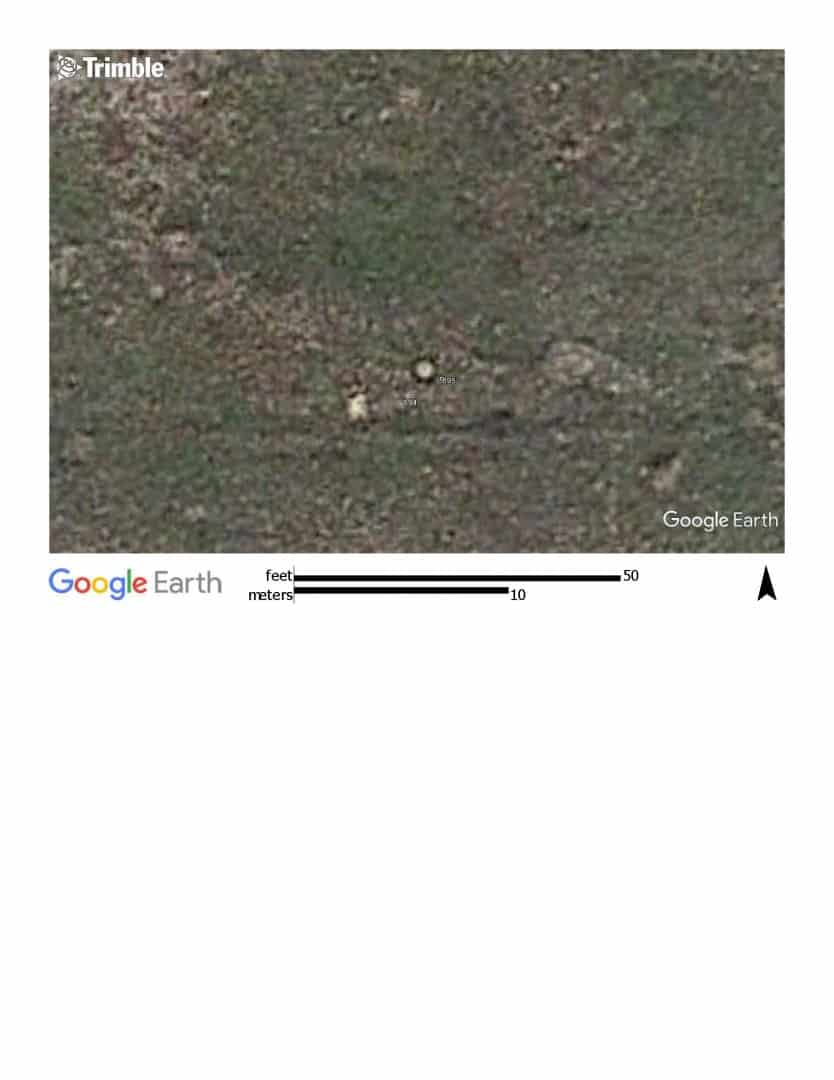
it's amazing how clear the google photos are sometimes, this is it zoomed in, with the stone and the pit coordinate plotted on it. The points come in a few feet southeast of the photo positions. Not too surprising.
Posted : January 25, 2017 3:16 pm

Translate
▼
English
Spanish
French
German
Italian
Portuguese
Russian
Chinese
Japanese
Korean
Arabic
Hindi
Dutch
Polish
Turkish
Vietnamese
Thai
Swedish
Danish
Finnish
Norwegian
Czech
Hungarian
Romanian
Greek
Hebrew
Indonesian
Malay
Ukrainian
Bulgarian
Croatian
Slovak
Slovenian
Serbian
Lithuanian
Latvian
Estonian
Thats really cool.
(cold too!)
What did you do, in the snow, and frozen ground, to perpetuate the corner?
I've heard of using an rv tank, with hot water, to thaw/search.
Did you leave anything magnetic?
Posted : January 26, 2017 4:28 am
Topic starter
Translate
▼
English
Spanish
French
German
Italian
Portuguese
Russian
Chinese
Japanese
Korean
Arabic
Hindi
Dutch
Polish
Turkish
Vietnamese
Thai
Swedish
Danish
Finnish
Norwegian
Czech
Hungarian
Romanian
Greek
Hebrew
Indonesian
Malay
Ukrainian
Bulgarian
Croatian
Slovak
Slovenian
Serbian
Lithuanian
Latvian
Estonian
Nate The Surveyor, post: 410882, member: 291 wrote: Thats really cool.
(cold too!)
What did you do, in the snow, and frozen ground, to perpetuate the corner?
I've heard of using an rv tank, with hot water, to thaw/search.
Did you leave anything magnetic?
I will file a corner record for it, ties to nearby corners, I did not disturb the stone, it is imbedded in solid ice which is probably 4 feet deep at this point, trying to dig it up now would only destroy it.
Once the corner record is filed no one should have any issue finding it again. According to the landowner it's looked just like that for 60+ years now.
Posted : January 26, 2017 6:31 am

Translate
▼
English
Spanish
French
German
Italian
Portuguese
Russian
Chinese
Japanese
Korean
Arabic
Hindi
Dutch
Polish
Turkish
Vietnamese
Thai
Swedish
Danish
Finnish
Norwegian
Czech
Hungarian
Romanian
Greek
Hebrew
Indonesian
Malay
Ukrainian
Bulgarian
Croatian
Slovak
Slovenian
Serbian
Lithuanian
Latvian
Estonian
MightyMoe, post: 410898, member: 700 wrote: .. According to the landowner it's looked just like that for 60+ years now.
There is nothing like having a property owner with the longevity and memory to help out.
I ran into a corner location once that instead of a pin or stone, we just found an 8" timber post with the top 18" visible. This was near the Cimarron River and it wasn't snow that had covered the ground, but the sand hills that blow and move. I was convinced the post meant something as it's location was really, really close to where a 1/4 cor. should have been and there were no fences in the area.
The older gent that owned the place explained there was a stone at the bottom of the 8' x 8" timber post. He had been a young man when his father decided to mark the stone with the post because the sand kept covering it up. I told him I would like to expose the stone and he said he'd like to see it too.
Later that week he brought his rubber tired backhoe around and made short work of a 7' hole. We found the stone at the bottom of the post and got a good location before the sand fell back in the hole.
Gotta love a good memory.
Posted : January 26, 2017 7:00 am
Topic starter
Translate
▼
English
Spanish
French
German
Italian
Portuguese
Russian
Chinese
Japanese
Korean
Arabic
Hindi
Dutch
Polish
Turkish
Vietnamese
Thai
Swedish
Danish
Finnish
Norwegian
Czech
Hungarian
Romanian
Greek
Hebrew
Indonesian
Malay
Ukrainian
Bulgarian
Croatian
Slovak
Slovenian
Serbian
Lithuanian
Latvian
Estonian
paden cash, post: 410903, member: 20 wrote: There is nothing like having a property owner with the longevity and memory to help out.
I ran into a corner location once that instead of a pin or stone, we just found an 8" timber post with the top 18" visible. This was near the Cimarron River and it wasn't snow that had covered the ground, but the sand hills that blow and move. I was convinced the post meant something as it's location was really, really close to where a 1/4 cor. should have been and there were no fences in the area.
The older gent that owned the place explained there was a stone at the bottom of the 8' x 8" timber post. He had been a young man when his father decided to mark the stone with the post because the sand kept covering it up. I told him I would like to expose the stone and he said he'd like to see it too.
Later that week he brought his rubber tired backhoe around and made short work of a 7' hole. We found the stone at the bottom of the post and got a good location before the sand fell back in the hole.
Gotta love a good memory.
The landowner in question is in his late 80's (I'm guessing), he said he went with his dad to show a surveyor that rock 60 years ago. He said his dad pointed it out to the surveyor and promptly kicked him off his land. Considering the time frame, it may have been the crews looking for corners to put on quad sheets, this one shows up as an X. Since it's been flush for 60 years I'm glad its still showing at all; record is a 20x16x4. I measure the top to be 13x5 so there may be almost 2 feet in the ground. That will have to wait till spring, if I'm back there I will take another look at it.
Posted : January 26, 2017 8:35 am