

I've been asked to submit a proposal to cross-section about 1800 l.f. of what used to be a creek but is now basically a long skinny lake. The channel was closed at both ends decades ago, and is now more of a distended duck pond. Bank-to-bank width runs from about 10 feet to 30 feet. Water depth is around 4 feet, with a lot of organic muck on the bottom.
Because of the muck and the depth I don't want to try walking it in waders, so I'm considering floating platforms. Kayak, canoe, float tube? I'm looking for good ideas.
Thanks!

Well if you can't go with this http://www.oceanscience.com/Products/Z-Boat/Home.aspx
http://www.ilinks.us/iboat.html
I would go with a canoe. It is stable. Or a a kayak. You can usually hold it steady with a 25' level rod. Or a a kayak would be good. John boats are great but if there is any wind they are hard to hold in place. When I was doing that all the time. We used to modify a mast from a sail board with a mushroom anchor on the bottom. It was rigid and fixed height. Then you could mount gps, prisim on top. But it was strong enough to hold the boat still.

Two guys, one on either side, with a 30-foot rod holding the prism pole (securely) at the center. Another guy running the gun. We aren't building watches today. You'll have all the center line shots in no time. Adjust the pole location to be within 10-feet of one end of the pole. Run along one side then back down the other by flipping ends before the return trip. No one has to enter the water this way.
I know some surveyors who think they can walk on water...subcontract the work to them.
Holy Cow, post: 344750, member: 50 wrote: Two guys, one on either side, with a 30-foot rod holding the prism pole (securely) at the center.
Good idea, but trees and brush preclude walking along the banks for much of the project. The approach is going to have to be from the water.
I have tried this just about every way I could think of. The kayak didn't work, to much with the paddle, glass and staff. Paddle board, wet suit and swimming etc.
The most success that I have had is with a small row boat, or the absolute best was a 2 person wave runner the client offered us!
Dtp
Chainsaw:party:

Flat bottom boat (aka Jon Boat) stable enough to stand on either end.
Extra man can maneuver around by pole or paddle or one man can do everything.
Iman man may need to setup in water......

I did 1-1/2 miles of Caddo River.
I used a Canoe. With a range pole. Set inside a tire rim, with a welded vertical pipe in the middle, and all bungied down.
Data collector in my lap. 100' cloth tape. with weight on the end. And, a navigational assistant. (Big Help)
We'd take a shot in the flow line, and I carried a Laser Range finder. Shot distance to both waters edges. And, changed the HR (TDS software) to reflect CL with depth, GPS was 4.2' above boat floor. Add water depth, and that is HR of CL. 4.2 is at waters edge. So, that was in the note. Edited later in the office.
We had no mishaps.
But we did have a few close calls. Wore life jackets.
N
You can pole sound the water. Set a stake anywhere for a water gage (mark water level) and set a stake/hub at water level too. Acquire water level elev. Before and after soundings.
Best boat in this case would be a 10Ûª Jon boat or medium sized canoe. I donÛªt know what your station interval is 100ft? 50ft? Do the overbanks, water edge first (RTK, Total station..and set a stake at waterÛªs edge with stationing.
Come back in the boat/canoe and use a vinyl tape or hip chain to measure from the stake and take the soundings with a rod recording them in a field book.
When we did these we had a choice of a 8Ûª jon boat , 17Ûª Coleman marine canoe or 12Ûª pirogue. No one likes the small jon boat. It needed to be 10 ft.
If you want to you can record the top of th silt mud and tern push for at true sounding.
This could be done solo but 2 man would be better.

4 feet isn't that deep; you just need to keep your feet out of the mucky muck.
Try this:
 B-)
B-)
try not to say quack quack; if it's hunting season....:woot:

Did a hydrographic survey of a muddy bottomed river with a https://www.seafloorsystems.com/&apos ;">Hydrolite depth sounder and a rowboat while I was in Oklahoma. Worked pretty well.
I've tried the kayak route before. Not good... As stated, it's cumbersome to manage the paddling and the rod. The float tube idea is quite interesting! If you're referring to the average fishing float tube, with a seat, gear tray, flippers... Easy enough to control with your feet so you don't have to fumble with a paddle, yet it shouldn't be difficult to hold steady to get the shot. That's the route I would try. Also, if you don't have a boat/kayak/canoe, the float tube can usually be had for under $100, making it the cheapest option. Check craigslist. Best of luck!
Kayak. Done similar stuff......be careful if you use 25' rod with prism attachment not to pull it apart and lose the bottom section. We used an old junk 15' prism pole. If it's only approximately 4' deep you can just push along the bottom with that....no need for paddle, but take one anyway just in case.
True, I didn't even consider the lack of depth that he's dealing with... I used a 25' fiberglass level rod and it filled with water the second it water was deeper than the first section, making it heavy and awkward. A 2 section prism pole with a topo shoe may work much better.
If you're only looking at 30 foot maximum width you could RTK it from standing on the shore/shallows by attaching an outreach pole to the top of the GPS pole just below the rover so that the pole hangs down vertically and can be dipped from the shore onto the bed. This assumes a bluetooth connection between the rover and dc and access to both banks so you wouldn't need to reach out more than say 10'. Is your client looking for top of silt, hard bottom or both?
I've found an oversize topo shoe made of plywood sits fairly well on top of silt but there can be a suction effect to overcome when lifting off.

Artie Kay, post: 344879, member: 3428 wrote: Is your client looking for top of silt, hard bottom or both?
Both. I'm thinking that a regular topo shoe should give enough tactile feedback to allow me to identify the top of silt. But I'm not planning to do this from shore, I've worked with an outreach pole before and found it annoyingly difficult to control.
Pump that turkey dry and wait for the bottom to dry up. Man, why didn't I think of that sooner! :-S
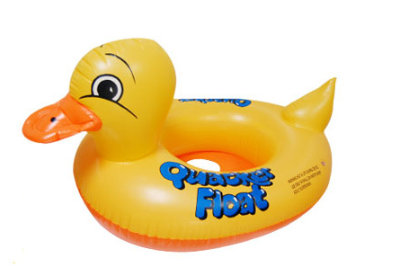
You need a duck.
A real duck with a fish finder that records data - attached to it. Then while it swims around get some reflectorless pops! Have someone shoo it around or get a male duck to chase it!
Heck I don't know.
Good Luck.