Reading RPLS is free for the whole profession. Members post, reply, and get the members-only rooms.

Notifications
Clear all
Strictly Surveying
11
Posts
6
Users
0
Reactions
1,048
Views

Topic starter
Translate
▼
English
Spanish
French
German
Italian
Portuguese
Russian
Chinese
Japanese
Korean
Arabic
Hindi
Dutch
Polish
Turkish
Vietnamese
Thai
Swedish
Danish
Finnish
Norwegian
Czech
Hungarian
Romanian
Greek
Hebrew
Indonesian
Malay
Ukrainian
Bulgarian
Croatian
Slovak
Slovenian
Serbian
Lithuanian
Latvian
Estonian
What are the numbers (No. 1, No. 2 all over it)? I don't think they are lot numbers. The Plat is T12S, R19E, MDM, 1856. The NW1/4 of Section 6 was patented with no mention of lot numbers. The west half of the SW1/4 of Section 7 was patented with no mention of lot numbers. Interesting.

Posted : January 5, 2017 6:01 pm

Translate
▼
English
Spanish
French
German
Italian
Portuguese
Russian
Chinese
Japanese
Korean
Arabic
Hindi
Dutch
Polish
Turkish
Vietnamese
Thai
Swedish
Danish
Finnish
Norwegian
Czech
Hungarian
Romanian
Greek
Hebrew
Indonesian
Malay
Ukrainian
Bulgarian
Croatian
Slovak
Slovenian
Serbian
Lithuanian
Latvian
Estonian
I've seen the same thing in 1855 era township plats for the subdivision of sections. The Oregon Instructions and 1855 Manual don't describe such a thing. See where Section 6 has three sets of No. 1 and No. 2?
Posted : January 5, 2017 6:48 pm

Translate
▼
English
Spanish
French
German
Italian
Portuguese
Russian
Chinese
Japanese
Korean
Arabic
Hindi
Dutch
Polish
Turkish
Vietnamese
Thai
Swedish
Danish
Finnish
Norwegian
Czech
Hungarian
Romanian
Greek
Hebrew
Indonesian
Malay
Ukrainian
Bulgarian
Croatian
Slovak
Slovenian
Serbian
Lithuanian
Latvian
Estonian
They are lots. I have never seen one exactly like this but there were many different styles of loting until the 1870s when they settled on what is standard today. The lots were often ignored if a whole "1/4" or "1/2" were patented, but they could also call for an individual lot like this:
Lot 1 of the NW 1/4 of section 6
Or the lot could be broken down as shown on the plat:
W1/2 of Lot 1 of the NW 1/4 of section 6.
This is a rare example where it would be correct to describe a 1/2 of a lot.
Posted : January 5, 2017 7:40 pm
Topic starter
Translate
▼
English
Spanish
French
German
Italian
Portuguese
Russian
Chinese
Japanese
Korean
Arabic
Hindi
Dutch
Polish
Turkish
Vietnamese
Thai
Swedish
Danish
Finnish
Norwegian
Czech
Hungarian
Romanian
Greek
Hebrew
Indonesian
Malay
Ukrainian
Bulgarian
Croatian
Slovak
Slovenian
Serbian
Lithuanian
Latvian
Estonian
Warren Smith, post: 407629, member: 9900 wrote: I've seen the same thing in 1855 era township plats for the subdivision of sections. The Oregon Instructions and 1855 Manual don't describe such a thing. See where Section 6 has three sets of No. 1 and No. 2?
This is interesting. Turner v. Sekhon (unpublished) is a dispute over the dividing line between the east and west half of the northwest quarter of the northwest quarter or the west half of government lot 2 in the northwest quarter.
Turner:
The East1ã2 of the West1ã2 of Government Lot 2 in the Northwest1ã4 of Section 6, Township 12 South, Range 19 East, Mount Diablo Base and Meridian, according to the Official Plats thereof....
Sekhon:
The W1ã2 of the W1ã2 of Lot 2 in the NW1ã4, being the W1ã2 of the NW1ã4 of Section 6, Township 12 South, Range 19 East, Mount Diablo Base and Meridian, according to the official plat thereof.
I accidentally picked up some briefs for this case and it appears Sekhon wants to divide the quarter by midpoint protaction citing Wood v. Mandrilla (1914) whereas Turner wants to follow the plat. It appears that the quarter is divided in north and south halves per the plat and east and west halves equally just looking at google maps but that's rough. Turner could lose land on his east but that is just eyeballing.
Turner prevailed and Sekhon wants the Supreme Court to review the surveyor's incorrect conclusion of law which is interesting but he didn't get his review. It looks to me like Turner's Surveyor is probably correct because the descriptions say according to the ... plat...
Posted : January 5, 2017 7:55 pm
Translate
▼
English
Spanish
French
German
Italian
Portuguese
Russian
Chinese
Japanese
Korean
Arabic
Hindi
Dutch
Polish
Turkish
Vietnamese
Thai
Swedish
Danish
Finnish
Norwegian
Czech
Hungarian
Romanian
Greek
Hebrew
Indonesian
Malay
Ukrainian
Bulgarian
Croatian
Slovak
Slovenian
Serbian
Lithuanian
Latvian
Estonian
I don't see how the court could have ruled any other way.
Posted : January 5, 2017 8:24 pm
Topic starter
Translate
▼
English
Spanish
French
German
Italian
Portuguese
Russian
Chinese
Japanese
Korean
Arabic
Hindi
Dutch
Polish
Turkish
Vietnamese
Thai
Swedish
Danish
Finnish
Norwegian
Czech
Hungarian
Romanian
Greek
Hebrew
Indonesian
Malay
Ukrainian
Bulgarian
Croatian
Slovak
Slovenian
Serbian
Lithuanian
Latvian
Estonian
aliquot, post: 407648, member: 2486 wrote: I don't see how the court could have ruled any other way.
The descriptions can be interpreted two ways so practical construction may point to one or the other, either of which interpretation the description is reasonably susceptible to.
This paragraph from the opinion contains the original descriptions from 1911 (the quarter was not subdivided by the Federal government):
Appellants say much about a September 1911 deed conveying what is now the Sekhon parcel (ÛÏThe W1ã2 of NW1ã4 of NW1ã4 of Section 6Û) and a November 1911 deed conveying what is now the Turner parcel (the ÛÏE1ã2 of NW1ã4 of NW1ã4 of Sec. 6Û), but appear to ask us to conclude as a matter of law that the Sekhon west half is larger than the Turner east half.
Posted : January 5, 2017 8:31 pm

Translate
▼
English
Spanish
French
German
Italian
Portuguese
Russian
Chinese
Japanese
Korean
Arabic
Hindi
Dutch
Polish
Turkish
Vietnamese
Thai
Swedish
Danish
Finnish
Norwegian
Czech
Hungarian
Romanian
Greek
Hebrew
Indonesian
Malay
Ukrainian
Bulgarian
Croatian
Slovak
Slovenian
Serbian
Lithuanian
Latvian
Estonian
Those are lots in a fraction section. Very common in Missouri. We have some sections that are 4-5 miles long North to South and have several lots.
Posted : January 5, 2017 9:29 pm
Topic starter
Translate
▼
English
Spanish
French
German
Italian
Portuguese
Russian
Chinese
Japanese
Korean
Arabic
Hindi
Dutch
Polish
Turkish
Vietnamese
Thai
Swedish
Danish
Finnish
Norwegian
Czech
Hungarian
Romanian
Greek
Hebrew
Indonesian
Malay
Ukrainian
Bulgarian
Croatian
Slovak
Slovenian
Serbian
Lithuanian
Latvian
Estonian
Michael White, post: 407662, member: 12162 wrote: Those are lots in a fraction section. Very common in Missouri. We have some sections that are 4-5 miles long North to South and have several lots.
My point is "No. 2" covers two rectangles. This is an early Plat (1854) so they hadn't ironed out the Lot system yet.
Posted : January 6, 2017 11:04 am

Translate
▼
English
Spanish
French
German
Italian
Portuguese
Russian
Chinese
Japanese
Korean
Arabic
Hindi
Dutch
Polish
Turkish
Vietnamese
Thai
Swedish
Danish
Finnish
Norwegian
Czech
Hungarian
Romanian
Greek
Hebrew
Indonesian
Malay
Ukrainian
Bulgarian
Croatian
Slovak
Slovenian
Serbian
Lithuanian
Latvian
Estonian
similar, but different. right now reviewing a survey of lots 1-6, block 4. trying to decide what that means in relation to the plat of record.

Posted : January 6, 2017 12:02 pm

Translate
▼
English
Spanish
French
German
Italian
Portuguese
Russian
Chinese
Japanese
Korean
Arabic
Hindi
Dutch
Polish
Turkish
Vietnamese
Thai
Swedish
Danish
Finnish
Norwegian
Czech
Hungarian
Romanian
Greek
Hebrew
Indonesian
Malay
Ukrainian
Bulgarian
Croatian
Slovak
Slovenian
Serbian
Lithuanian
Latvian
Estonian
flyin solo, post: 407776, member: 8089 wrote: similar, but different. right now reviewing a survey of lots 1-6, block 4. trying to decide what that means in relation to the plat of record.
Well, the plat of record is probably a crude transcription of the actual plat of the addition and it may well be that the clerk who copied the surveyor's plat left a line or four out. One place to look would be in the Engineering File Room to see whether they have either a better copy of the original or records indicating how the plat has been interpreted for more than a century.
At a minimum, the plat shows a scheme of lot and block numbering and shows the blocks bounded by certain streets, some of which existed prior to platting. Often, the original deeds given by the subdivider recite lot sizes and fill in some of the missing details or provide a basis from which they may be deduced.
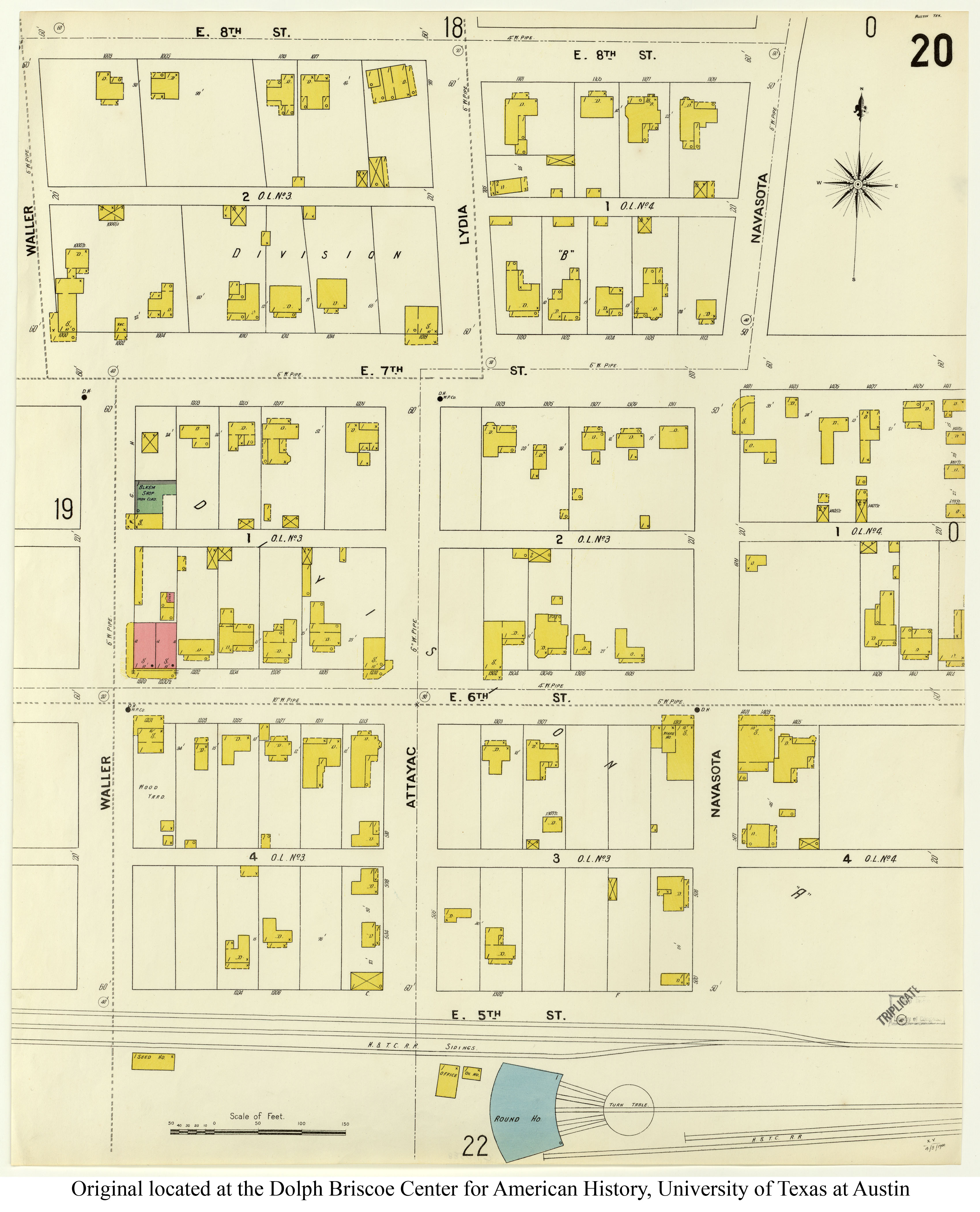
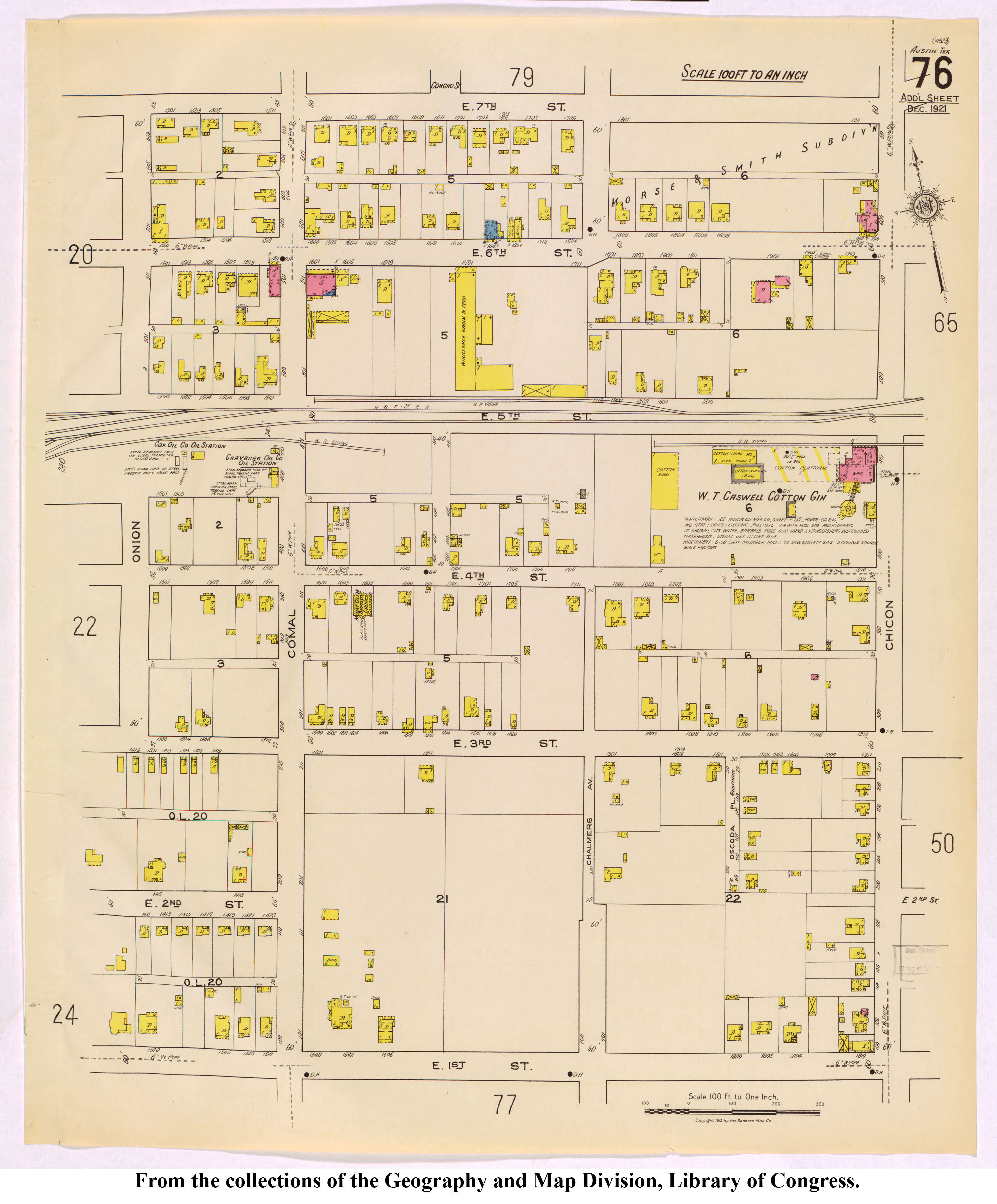
Here are links to Sanborn maps from 1900 (Map 20) and 1921 (Map 76):
Posted : January 6, 2017 12:25 pm
Topic starter
Translate
▼
English
Spanish
French
German
Italian
Portuguese
Russian
Chinese
Japanese
Korean
Arabic
Hindi
Dutch
Polish
Turkish
Vietnamese
Thai
Swedish
Danish
Finnish
Norwegian
Czech
Hungarian
Romanian
Greek
Hebrew
Indonesian
Malay
Ukrainian
Bulgarian
Croatian
Slovak
Slovenian
Serbian
Lithuanian
Latvian
Estonian
This all started because I was looking into our case of Wood v. Mandrilla, 167 Cal. 607, 140 P. 279 (1914) which held a fractional quarter should be divided into equal halves, not an east 80 and west 100 acres as per the GLO Plat. It has no Westlaw headnotes but I found it cited in CJS Deeds, Am Jur Deeds, and Cal Jur Deeds. It is not cited in the first two editions of Brown, Boundary Control and Legal Principles, but is cited in the fourth (I forgot to look in the third yesterday).
I found that Wood is distinguished by the Kansas case, Hoyne v. Schneider, 138 Kan. 545, 27 P.2d 558 (1933). I like the analysis in Hoyne a lot better than the analysis in Wood and I think Wood is "a derelect on the waters of the law" in California anyway. A review of the Section in Wood shows that it is currently divided by government measure on the Assessor's Plats and current filed Surveys, not per the affirming opinion. Wood is limited to the southwest quarter of Section 30 whereas Hoyne involves the entire south half of Section 18 (both are closing sections on the west side of the township). The Hoyne court reasons that Federal Statute outlines how sections are to be subdivided, the Plat shows how to subdivide the Section, and the original Grantor (by will) could've specified something different, the Hoyne descendants had notice of the statutes and the plats, they are not secret. The Hoyne court also points out that if the west half of the southwest quarter is to equal the east then they actually should have ignored the south quarter corner and spread the equalness across the four "80s" that were inherited by the Hoyne brothers but that the east half owner never pointed this out because then they would have to share the windfall to the east. I think the Hoyne court saw that ruling the same as our Wood case would open a huge can of worms and make a mess so they declined to do it.
I came across the plat by reviewing Turner v. Sekhon (unpublished-2008-linked above). Turner is an unpublished Agreed Boundary case which I had read before because it cites Bryant v. Blevins (1994). In the process of getting cases and other materials that cite Wood I got the Turner briefs (briefs are really useful because they often contain a lot more than the opinion of the court). This case is a lot more interesting than the case opinion indicates; I found some Surveys on-line. At this point I think the Turner's surveyor was correct and the north tier of aliquots in the northwest quarter are unequal as shown on the Plat. Closer inspection of google maps shows that the apparent possession lines more or less look like the Plat so holding for equal areas would cause too much havoc in the Section.
Wood seems to try to limit the analysis to the bare words of the Deed without reference to surrounding circumstances as found in Statutes, Plats, and Deeds which is unnecessarily limiting. Hoyne more properly holds that a complete inquiry into the surrounding circumstances is necessary.
Posted : January 6, 2017 1:21 pm