Since you are so inspired about using GPR to find buried stones, you should go for it Kent. The company that Mr. Tostick referenced is Exploration Instruments, LLC. They are conveniently based in Austin, TX. You seem to have some spare time at the moment, so go rent one of their units and conduct some experiments to develop, "a technique that is optimized for finding planted stones of some threshold minimum size that is both spatially accurate and minimally invasive."
You can optimize the system to find out which antenna is best for finding buried stones and develop how best to couple survey-grade GPS to the GPR unit so that you maintain your nominal accuracy of +/- 5mm for the GPR images. And I'm sure with minimal effort, you will also be able to minimize the time to cover the area where the stone most likely is located. I've seen estimates for the lower cost GPR units that they can cover 100 sq.ft. in approx. 30 minutes.
After you develop your stone finder prototype, you should fly up to Harrisburg, PA to Exploration Instruments other US facility, rent the needed equipment and head off to Harmonyville for extensive field tests. If things go as peachy as you have predicted, I see a big payout when you sell your system to Schonstedt. Why the name nearly writes itself, Schonstedt's Subterranean Stone Survey Sounding System, or S6 for short (apologies to Mr. Tostick for borrowing his alliterative phrasing).
With that pile of cash, you can retire and spend more time here and at the Austin tofu chorizo bars. 🙂
Scott Ellis, post: 445259, member: 7154 wrote: Bill.
I am in no way a troll as you have called me. I am on this forum under my real name and not hiding behind a name like some of the members of this forum. I am also a register professional land surveyor on a land surveying forum.
How many Surveys have you stamped and signed?
Yes I believe the PLSS is an easy system to learn and survey in. The only time it is complicated is when the step by step instructions are not followed.
Prior to this post, I thought that you were just poking a little good natured fun at those of us that work in the PLSS and that Bill, albeit a Colonial State guy, was being a bit too thin-skinned on our behalf in coming to our defense.
Perhaps you don't have enough experience outside of TX to know, but the step-by-step instructions were almost never fully followed. That's partially due to deputies that were not fully familiar with the instructions or took shortcuts, but more due to the fact that most of us recognize that no set of instructions can successfully foresee all circumstances that will be encountered in the field.
The knowledge needed these days by the surveyor working in PLSS states is how to appropriately handle the circumstances caused by those deviations in previous surveys from the instructions, knowing how to handle the situations where the PLSS adjoins or is mingled with other systems, and do so by methods that can be consistently applied to similar circumstances yet remain somewhat flexible to adapt to differing circumstances.
But since down in TX, you folks just make it up as you go along, I can understand why that might be difficult for you to comprehend.
(You should consider that last sentence as a friendly jab)
Try to keep in mind... this is HARMONYVILLE! 🙂
[SARCASM]Until someone gets on Google Street View, and does some actual field work, this will go on forever.[/SARCASM]
R.J. Schneider, post: 445359, member: 409 wrote: [SARCASM]Until someone gets on Google Street View, and does some actual field work, this will go on forever.[/SARCASM]
You jest, but there's an outfit down in your neck of the woods who I'm ever more convinced (like, by the day) does this as their s.o.p.- weird thing is I'm fairly sure their office is still underwater, but they're still sending out work, emails, etc. I'd love to bend the ear of somebody who just collects a paycheck there.
Gene Kooper, post: 445334, member: 9850 wrote: Since you are so inspired about using GPR to find buried stones, you should go for it Kent. The company that Mr. Tostick referenced is Exploration Instruments, LLC. They are conveniently based in Austin, TX.
Thank you for being late to the party, Eugene. I originally posted the link to that company earlier in this thread with the observation that GPR equipment is available for rent.
R.J. Schneider, post: 445359, member: 409 wrote: [SARCASM]Until someone gets on Google Street View, and does some actual field work, this will go on forever.[/SARCASM]
I actually tried street view, but could find none in Google Maps or Google Earth... I thought it would be interesting to eyeball the value of the property.
Most of the convoluted boundaries such as this seem to be in areas that obviously can not afford the cost of extensive search and research... But that is just my experience out West.
Peter Ehlert, post: 445378, member: 60 wrote: I actually tried street view, but could find none in Google Maps or Google Earth... I thought it would be interesting to eyeball the value of the property.
Most of the convoluted boundaries such as this seem to be in areas that obviously can not afford the cost of extensive search and research... But that is just my experience out West.
I looked around the area on real estate websites, it's not rock bottom but it's less than the area here. Mid 300s will get you a pretty nice house on 2 acres.
Peter Ehlert, post: 445378, member: 60 wrote: I actually tried street view, but could find none in Google Maps or Google Earth... I thought it would be interesting to eyeball the value of the property.
Most of the convoluted boundaries such as this seem to be in areas that obviously can not afford the cost of extensive search and research... But that is just my experience out West.
I spent a bit of time just searching Google Images for photos, thinking that there might be some photos of Harmonyville and the old Schoolhouse, but evidently the Children of the Corn had the photos removed if they were ever on line.
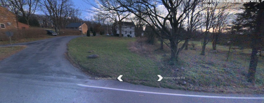
Bing.com/maps covers Harmonyville Rd. and some of School Rd. with Streetside images quite well.
Dave Karoly, post: 445388, member: 94 wrote: I looked around the area on real estate websites, it's not rock bottom but it's less than the area here. Mid 300s will get you a pretty nice house on 2 acres.
last March we drove up there from Bel Air, Md... to view the Amish country. We first went to Lancaster, then on over that a way... maybe right in front.
Nice area, but not what I would expect you might call "spendy".
Being many Amish in the area may be the reason the Google guys did not photograph it. 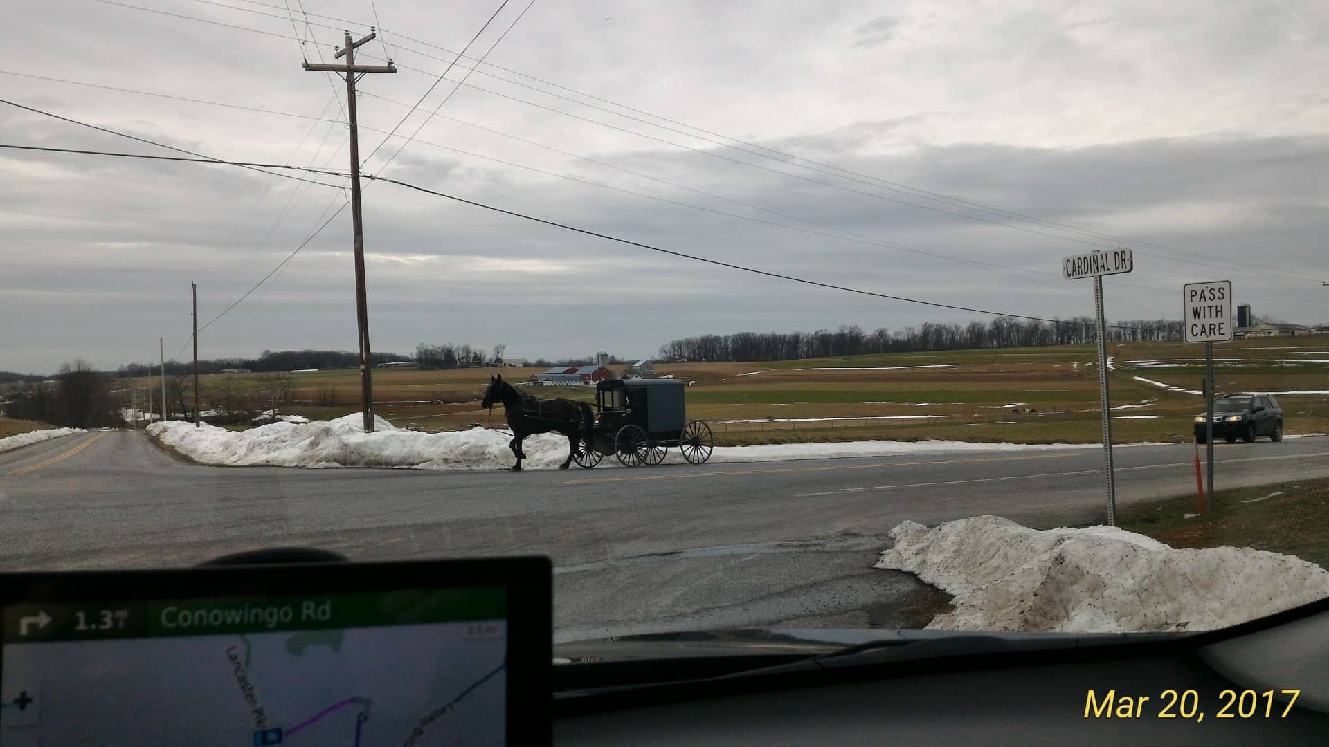
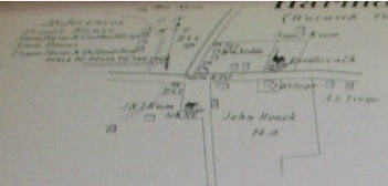
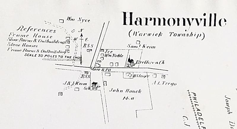
Ohio Surveyor, post: 445403, member: 12195 wrote: Found on the web: 1883 Atlas of Harmonyville.
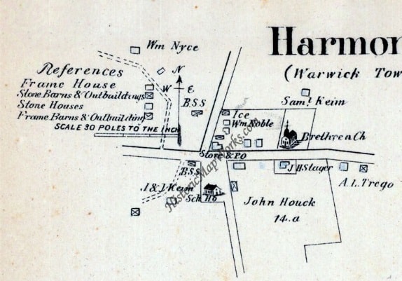
This map doesn't make any distinction between the road and school properties.
What's particularly interesting about that map is that it shows a LANE along the south side of the School Lot. If a lane were in place in about 1882 when the western triangle was sold off, that would explain the slightly odd angle that the South line of the western triangle makes.
One thing leads to another. Here's a better scan, from HistoricMapWorks.com
Kent McMillan, post: 445409, member: 3 wrote: I take it back. I found that 1883 map and see that what I thought said "LANE" actually reads "Sch Ho"
This is generally consistent with the 1883 map published in the Farm Atlas I posted above:
Got your airline ticket yet or are you going to drive?
More fun stuff:
Growing up around a school house in the northeastern part of Warwick Township, this settlement received its name about 1879 when the Brethren and Methodists worshipped there together. They got along so harmoniously that each group was alternately in charge of the Sabbath School until the Methodists erected their own church. With so many places with a similar name in the country, the post office in existence there from March 7, 1888, to Dec. 31 1901, was named Smedley in honor of Smedley Darlington, who was a U. S. Congressman from Chester County. John Plank, who worked for William Noble, superintendent of the French Creek Ore Mines, was the postmaster.
Pinkowski, Edward. Chester County Place Names,, Sunshine Press, Philadelphia, 1962
Dave Karoly, post: 445410, member: 94 wrote: Got your airline ticket yet or are you going to drive?
Actually, Oklahoma is much closer than Pennsylvania.
Kent McMillan, post: 445415, member: 3 wrote: Actually, Oklahoma is much closer than Pennsylvania.
Come on Kent, be a man, back up your words with action! Oklahoma has nothing to do with this. You have what? 200 of the posts in this thread?
Peter Hughes-Davies, post: 445397, member: 48 wrote: Bing.com/maps covers Harmonyville Rd. and some of School Rd. with Streetside images quite well.
The interesting thing about those images is that they show that, as expected for 19th-century roads, the roads have not been deeply cut but appear to have a slight fill. That should be a very good omen for the continued existence of planted stones under the modern road pavement. I definitely like the odds.
