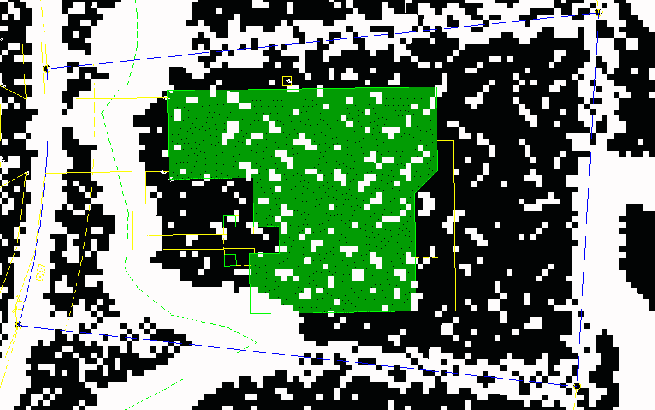
My client is buying a house wants to know if it's in or out of the flood zone. It is so close, that it actually depends on how I draw the scaled lines. I've never had it before that a corner of the house falls on the line, but if I scale to the center of the flood zone (which is what I usually do), it would be clear. What are the thoughts, here. Does have any guidelines on how to scale?
I'm kind of leaning towards just sending him this GIF and telling him to talk to an insurance agent about it. I'd advise getting an el cert and seeing if an LOMA, or "Out as Shown LOMA" would apply, but I think he only has a few days for "inspection period" to make the call.
I would ask my local floodplain administrator...
I would contact the floodplain Adm. and the company who checks these for the bank.
I've been told by fema to 'be conservative'
What does the FEMA interactive map show? I know it's "not official", but any additional info can help make the decision. Also, do you have a BFE and what is the ground elevation at that corner of the house?
You may be able to download additional data from the FEMA website- click on show all flood risk products. There are Geotiffs and shapefiles available in lots of cases.
Also, remember that being right next to a zone is still a high flood risk.
I didn't run a benchmark in so I don't know the elevations. I just sent the info the client and he wants me to go ahead and do an elev. cert., which I think is a wise choice for this property.
What sort of zone is it?
Mostly X shaded, the Along the west side is an AE 12 line.
Advise that even if they need flood insurance to complete the transaction, if a LOMA is forthcoming they can receive a refund on the previous 12 months premiums. If an elev cert shows they are in the flood zone then they should have the coverage.
Sent from my SM-G900P using Tapatalk
The Pseudo Ranger, post: 365585, member: 18 wrote: Mostly X shaded, the Along the west side is an AE 12 line.
Darn, it would have been perfect without the Shaded X. Did you review the FIS and interpolate between the nearest 2 transects to approximate the stillwater?
Any aerials?
I would start with a georeferenced FIRM and a field located house. That would give you a regulatory 'in' or 'out'. AFTER that I would investigate actual flood risk. The paper I print LOMAs on won't stop water...
I was just speaking with some of the local agency surveyors today. It seems that most communities around here don't have a local administrator. Or perhaps they do, but they don't know who it is...
Since it's newer zoning designations, the area should appear digitally here:
http://fema.maps.arcgis.com/home/webmap/viewer.html?webmap=cbe088e7c8704464aa0fc34eb99e7f30
You can also see if other LOMAs have been done nearby.
Is the lght green dashed line in front of the house indicative of a stream or water outfall? If so More examination of the associated profiles, if any, should be looked at.
If it is just a swale or some other line I'd call the whole shoot'in match in "X". B-)
I'm working on a funky one right now, also. From the west, the BFE is about 40.0 and from the east, it's about 43.5 - using every resource I can find. I have a full-blown topo survey that proves there is no ridge or levee or anything else between the two AE areas. Both apparent sources of flooding - the ditch immediately east and the bayou to the south-southwest - outfall to the same river.So, what would you say is the BFE in the adjacent AE? I generally agree with being conservative, but 3.5' makes a hell of a difference!


