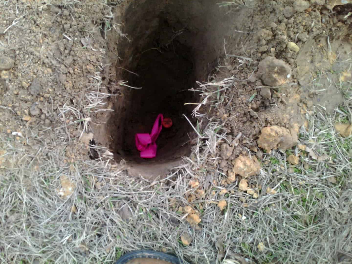
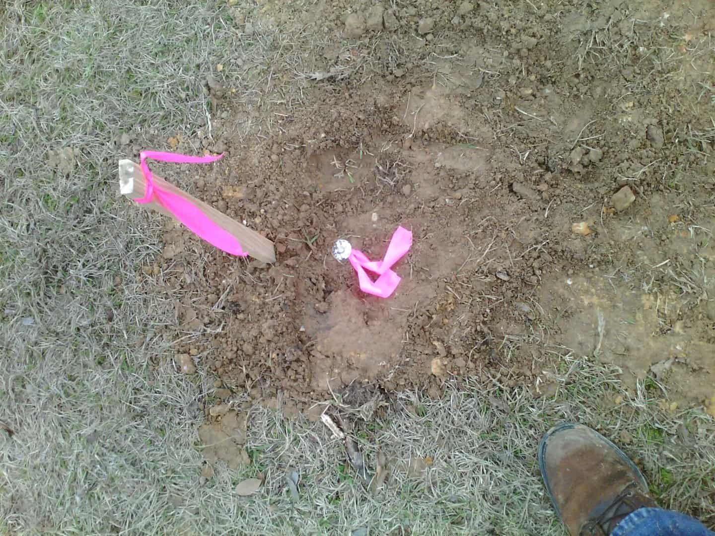
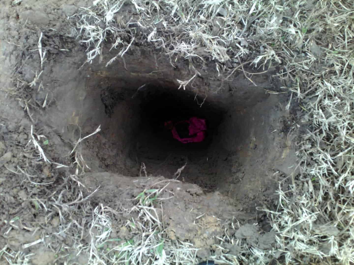
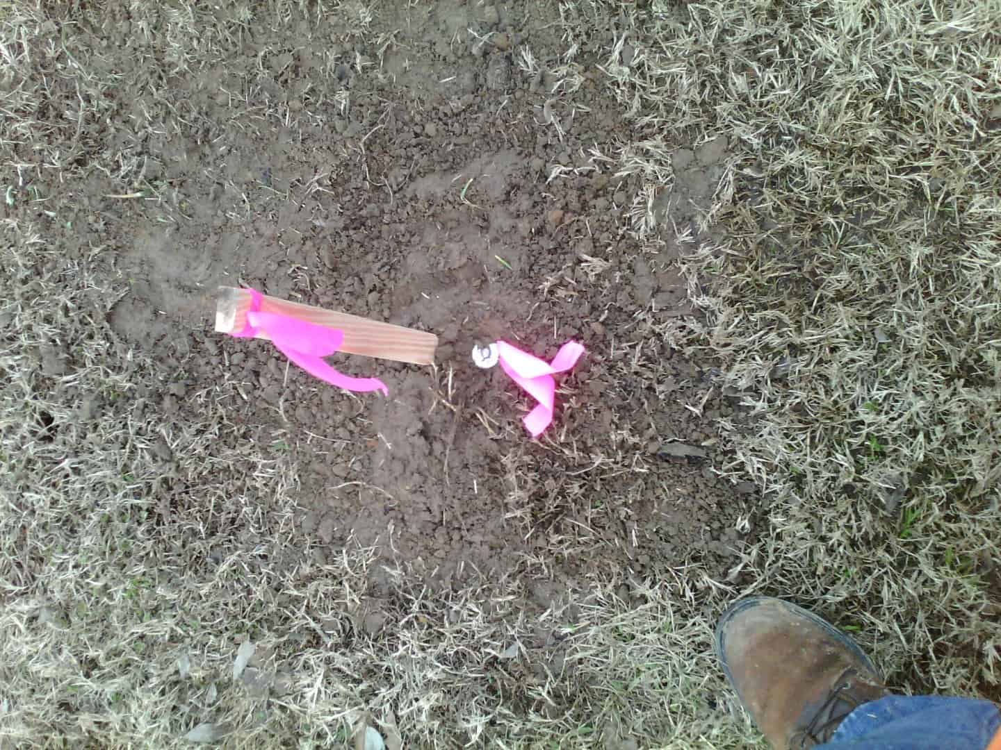
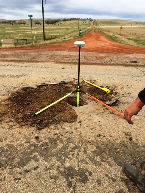
A couple of days ago I surveyed a small lot in a subdivision that was developed in 2011. Apparently the front was ditch to drain when the property was developed and some time during development the ditch was filled in. This caused both front corners to get buried. One was 16" deep and the other was 22" deep. Fortunately, both monuments (1/2" rebar with plastic ID cap) were not damaged, only covered by fill.
I collected my points on each and after I was sure that everything checked out, I covered the hole back and placed a nail over the rod at ground surface. Hopefully some future surveyor will see that these nails are real boundary monuments and look for themselves, but I felt that a rod buried 2 feet deep wasn't very helpful to the property owner. I set a tripod and tribrach over the rod, filled the hole, and then used the tribrach sight to put the nail in precisely over the rod.
What do you do in these sorts of instances?
Similar process many times. More typically I will have a sideshot to the monument from my TS and simply repeat the sideshot once the filling/packing/refilling/repacking/monument setting is complete.
The challenge comes with finding an appropriate way to set a worthy monument if the old one is a bit too shallow for the standard two-footer.
so you set a rod then? I just set 60d nails.
We're a recording state, so I file a record of survey showing the monument, and to help those who will follow me I state how deep it is, probably the most important piece of information. Several years ago I would never have found a key monument except the record said three feet down at the wall corner.
I have never had a problem with adding extra rod or pipe to get the monument closer to the surface, especially in a city where the land owners have a fit about their manicured lawns.
A short rod in a pipe will join two pieces of pipe together and a small section of pipe will join two rods together.
Have also set a deep rod and another on top to assure something remains when I know someone will pull up the monument as soon as I have left the property.
BTW, a fine tuned locator is worth its weight in gold for those kind of finds.
My approach to this problem has been to put a couple of nails directly over the buried monument to boost magnetic signal and tie flagging over them with the tail of flagging leading up to surface. If the client wants a surface monument then I set one and file record with both describing the set monument and the buried one. I don't like to set anything over original monuments as it might discourage future surveyors from digging deeper while looking for the all important original monuments. I figure that if I can find it so will the next surveyor.
Shawn Billings, post: 409907, member: 6521 wrote: Hopefully some future surveyor will see that these nails are real boundary monuments and look for themselves
this should have said "are NOT real boundary monuments and look for themselves."
A Harris, post: 409914, member: 81 wrote: BTW, a fine tuned locator is worth its weight in gold for those kind of finds.
The locator I used weighs about 5oz and fits in my vest pocket. I was pleased that it picked up these rebar. The signals were pretty weak at the surface, but no doubt there was something there, and of course, the signal quickly became stronger as I excavated.
I was determined to put ribbon on that one 22" deep and it took some real effort. I was on my stomach, laying flat reaching almost as far as I could to reach that rod to wrap ribbon on it.
Shawn Billings, post: 409917, member: 6521 wrote: The locator I used weighs about 5oz and fits in my vest pocket.
Brand and model please! 🙂
astrodanco, post: 409918, member: 7558 wrote: Brand and model please! 🙂
Why, Javad, of course!
I carry small ceramic magnets, and on deep monuments, I will place a couple of magnets around the pin, and tie long streamer of flagging, holding the flagging up as I re-bury the monument. Hopefully, the good zing on the magnet, the flagging in the hole, will lead someone to keep digging. Maybe.
Well, many things come to mind.
I have been an LS (That's a Land Surveyor!) for many years.
I have been buying 1/2" thinwall pvc, and using it in the place of wood stakes for a long time. I have found that the tops get weak, from long sunlight exposure. So, if you find a survey monument 20" deep, and stick a 30" pvc. Beside it, it serves to indicate very well, for most landowners. If they hit it with a mower, it gets cut off, and still indicates. But it does not mess up a mower, like metal does. If it gets run over, it does not damage a tire, or vehicle. It is usually accurate enough, for most landowners, to build fence. Since the top tends to get weak, the lower and underground part does not, then it seems to last very well. It makes a "trail" vertically, down to the monument.
It is cheap. It usually gets painted by me, when set. This blocks the sun's radiation, and uv deterioration.
They are light weight. (easy to carry).
I like the 6" dia ones mentioned above. But they could get hard to carry long distances.
Of late, I have backslidden. I now tie 10 or 15 pin flags to my prism pole, and use those. But, the pvc are better. Especially for set monuments.
When in the backwoods, I often cut a sapling, and set it, with a rock pile around the corner monument. Cedar is pretty good, and the red core does not rot very fast. Especially if painted. Rock piles seem to preserve monuments very well. They both provide a findable surface object, and the stones block vegetation growth. There is a real art to a well made rock pile. Set them with the flattest surface down, so it won't roll. Set at least 3 of them, around the monument.
I've literally set hundreds, or thousands of these rock piles.
Whatever you do, think in terms of monument preservation, and findability.
Even for a traverse nail, dig, or scoop out a hole, 2-3" deep. Set the nail at the bottom of the hole. Then tie flagging around a stone, and place the stone on top of the trv. Pt. If desired, cover with leaves, or dirt. These are very findable. We wrap the flagging several times around the stone, and place it knot down. The last for a very long time. I have found them 30 yrs old.
Anyway, good surveying, all the way down to the set monument, is not an accident.
Leave a trail.
N
Shawn Billings, post: 409907, member: 6521 wrote: A couple of days ago I surveyed a small lot in a subdivision that was developed in 2011. Apparently the front was ditch to drain when the property was developed and some time during development the ditch was filled in. This caused both front corners to get buried. One was 16" deep and the other was 22" deep. Fortunately, both monuments (1/2" rebar with plastic ID cap) were not damaged, only covered by fill.
I collected my points on each and after I was sure that everything checked out, I covered the hole back and placed a nail over the rod at ground surface. Hopefully some future surveyor will see that these nails are real boundary monuments and look for themselves, but I felt that a rod buried 2 feet deep wasn't very helpful to the property owner. I set a tripod and tribrach over the rod, filled the hole, and then used the tribrach sight to put the nail in precisely over the rod.
What do you do in these sorts of instances?
Nice precise holes. Well dug
Shawn Billings, post: 409907, member: 6521 wrote: A couple of days ago I surveyed a small lot in a subdivision that was developed in 2011. Apparently the front was ditch to drain when the property was developed and some time during development the ditch was filled in. This caused both front corners to get buried. One was 16" deep and the other was 22" deep. Fortunately, both monuments (1/2" rebar with plastic ID cap) were not damaged, only covered by fill.
I collected my points on each and after I was sure that everything checked out, I covered the hole back and placed a nail over the rod at ground surface. Hopefully some future surveyor will see that these nails are real boundary monuments and look for themselves, but I felt that a rod buried 2 feet deep wasn't very helpful to the property owner. I set a tripod and tribrach over the rod, filled the hole, and then used the tribrach sight to put the nail in precisely over the rod.
What do you do in these sorts of instances?
I wouldn't have put a nail. Typically, I just note how deep they are so that it forces the next surveyor to actually go get it. Not that what you're doing is wrong, but the nail isn't original and some folks just don't take the effort if a nail is there. If I were to do what you're doing, I'd have driven a rod and not a nail, but I don't (haven't) done either.
A Harris, post: 409914, member: 81 wrote: [SNIP]
BTW, a fine tuned locator is worth its weight in gold for those kind of finds. [/SNIP]
How true.
A couple of years ago I had to locate some 1926 R/W for old U.S. 99, and one of the ties to a 1/16th corner just did not fit very well. So we searched using the calculated distance from the 1926 plan and sure enough, the metal detector gave a howl. About 18" down there was an old iron pipe that fit within 0.33 feet of record. The other 1/16th on the surface which was set circa 1975 or so rested just a couple of feet westerly.
I hesitate setting any form of a monument over an existing monument that is deeply buried, especially without filing a new corner recordation stating exactly what I did. The attached picture is a corner that I dug up in a county road, buried approximately 3 feet deep. There was another monument set by a different surveyor who set his at the surface approximately 8 feet east (picture is looking north) of this monument, both set by lines of occupation, approximately 10 years apart.
Monte, post: 409953, member: 11913 wrote: I carry small ceramic magnets, and on deep monuments, I will place a couple of magnets around the pin, and tie long streamer of flagging, holding the flagging up as I re-bury the monument. Hopefully, the good zing on the magnet, the flagging in the hole, will lead someone to keep digging. Maybe.
Ditto. If no magnets, add extra nails etc
Add more flagging than usually necessary as you described
One expects to dig deep here at times because of conditions.
Once long ago as a PC was looking for a corner along a minor drainage canal between old subdivisions. Got a faint beep and we started digging. Got deeper and crew started to become exasperated as time passed.Finally after digging 2' + found an old horseshoe. Crew started to give me a hard time about it amid their laughter.
Got the horse shoe out and buzzed again...beep...another foot or so down was the old pipe. Not a peep from the crew.
He who laughs last has....
Kris Morgan, post: 409956, member: 29 wrote: I wouldn't have put a nail. Typically, I just note how deep they are so that it forces the next surveyor to actually go get it. Not that what you're doing is wrong, but the nail isn't original and some folks just don't take the effort if a nail is there. If I were to do what you're doing, I'd have driven a rod and not a nail, but I don't (haven't) done either.
The problem, as I see it, with just noting how deeply the monument is buried is that that information would be lost within a title company file after the closing for the lot was finished. I doubt, seriously, that any besides the most dedicated of surveyors would ever see that notation on Shawn's plat, since this was in a modern subdivision, which most likely is recorded. I would assume the survey was for a real estate closing or something similar.
In extreme circumstances, such as this one, where the record of Shawn's work won't see the light of day until the Title Company decides to scan and shred the paper file, I think raising the original monument to the surface would be a consideration. It seems that we have a duty to rehab corner monuments that we find displaced, bent, run over, or what have you, and that raising an original monument to the surface would serve the public interest.
Rehab, and raise the original mon? It MIGHT be one slightly better, to PLACE a fresh monument, on the surface, but LEAVE the one below surface. In fact, I did just that the other day. A nice deep 5/8" rebar, down deep at a fence corner, with rock pile. I drove a 3/8" reb BESIDE it, and tweeked the top of it, to be directly OVER the 5/8" rebar. Now, No matter what, the correct position will get used. And, there is a MONUMENT on the surface.
N
