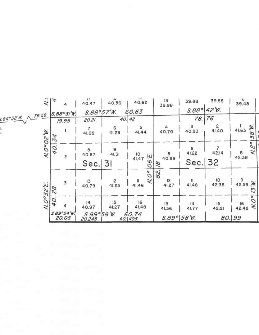
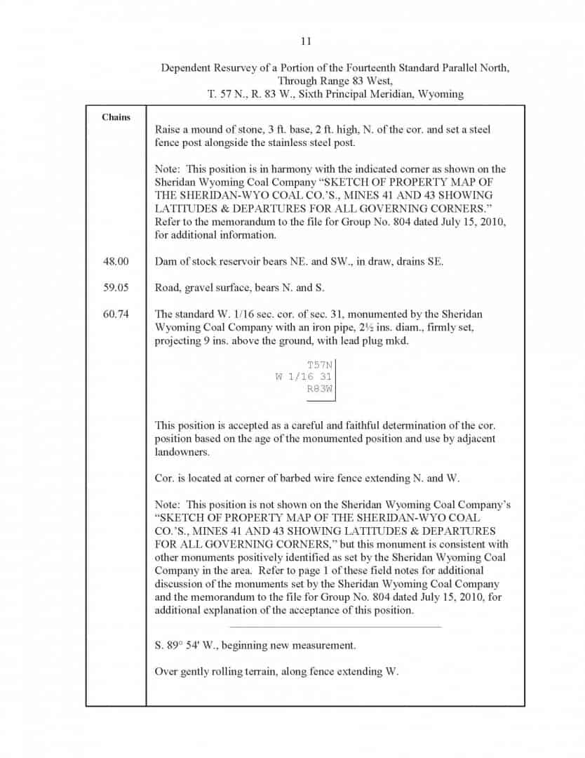
An example of the BLM accepting some old monuments at the 1/16th corners and using one for control to prorate Standard Corners.
The monuments in question are from the 1930's and were set by a private surveyor.
The BLM survey was finished in 2012.
The monuments accepted are at the NE Lot 1 and the SE Lot 4
NICE!
If more surveyors would explain how they picked the position they did there would probably be a lot more of this. It's hard not to accept a corner if it the reasoning used to place was reasonable, even if it's not what I would do. It's a lot easier to not accept a corner that for all I know was picked at ramdom and is a significant distance from where I would put it.
It's encourging, would love to see it more often. The surveyor is a young one, under 40 probably, young to me anyway;)
Had some good discussions with him and he knows what he's doing.
I'm just guessing that he was for breaking the lines at those monuments, but whoever it was pushing for it, a big thumbs up, hope some private guys will take note.
I would have to see the notes to agree plus all other information. Missing too much information. From what is given... I would have to disagree.
Sent from my SM-G925V using Tapatalk
Scotland, post: 438803, member: 559 wrote: I would have to see the notes to agree plus all other information. Missing too much information. From what is given... I would have to disagree.
Sent from my SM-G925V using Tapatalk
If you'd like to look at it, it's 57N 83W 6th, can be found on the BLM WY website
MightyMoe, post: 438805, member: 700 wrote: If you'd like to look at it, it's 57N 83W 6th, can be found on the BLM WY website
I will... In my spare time. Lol. Maybe you know the quick answer why breaking at the 16th corner.
Sent from my SM-G925V using Tapatalk
A monument set for a 1/16th corner establishes a point on the line. It is possible that the line although not perfectly straight mathematically nonetheless it is straight in legal contemplation. It is a boundary not an engineering problem.
This would happen more often if more surveyors would explain why they set a monument at a particular point.
Would be interested to know where federal lands and private lands are located in this survey.
J Tanner, post: 438850, member: 7358 wrote: Would be interested to know where federal lands and private lands are located in this survey.
It's fairly easy to tell with these new plats, you can be almost 100% sure that Lots 1-4 have no federal interest and the rest of the section does.
There are no federal surface lands in 31 it's all been patented.
So the NE of Lot 1 and the SE of Lot 4 are corners of federal lands.
If a survey is done in this section you would not recognize any of the new Lots for a description, it would only be valid to use the original plat and the patents from that plat, the new lots are federal interest only. Unless of course you are doing a survey for a coal company and then the lots and original descriptions would have important significance. I haven't looked but I don't remember any federal oil and gas leases in this area, so it's probably coal only.


