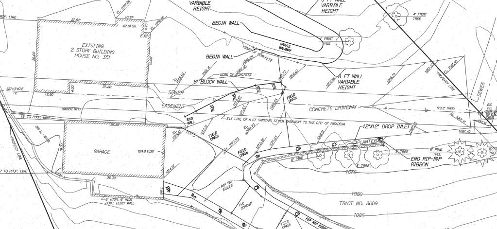
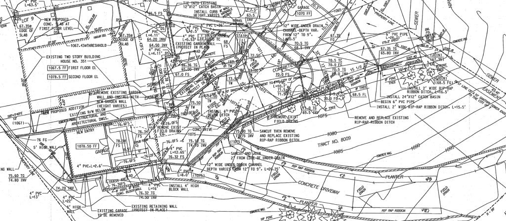
Below are two pictures. The Before one is a snapshot of part of a topo that was done by another surveyor. This guy needs to learn how to prepare a map but that's nothing compared to the totally screwed up comical mess that is shown as the After snapshot.
The After picture is, believe it or not, actually part of a set of approved city plans. It was prepared by a, and I say this in jest, California Registered Professional Engineer who is of middle eastern heritage. The individual RE rotated the Before map some before he/she threw up his/her lunch on it and included it in the plan package.
I am being asked to do the construction staking of the site.
My own personal opinion is that if the map looks like a pile of crap then the information on the map should be looked at with suspicion. Clean drafting does not guarantee correct information but it does show that the person preparing the map or plans has put some professional effort into attempting to make a professional product.
As far as the survey part goes, the Before picture, that is also sub standard. The general contractor got an eye opener yesterday when I told him that nothing had been filed for the survey.
BEFORE

AFTER
These types of engineered plans are not uncommon in my area.
uh, at huge risk, what is so severely wrong with the before pic?
the text can be manipulated, etc.
the sanitary esm't into the house by 4' or more?
Either that driveway is really bad or those contours are that messed up!h I wish you the best on those plans.
I once testified in a court case for which I prepared a stripped-down, large font, easy-to-read plan for courtroom presentation. The opposition presented a busy busy plan not dissimilar from Paul's second sample and replete with a lot of superfluous data. I don't think it decided the case but we did win.
> uh, at huge risk, what is so severely wrong with the before pic?
A few things, mainly the contours do not run that way when they hit the back of
retaining walls that are 6ft + high.
> the sanitary esm't into the house by 4' or more?
Nothing wrong with that.
Without knowing what the site looks like on the ground, the one thing that jumps out at me is the contours. I see several with sharp zig-zag changes in direction and several that run through walls with no apparent change of elevation. Both are red flags for me.
> Either that driveway is really bad or those contours are that messed up!h I wish you the best on those plans.
Yep...bad contours usually shows a sign of sparse shots. "
"Get in and get out as fast as possible so more money can be made per hour and the rodman doesnt get as much per day."
Seems to be the way many people think about doing surveys.
> I once testified in a court case for which I prepared a stripped-down, large font, easy-to-read plan for courtroom presentation. The opposition presented a busy busy plan not dissimilar from Paul's second sample and replete with a lot of superfluous data. I don't think it decided the case but we did win.
A clean drawing did NOT hurt your presentation.
The "after" looks kinda like the VDOT R/W plans that I get to occasionally calculate. I usually need a few Tylenol after those days.
Carl,
I was thinking the same thing. The after should have had all the existing screened and the proposed heavier in pen weights. Awfully confusing.
> Carl,
> I was thinking the same thing. The after should have had all the existing screened and the proposed heavier in pen weights. Awfully confusing.
Yep. You can tell it's the same drawing program too. Probably MicroStation.
That after plat gives me a headache just trying to read it. And so much for making sense of how those contours work. Shame. I've done better sketches in a field book...
And, as much as I used to complain way back when I was a rodman and we did plane-table topo's, looking back now you couldn't beat that method for producing a clean contour map in the field, making it easier for the tech in the office to avoid a mess like the after, and providing more information in the before...
Carl
It's not just Virginia, and it's not just Microstation (but that's bad enough). I've seen lots of DOT plans that were almost unusable due to the amount of "stuff" that was crammed onto a drawing. Survey centerline, construction centerline, station and offsets (from which centerline?), and WAY too much info not necessary for right of way plans.
Andy
Andy
> It's not just Virginia, and it's not just Microstation (but that's bad enough). I've seen lots of DOT plans that were almost unusable due to the amount of "stuff" that was crammed onto a drawing. Survey centerline, construction centerline, station and offsets (from which centerline?), and WAY too much info not necessary for right of way plans.
>
> Andy
Yep... And it's gotten worse in the last 10 years. I worked for VDOT for a year and they had a rigid drafting standard they had to adhere to. Now, they must not. At least now when you go out you got a 50/50 chance of finding some monumentation to work from. Before 2000... might be 20/80 of finding something. For about 8 years all of VDOT stuff was in metric too... oh, what a joy (not).
Paul-
Definitely "too much information".
This person has not heard the concept of KISS.
Sewer Easement through a house is a flag to me too.
Find the "REJECT" button fast before the *hit hits the fan and you get blamed.
Cheers
Derek
At first I didn't think the topo looked too bad, but when I looked at it a while, they would have been better off just showing the spot elevations, and a lot more of them, than trying to create half-baked contours that don't make any sense.
As far as the "plan", I can't even tell what the heck they are trying to do, it's so busy. And with the sketchy existing data from the topo, I have no idea how the engineer came up with that elaborate and detailed of a plan that would have any chance of matching existing field conditions. The job would go a lot smoother if they just got a good contractor in there and eyeballed a solution to whatever problems they have. If you take on this staking job, that eyeballer is going to be you. I don't see how you could even sort out what to stake where and even if you could, chances are it ain't gonna work.
Looks pretty much like most of the plans I've seen in MD. Stake it, check your elevations against the topo when preparing cutsheets and report any problems back to the engineer for a solution.
It looks as thought he (the surveyor who prepped that plan) didn't even make an attempt at flopping the tins to smooth out some of those contours, even the best field crews topo will be pulling some elevations from shots across the model space. GOOD LUCK is all I have to say.
Request the digital cad files because the plans are unreadable, and move on.


