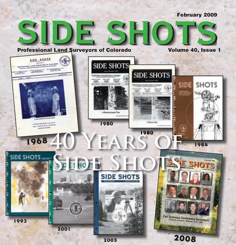
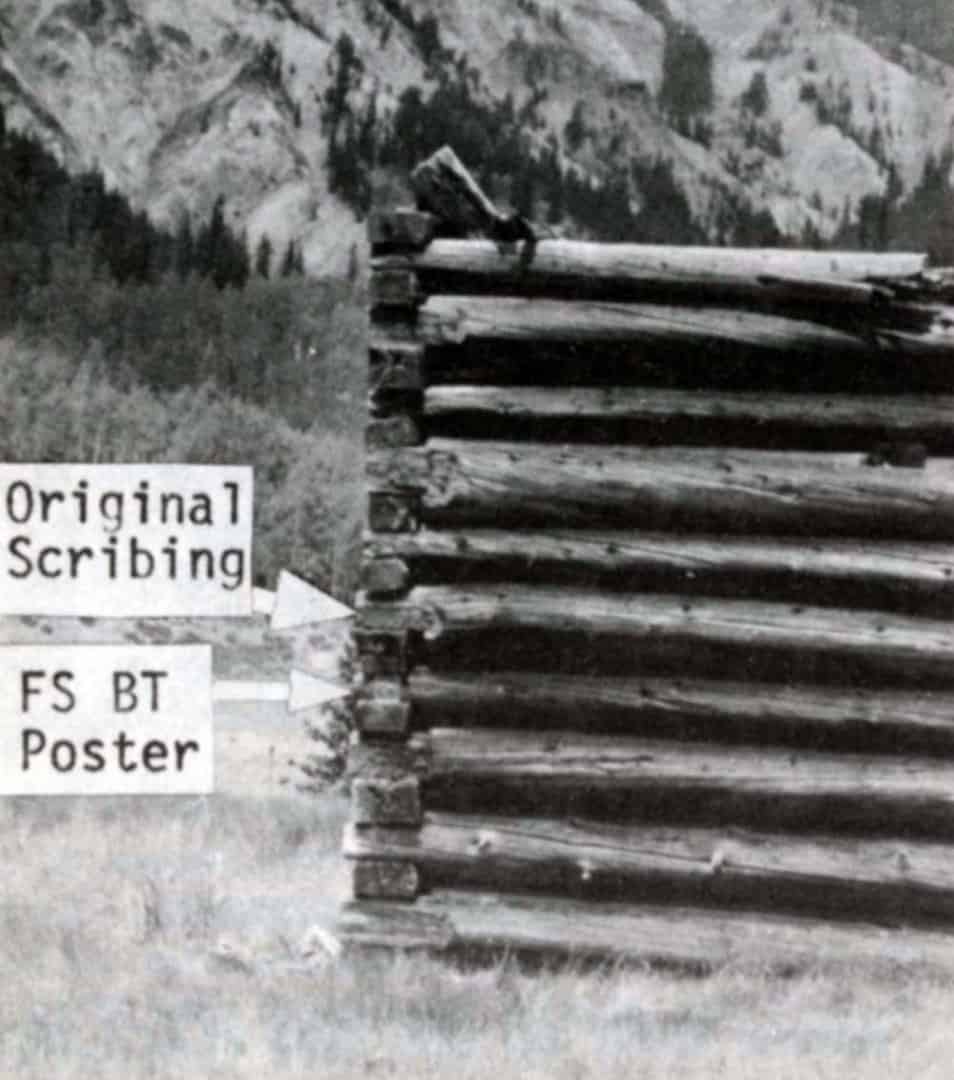
Many years ago when I was the PLSC Executive Director, I was asked to put together a cover for the PLSC journal Side Shots to celebrate its 40th year of publication. I decided to create a collage of the cover designs over the years. Because of my interest in mineral surveys the May 1980 issue stuck out. The May 1980 cover has two photos of a "Bearing House" located near the Alamosa River in Conejos County, CO.
The two photos are attributed to Harry Mahoney, Pike-San Isabel National Forest. I contacted the U.S. Forest Service this summer with the hope of getting scans of the original photos. So far the photos have not been found, so I ended up scanning the cover.
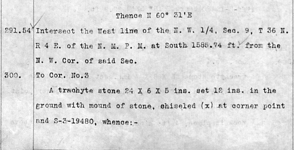
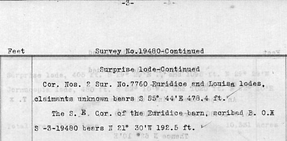
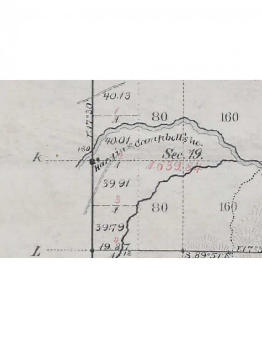
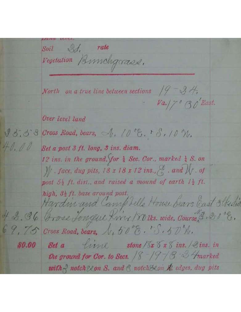
The bearing house is mentioned in the field notes for Sur. No. 19480, the Cliff, Surprise and Cornucopia lodes. I attached the plat (not on GLO Records web site) below. The snippet of the field notes for Cor. No. 3 of the Surprise lode calls for the SE Cor. of the Euridice barn.
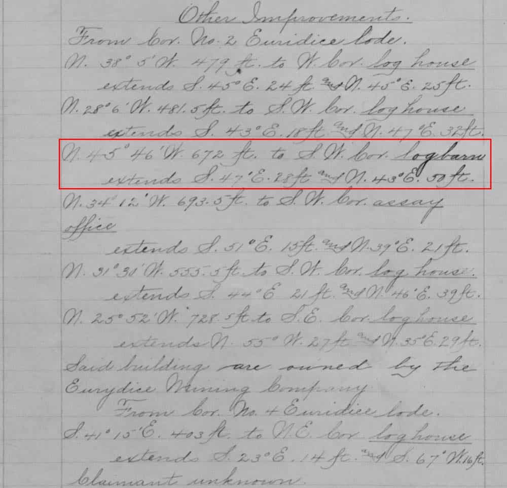
The log barn is shown on the original and amended plats of Sur. No. 7760, the Orpheus, Euridice and Louisa lodes. Here are the GLO Records links.
https://glorecords.blm.gov/details/survey/default.aspx?dm_id=249618&sid=4zjutwdv.30w&surveyDetailsTabIndex=1
https://glorecords.blm.gov/details/survey/default.aspx?dm_id=264239&sid=4zjutwdv.30w&surveyDetailsTabIndex=1
And here is the snippet of the amended field notes of Sur. No. 7760 that describes the "log barn" on the Euridice lode.
I do not know the age of the photos. I assume that Mr. Mahoney was a friend and collegue of Art Hipp.
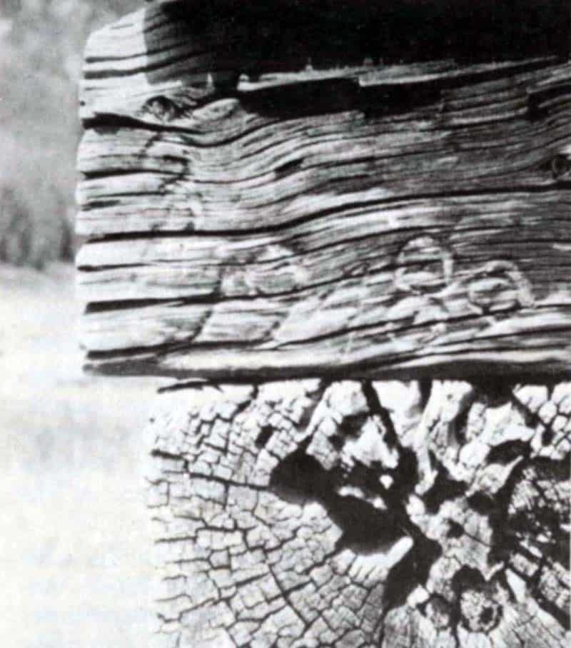
Close up of the scribing showing a "3" for the corner number (upper left) and "19480" for the mineral survey number.
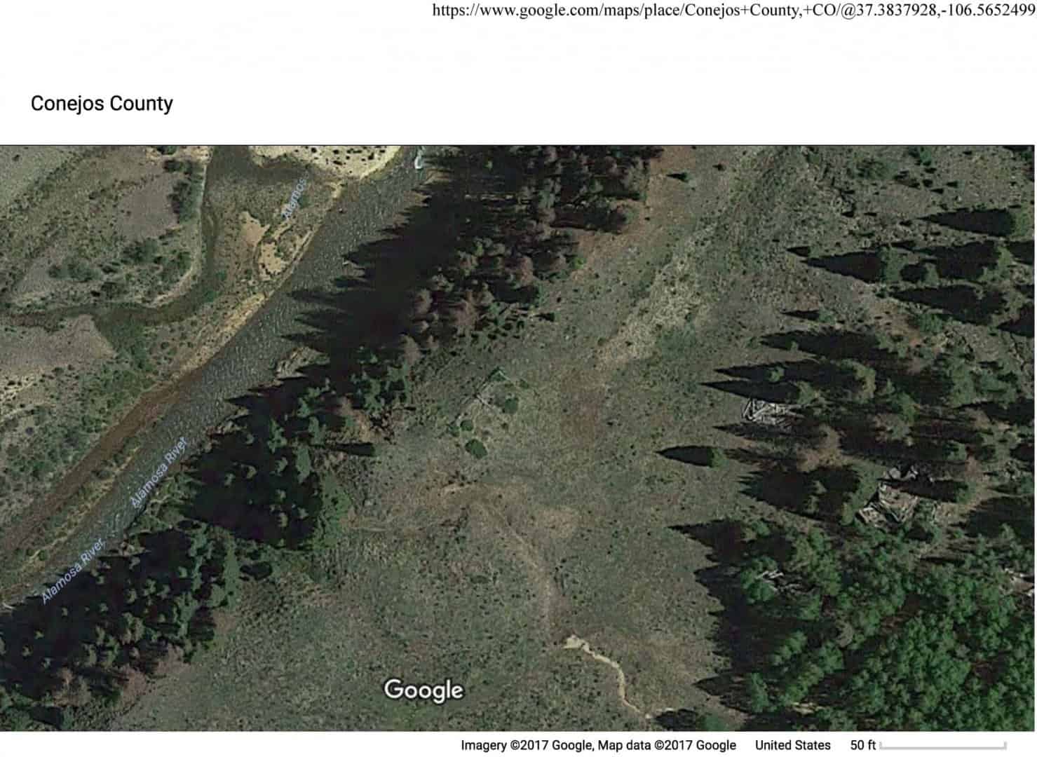
Unfortunately, the log barn and other log buildings listed in the field notes for Sur. No. 7760 are no longer standing. Here is a Google Earth image that shows a portion of the outline of the log barn (center of image). To the east and in the trees are three collapsed log buildings shown on the plats of Sur. No. 7760. The dimensions of the barn are 50 ft. NE-SW and 28 ft. NW-SE.
This is new to me. I've seen vague, sometimes not so vague, ties to cabins in passing, but never scribed. I can imagine the deputy trying to explain that to the settler.
Thanks,
Don
I thought it was a house where they made ball bearings.
Or maybe a house with the big wheel bearing in it for the stamp mill.
Don Blameuser, post: 452928, member: 30 wrote: This is new to me. I've seen vague, sometimes not so vague, ties to cabins in passing, but never scribed. I can imagine the deputy trying to explain that to the settler.
Thanks,
Don
I too have seen numerous ties to cabins and other buildings, but never seen a building selected as a corner accessory and bearing object (complete with scribing). I was hoping that the Forest Service had some additional photos that showed the "B.O." and "S" scribed on the other side of the corner along with their poster.
I have seen several building corners used as triangulation stations in mining districts. One network that comes to mind is the triangulation network for Central City, Colorado established in 1882. For example, Tri Station No. 8 is described as the "S.W. Cor. East Brick Powder House on Bates Hill", Tri Station No. 25, "S.W. Cor. of Wilson Bros' stone stable in Eureka Gulch", and Tri Station No. 26, "N.W. Cor. of Main Building of St. Aloysius Academy".
Here is a photo of Tri Station 26, which is up the hill and to the west of the casinos in Central City. The school could use a new roof. Tri Station 3 in the photo is a stone and was the southern station for the astronomic determination of north for the triangulation network. The magenta lines are lines between inter-visible triangulation stations.
Dave Karoly, post: 452931, member: 94 wrote: I thought it was a house where they made ball bearings.
Or maybe a house with the big wheel bearing in it for the stamp mill.
I should have gone for the alliterative term, Bearing Barn. 😉
Gene Kooper, post: 453056, member: 9850 wrote: I should have gone for the alliterative term, Bearing Barn. 😉
Bearing Barn, isn't that a big box store where you can get all of your bearings?
Look Mabel, we can get huge case of N 21-36 W for only $5!
Nice.
Even in a metes and bounds, we get the occasional bearing to a building (it is rare). 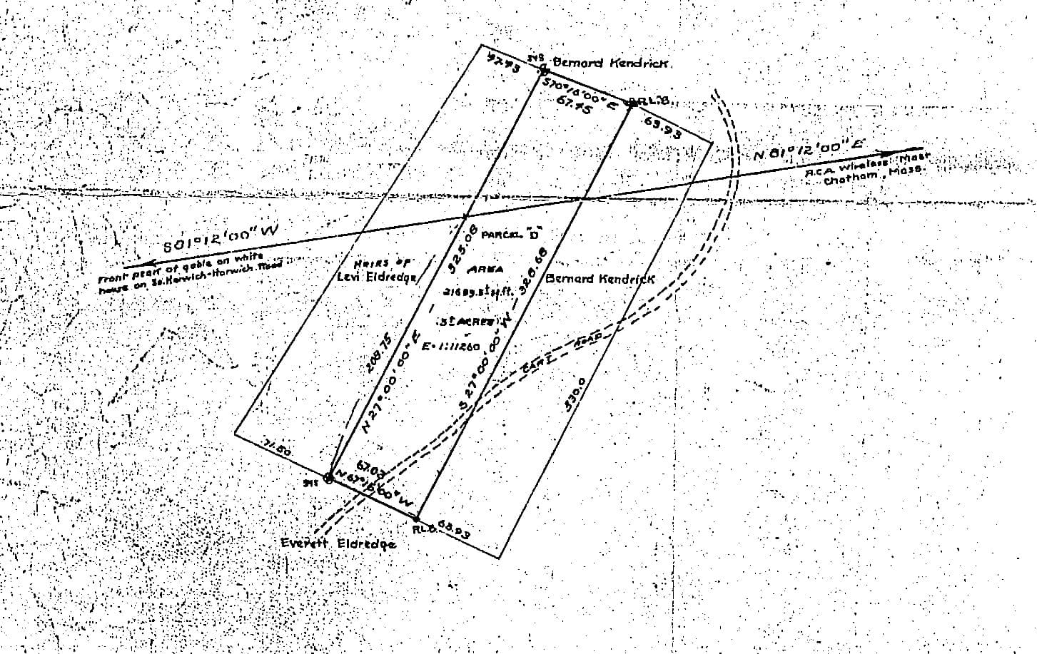 Here's an old forgotten about Land Court Plan from 1930 with bearing ties to the gable on white house and the RCA wireless mast. This was lost to owners unknown at some point. The Land Court even forgot about it when they registered a parcel to the south that severs the Cart Road which is the legal access to this lot and others.
I have found that any time there was a cabin/structure/trail/road near a PLSS line, the original GLO notes call it out.
Very handy resource for those that enjoy going out in the woods and taking a trip back in time
I have seen a few of these over the years (nearly all were Mineral Surveys), and have been able to recover several. One that I remember, was a stone cabin/building (chiseled + w/ letter Corner # & MS #), but most were log or frame buildings (most of which evidenced only by footings or foundations when I got there).
I have some 35mm pictures of some of them (somewhere), but I don't know where to find those boxes!
I love Mineral Surveys, [usually] lots of accessories:
Bearing Trees (BT)
Bearing Stump (BS)
Bearing Rock (BR)
Bearing Object (BO)
Bearing Post (BP)
Bearing Building (BB)
Bearing Cabin (BC)
Etc.
I even remember a call to a Mine Timber (BMT?) at the Mouth of an Adit that was scribed, but said adit had long since caved in, and the timbers were covered by tons of rock and soil.
Loyal
Loyal, post: 453278, member: 228 wrote: I have seen a few of these over the years (nearly all were Mineral Surveys), and have been able to recover several. One that I remember, was a stone cabin/building (chiseled + w/ letter Corner # & MS #), but most were log or frame buildings (most of which evidenced only by footings or foundations when I got there).
I have some 35mm pictures of some of them (somewhere), but I don't know where to find those boxes!
I love Mineral Surveys, [usually] lots of accessories:
Bearing Trees (BT)
Bearing Stump (BS)
Bearing Rock (BR)
Bearing Object (BO)
Bearing Post (BP)
Bearing Building (BB)
Bearing Cabin (BC)
Etc.I even remember a call to a Mine Timber (BMT?) at the Mouth of an Adit that was scribed, but said adit had long since caved in, and the timbers were covered by tons of rock and soil.
Loyal
Kent would've dug it out and found it.
Okay I'll stop now 😉
Dave Karoly, post: 453289, member: 94 wrote: Kent would've dug it out and found it.
Okay I'll stop now 😉
Kent who?
:p
How about a Bearing Indian Grinding Hole?
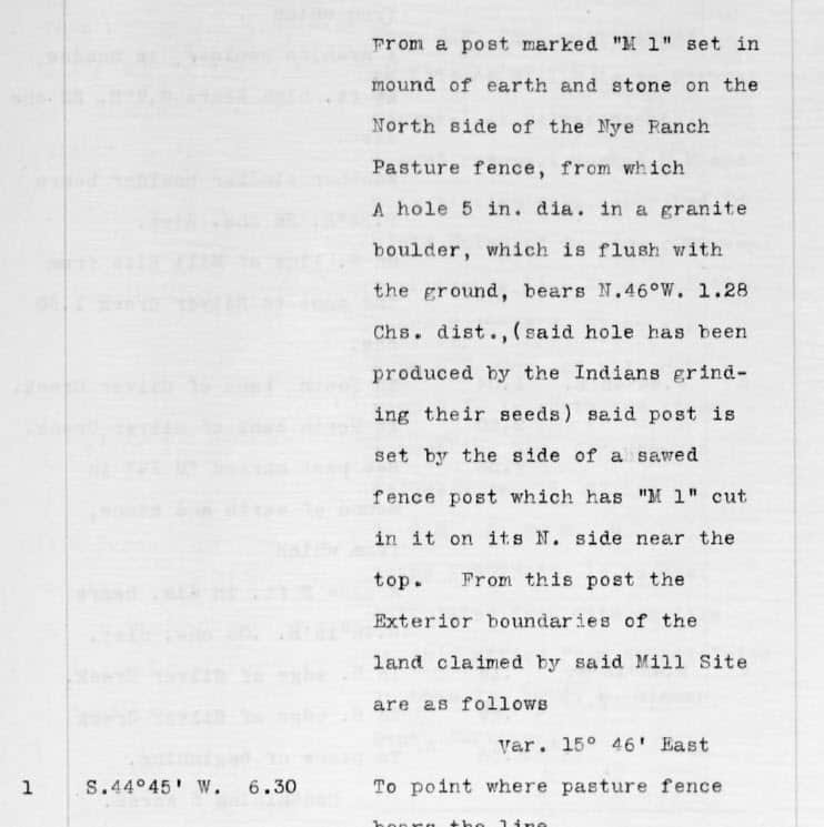
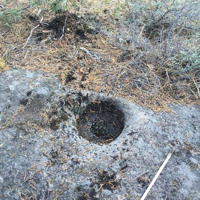
This summer, just for fun, I was retracing a silver mining claim originally monumented in 1876. I obtained the original plat and transcription of the original notes from the BLM. To my surprise, there was a call to an Indian grinding hole from the first corner they set. A friend's cabin sits on the land covered by this claim and it has been in his family for over 50 years. He had never seen any signs of such a rock or hole in the area. To my surprise, and his, I found it. Has to be one of the oldest man made features called for in survey notes, at least in my part of the world.
SPMPLS, post: 453329, member: 11785 wrote: How about a Bearing Indian Grinding Hole?
This summer, just for fun, I was retracing a silver mining claim originally monumented in 1876. I obtained the original plat and transcription of the original notes from the BLM. To my surprise, there was a call to an Indian grinding hole from the first corner they set. A friend's cabin sits on the land covered by this claim and it has been in his family for over 50 years. He had never seen any signs of such a rock or hole in the area. To my surprise, and his, I found it. Has to be one of the oldest man made features called for in survey notes, at least in my part of the world.
SWEET!
Very cool, SPMPLS.
Loyal, post: 453300, member: 228 wrote: Kent who?
:p
NAB (National Association of Boundators) may have to take away your ??Consult a Boundator? license plate frame if you don??t dig that up!
imaudigger, post: 453275, member: 7286 wrote: I have found that any time there was a cabin/structure/trail/road near a PLSS line, the original GLO notes call it out.
I posted a few years ago in this thread and this thread about helping an archaeological investigation where the GLO notes gave bearings to a trading house set up to trade with the native Americans. That info would have been really helpful if there were any section corners to work from. Unfortunately since most of the land for miles around belonged to a communal colony since 1856, which was then turned into a private corporation, there has been no incentive to preserve section corners.
[USER=3579]@spledeus[/USER]
Interesting intersection above
Land Court Plan from 1930 with bearing ties to the gable on white house and the RCA wireless mast.
I wonder how long it took surveyor to make that intersection unless he just used 'about here' for the lot boundary and strike northerly and southerly to the terminals.
Still involved a terminal line intersection.
what do the symbols denote at end of lines?
Richard, post: 453346, member: 833 wrote: [USER=3579]@spledeus[/USER]
Interesting intersection above
Land Court Plan from 1930 with bearing ties to the gable on white house and the RCA wireless mast.
I wonder how long it took surveyor to make that intersection unless he just used 'about here' for the lot boundary and strike northerly and southerly to the terminals.
Still involved a terminal line intersection.what do the symbols denote at end of lines?
On the line it looks like arrows. On the lot are two RLBs or Registered Land Bounds and two STKs which seem to have stone symbols around. I poked around for the monuments and located the cart path when we completed a survey a little removed. When we return for something, I will stake out the points to see if I can find anything.
I have never plotted out the old RCA masts, but we have a museum that might have decent locations. We still have the giant concrete anchors around town.
The house with the white gable... There are a few of those on the road...
Sent from my SM-G930V using Tapatalk
Dave Karoly, post: 453340, member: 94 wrote: NAB (National Association of Boundators) may have to take away your ??Consult a Boundator? license plate frame if you don??t dig that up!
Screw'em!
