Is the red and white pole part of an external radio arrangement?
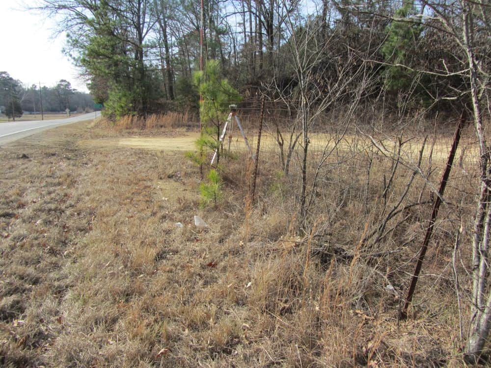
It's an old range pole. With external antenna. Gps is an r-8.
There is an older 35 watt radio, on the tripod.
The gps antenna height is around 5 ft.
The base extrrnal antenna is up about 12 ft.
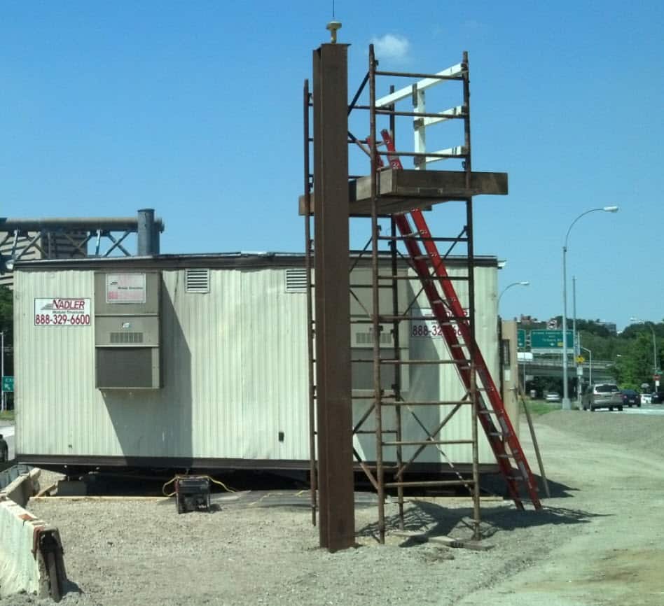
I came across this one a couple of years ago. The tall metal building behind the base is on the South side of the receiver too. This was a contractor working on a road widening project that was about a 1/2 mile long. I'm surprised they got anything out of the rover. If they were getting any results, it would have been a testament to the receiver, which looks like one of the later variations of the original Topcon Hipers.
Base station placement is so, so, so important to successful RTK operations. As I tell people all the time, take a rover under a tree and that tree will affect that shot, put a base under a tree and that tree will affect every shot.
There could be any number of reasons people set up bases where they do. Sometimes the operator thinks they are just "doing what they can". I can see in the second picture there's definitely a clearer spot down the road on the opposite side.
In the early '90s I was with the highway department and all our work was static. Most of our High Accuracy Reference Network monuments were 25 to 40kM apart. To simplify things we would "reuse" job control points that had been occupied on a previous job that were closer.
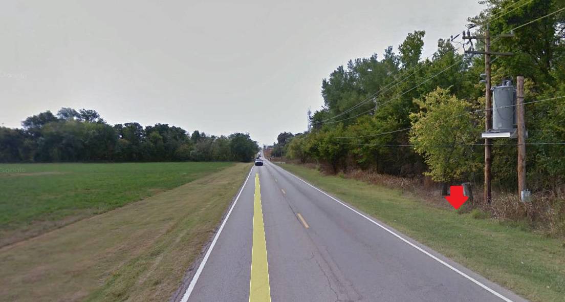
Over two or three jobs in one county I kept noticing one particular control point that never had any really good vectors. I had not personally visited this site but decided one day to drive by and check it out.
The arrow is at the approximate location of the control point. When I asked the guy that had originally established its location as to "why" he didn't pick the alfalfa field on the other side of the road...all he said was "my truck was pointed south so I stayed on the west side of the road..." 🙁
Nate The Surveyor, post: 405381, member: 291 wrote:
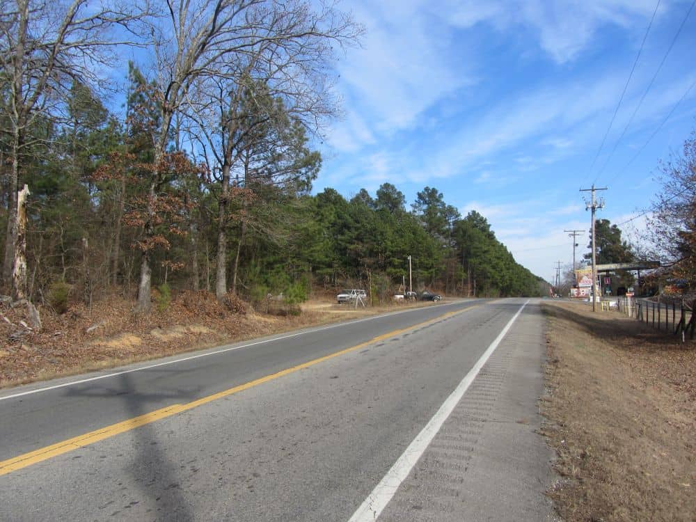
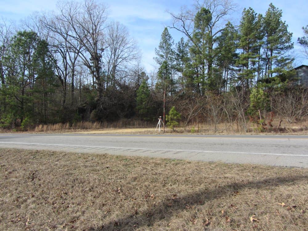
This was one I found today. I wonder what others think. Would you select this base site?
Why, or why not?
Thanks
Nate
Ahhh rookies. Gotta love em. I saw one the other day, wish I would have taken a picture. The grade hop had made a deal that was attached to the chain link fence and right along the tree line. Smart!
NOT rookies... (They informed me, so that's how I know) They have set it in WORSE places than this, and it worked just fine, they said.
I did talk with they guys that put this up, but, I'll not name them. That would not be polite... however I did let them know, that there would be times of the day, when there would be data jumps, in the magnitude of a few feet. "this is how we always do it", they said.
This is what tends to "Dither" RTK data, and make it less reliable. They had the GPS rover in the BACK of their truck, with the GPS antenna, UNDER the tool box in the back of the truck. The tip of the pole was sticking out over the tailgate, by maybe a foot.
They were a bit nervous, (I simply stop, and start taking pics!) So, they were somewhere nearby, and saw me, and came to investigate. I asked for a card, they had none. I gave them my card. Told them the possible problems with their base site, and went on my way.
I DID my own testing, with my BASE under a tree, about a year ago. It does 2 things. Makes your final coords, error ellipses LARGER, and occasionally JUMPS several feet.
An excellent base site, is a bald hill top, with NO obstructions, from the horizon up.
It all goes DOWNHILL from there.
A PLUS in their favor, was they set a 1/2" rebar, with a cap, stamped GPS CP.
However, it was NOT buried, just flush, so, in a few years, when the cap is gone... well, here is a property corner for SOMEBODY! 🙂 HA!
Suggestion: When you FIND that perfect BALD hilltop, for your base, try the magnetic locator, and SEE if another surveyor has set something. Pincushion GPS base points, is becoming a SOURCE of survey errors.
But, as George Carlin said: 'Never argue with an idiot. They will only bring you down to their level and beat you with experience.'
Replace the word "Idiot" with "Experienced Surveyor, or Party Chief", and we have a "mess waiting to happen".
O well, ya can't swat all the skeeters, that fly by.
Nate
Nate The Surveyor, post: 405454, member: 291 wrote: NOT rookies... (They informed me, so that's how I know) They have set it in WORSE places than this, and it worked just fine, they said.
I did talk with they guys that put this up, but, I'll not name them. That would not be polite... however I did let them know, that there would be times of the day, when there would be data jumps, in the magnitude of a few feet. "this is how we always do it", they said.
This is what tends to "Dither" RTK data, and make it less reliable. They had the GPS rover in the BACK of their truck, with the GPS antenna, UNDER the tool box in the back of the truck. The tip of the pole was sticking out over the tailgate, by maybe a foot.
They were a bit nervous, (I simply stop, and start taking pics!) So, they were somewhere nearby, and saw me, and came to investigate. I asked for a card, they had none. I gave them my card. Told them the possible problems with their base site, and went on my way.
I DID my own testing, with my BASE under a tree, about a year ago. It does 2 things. Makes your final coords, error ellipses LARGER, and occasionally JUMPS several feet.
An excellent base site, is a bald hill top, with NO obstructions, from the horizon up.
It all goes DOWNHILL from there.
A PLUS in their favor, was they set a 1/2" rebar, with a cap, stamped GPS CP.However, it was NOT buried, just flush, so, in a few years, when the cap is gone... well, here is a property corner for SOMEBODY! 🙂 HA!
Suggestion: When you FIND that perfect BALD hilltop, for your base, try the magnetic locator, and SEE if another surveyor has set something. Pincushion GPS base points, is becoming a SOURCE of survey errors.
But, as George Carlin said: 'Never argue with an idiot. They will only bring you down to their level and beat you with experience.'
Replace the word "Idiot" with "Experienced Surveyor, or Party Chief", and we have a "mess waiting to happen".
O well, ya can't swat all the skeeters, that fly by.Nate
I'd rather have a RTK Base a mile away in a GOOD spot, than one next door in a crappy spot.
It doesn't really matter how good the Rover site is (or how many birds there are), IF the Base Station is set up in a metal barn!
Loyal
Absolutely!
For me I'd be concerned for its longevity, right beside a handy pullover spot followed by a quick getaway. Might not be there for long.
In that location that would be my primary concern.
As for GPS base locations I agree with comments made. For me NO, not suitable.
That's an "interesting" set up, above by Ring.
Who trains these people in their GPS use?
Here is a contractors Base setup for a long term construction project. It has been there for more than 3 years now.
This a 12" steel I-beam 50 ft long. Set 20ft below ground in 5 yards of concrete. Unlike the others, this spot was suggested by a surveyor with GPS experience.
Lee, does that beam move with heat, ie, sunshine, or day and night?
Shrink and expand.
I ask, because I'm thinking of making a CORS site, or, similar.

