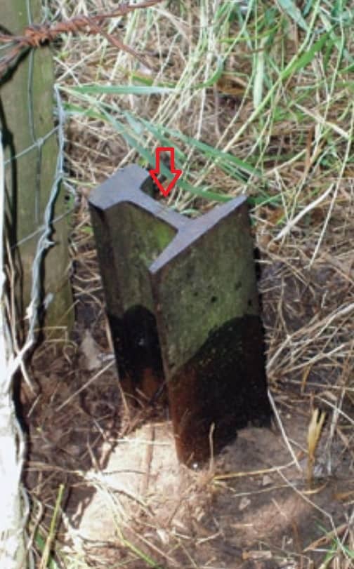
A rail is just a very heavy duty Tee bar. Shoot the Tee.
Paul in PA
The ones I see in Nebraska that were set by the Burlington Railroad (CB&Q) generally have a "+" in the center. I don't think that you can apply one theory to fit all when it comes to where they were measured to. I agree with those stating they were probably not set with precision, so take that for what it is worth.
Thanks to you Ryan I found this link:
http://www.plso.org/Resources/Documents/OREGON%20RRS101%20PART%201%20%5BCompatibility%20Mode%5D.pdf
Cheers,
Derek
I've run in to a similar situation here in California. In my hometown the Hetch Hetchy aqueduct runs generally east-to-west through the north part of town. The right-of-way was marked with concrete monuments. I've found and tied in many of them. Most people just shoot the center and go from there. About 10 years ago, I attended a seminar put on by the Hetch-Hetchy team. It turns out that the monuments were all originally set in pairs, one on each side of the R/W. And it was the outside face of the monument that was intended to mark the limits of the R/W...
So I think it just goes to show that there isn't one "tried and true" standard for where on a given monument the "actual point" is. I've seen a few vertical rails used as monuments, but usually, they weren't marking the RR R/W. And in those cases, there's no telling what the original surveyor intended...
learn something new everyday.
The moral of Charlie Tucker's story that day was that you should at least attempt to find the standard plans for the RR you are working on and see what they say regarding the rail placements. I think if you zoom in to the plan shown on the fourth picture I posted above, you can see they indicate an X set in the upper part of the rail. Tucker indicated the most common location was at the center bottom of the rail.
Show us a picture.
Worth Thousands of words.


