That's the "holy grail" of land surveying.
Here in Arkansas, the State Surveyor is developing a set of standards, for monumenting, and documenting these things. I want to see what they come up with. I want to see a gis type page, complete with metadata, and room for photos, and plenty of documentation.with extra money for high accuracy spc.
I'm also a fan of witness markers, for good finds. Such as far away ties to bridges, with hwy. Dpmt disks, to preserve them.
Ie, room or space for additional spc in the network.
I set a nail or spike in a busy hwy. For a 40 corner. Then, at random, set a 1/2" rebar and cap flush in the r/w. Then, published a b/d between them.
Leave footsteps. Of you want to "be followed".
N
That's the "holy grail" of land surveying.
Here in Arkansas, the State Surveyor is developing a set of standards, for monumenting, and documenting these things. I want to see what they come up with. I want to see a gis type page, complete with metadata, and room for photos, and plenty of documentation.with extra money for high accuracy spc.
I'm also a fan of witness markers, for good finds. Such as far away ties to bridges, with hwy. Dpmt disks, to preserve them.
Ie, room or space for additional spc in the network.
I set a nail or spike in a busy hwy. For a 40 corner. Then, at random, set a 1/2" rebar and cap flush in the r/w. Then, published a b/d between them.
Leave footsteps. If you want to "be followed".
N
Nice ones!!!!
They don't look like they need any help, are you just leaving them like that?
Looks like you got the same moisture that we did this winter.
Nate The Surveyor, post: 361095, member: 291 wrote: That's the "holy grail" of land surveying.
Here in Arkansas, the State Surveyor is developing a set of standards, for monumenting, and documenting these things. I want to see what they come up with. I want to see a gis type page, complete with metadata, and room for photos, and plenty of documentation.with extra money for high accuracy spc.
I'm also a fan of witness markers, for good finds. Such as far away ties to bridges, with hwy. Dpmt disks, to preserve them.
Ie, room or space for additional spc in the network.
I set a nail or spike in a busy hwy. For a 40 corner. Then, at random, set a 1/2" rebar and cap flush in the r/w. Then, published a b/d between them.
Leave footsteps. If you want to "be followed".
N
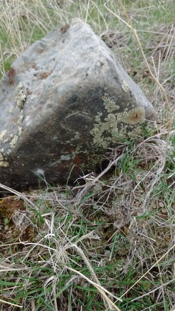
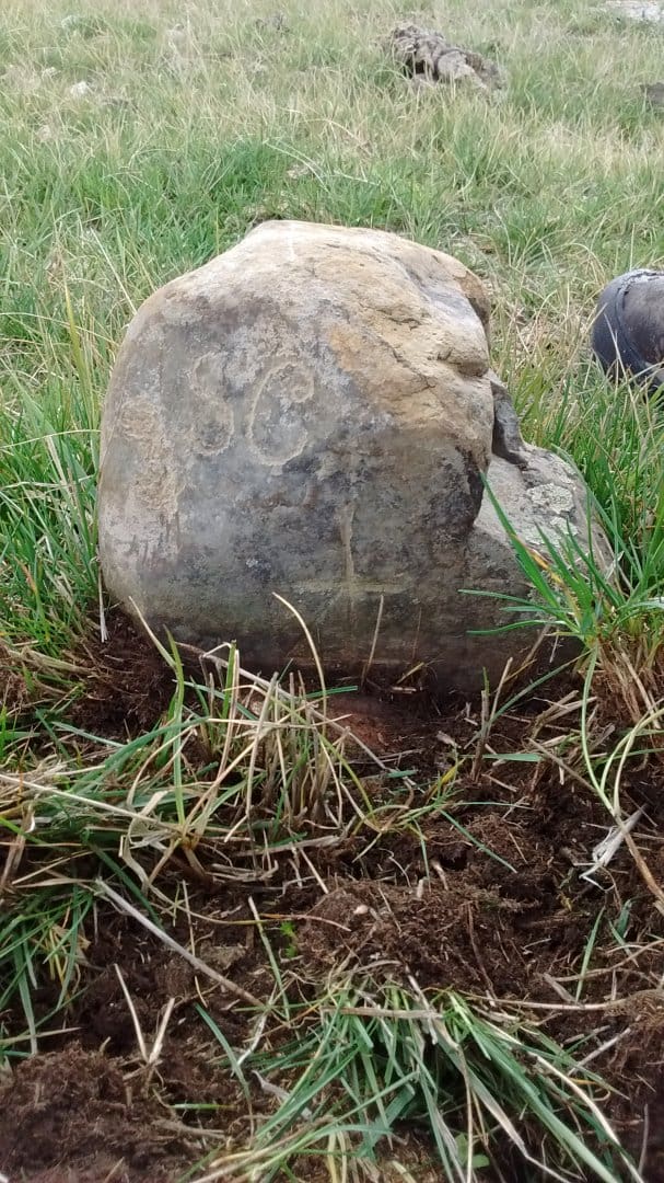
Nate, kinda looks like the original accessories are still there, at least some of them.
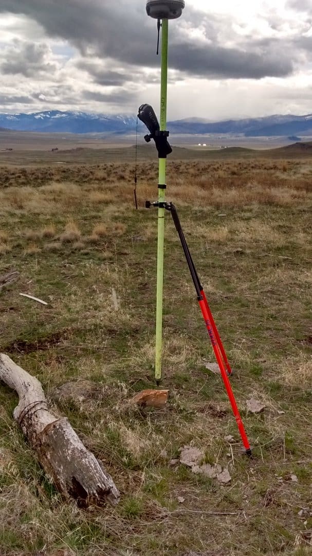
Look at the photo with the bipod, to the left, see the pit?
For anyone who has never seen one...............
I would be much more happy if he shows ties to the other monuments instead of SPC and all that. A nice mound of stone out there would be the most helpful and if he wants to replace bury the original alongside.
Although, it also looks like it has a mound of stone, so maybe the "pit" is just coincidental
Nice!!!
Mr. File,
Sorry to high jack your thread. A good find indeed.
DDSM
Nate The Surveyor, post: 361095, member: 291 wrote: That's the "holy grail" of land surveying.
I want to see what they come up with. I want to see a gis type page, complete with metadata, and room for photos, and plenty of documentation.with extra money for high accuracy spc.Leave footsteps. If you want to "be followed".
N
Nate,
THEY are US. Don't wait for the MANDATE telling you what and how. Get involved. I strongly urge you to attend 2016 ASPS Trade Show and MAKE YOUR SUGGESTIONS.
4/7/2016 1:30 PM - 2:50 PM Presenter: John Thornton, PS and Shelby Johnson
This session will provide an update on the Certified Land Corner Restoration Perpetuation and filing record. The new digital format and photos of corners and accessories will be reviewed, as well as the process and requirements for a business to enter into contracts through the State Department of Finance and Administration.
The presenters will also be introducing the roll out of the new access to all the Arkansas GLO plats and notes on their website: <"> http://surveyor.arkansas.gov> .
The session will wrap up with a question and answer period.
4/7/2016 3:00 PM - 4:00 PM Presenter: Tom Jacobs, PS and John Dennis
In the fall of 1815, the largest land survey to occur within the United States Public Land Survey System (U.S. PLSS) was begun. At that time, Edward Tiffin, Surveyor General, developed a list of detailed instructions into what would come to be known as Û÷Tiffins InstructionsÛª. One of his instructions required that the surveyor return his field notes to the Office of the Surveyor General so that the notes would be bound in a book. Through the years, the notes began to age. It was in the 1930Ûªs that numerous women transcribed these notes into a typed format. Today, students and faculty at the University of Arkansas at Monticello, with funding from Arkansas Commissioner of State Lands (ACOSL), are perpetuating these notes by converting them to a searchable pdf format that will be hyperlinked to a shapefile within a GIS environment. This is a continuation of the field to finish that began in 1815. The end goal of this project is to have an online interactive map whereby the user may select a township and retrieve transcribed copies of the original USPLSS field notes for the state of Arkansas. Those attending this session can expect to learn how the original notes from the PLSS surveys of Arkansas have been digitally converted into a format that geospatially associates them with the land that they describe.
[sarcasm]Just think of the future! All survey, original and retracement, will be geospatially associated via hyperlinked shapefiles/photos/SPC coordinates and ready for FREE download. Monument records will contain SPC with 'certified' values and ready for FREE download. When you submit your survey, the AGIO GISP's will use the BLM Manual (Chapter 3) and question your decisions...established lines? bah...Professional judgement? bah...Your Javad unit will be for 'staking' the GIS cadastral layer...NOT for boundary surveying.[/sarcasm]
I am all for GIS and progress and following in the footsteps, but I worry about which footsteps will be MANDATED.
DDSM:beer:
Dan, I anticipate going. As far a mandated, I'd like to see MANDATED that all surveys be:
1.) On, or REFERENCED to an OBJECTIVE basis of bearings.
Definitions: OBJECTIVE basis of bearings, is either GEODETIC north, or State Plane Grid BEARINGS.
Reference to, means that it can be on ANY basis of bearings, you like, HOWEVER, a plain conversion to either GEODETIC, or Grid, shall be given, in Degrees, minutes, and seconds (DMS) format.
IF Geodetic is used, then, the LOCATION where geodetic is taken, shall be published. OR, Theta, (convergency) shall be Published. LOCATION shall be published, either with Lat Lon, in DMS format. Accuracy of this location shall also be shown to the degree as was used, and the METHOD for deriving it shall also be published.
So, this would be acceptable:
Basis of Bearings: Based upon the North line of XYZ subdivision, as shown on the recorded plat, as N 89å¡10' E.
For Geodetic north, rotate these bearings Counter Clockwise 0å¡15'04".
Geodetic North, was taken from a solar observation, hour angle method, with 3 direct, and 3 reverse observations, averaged, and taken at N 34å¡20'37.22" & W93å¡28'46"
Or, you can just put
Basis of Bearings
Geodetic North, was taken from a solar observation, hour angle method, with 3 direct, and 3 reverse observations, averaged, and taken at N 34å¡20'37.22" & W93å¡28'46"
Or you can put:
Basis of Bearings: Based upon the North line of XYZ subdivision, as shown on the recorded plat, as N 89å¡10' E.
For State Plane Grid bearings,NAD 1983, Arkansas South Zone, rotate these bearings Clockwise 1å¡15'04".
Bearings were derived via an autonomous GPS observation, Estimated to be accurate to 0.03 arc seconds.
Or, you can just publish Basis of Bearings is:
State Plane Grid North, Arkansas South Zone. NAD 1983, and use that.
The idea is NOT to limit what you can do, BUT to PUBLISH what you did. The idea is to GET surveyors more involved in "Big Picture" surveying, so that they will function as professional surveyors, USING their capacity, to make the world of data more usable.
This will in turn, reduce the confusion, generated by those who are not functionally literate, with our data. ie, the USERS of our plats. This will render our products more usable, and re-traceable.
By requiring that these numbers be published, will make surveyors more accountable to each other, and to the public, to lift the image of surveyors to a higher level, by causing them to FUNCTION at a higher level.
I expect opposition, from those who wish to stay put, and not participate in a larger world of understanding, and accountability.
Nate
Nate The Surveyor, post: 361147, member: 291 wrote: Dan, I anticipate going. As far a mandated, I'd like to see MANDATED that all surveys be:
1.) On, or REFERENCED to an OBJECTIVE basis of bearings.
Definitions: OBJECTIVE basis of bearings, is either GEODETIC north, or State Plane Grid BEARINGS.
Reference to, means that it can be on ANY basis of bearings, you like, HOWEVER, a plain conversion to either GEODETIC, or Grid, shall be given, in Degrees, minutes, and seconds (DMS) format.
IF Geodetic is used, then, the LOCATION where geodetic is taken, shall be published. OR, Theta, (convergency) shall be Published. LOCATION shall be published, either with Lat Lon, in DMS format. Accuracy of this location shall also be shown to the degree as was used, and the METHOD for deriving it shall also be published.So, this would be acceptable:
Basis of Bearings: Based upon the North line of XYZ subdivision, as shown on the recorded plat, as N 89å¡10' E.
For Geodetic north, rotate these bearings Counter Clockwise 0å¡15'04".
Geodetic North, was taken from a solar observation, hour angle method, with 3 direct, and 3 reverse observations, averaged, and taken at N 34å¡20'37.22" & W93å¡28'46"Or, you can just put
Basis of Bearings
Geodetic North, was taken from a solar observation, hour angle method, with 3 direct, and 3 reverse observations, averaged, and taken at N 34å¡20'37.22" & W93å¡28'46"Or you can put:
Basis of Bearings: Based upon the North line of XYZ subdivision, as shown on the recorded plat, as N 89å¡10' E.
For State Plane Grid bearings,NAD 1983, Arkansas South Zone, rotate these bearings Clockwise 1å¡15'04".
Bearings were derived via an autonomous GPS observation, Estimated to be accurate to 0.03 arc seconds.Or, you can just publish Basis of Bearings is:
State Plane Grid North, Arkansas South Zone. NAD 1983, and use that.The idea is NOT to limit what you can do, BUT to PUBLISH what you did. The idea is to GET surveyors more involved in "Big Picture" surveying, so that they will function as professional surveyors, USING their capacity, to make the world of data more usable.
This will in turn, reduce the confusion, generated by those who are not functionally literate, with our data. ie, the USERS of our plats. This will render our products more usable, and re-traceable.By requiring that these numbers be published, will make surveyors more accountable to each other, and to the public, to lift the image of surveyors to a higher level, by causing them to FUNCTION at a higher level.
I expect opposition, from those who wish to stay put, and not participate in a larger world of understanding, and accountability.
Nate
Nate, I would really hesitate to mandate state coordinate system bearings, a nice tool, but to tell everyone they HAVE to use them or reference them is not a good idea, putting lat, longs or coordinates on your corner record should be up to the surveyor, again nice and all but the GIS will never replace monuments, and lat, longs are always going to be a moving target.
Mandating this would be a very bad idea, I can't get surveyors to use site control from the 90's instead of OPUS pocus, let alone the chaos that will proceed once you mandate the GIS is used. How will a surveyor in 2100 use a NAD83(93) coordinate when all the local CORS stations and HARN points are gone and replaced with newer ones? And even if some are there will he even bother or even know how to? I can tell you right now that many can't do it.
How would you get on a NAD27 state plane coordinate, there are plenty of boundaries with them published and filed in the courthouse.
Moe, I have no idea how to get on NAD 27. But, I have resources. I can learn. I'm not afraid of it. If I don't know how to use it, I can still do a SUN shot, and use Geodetic. With Lat Lon scaled from USGS.
What's wrong with learning?
It's how a surveyor earns a living.
N
Nate my point being that no one can reproduce NAD27 to better accuracy than the actual monuments found for one of those boundary surveys.
Most surveyors today can't get on NAD27, cause they didn't work with it when it was being used, all they can do is hit a button on the black box, thinking that they are getting on it.
Surveyors knew this then, you put the coordinates on the monuments to work within the site, to go outside and bring in coordinates in NAD27 wouldn't work, you have to rely on the triangulation stations and somehow reproduce the adjustments the surveyor went through to get the coordinates he did, almost impossible.
And what will surveyors use in 2100, quite possibly not NAD83, maybe not even coordinates as we know them, maybe a lat, long, elevation system or earth center, earth fixed. They may well look at NAD83 and state plane numbers as some sort of quaint sloppy mess.
But the monuments on the ground will still have the same value as before.
I'm not against giving coordinates on your surveys, or getting on state plane, but I really am against mandating too much.
I much rather see good monuments required. I kinda shudder when I hear what is set in other parts of the country.
Nate The Surveyor, post: 361154, member: 291 wrote: I have no idea how to get on NAD 27.
McEntyre's book Land Survey Systems gives examples, and was written before NAD83. Unfortunately even if you are lucky enough to have NGS triangulation stations in your county so you can use their NAD27 coordinates, by the time you traverse what could be several miles to the property in question the accuracy will be rather loose and probably not the best evidence of location.
I think that's the main reason coordinates are low in the hierarchy of evidence. If everybody filed static GPS coordinates with good metadata on every parcel they survey, we could get to the point of raising their priority.
Bill93, post: 361172, member: 87 wrote: I think that's the main reason coordinates are low in the hierarchy of evidence. If everybody filed static GPS coordinates with good metadata on every parcel they survey, we could get to the point of raising their priority.
Could be a good idea. Now, if we only could get the land owners to be able to see, feel, and use those static GPS coordinates with good metadata as permanent monuments ..........
Well maybe not such a good idea ...........
Brian Allen, post: 361180, member: 1333 wrote: Could be a good idea. Now, if we only could get the land owners to be able to see, feel, and use those static GPS coordinates with good metadata as permanent monuments ..........
Well maybe not such a good idea ...........
I'm with you there, I think we sometimes lose sight of the point of our surveys, it's not about the next surveyor and making it easy for him, it's about the landowners and leaving good footsteps for THEM, and if you do that then the next surveyors should have a much easier time.
Using good metadata and all is great, but without good monuments, the kind a landowner can find and identify and aren't confusing, then,,,,,,,,,,,
Aren't the coordinates a way to help find the actual property evidence? Lo the day if coordinates become corners.
OK, I'm sorry Mr. Rankin, to spoil your thread. My bad. You have a great find.
May you find many more, and they all be as beautiful.
Nate
Brian Allen, post: 361180, member: 1333 wrote: if we only could get the land owners to be able to see, feel, and use those static GPS coordinates
I wasn't suggesting they be put above monuments. But perhaps they shouldn't be at the bottom of the list.
Brian Allen, post: 361180, member: 1333 wrote: Now, if we only could get the land owners to be able to see, feel, and use those static GPS coordinates with good metadata as permanent monuments ..........
But the earth is NOT static


