I just finished up a pre demolition survey for a site that had been surveyed two other times. The date of the first survey was 2004, the second survey was done in 2008.
I have not seen a copy of the first survey but it was apparently lacking to have the second one done in 2008, which was called an 'update' to the 2004 survey.
The 2008 survey was filled with errors.
The problems that haunt the public that some survey tradesmen practice is greed, short cuts, contracts that maybe just another tradesman or attorney would understand and basically, an extreme lack of care for the type of product that is cranked out and handed to the client with a bill.
As long as this exists on a minor scale, we will be looked at as ranch hands that can maybe add.
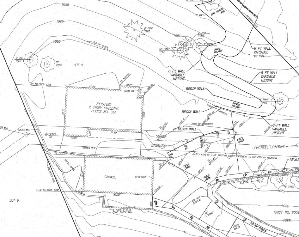
2008 Topo

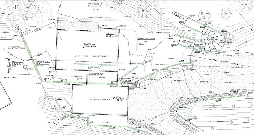
Just finished Topo

Not the best pictures in the world..but let me draw your attention to the call out on the wall on the east, that serpentines down the hill. 2004 says it is 8 feet high, well, its more like 2 feet high.
The list of errors is long and I wont get into that.
The 2008 survey was done by a part timer who works for the state full time. Maybe his mapping would be sufficient for state works, but it just wont fly for a new home in a hillside area.
The way the contours are drawn it looks like the wall would be less than two feet?
Has that sanitary sewer easment been there since before the 2004 survey? If so, the utilites ther must be a lot more lenient than they are around here. I'm surprised they haven't required the homeowner to relocate that section of the line.
Andy
So what is the complaint number you filed with the State ?
I like how they showed the building setback dimensions. Chuckling and shaking my head at the same time. JRL
It appears to me the 2008 "survey" may have been for construction of the wall?
Was it a surveyor that put the topo together?
I would suggest placing the benchmark symbol at the location of the BM rather than next to the annotation. At first glance I thought the BM was in the middle of the garage.
For those squinting at the picture, (with the num pad activated), hold down the CTRL key and press the + to enlarge the screen view, hit - to bring it back down. JRL
Question: On the 2008 survey, they show the sewer easement centered on man hole lids, I assume they located during the survey. The easement angles downward to the left. Your survey shows it continuing in a straight line. Which is correct?
Also I wonder if it is a blanket easement that is described to follow the physical sewer line. I only ask, because the utility company could decide to build somewhere other than centered to leave room for future sewer improvements. JRL
You are right, that is some piss poor topo work. It looks like the CAD operator does not know how to manipulate his software to reflect what the ground really looks like. Contour lines running straight through walls!
You would be surprised at how many "surveyors" I run across that can not ready or draw a topo map correctly.
Your map is pretty, Paul. Good work.
The slope on the right hand side of the drive runs uphill on one topo, and downhill on the next ??
Was the update topo by the moonlighter for fill they had added ?
Maybe the wall was higher before some fill ?
That's nothing.
Ha, that's nothing. I still think my guy from January has you beat by a mile.
The site benchmark is wrong by 130 feet, but the site elevations are "only" wrong by 9 feet, which makes me wonder what he used as the basis of elevations.
The boundary is wrong by 7 feet, but matches plat exactly for bearings and distances. It appears he put the boundary on the topo by using a GIS photo as a guide. The shift is about the same.
I'd dearly love to know how much the client paid the national coordinator, who subbed the work to a firm in another state, who in turn subbed the work to a firm in this state. Lots of close supervision, obviously.:-(
Snoop
Dad made me draw a small one by hand to understand breaklines and the limits of interpolation before I could use cad. It made me much better in the field doing topo and much better at proofing my maps.
Had my sit draw one the other day. Piss poor so I made him interpolate the site (flat and small) by hand to see what the answer was supposed to be. His next one was much better.
the top one looks like he contoured it without any breaklines. He probably got enough shots but then just contoured the shots without adding breaklines first.
> the top one looks like he contoured it without any breaklines. He probably got enough shots but then just contoured the shots without adding breaklines first.
And 5 foot contours are a joke for any type of design, so breaklines would add very little value to the map anyway.
> For those squinting at the picture, (with the num pad activated), hold down the CTRL key and press the + to enlarge the screen view, hit - to bring it back down. JRL
Thank you Jeremy, I learned something today.
James
Three surveys - Ben
> It appears to me the 2008 "survey" may have been for construction of the wall?
Both surveys are existing conditions prior to any construction
Three surveys - Jeremy
> Question: On the 2008 survey, they show the sewer easement centered on man hole lids, I assume they located during the survey. The easement angles downward to the left. Your survey shows it continuing in a straight line. Which is correct?
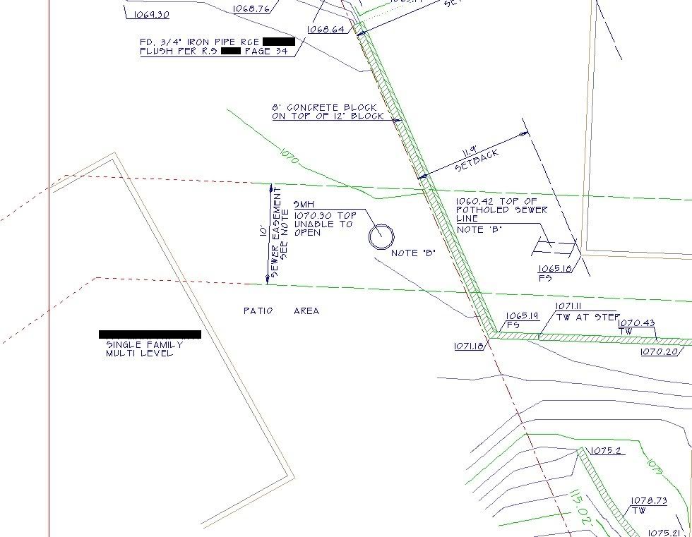
My map is correct. The easement was dedicated in 1926 by a subdivision map. The manhole is centered on the easement but not at the angle point of the easement, which is of no consequence for what is being planned. In the picture below, the vertical red line on the left is the edge of my drawing. The short dashed red lines is the sewer easement extending to it's angle points from where my drawing shows the easement lines in green dashed lines.
Sewer Easement

Three surveys - Jeremy
> I would suggest placing the benchmark symbol at the location of the BM rather than next to the annotation. At first glance I thought the BM was in the middle of the garage.
There is a note about the benchmark on my map not shown on the picture I posted. It was the only place on site that was certain in location to match the datum of the 2008 survey. I also hit him vertically in other places to the hundredth which double checked my choice of site benchmark for my survey. Plans had been generated from the 2008 work and matching his datum was important.
Is that supposed to be the correct topo ? The second one ?
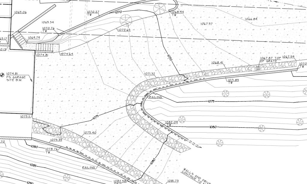
Somehow the bold contours on the right hand side of the drive (second topo) show the edge of drive or wall at around 182' then just to the right (bold contour) the label shows 160' ?
Is the label incorrect ?
The contour just above the 160' shows 175' which is roughly what the first topo shows, but then the slope is running backwards from the first topo then.
Is it a zooming into the label reading optical illusion? I don't get that.
Three surveys - R.J. Schneider

Three surveys - R.J. Schneider
Ok, right on, that makes sense. The zoom thing sucks.


