Very nice penmanship.
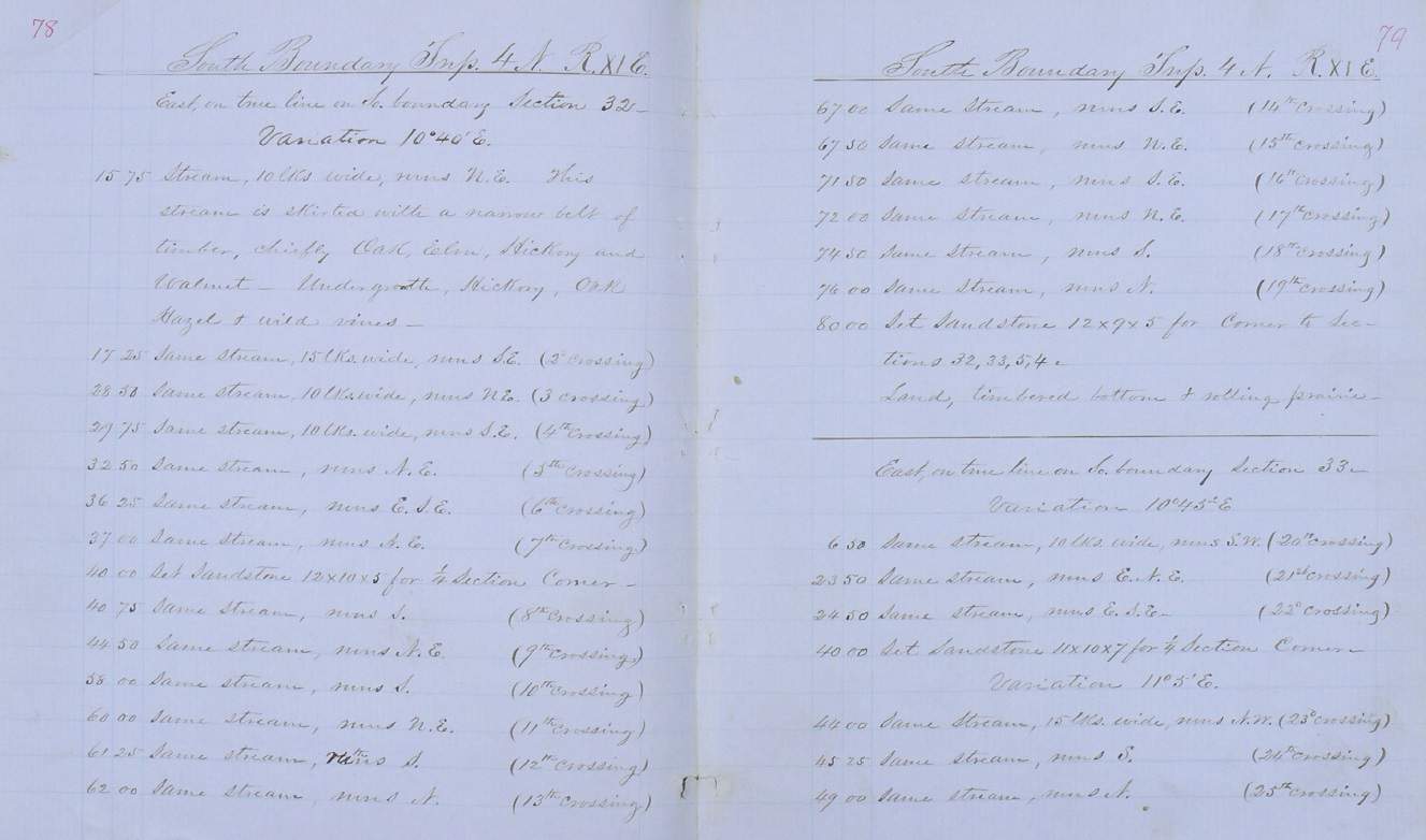
The question is did they really cross it that many times? I've seen that happen in my area and some of the distances seem out of whack in one case and I suspect they took some kind of short cut to not have to cross a small river several times.
David Livingstone, post: 456723, member: 431 wrote: The question is did they really cross it that many times? I've seen that happen in my area and some of the distances seem out of whack in one case and I suspect they took some kind of short cut to not have to cross a small river several times.
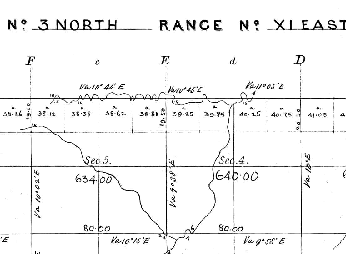
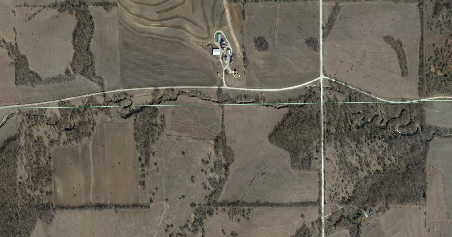
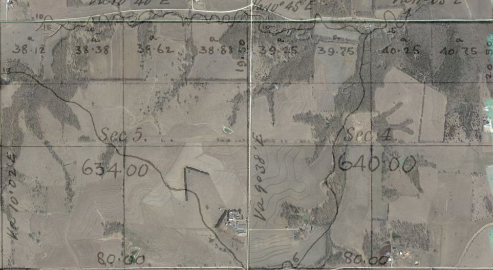
I tend to agree that the notes possibly look suspect. This was along a township line. I overlaid the GLO plat with Google Earth and I cannot see any evidence of crossing the stream three times east of the N 1/4 of Section 4.
40?ø15'44"N 96?ø11'31"W
In the case I remember it along the Spoon River. At the time I figured how many times it would have taken them to cross this river but I don't remember. Its not the kind of river you need a large boat to cross but in places it probably 10 feet deep. In Illinois the state was all done by compass and chain and I see a half mile varying between 2640 and 2700 feet. In this case I had a half mile that was almost 3000 feet but the half miles each side of it were about what I thought they should be. If it were me, I wouldn't have crossed the river that many times but measured the half mile and left flagging on the river bank and estimated the distance to the other side. Then once on the other side picked up my measurements.
The common practice for measuring a site that is obstructed was to offset a distance to where it is possible to avoid the obstruction.
In the case of a creek, while measuring along the open path, passing calls and distances to the bends are noted.
Then it is able to map the creeks location in relation to the boundary.
As to the fact that today's line not crossing the creek the same amount of times as in 1855, it would not be uncommon that the location of the creek has changed location.
0.02
The measurements may not be perfect, but they are less suspect than trying to recreate the 1855 location of a stream on the plains with a 20?? Google Earth image.
The offset method was fairly common, often they will even explain how they did it in the notes.
J. Penry, post: 456712, member: 321 wrote: Crossed the same stream 25 times in 1.66 miles
Well, that sure beats the one I found in the treaty line survey I've studied as a history hobby. There they crossed one stream 8 times.


