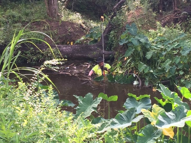
voidintheabyss, post: 441550, member: 11972 wrote: Today in Texas.
[SARCASM]Showin' off you got the full service Tiki bar and pool ... It ain't always that nice.[/SARCASM]
Dave Karoly, post: 441466, member: 94 wrote: I'm reading another thread about an extensive control survey at a reservoir
Does it really even matter ? It's not like it's gonna' survive all six California seasons anyway.
voidintheabyss, post: 441550, member: 11972 wrote:

Today in Texas.
.
[SARCASM]In the recent past, this picture would have gone by with a thought of "looks like some tough surveying", but post-EFF (8 ft fence), most all non -Texan surveyors will look at this and think, "He probably could have just walked around that pond and not gotten wet...." [/SARCASM]
Kent McMillan, post: 441602, member: 3 wrote: I feel your pain. You work hard in an idiot-proofed system to feel as if somehow you are breaking a sweat and along comes some surveyor in Texas who is dealing with problems on a regular basis that make the idiot-proofed system look, well, really simple. Bummer.
Of all the stories you've told here I've haven't heard anything so outstandingly complex. I can imagine things could be more time consuming without the use of maps. There is nothing like an actual map to bring one up to speed relatively quickly as to what preceding surveyors have done. A system that requires one to expend massive amounts of time to dig through notes, deeds and reports just to get a preliminary picture of what has happened, seems, well...idiotic.
roger_LS, post: 441868, member: 11550 wrote: Of all the stories you've told here I've haven't heard anything so outstandingly complex.
That's pretty amazing that you don't understand the complexity inherent in a metes and bounds system of land grants such as that followed in Texas as opposed to a simple system like the PLSS.
Kent McMillan, post: 441913, member: 3 wrote: That's pretty amazing that you don't understand the complexity inherent in a metes and bounds system of land grants such as that followed in Texas as opposed to a simple system like the PLSS.
Keep telling yourself that if it makes you feel better.
I guess if you can convince your dimwit clients of that fantasy, then you can make a few extra bucks on what is essentially a reasonably straight forward survey.
Loyal
Rankin_File, post: 441727, member: 101 wrote: most all non -Texan surveyors will look at this and think, "He probably could have just walked around that pond and not gotten wet...."
Most of the filed crew would probably figure it was a creek or bayou, and decide to stay on this side until the plss surveyor walks their way around 😉
Of all the odd things, that Kent McMillan has posted, this is probably the oddest. As others have said, it only reveals his lack of knowledge of the "Rest of the world". It's like saying that "Fords are harder to work on, than Chevys". They each have their problems. They each have their complexities. They each have their troubles. But, to compare their difficulty level, is an "across the board" issue, is simply the revelation of the fact that Kent does not get around enough.
BTW, Kent, the Javad LS is a wonderful tool. IF you want to simplify and TAME those Tejas Badlands. I recommend it. It could make your life easier. Even if 1-2 centimeters is not accurate enough... you can POST PROCESS all of it, simultaneously, while you do RTK. What's interesting, is you can USE rtk to get your search zones, (displayed in ANY kind of north, you like) and with GRID and GROUND distances. And, after getting close to a search zone, you can begin your search zone. Which can be 1' dia, to 400' diameter. In fact, there is a GLO corner, that is 340' from where everybody else was looking for it. That, and with some 150 seed ticks, biting your nether parts, it all has it's challenges. Then, there is the survey, done 30 yrs ago, by the "Lowest bidder" that now has to be reckoned with...and, it's built off the corner that is 165' wrong....
I once found a GLO corner, (using a total station) with a shovel. There was a pine knot, in a ravine, about 30' downstream, in a dry creek bed.
I got a search location, took the shovel, and probed the soil. Found a stone, carefully dug out the rock pile. It was filled in with erosion. The tops of the stones were 4-6" deep. There was also one stump hole, from the GLO survey. It was discernible, because what silted in, was a little different composition, than the local soil. This particular corner, is located SE of Mena AR. In the Nunely area. It's been years, since I did the survey. Dad went later, and set an ALUMINUM marker there. I did this survey, under my dad's license. In fact, I did a brief look up on this survey. Here it is:
http://geostor-plats.geostor.org/Polk/167622.pdf
Anyway, to let your apparent confidence in your abilities bring you to the point of disparaging other surveyors, operating under a differing system, is a sure method, of blinding you to your next big pile of evidence, and causing you to fall.
"Pride goeth before destruction, and a haughty spirit before a fall", says the proverb of the ancients. I'd spare you the fall.
Anyway, happy Sunday afternoon, and maybe we'll get some rain.
PS, the found GLO corner is the S1/4 of 36, on the above posted plat.
Nate
Nate he is just funin with you.
Maybe he finally got a copy of The Art Of The Deal... or one of my other recommended references.
I have coworker like that, you can never tell if he is joking or serious.
If a good retracement has been performed, they are both easy. If not, they are both... time consuming.
N
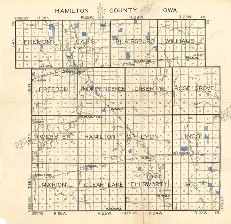
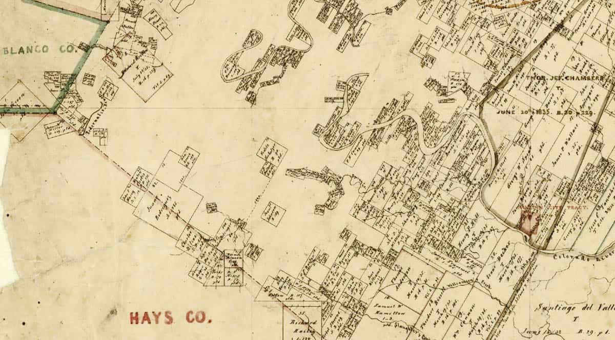
Kent McMillan, post: 441932, member: 3 wrote: I've posted these maps before.
Which is more complex?
This:
Hmm?
If you're confusing "which one appears more complex" with which one is a "total mess"..I'm sure you're going to bestow upon us all the intricate pitfalls of attempting to retrace something that (a) may not have ever been established to start with; or (b) record bearings and distances that are so far from the truth it's laughable. You keep wanting us to believe that the mess that the Texas land tenure system has become somehow magically gives you goons some sort of magical power. If that were true, all boundaries in Texas should have been rectified before you ever came down the pike. But you and your ilk continue to miss each others' corners by hundreds of feet and you continue to keep setting new corners to add to the cacophony.
But to answer your question: I would say the former. The latter is a mere scattering of independent parcels, most with only three or four adjoiner's. One corner might only bear upon a couple of dependent or junior corners. One truly could possibly bound a parcel with little or no concern of a parcel that isn't an immediate adjoiner. That is not necessarily so in the plss system.
Depending on the task at hand, the interdependent corners of the public system can involve hundreds of parcels and stretch all the way across the 16 townships you've shown.
Kent McMillan, post: 441913, member: 3 wrote: That's pretty amazing that you don't understand the complexity inherent in a metes and bounds system of land grants such as that followed in Texas as opposed to a simple system like the PLSS.
I don't know PLSS so wouldn't be qualified to make that comparison, you don't seem to know it either so you'd be equally unqualified, moot point as no one here seems to be interested in that particular question if you hadn't noticed.
The complexity happens when half the parcels in a Section are based on the subdivision done in 2005 and the other half are based on the subdivision done in 1949. Then in another section there is 1880 then built on in 1925 then various surveys in the 1960s then 1980 just called everybody off and started over. I know Kent would just start over but that's not a good plan when you have decades of possession to established lines.
As a bit of a history nerd I'd like to say that I find Kent's posts quite informative - the detail of knowledge of the early surveyors and their foibles - the use of the original field notes etc etc. It is quite different to what I have to deal with on a daily basis
Around here complexity comes from 6.8 and 7.2 magnitude earthquakes and all their little cousins
jim.cox, post: 441948, member: 93 wrote: As a bit of a history nerd I'd like to say that I find Kent's posts quite informative - the detail of knowledge of the early surveyors and their foibles - the use of the original field notes etc etc. It is quite different to what I have to deal with on a daily basis
Around here complexity comes from 6.8 and 7.2 magnitude earthquakes and all their little cousins
Yes, working in the genuinely complex system of land grants that Texas has does require significant knowledge of the surveyors who put it all on the ground originally: tools, methods, and the procedures of the day. I've spent quite a few hours this weekend working on unraveling how about 80,000 acres of land along a river were originally subdivided in 1839. The basic problem was one of surveying tracts of a given width (2550 varas = 7083.3 ft. = 2159.0m), with their sidelines on a given bearing, with square end lines, and running back from a river with an irregular frontage to enclose 26,000,000 labors of land (about 4605 acres = 1,864 hectares)
Knowing that was the problem before the original surveyor (who turns out to have recycled the meanders of the river bank OPPOSITE his locations from another essentially contemporaneous (within a few days) survey by another deputy surveyor) cast considerable light upon his calls for unidentifiable "stone mound" corners nearly everywhere except at two of the upland corners where there were calls for bearing trees.
paden cash, post: 441940, member: 20 wrote: Depending on the task at hand, the interdependent corners of the public system can involve hundreds of parcels and stretch all the way across the 16 townships you've shown.
So, are you saying that in Oklahoma just a PK nail in the county road won't do it? Color me skeptical from reading years of postings from PLSSia.
The reality in OKPLSSia seems to be that since you have a record of how the survey was presumptively made, in most cases the "retracement" exercise just boils down to the earth-shattering question of either (a) which fence post to consider to mark the "original" corner or (b) whether to drive another survey marker in a county road intersection that already has one or two in place.
Kent,
With all due respect, I was taught that a real surveyor "rises to the ocasion".
That's what we should ALL do.
We should always let the needs of the survey dictate how it gets done.
Not the budget, orthe time frame.
I've seen way too many "budget/time dictated" surveys.


