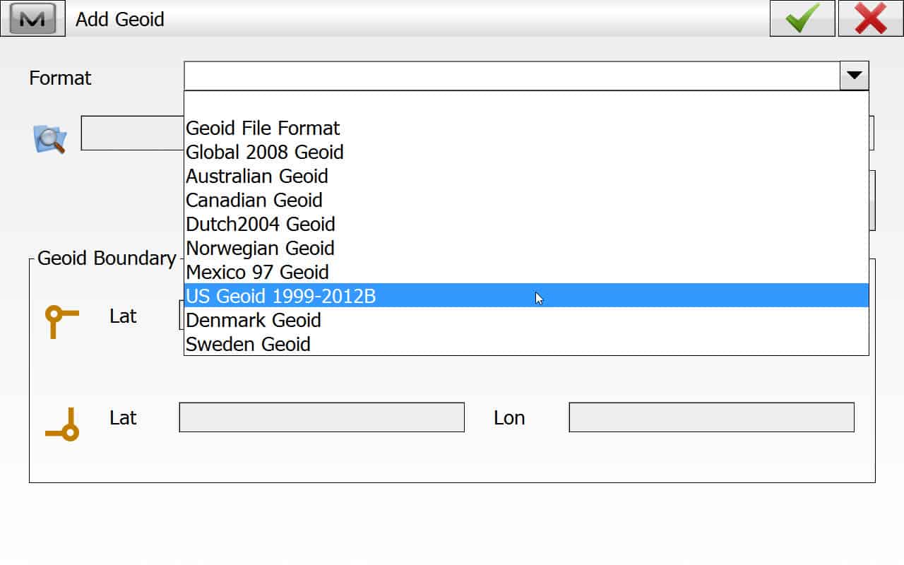
The Geoid model here has been updated in the last year. I contacted our Topcon dealer about getting the geoid file for our FC-2500 with Topsurv and he informed me that it was only available for Magnet and I would have to purchase a new collector to use the new geoid.
Is this a load of bull or not?
sounds like bs to me????
However you have loaded GEOID files in the past should still work. Just download the new file from NGS and create a new GEOID field file like you've always done... That is if it works the same way Leica does...
I currently utilize a Carlson Surveyor2 Data Collector running SurvCE and had to obtain a Geoid File from a fellow Surveyor. Then install that file into the folder My Documents on the Data Collector. Ran through the menus and selected the file to use. You should never have to purchase a new collector just have to locate where the file needs to be placed in the Collector.
If OSI changed the specs on the file format or even the header info on the old format (denser, different information, etc), it could be that the DC won't read the file correctly. This is me, giving Topcon the benefit of a doubt. If the new geoid file format is documented, and someone knows the previous file format that the collector uses, the new geoid file could be re-written into a format that the DC supports. Topcon may not think it makes sense financially.
I can't believe that NGS would change the file format of the new geoid files, but then again, I can't believe much of anything else these days either...
OP is in Ireland, not the US, and yes, both DMA/NIMA/NGA and NGS have changed geoid file formats.
Magnet and TopSurv can both read BIN or GFF files.
So if you can file the latest GEOID in one of those format for your area, then just download it and point TopSurv to the file.
What the dealer is likely referring to, is the context in how Magnet and TopSurv describe the GEOID type. See text below. Obviously in TopSurv that was last updated wheel before 2012, it would certainly not say in text that it would find a 2012B Geoid. They are just naming wrong. The format selected below will look for and any Geoid .BIN file
mkennedy, post: 430667, member: 7183 wrote: OP is in Ireland, not the US, and yes, both DMA/NIMA/NGA and NGS have changed geoid file formats.
Is this announced on the NGS website? I don't see it...
What is the current GEOID for Ireland? I'll test it.
leegreen, post: 430672, member: 2332 wrote: What is the current GEOID for Ireland? I'll test it.
It is Osgm15 replacing osgm02. I am trying to locate it for download at the moment in any format.
I have a data collector that will not read the Geoid12B file. It is a TDS Ranger 2 running Survey Pro 4.5.1 I believe. I have tried every trick in the book to get it to read the file, and it just won't do it. I have to upgrade to 4.7.1 for it to read the new geoid. I just sold the robot that I used that DC with, and will now probably upgrade that DC. It had some features that ran the robot much better than the 4.7.1 version.
leegreen, post: 430672, member: 2332 wrote: What is the current GEOID for Ireland? I'll test it.
Just wondering if you had any success with this, thanks.
The format of GEOID from link above is not familiar to me. I not sure it can be use directly in Magnet or TopSurv, without a translator. I would contact Topcon support, not the dealer.
leegreen, post: 431617, member: 2332 wrote: The format of GEOID from link above is not familiar to me. I not sure it can be use directly in Magnet or TopSurv, without a translator. I would contact Topcon support, not the dealer.
Thanks will try Topcon support.


