Reading RPLS is free for the whole profession. Members post, reply, and get the members-only rooms.

Notifications
Clear all
Strictly Surveying
23
Posts
13
Users
0
Reactions
1,308
Views

Topic starter
Translate
▼
English
Spanish
French
German
Italian
Portuguese
Russian
Chinese
Japanese
Korean
Arabic
Hindi
Dutch
Polish
Turkish
Vietnamese
Thai
Swedish
Danish
Finnish
Norwegian
Czech
Hungarian
Romanian
Greek
Hebrew
Indonesian
Malay
Ukrainian
Bulgarian
Croatian
Slovak
Slovenian
Serbian
Lithuanian
Latvian
Estonian
Visiting the U.S.A to hike the Pacific Crest Trail and on the way through am keeping an eye out for Survey marks. Found heaps of Bearing Trees and NGS marks, some Exposed Pins and corner rocks (all left undisturbed of course).
By far my favourite marks though have to be the 2 monuments atop Mt Whitney, highest mountain in the Lower 48 states... so of course I had to get out my Jigga and ensure that it was still the highest!


Would be really cool if someone could pull out/link the fact sheets for the two marks for me, it's difficult to navigate the NGS marks site on phone while still on trail.
Posted : July 28, 2016 5:03 pm

Translate
▼
English
Spanish
French
German
Italian
Portuguese
Russian
Chinese
Japanese
Korean
Arabic
Hindi
Dutch
Polish
Turkish
Vietnamese
Thai
Swedish
Danish
Finnish
Norwegian
Czech
Hungarian
Romanian
Greek
Hebrew
Indonesian
Malay
Ukrainian
Bulgarian
Croatian
Slovak
Slovenian
Serbian
Lithuanian
Latvian
Estonian
I am on my iPhone now, so not much help.
Try the findacontrol app.
Posted : July 28, 2016 5:12 pm

Translate
▼
English
Spanish
French
German
Italian
Portuguese
Russian
Chinese
Japanese
Korean
Arabic
Hindi
Dutch
Polish
Turkish
Vietnamese
Thai
Swedish
Danish
Finnish
Norwegian
Czech
Hungarian
Romanian
Greek
Hebrew
Indonesian
Malay
Ukrainian
Bulgarian
Croatian
Slovak
Slovenian
Serbian
Lithuanian
Latvian
Estonian

Here's one
Posted : July 28, 2016 7:49 pm
Translate
▼
English
Spanish
French
German
Italian
Portuguese
Russian
Chinese
Japanese
Korean
Arabic
Hindi
Dutch
Polish
Turkish
Vietnamese
Thai
Swedish
Danish
Finnish
Norwegian
Czech
Hungarian
Romanian
Greek
Hebrew
Indonesian
Malay
Ukrainian
Bulgarian
Croatian
Slovak
Slovenian
Serbian
Lithuanian
Latvian
Estonian


And the other. Sorry for the overlap, they are screenshots from my phone
Posted : July 28, 2016 7:50 pm

Translate
▼
English
Spanish
French
German
Italian
Portuguese
Russian
Chinese
Japanese
Korean
Arabic
Hindi
Dutch
Polish
Turkish
Vietnamese
Thai
Swedish
Danish
Finnish
Norwegian
Czech
Hungarian
Romanian
Greek
Hebrew
Indonesian
Malay
Ukrainian
Bulgarian
Croatian
Slovak
Slovenian
Serbian
Lithuanian
Latvian
Estonian
Don't forget to go to the NGS website & submit a recovery note and photo... [sarcasm]make sure you include the "correct" Lat and Long from your phone.[/sarcasm]
Posted : July 28, 2016 8:42 pm

Translate
▼
English
Spanish
French
German
Italian
Portuguese
Russian
Chinese
Japanese
Korean
Arabic
Hindi
Dutch
Polish
Turkish
Vietnamese
Thai
Swedish
Danish
Finnish
Norwegian
Czech
Hungarian
Romanian
Greek
Hebrew
Indonesian
Malay
Ukrainian
Bulgarian
Croatian
Slovak
Slovenian
Serbian
Lithuanian
Latvian
Estonian
I want a pocket instrument like that!! It would fit in my saddlebags and be so handy for getting under that one tree that gets in my way! Except, how thick are your eyeglasses for reading that thing??
Posted : July 28, 2016 9:14 pm

Translate
▼
English
Spanish
French
German
Italian
Portuguese
Russian
Chinese
Japanese
Korean
Arabic
Hindi
Dutch
Polish
Turkish
Vietnamese
Thai
Swedish
Danish
Finnish
Norwegian
Czech
Hungarian
Romanian
Greek
Hebrew
Indonesian
Malay
Ukrainian
Bulgarian
Croatian
Slovak
Slovenian
Serbian
Lithuanian
Latvian
Estonian
Still trying to process the Bench Marks that are described,,,,,,,,,,
Bench Marks? Really? they ran levels up there, now that is impressive!!!!!!!
Posted : July 29, 2016 6:57 am
Translate
▼
English
Spanish
French
German
Italian
Portuguese
Russian
Chinese
Japanese
Korean
Arabic
Hindi
Dutch
Polish
Turkish
Vietnamese
Thai
Swedish
Danish
Finnish
Norwegian
Czech
Hungarian
Romanian
Greek
Hebrew
Indonesian
Malay
Ukrainian
Bulgarian
Croatian
Slovak
Slovenian
Serbian
Lithuanian
Latvian
Estonian
Still trying to process the Bench Marks that are described,,,,,,,,,,
Bench Marks? Really? they ran levels up there, now that is impressive!!!!!!!
Posted : July 29, 2016 6:58 am

Translate
▼
English
Spanish
French
German
Italian
Portuguese
Russian
Chinese
Japanese
Korean
Arabic
Hindi
Dutch
Polish
Turkish
Vietnamese
Thai
Swedish
Danish
Finnish
Norwegian
Czech
Hungarian
Romanian
Greek
Hebrew
Indonesian
Malay
Ukrainian
Bulgarian
Croatian
Slovak
Slovenian
Serbian
Lithuanian
Latvian
Estonian
MightyMoe, post: 383121, member: 700 wrote: Really? they ran levels up there
No, they didn't. Only one has a measured elevation and it was by vertical angle.
http://www.ngs.noaa.gov/cgi-bin/ds_mark.prl?PidBox=gt1811
GT1811 NGVD 29 (07/19/86) 4419.1 (m) 14498. (f) VERT ANG
GT1811 NAVD 88 ORTHO HEIGHT - 4421.0 (meters) 14505. (feet) VERTCON
http://www.ngs.noaa.gov/cgi-bin/ds_mark.prl?PidBox=gt1813
GT1813* NAVD 88 ORTHO HEIGHT - 4420. (meters) 14501. (feet) SCALED
Posted : July 29, 2016 9:57 am
Translate
▼
English
Spanish
French
German
Italian
Portuguese
Russian
Chinese
Japanese
Korean
Arabic
Hindi
Dutch
Polish
Turkish
Vietnamese
Thai
Swedish
Danish
Finnish
Norwegian
Czech
Hungarian
Romanian
Greek
Hebrew
Indonesian
Malay
Ukrainian
Bulgarian
Croatian
Slovak
Slovenian
Serbian
Lithuanian
Latvian
Estonian
Bill93, post: 383198, member: 87 wrote: No, they didn't. Only one has a measured elevation and it was by vertical angle.
http://www.ngs.noaa.gov/cgi-bin/ds_mark.prl?PidBox=gt1811
GT1811 NGVD 29 (07/19/86) 4419.1 (m) 14498. (f) VERT ANG
GT1811 NAVD 88 ORTHO HEIGHT - 4421.0 (meters) 14505. (feet) VERTCONhttp://www.ngs.noaa.gov/cgi-bin/ds_mark.prl?PidBox=gt1813
GT1813* NAVD 88 ORTHO HEIGHT - 4420. (meters) 14501. (feet) SCALED
Data Sheet RetrievalThe NGS Data Sheet
See file dsdata.txt for more information about the datasheet.
PROGRAM = datasheet95, VERSION = 8.9
1 National Geodetic Survey, Retrieval Date = JULY 29, 2016
GT0239 ***********************************************************************
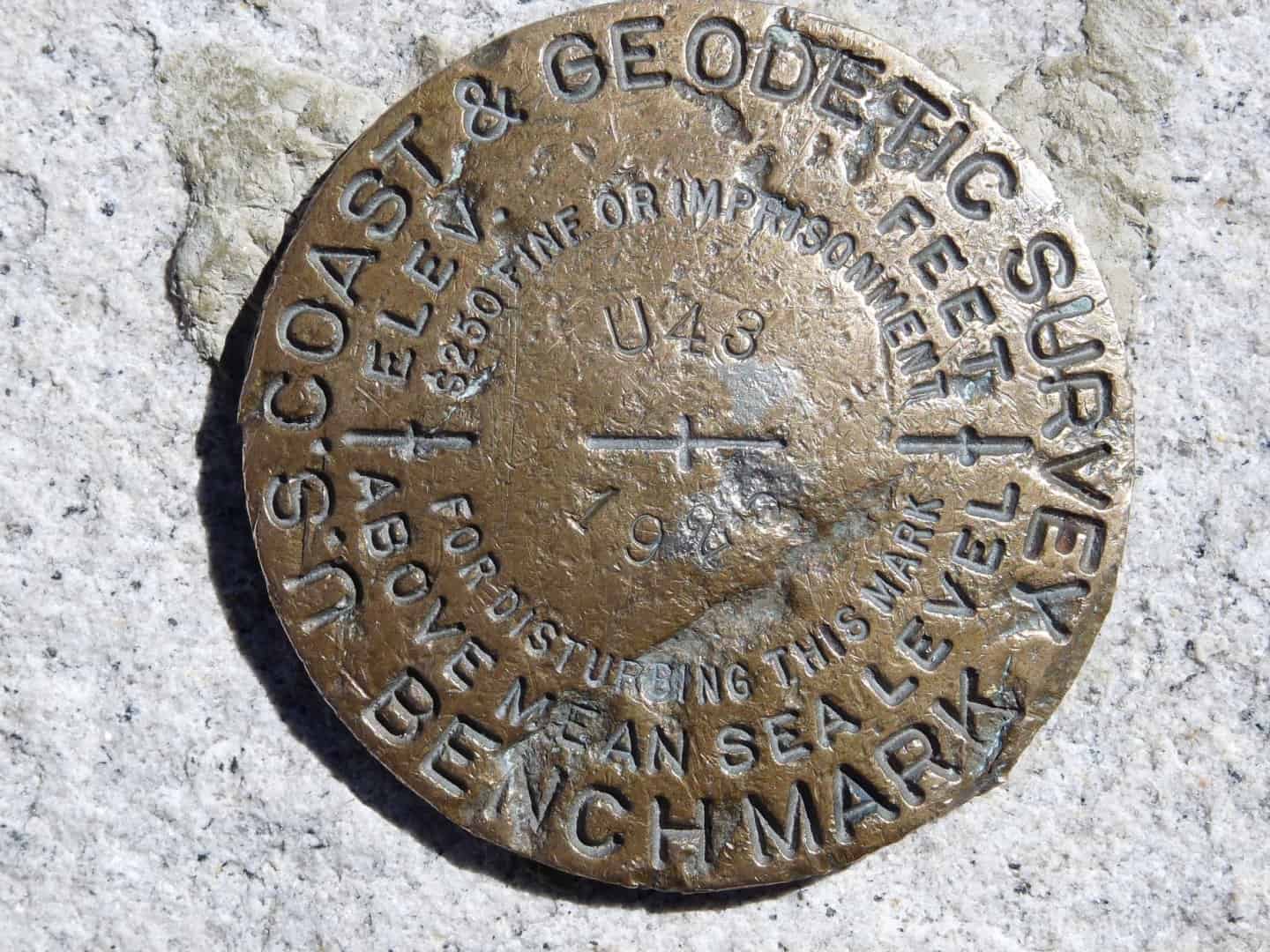
GT0239 DESIGNATION - U 43
GT0239 PID - GT0239
GT0239 STATE/COUNTY- CA/INYO
GT0239 COUNTRY - US
GT0239 USGS QUAD - MOUNT WHITNEY (1994)
GT0239
GT0239 *CURRENT SURVEY CONTROL
GT0239 ______________________________________________________________________
GT0239* NAD 83(1992) POSITION- 36 34 42.96827(N) 118 17 31.25596(W) ADJUSTED
GT0239* NAD 83(1992) EPOCH - 1991.35
GT0239* NAVD 88 ORTHO HEIGHT - 4419.48 (+/-2cm) 14499.6 (feet) VERTCON
GT0239 ______________________________________________________________________
GT0239 LAPLACE CORR - -8.51 (seconds) DEFLEC12B
GT0239 GEOID HEIGHT - -25.216 (meters) GEOID12B
GT0239 HORZ ORDER - SECOND
GT0239 VERT ORDER - FIRST CLASS II (See Below)
GT0239
GT0239.The horizontal coordinates were established by classical geodetic methods
GT0239.and adjusted by the National Geodetic Survey in March 1994.
GT0239.
GT0239.The NAVD 88 height was computed by applying the VERTCON shift value to
GT0239.the NGVD 29 height (displayed under SUPERSEDED SURVEY CONTROL.)
GT0239
GT0239.Significant digits in the geoid height do not necessarily reflect accuracy.
GT0239.GEOID12B height accuracy estimate available here.
GT0239
GT0239.The vertical order pertains to the NGVD 29 superseded value.
GT0239
GT0239.The Laplace correction was computed from DEFLEC12B derived deflections.
GT0239
GT0239. The following values were computed from the NAD 83(1992) position.
GT0239
GT0239; North East Units Scale Factor Converg.
GT0239;SPC CA 4 - 638,410.219 2,063,360.631 MT 0.99994110 +0 25 20.5
GT0239;SPC CA 4 - 2,094,517.53 6,769,542.34 sFT 0.99994110 +0 25 20.5
GT0239;UTM 11 - 4,048,903.761 384,407.399 MT 0.99976462 -0 46 12.1
GT0239
GT0239! - Elev Factor x Scale Factor = Combined Factor
GT0239!SPC CA 4 - 0.99931084 x 0.99994110 = 0.99925198
GT0239!UTM 11 - 0.99931084 x 0.99976462 = 0.99907563
GT0239
GT0239 SUPERSEDED SURVEY CONTROL
GT0239
GT0239 NAD 83(1986)- 36 34 42.95909(N) 118 17 31.24781(W) AD(1984.00) 2
GT0239 NAD 27 - 36 34 43.19020(N) 118 17 27.93070(W) AD( ) 2
GT0239 NGVD 29 (??/??/92) 4417.606 (m) 14493.43 (f) ADJ UNCH 1 2
GT0239 NGVD 29 (07/19/86) 4417.60 (m) 14493.4 (f) LEVELING 3
GT0239
GT0239.Superseded values are not recommended for survey control.
GT0239
GT0239.NGS no longer adjusts projects to the NAD 27 or NGVD 29 datums.
GT0239.See file dsdata.txt to determine how the superseded data were derived.
GT0239
GT0239_U.S. NATIONAL GRID SPATIAL ADDRESS: 11SLA8440748903(NAD 83)
GT0239
GT0239_MARKER: DB = BENCH MARK DISK
GT0239_SETTING: 80 = SET IN A BOULDER
GT0239_STAMPING: U 43 1925
GT0239_MARK LOGO: CGS
GT0239_STABILITY: C = MAY HOLD, BUT OF TYPE COMMONLY SUBJECT TO
GT0239+STABILITY: SURFACE MOTION
GT0239_SATELLITE: THE SITE LOCATION WAS REPORTED AS SUITABLE FOR
GT0239+SATELLITE: SATELLITE OBSERVATIONS - August 20, 2006
GT0239
GT0239 HISTORY - Date Condition Report By
GT0239 HISTORY - 1925 MONUMENTED CGS
GT0239 HISTORY - 1940 GOOD CGS
GT0239 HISTORY - 1962 SEE DESCRIPTION CGS
GT0239 HISTORY - 1962 GOOD CGS
GT0239 HISTORY - 20060820 GOOD GEOCAC
GT0239
GT0239 STATION DESCRIPTION
GT0239
GT0239'DESCRIBED BY COAST AND GEODETIC SURVEY 1940
GT0239'13 MI W FROM LONE PINE.
GT0239'AT THE SUMMIT OF MT. WHITNEY, TULARE COUNTY, 6 FEET WEST OF THE
GT0239'HIGHEST POINT OF THE PEAK, 6 FEET WEST OF BENCH MARK 14501
GT0239'(USGS), IN THE TOP OF A BOULDER, AND ABOUT 2 FEET BELOW THE
GT0239'HIGHEST POINT OF THE PEAK. A STANDARD DISK, STAMPED U 43 1925.
GT0239
GT0239 STATION RECOVERY (1962)
GT0239
GT0239'RECOVERY NOTE BY COAST AND GEODETIC SURVEY 1962
GT0239'SEE STATION WHITNEY
GT0239
GT0239 STATION RECOVERY (1962)
GT0239
GT0239'RECOVERY NOTE BY COAST AND GEODETIC SURVEY 1962
GT0239'RECOVERED IN GOOD CONDITION.
GT0239
GT0239 STATION RECOVERY (2006)
GT0239
GT0239'RECOVERY NOTE BY GEOCACHING 2006 (JER)
GT0239'MARK HAS SOME PITTING AND SCRATCHES. CAN NO LONGER MAKE OUT THE LAST
GT0239'TWO DIGITS OF THE YEAR.
*** retrieval complete.
they say leveling
Posted : July 29, 2016 10:03 am
Translate
▼
English
Spanish
French
German
Italian
Portuguese
Russian
Chinese
Japanese
Korean
Arabic
Hindi
Dutch
Polish
Turkish
Vietnamese
Thai
Swedish
Danish
Finnish
Norwegian
Czech
Hungarian
Romanian
Greek
Hebrew
Indonesian
Malay
Ukrainian
Bulgarian
Croatian
Slovak
Slovenian
Serbian
Lithuanian
Latvian
Estonian
Wow. I saw two PIDs quoted up there and didn't think to look for a third.
Posted : July 29, 2016 10:12 am
Translate
▼
English
Spanish
French
German
Italian
Portuguese
Russian
Chinese
Japanese
Korean
Arabic
Hindi
Dutch
Polish
Turkish
Vietnamese
Thai
Swedish
Danish
Finnish
Norwegian
Czech
Hungarian
Romanian
Greek
Hebrew
Indonesian
Malay
Ukrainian
Bulgarian
Croatian
Slovak
Slovenian
Serbian
Lithuanian
Latvian
Estonian
Bill93, post: 383205, member: 87 wrote: Wow. I saw two PIDs quoted up there and didn't think to look for a third.
Those are real men that did that level loop!!!!
Just imagine, what a bunch of whimps surveyors have become (including myself).....
Posted : July 29, 2016 10:19 am

Translate
▼
English
Spanish
French
German
Italian
Portuguese
Russian
Chinese
Japanese
Korean
Arabic
Hindi
Dutch
Polish
Turkish
Vietnamese
Thai
Swedish
Danish
Finnish
Norwegian
Czech
Hungarian
Romanian
Greek
Hebrew
Indonesian
Malay
Ukrainian
Bulgarian
Croatian
Slovak
Slovenian
Serbian
Lithuanian
Latvian
Estonian
I recently watched "Wild", it was about a 1,100 mile journey of the 2,659 mi trail.
It reminded me of the cross country electric transmission lines worked on in the 1970s.
Posted : July 30, 2016 11:19 pm

Translate
▼
English
Spanish
French
German
Italian
Portuguese
Russian
Chinese
Japanese
Korean
Arabic
Hindi
Dutch
Polish
Turkish
Vietnamese
Thai
Swedish
Danish
Finnish
Norwegian
Czech
Hungarian
Romanian
Greek
Hebrew
Indonesian
Malay
Ukrainian
Bulgarian
Croatian
Slovak
Slovenian
Serbian
Lithuanian
Latvian
Estonian
Did you miss this one? I don't think it's in the IDB, but someone had a sense of humor.
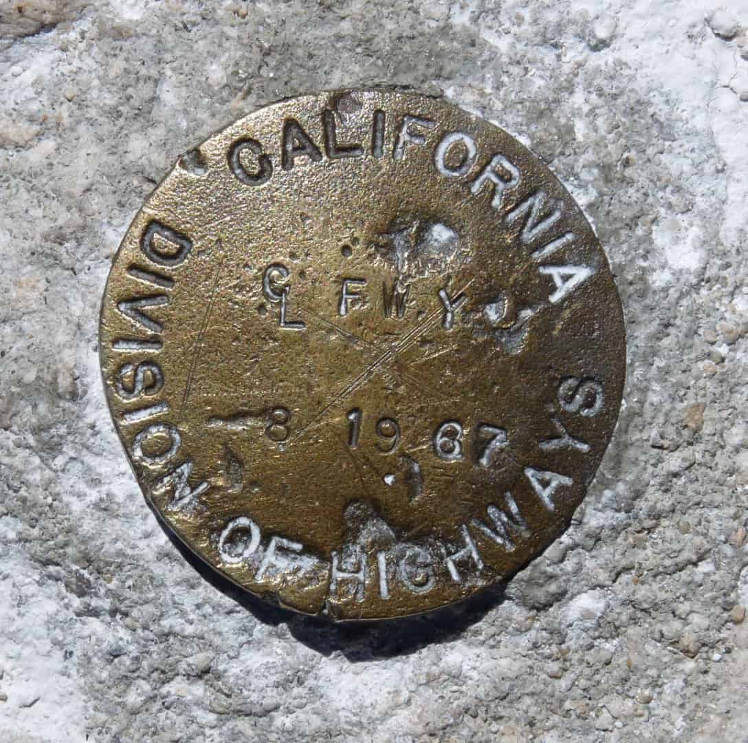
Here's the shot of U43 I took in 2010:
Posted : July 31, 2016 9:58 am
Topic starter
Translate
▼
English
Spanish
French
German
Italian
Portuguese
Russian
Chinese
Japanese
Korean
Arabic
Hindi
Dutch
Polish
Turkish
Vietnamese
Thai
Swedish
Danish
Finnish
Norwegian
Czech
Hungarian
Romanian
Greek
Hebrew
Indonesian
Malay
Ukrainian
Bulgarian
Croatian
Slovak
Slovenian
Serbian
Lithuanian
Latvian
Estonian
Rankin_File, post: 383078, member: 101 wrote: [sarcasm]make sure you include the "correct" Lat and Long from your phone.[/sarcasm]
I did actually ping a location on my GPS Watch, far more accurate than the current location I'm sure!
Jim Frame, post: 383491, member: 10 wrote: Did you miss this one?
I only had a quick look around so it may have been under snow, was ~8" dumped up there the day before I hit the summit.
Posted : August 3, 2016 3:39 pm

Translate
▼
English
Spanish
French
German
Italian
Portuguese
Russian
Chinese
Japanese
Korean
Arabic
Hindi
Dutch
Polish
Turkish
Vietnamese
Thai
Swedish
Danish
Finnish
Norwegian
Czech
Hungarian
Romanian
Greek
Hebrew
Indonesian
Malay
Ukrainian
Bulgarian
Croatian
Slovak
Slovenian
Serbian
Lithuanian
Latvian
Estonian
Which section of the PCT are you hiking?
I hiked about 100' of the PCT inadvertently last weekend on a side trip searching for drinking water.
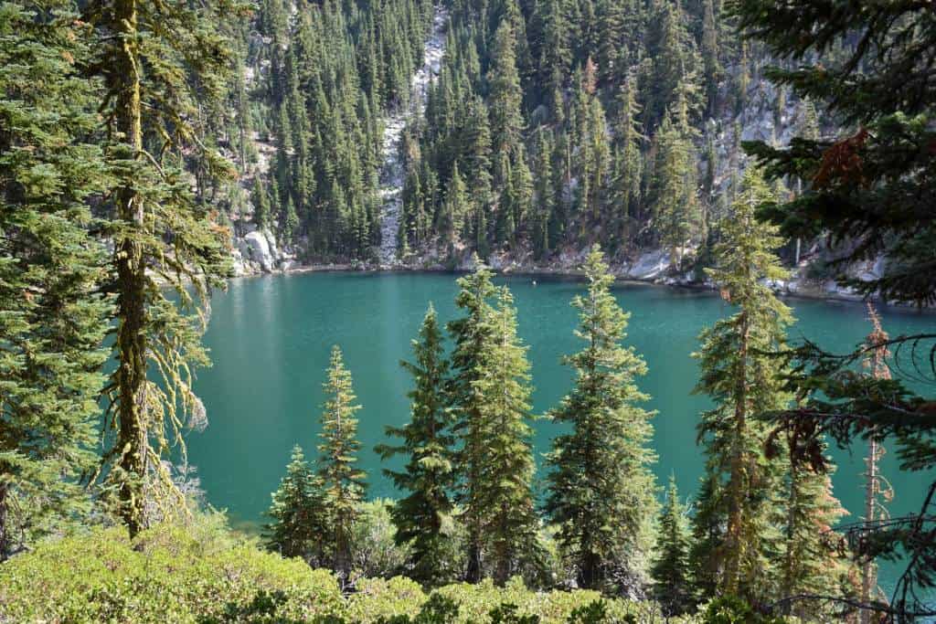
Here is a picture taken on the way down the mountain (cross country) to give you an idea what Northern California looks like.
Not a single fish in the lake! Have a suspicion the fish were killed off to improve frog habitat, but have not verified that yet.
Took us about an hour to drive to the trail head. It's one of the main reasons I live where I do.
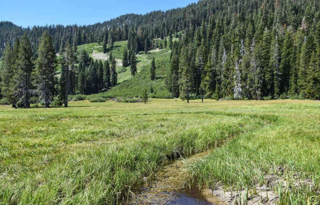
This stream was full of rainbow trout!
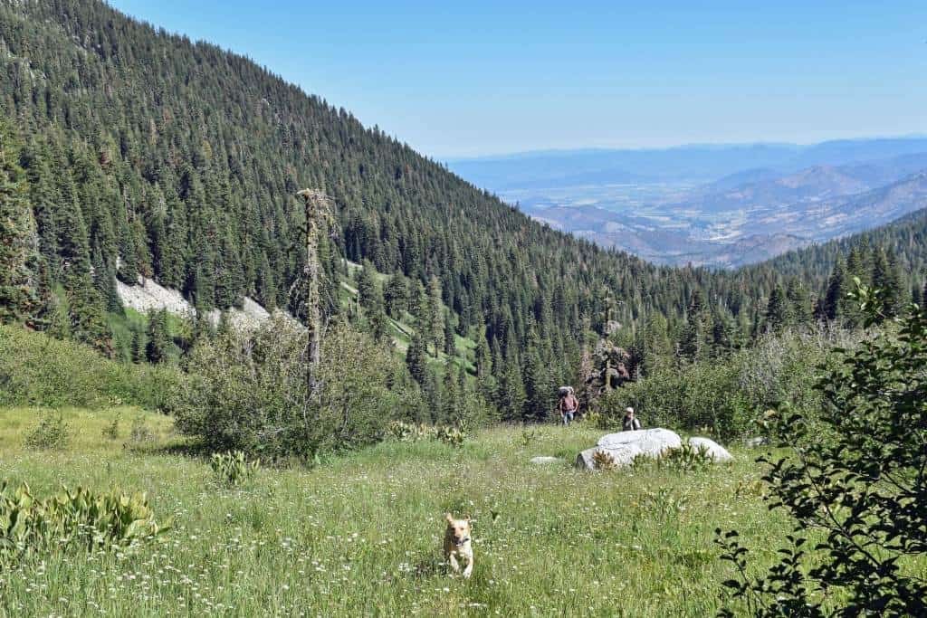
The dog was VERY happy to run around through the meadows.
Posted : August 3, 2016 4:52 pm
Translate
▼
English
Spanish
French
German
Italian
Portuguese
Russian
Chinese
Japanese
Korean
Arabic
Hindi
Dutch
Polish
Turkish
Vietnamese
Thai
Swedish
Danish
Finnish
Norwegian
Czech
Hungarian
Romanian
Greek
Hebrew
Indonesian
Malay
Ukrainian
Bulgarian
Croatian
Slovak
Slovenian
Serbian
Lithuanian
Latvian
Estonian
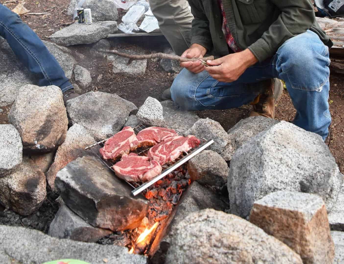
Sorry to do this to you, but I couldn't resist.....We had a meager dinner. Meat and bread.
Posted : August 3, 2016 4:57 pm

Translate
▼
English
Spanish
French
German
Italian
Portuguese
Russian
Chinese
Japanese
Korean
Arabic
Hindi
Dutch
Polish
Turkish
Vietnamese
Thai
Swedish
Danish
Finnish
Norwegian
Czech
Hungarian
Romanian
Greek
Hebrew
Indonesian
Malay
Ukrainian
Bulgarian
Croatian
Slovak
Slovenian
Serbian
Lithuanian
Latvian
Estonian
imaudigger, post: 384174, member: 7286 wrote: Sorry to do this to you, but I couldn't resist.....We had a meager dinner. Meat and bread.
And beer I hope!
Posted : August 3, 2016 5:22 pm

Translate
▼
English
Spanish
French
German
Italian
Portuguese
Russian
Chinese
Japanese
Korean
Arabic
Hindi
Dutch
Polish
Turkish
Vietnamese
Thai
Swedish
Danish
Finnish
Norwegian
Czech
Hungarian
Romanian
Greek
Hebrew
Indonesian
Malay
Ukrainian
Bulgarian
Croatian
Slovak
Slovenian
Serbian
Lithuanian
Latvian
Estonian
imaudigger, post: 384172, member: 7286 wrote: Which section of the PCT are you hiking?
I hiked about 100' of the PCT inadvertently last weekend on a side trip searching for drinking water.
Here is a picture taken on the way down the mountain (cross country) to give you an idea what Northern California looks like.
Not a single fish in the lake! Have a suspicion the fish were killed off to improve frog habitat, but have not verified that yet.
Took us about an hour to drive to the trail head. It's one of the main reasons I live where I do.
This stream was full of rainbow trout!
The dog was VERY happy to run around through the meadows.
No Fish! What's that about!
Posted : August 3, 2016 5:28 pm
Translate
▼
English
Spanish
French
German
Italian
Portuguese
Russian
Chinese
Japanese
Korean
Arabic
Hindi
Dutch
Polish
Turkish
Vietnamese
Thai
Swedish
Danish
Finnish
Norwegian
Czech
Hungarian
Romanian
Greek
Hebrew
Indonesian
Malay
Ukrainian
Bulgarian
Croatian
Slovak
Slovenian
Serbian
Lithuanian
Latvian
Estonian
Warren Smith, post: 384179, member: 9900 wrote: And beer I hope!
Yeah, whoever was carrying the beef should have been able to add some fluid ounces!
Posted : August 3, 2016 5:29 pm
Page 1 / 2
Next