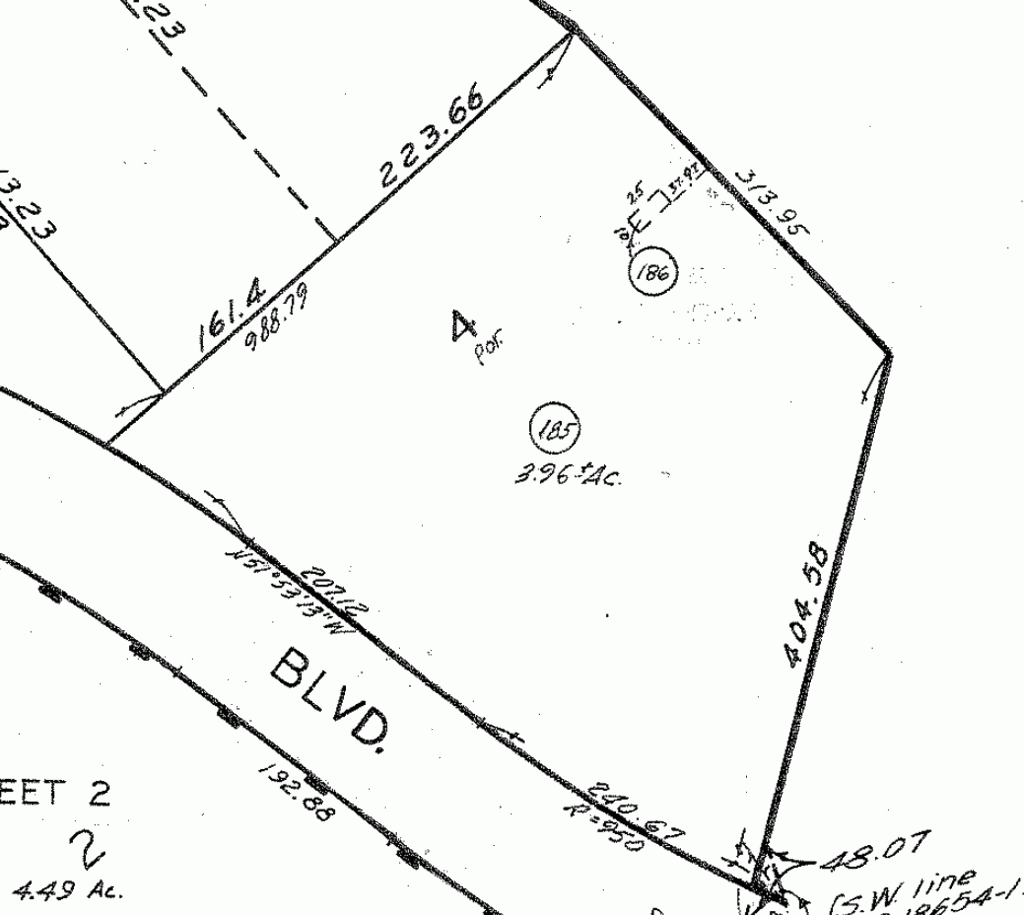
A realtor called me about doing a survey on about 6.5 acres of equestrian property. After she gave me an address I did some online research. At a glance it looked like a sweet job to do. Then I noticed a small area on the assessors map and zoomed in. It shows a fee parcel within one part of the property. It is labeled as assessors parcel No 186. It is a 10' x 25' parcel seperately assessed and is not tied with a land hook to the main parcel, No. 185.
[APN No 186]
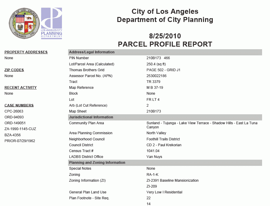
I checked the city web site and they have a write up on it.
[City Report (partial) on No. 186]
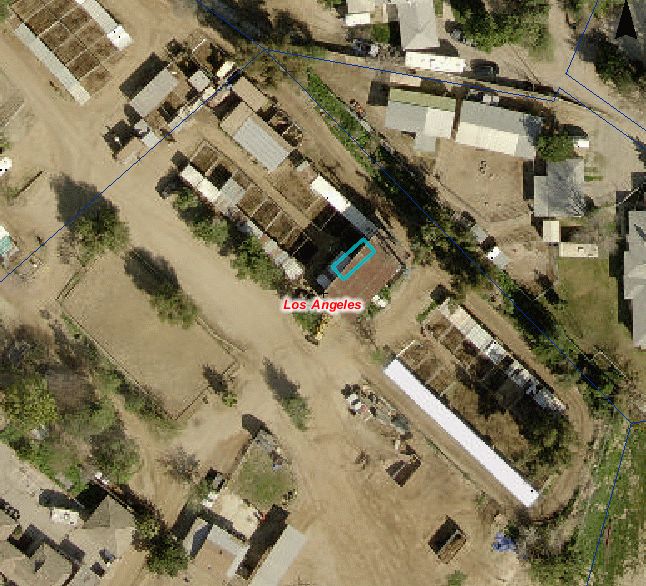
I did a Google Earth on it, looking for maybe a cell repeater site (those are lease sites though, not fee) and ANP No. 186 appears to be landing near a structure of some type. Next stop was the LA County GIS site. It also shows up as a fee parcel. The county site borders fee asessor parcels in thick blue to make them stand out. The darker thin blue lines are other assessor/lot lines.
LA COUNTY GIS APN No 186

This could very well be a deal killer. The realtor was totally unaware that a 250 sq.ft. fee parcel was within the larger parcel. Tomorrow I am getting a prelim and it should be interesting to see what the title company says about it.
If the person that own APN No 185 is getting a tax bill for APN No 186..No problem.
If another person is paying on APN No 186..Big problem.
Another possibility is that it was a spite parcel that was created prior to 1960. The city of LA has prohibited deed cut properties since 1960. That law went statewide in 1972.
One problem with the whole things is that the parcel still appears on the assessor map that means a name and mailing address is associated with it...fingers crossed that that name is the same one that owns APN No 185
I hope I get this job, its a nice boundary and RS to do..
You don't have access to ownership info? I buy CD's from ParcelQuest every year for the three counties I do most of my work in that shows ownership, use code, latest recording info, etc. If I had to guess, I'd say it looks like maybe a well site for a water district or some other type of utility installation. They're exempt from the Map Act and the parcel could have been created fairly recently. I don't see anything obvious in the aerial, though. I have never understood why the Assessor doesn't show ownership online although if you go to their office, you can find out and you can buy the info for a pretty reasonable price from a third party.
Well site was my reaction also, which may or may not be used today, but was kept as a fee parcel from a prior owner who sold the larger parcel off, but wanted that well site kept as clear title. I would expect there would be some type of access easement if it was done properly back in the day.
I wasn't thinking it was retained as a well site or other utility site by a prior owner of the big piece, but that it was granted from the big piece owner to the utility company some time back in history. It might or might not be in use anymore and if not, the utility company would probably be glad to get rid of it. You're right, if it was done properly, there's likely to be at least a utility easement to connect it to the public right of way and maybe an access easement for the owner of the little piece to get to it with a vehicle.
The reason I thought of a well site is that we do work for a couple of water districts and also a couple of phone companies. The water districts obtain their parcels in fee and the phone companies get their sites as easements or licenses. The water districts are exempt from the Subd. Map Act and the phone companies aren't.
> You don't have access to ownership info?
I also don't get free passes to Disneyland.
Further checking showed that the parcel sold in 2002, same day as the larger one (185) did. From that, it's probably just two parcels, one owner.
Family cemetery?
BTW, I noticed they list the area as 250.4 square feet for a 10 x 25 tract. What's up with that?
> Family cemetery?
>
>
> BTW, I noticed they list the area as 250.4 square feet for a 10 x 25 tract. What's up with that?
Hillside factor~;-)
Here's an odd one-Paul
Without a doubt in Oklahoma I would expect to find the deed at the courthouse that would likely be to a communications or other utility. Rare, but it happens, that they purchase in fee instead of an easement but I've seen several of them, along with wording on the access easement.
Could be a gas riser substation, telephone relay boxes or about any sort of utility. I don't see a tie along the lot line but maybe the scan is poor and you could see it. Otherwise it looks like no clear distinction on just where it is located.
I found one of these in Lawton where it was plotted off of the wrong lot line. It was obvious in the field that it was along the road and not in the rear. The deed clearly had it along the road and it was just plotted by the assessor wrong. To them the acreages were the same so it really did not matter to them for tax purposes.
I'll be curious what you find out.
Deral
> Family cemetery?
>
>
> BTW, I noticed they list the area as 250.4 square feet for a 10 x 25 tract. What's up with that?
hahaha....
That is what you get when you run it through a software with bearings and distances and don't pay attention to significant digits.
GIS - it's easier than multiplying 2 double digit integers!
According to the First American Title website, they are both owned by the same person, James H. Wallace.
Here's an odd one-Ruel
Perhaps when he acquired the land a title search showed up some previous utility company as the owner and he bought it back to clear the titles up at the same time as his other purchase.
I have never trusted title companies to do an adequate search so every time it was a trip to the courthouse to build the parcel from scratch. I found it just safer that way.
dp
Here's an odd one-Ruel
Only a surveyor can do a surveyor's research. Not 1 in 10 title officers I have dealt with know how to do it. With the errors and omissions on half or more of the title reports I have reviewed, half of them can't get that done properly.
True abstracts have become an abstract notion to everyone except surveyors and likely a very few judges and attorneys. And even a full abstract will not include adjoiners, nor surveys in the area. If the surveyor doesn't scour the record for HIS needs, no one else can be expected to do it properly, unless directly trained to do so by that surveyor. Some office guys and gals have become key employees when trained to do surveyor's research reports.


Here are the property reports from the program I use for Assessor info.
Both parcels are named in the Prelim.
I'm curious as to when and why it was created. I'll find that out later on.


