leegreen, post: 410488, member: 2332 wrote: The P4-Pro with Map Pilot + Terrain Feature awareness by Maps Made Easy, run double grid. Process with Pix4d. Map Pilot and Pix4d Mapper software are not Free.
80 acres (rule of thumb always get 20% more with drone mapping) will take at least 3 flights for a single grid. You will need 6 flights (and 6 batteries) for a Double Grid. Depending on your computer specs, it may take 4-24 hours to process the data. You are reaching the limit of drone mapping, where conventional aerial mapping may be more efficient.
Just curious - what would be the effect of using drone mapping over these limits. Ie what is the limiting factor?
And what is the difference to conventional aerial mapping.
Thanks for educating me
The limiting factors:
Line of Site - FAA Part 107 require the drone always within line of site
Battery life - drone flights w/ P4P are limited 20 minutes
Storage - SD cards limit
Processing time - may days
As far as I know there is little to no difference to conventional aerial mapping. Except you control the flight altitude, time of day, and processing. Not sure if aerial mapping produces a 1 inch GSD Digital Ortho.
Another question from me, why spend hours in the field and proccesing time in office some days, in order to make contours in a 40 acres and not doing it with a pair of GPS?
I think if you calculate the time it will be more sufficient and accurate to use GPS L1/L2.
On an open field of 40 acres you are probably correct.
One reason would be safety, on sites such as landfills or quarries with a lot of heavy plant moving around or with a lot of contamination. you only need to go round the edges to pt down markers (assuming you haven't already installed permanent ones). I've done 80 acres of landfill, including ground markers in 4 hours, when it used to take 2 days on foot. I'd rather spend the time safely in the office than jumping around on waste material.
In open areas, the break-even point comes on larger areas - 600 acres can be done in a full day including control; and you have a record of what the site was like.
It's just another tool added to our arsenal. Can't be used exclusively. In the summer when there are crops in the field or tall grass, an RTK topo is far more accurate than an aerial topo from photos (Lidar may work, but more $$$).
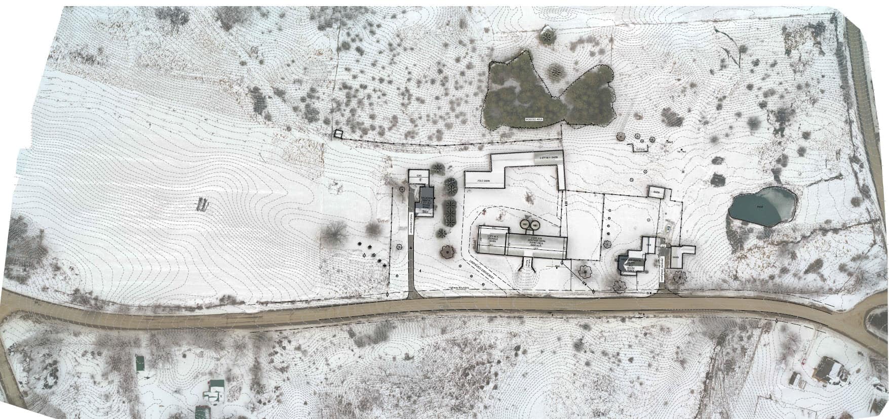
Here is a 30 acre topo from a 20 minute flight using a double grid method and 75å¡ camera angle. Had about 32 RTK shots for control, check points and small features. One site a total of 2.5 hours, with an OPUS solution for Grid Coordinates. Contours are 100% from aerial. Hard to tell but there was only about 1" or 2" of snow on the ground.
That is a nice looking image. I guess my somewhat vague questions is How Good is It? Is this a design level deliverable? Are you confident in giving this to client/engineer/owner as the basis for design development? Or are you somehow couching the deliverable as being less accurate? What sort of errors did you have on this particular project (GCPs and CPs) and what are the limits that differentiate "Design Grade" vs. "GIS Grade"? I know that is what I struggle to wrap my head around. Obviously we can't topo the whole thing as a check so we must rely on our GCPs and check points. And maybe some of that comes with sheer experience of doing it and comparing, repeat.
Are the checkboard or iron cross patterns advantageous to the software? Is that point of intersection of the contrasting black & white what the software is looking for? Or does that even matter? I'm wondering if I can use my stockpile of aerial target plastic to place a black (or white, depending on what side I use) chevron on the ground with the GCP at the point.
In Photoscan you manually fine tune the positioning on each image of the target, the same I think in Pix4D. Once you have shown the software what each target is it finds them on all images and presents you with a list so you can tweak the points. You can use anything for a target, as long as you can identify it easily. I wouldn't recommend service covers since they often seem to blend into the tarmac and are difficult to positively pick on a corner.
If you are walking between the GCPs when you coordinate them with the GPS keep picking check points as you go - it takes hardly any extra time. Points in areas of longer vegetation also help in providing a correction factor to apply. (Yes, I know that isn't very accurate, but then neither is taking points at random spacing wherever you can get into the brushwood.)


