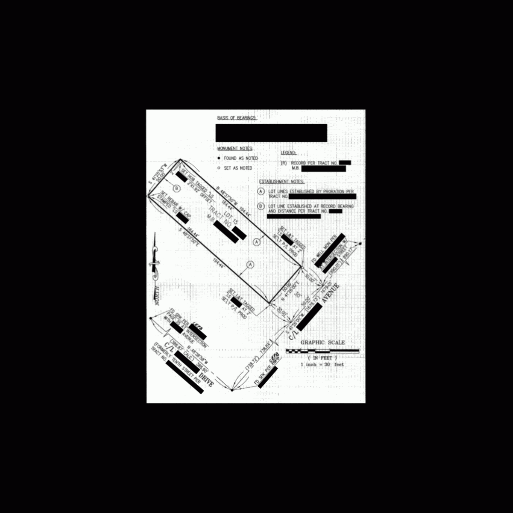
Below are two pictures. The first one is a corner record that was filed in 2010. I have done a lot of editing so as not to embarass the surveyor who did the survey.
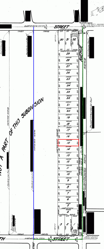
The second picture (edited for location) is the parent tract for the lot the survey was done for. The coloring in the second picture is as such..
Red Box = The surveyed lot.
Green line = The lines surveyed on the corner record, excluding the lot.
Blue Line = The centerline of a street that went in after the parent tract.
Sorry about the image quality.
I went and researched for ties where the blue line terminates on the north. None have ever been done for that intersection. There are ties to streets to the west, about 400 feet west.
This is not a trick question, so what's wrong with that survey?
Corner Record (Edited)

Parent Tract
The images are small, my apologies.
IMO
First, search for the 2" IPs along the common line of lots 17/18. If they exist, you can't prorate beyond original found monuments. Confine the survey to the southerly side of the tract.
The 2"IP monument at the SW'ly corner should be dug for to use as the basis to prorate in the back lot corners. If searched for and not found, state so on the map. If there is original tract construction era occupation that fits where those 2" IPs should be, possibly use that to re-establish the 17/18 common line/corners and go from there.
Popping in the back line and corners by record B/D may create a gap or overlap in the future if other more expansive block surveys reveal an excess or shortage and prorate in the back corners in the abutting tract
Bottom line, probably need to do a block survey, evaluate JR/SR rights between tracts, maybe end up with a ROS.
Thanks Paul, now my eyes are killing me... 😉
It aint quite a perfect parallelogram by 7"?
It's difficult to see on my screen but if I'm not mistake the subdivision plat shows the north line of tract 15 as 164.44 but the first image (tract 15 only) is showing 194.44.
Nevermind, I see the outer dims are to the CL of the street.
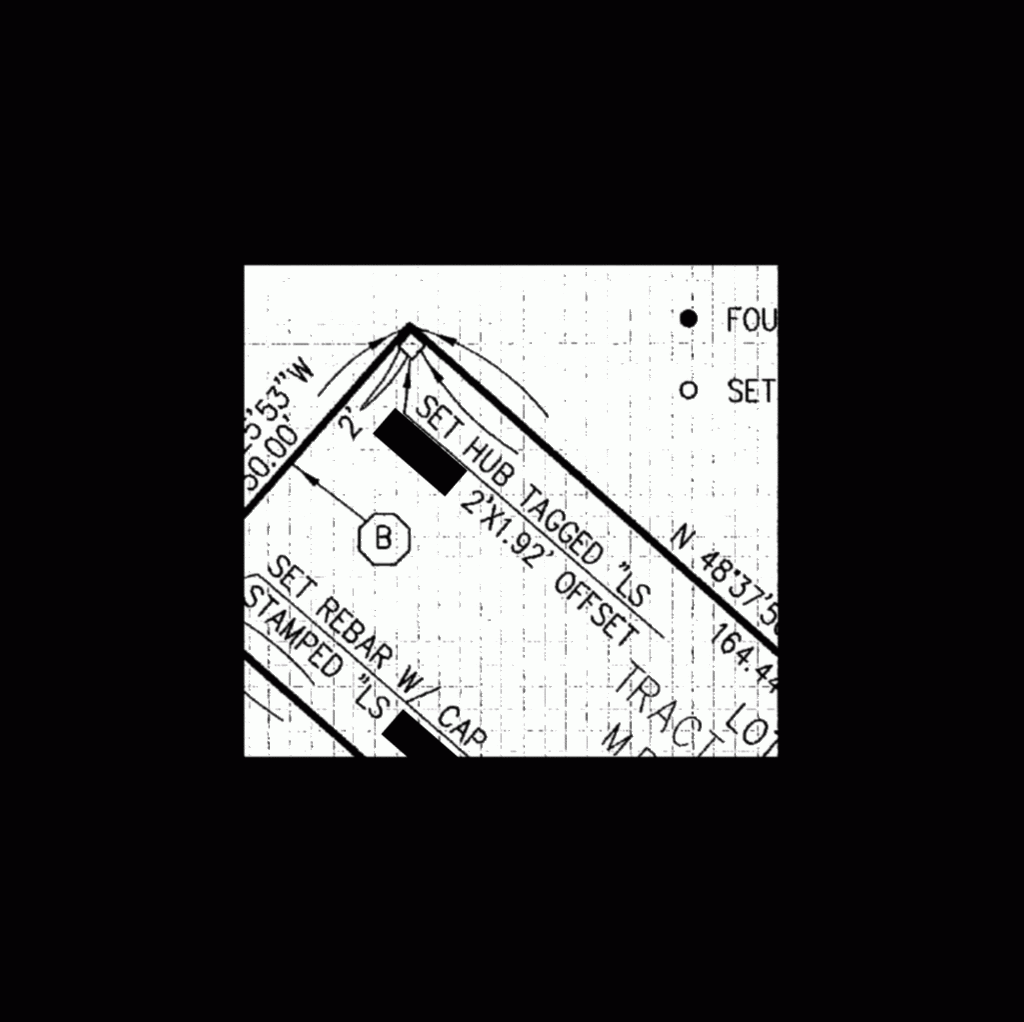
Why would you offset a hub 2' some direction and 1.92 feet another? If you did, how is the user supposed to know which is 2' and which is 1.92' ? Is a so-called hub permitted in California? It makes me wonder why there was a need for a double offset in the first place.
Also, there appears to be prorated error indicated along the street centerline which is just big enough to cause the 50.00 to round up to 50.01.
BigE,
Yeah the image is kind of hard to read, but it looks like the 194 dimension is to the c/l, look closely at the interior of lot 15 in the first pic.
Have a great week!
The centerline distance southerly from his tract should be 738.74, not 738.72....I think. And, the back line should have been prorated between two constraints, but, he only has the southerly constraint shown....and it is different from record.
What in tarnation ....
is a corner record? (I hear you guys always talking about them.)
Sounds like just another hoop you have to jump though.
No indication of any occupation.
No local monuments
this looks like yet another "paint by the numbers" survey.
What in tarnation ....
A "corner record" is a simple sketch showing reestablished lines on and existing recorded map and no ambiguity is found. A very nice tool, they should be used more often.
The County Surveyor is to simply file and index... self appointed survey cops in some areas really muck up the works at times, but thankfully those dweebs are not all that common.
> First, search for the 2" IPs along the common line of lots 17/18.
Gone. Driveways/walls etc took it out.
> The 2"IP monument at the SW'ly corner should be dug for
Also gone, same situation.
> Bottom line, probably need to do a block survey,
In process. 10 1/2 hrs so far, I see another 10.
>.. evaluate JR/SR rights between tracts, maybe end up with a ROS.
Tract is senior. RS will be done.
My views on the tract..
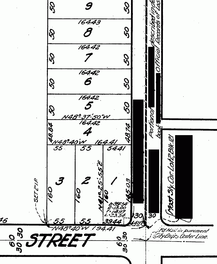
The Tract has an intent like a deed. The north line of Lots 1, 2 and 3 are held parallel with the southern street. The sidelines of Lots 5 through 29 are parallel with the northern street. Lot 4 takes any excess/defiency.
My views on the Corner Record..
It's IMPOSSIBLE to prorate without tying down and measuring the northern street.
> Thanks Paul, now my eyes are killing me... 😉
You are welcome. It's a good thing I do not survey just for the money 🙂
Yesterday we searched the northern street. The city has no ties at where the blue line intersects the northern street, which is a street that came in a few years after the parent tract recorded. Dug two holes 12" x 12" x 4" until we hit the concrete paving. Found four private monuments along that north sideline. They match a meaned line between them by 0.03' in a distance of 366 feet. We also found the NW tract pipe, 2 feet down. That matches the CL monument by 0.03' at a 90° offset.
Here is a problem...
Using the meaned line that the 4 private monuments create and extending NW from the CL monument which is the one shown at the top right corner on the CR and also matches the found 2" pipe, it misses the next set of C/L ties by 8". This set is 800 ft NW of the set the pipe agrees with..
Rats nest..I see at least 10 more hours in this..
Gotta run. Have to meet an architect in West LA. I hate LA traffic and I think that West LA tops out as the worst.
I have not read any of the thread, so my apologies to beerleggers who have replied..
Later
>.. but, he only has the southerly constraint shown....
BINGO!
Whats wrong with this survey? Cow
Here is a blowup of that offset. I guess the 1.92' is just arrived at because the 2 foot is dimensioned..

It was probably set that way because the actual corner was in a congested fence area..dunno, this corner does not concern me.
> No indication of any occupation.
> No local monuments
>
>
> this looks like yet another "paint by the numbers" survey.
Right in all aspects.
I was hired to retrace the line between 14/15. We still have to get some more pipes up (hopefully) and maybe some old centerline. The centerline is the worse part. Narrow and busy street in Glendale. All this is being done on the northern street.
Here is a blow up of the Lot 4 area.


