In a thread a while back I learned that my education on State Plane Coordinates was incomplete in that older books didn't discuss the small arc-to-chord azimuth correction. Wolf and Ghilani discuss it but don't clearly lay out the formula for it in Lambert projections. They give a rule of thumb that it is negligible for up to 8 km lengths, but don't seem to state what accuracy that yields.
I made an estimate for my hobby project, which is a network across the north end of our small city. I have taken angle measurements from several points on the ground, a few of which I had coordinates for, and sighting the lights on antenna towers, spires, etc. I do the least squares fit using SPC Iowa North (1401), a Lambert zone, and am near the southern edge and considerably east of center of the zone near N42 00 W91 40. I made the comparison by assuming fixed positions in SPC, converting to Lat-Lon by CorpsCon, calculating azimuths by NGS Inverse, and comparing the resulting angles to the SPC angles.
With 5 km/3 mile legs or less, I calculate differences up to one second of arc. But I'm not completely confident in that number. It is significant when I have many observations in a redundant network -- LS tells me I know some of the angles to less than 2 seconds rms after processing.
Does anybody here ever consider the arc-to-chord correction? Possibly not since GPS became a standard tool and mostly replaced long-leg triangulation. Does my result sound reasonable?
I did in the days before GPS, but who actually has a sight that long anymore? Well, I take that back...I have used towers, spires, tanks, etc very far off for intersection stations and to provide an easy backsight for future users.
But, since I do my adjustment in a program that does it all in ECEF XYZ, it becomes unnecessary to compute it for the adjustment.
If you can find one, there were booklets published for each state plane. The ones I had were for four states and they were NAD27. Each would describe how to calculate in the state plane system, we mostly used them for determining scale factors.
If you can find one they are quite useful, I looked for ours knowing that one was missing and now I can't find any of them, maybe they got purged, quit using them in the early 80's when programs became available to do all that stuff.
The old booklets for computing the relationship for Lat/Long to/from SPC for NAD 27 were commonly called Blue Books before NGS used the same name to describe the process of submitting data for publication. All of them have been scanned and are on the NOAA library web site. That being said they are hard to track down unless you know the secret hand-shake. Years ago I created my own search file for all of the old USC&GS Special Publications. Let me know which, if any, states you might be interested in and I'll post the url's here.
Bill93, post: 365043, member: 87 wrote: In a thread a while back I learned that my education on State Plane Coordinates was incomplete in that older books didn't discuss the small arc-to-chord azimuth correction. Wolf and Ghilani discuss it but don't clearly lay out the formula for it in Lambert projections. They give a rule of thumb that it is negligible for up to 8 km lengths, but don't seem to state what accuracy that yields.
Check the NGS State Plane Coordinate System manual by James Stem. Printed manual page 37 has details. Manual is available as PDF on NGS site here:
http://www.ngs.noaa.gov/PUBS_LIB/ManualNOSNGS5.pdf
Remember that corrections are cumulative.
HTH,
Bill93
Sorry I did not see your post sooner. I have NO idea what the poster who calls himself base9geodesy is talking about. It looks like his memory
is fading.
If you will look at Surveying and Mapping, June 1986, Vol. 46, No.2, pp. 163-167 you will find a very nice article By Mr. T. Vincenty
"Lambert Conformal Conic Projection: Arc-to-chord Correction". A very nice article that should help you fill in the void in your knowledge.
(base9; remember Mr. Vincenty?)
JOHN NOLTON
Thaddeus Vincenty was certainly a noteworthy geodesist. His solutions to the inverse and forward problems are still relevant today. Wikipedia has a nice article on him.
Unfortunately, the article to which you refer does not seem to be available on line. Do you know otherwise? Using Google Scholar yields links to articles citing it but not the paper.
Given the shift from conventional optical to GNSS technology the level of interest in these small corrections has diminished. When I started dealing with highway departments and private surveyors I was surprised at their perception that SPCS were new and high technology. At the time, I had not used them in a decade or more.
The SPCS manual in my earlier post is, in my opinion, the best source of information on the SPCS in the US. Dr Ghilani has written on many issues with using the system. Now that he has retired I do not where his articles are to be found.
As for base9geodesy's post, I believe he was addressing an earlier post inquiring about specific NGS documents which address NAD 27 SPCS on a state-by-state basis. I recollect them and vaguely recollect disposing of them, along with other
out-dated materials upon my retirement.
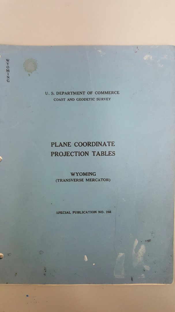
This is the blue book referenced above, just noticed it wedged between two other publications
It's a publication that is 20 pages and has the information needed to calculate state plane coordinates and between geographic and the state plane system.
Before computer programs were available for the HP calculators (maybe 1980-81) this is what most used to work in the state plane system, scale factors, formulas, constants are all in here.
Special Publication No.258:


