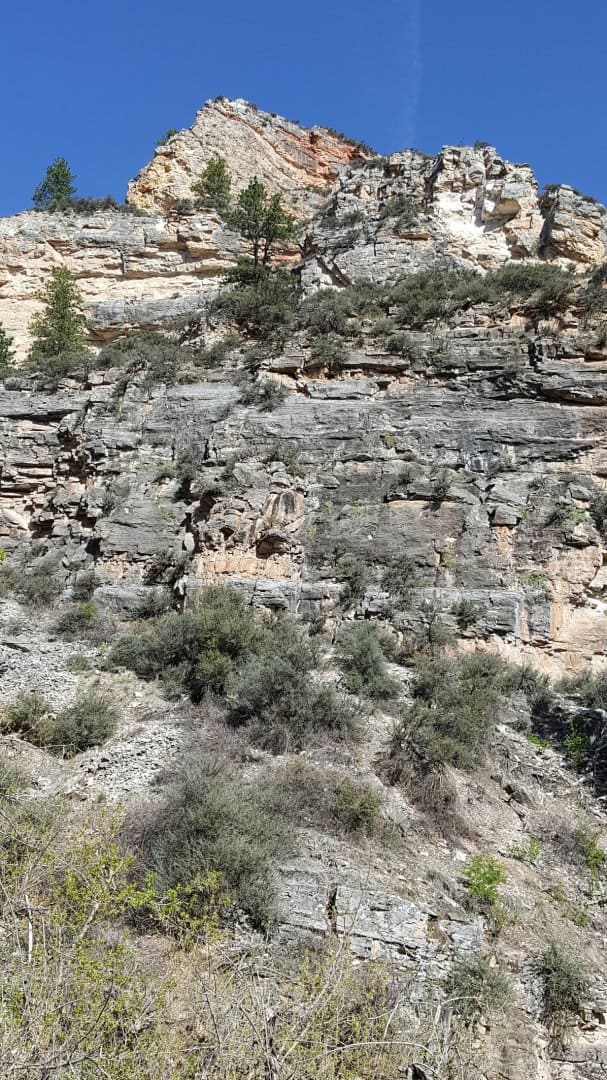
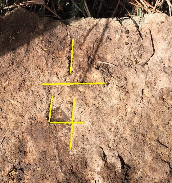
Another surveyor and I went out to look for the 1/4 that I really wanted to find, and what do you know it was there, steep slope, rock falls, dang thing survived.
One BT left, the other one has vanished:
Then from the 1/4 it's north along the centerline to the top of the rims for the next property corner:
I thought this was going to be a post about new wheels for your survey rig or something.........
Ya, I can kind of see that too.
A little water and a stiff brush and it would probably stand out well.
When I was young...probably a sophomore in high school, I was sent out to locate a "set marked stone".
It was a nicely chiseled sand stone monument, surrounded by hundreds of similar type rocks. I set the tripod up over it and waited about 5 minutes for the instrument man to signal me that he had gotten the measurements...then proceeded to cover it in paint so it could be found easily later (didn't see a problem with that given the effort it took to find it).....I forget who it was, but somebody gave me a good talking to about how I shouldn't have defaced the monument. I then felt bad about it and kind of still do, even though it has surely weathered off by now.
Loyal, post: 370488, member: 228 wrote: I dunno, it looks like "closed 4" to me.
This one is open Loyal, there is a fracture that kinda makes it look closed
MightyMoe, post: 370499, member: 700 wrote: This one is open Loyal, there is a fracture that kinda makes it look closed
I'm going to blame my [new] cataracts and go take a nap o.O
Loyal, post: 370501, member: 228 wrote: I'm going to blame my [new] cataracts and go take a nap o.O
Just like always,,,,,,,much easier to see in the field with natural sunlight,,,,,,,,B-)
imaudigger, post: 370497, member: 7286 wrote: Ya, I can kind of see that too.
A little water and a stiff brush and it would probably stand out well.
When I was young...probably a sophomore in high school, I was sent out to locate a "set marked stone".
It was a nicely chiseled sand stone monument, surrounded by hundreds of similar type rocks. I set the tripod up over it and waited about 5 minutes for the instrument man to signal me that he had gotten the measurements...then proceeded to cover it in paint so it could be found easily later (didn't see a problem with that given the effort it took to find it).....I forget who it was, but somebody gave me a good talking to about how I shouldn't have defaced the monument. I then felt bad about it and kind of still do, even though it has surely weathered off by now.
I'm one of the leave it as natural as possible guys. Some will chalk them, but i want to see tbe marks without enhancements. I do carry a brush, but too stiff a brush can brush markings right off and that stone is a good example of a soft one, it needs a gentle hand. That one i hand swiped to clean, that was all it needed. I have to say it was exciting, the hike to the section corner would have been daunting more importantly time consuming...
I might not be tracking this one, correctly. But, wasn't the deed call you started with "to the rim"? And, now you've got a quarter corner anchoring that line? Pretty cool.
back-chain, post: 370552, member: 7900 wrote: I might not be tracking this one, correctly. But, wasn't the deed call you started with "to the rim"? And, now you've got a quarter corner anchoring that line? Pretty cool.
Yes, you are right on, the deed is basically the W2 of a section and the E2 lying between two rimrocks and a river. In this case the S and N1/4's are property corners, then where the two rims cross line between them on the N-S section centerline the deed for the rims begin in the E2. It's a small section (300ac) and the parcel is 200 of that
10 4. I'm mostly doing urban, suburban stuff in the 'colonial' east. Enjoying this one as it moves ahead. Everybody have a good one.


