Jim in AZ, post: 431281, member: 249 wrote: Wind speed and direction? Instantaneous or averaged over some time period? On the ground or on the wire?
It was about 10 years ago so the details are a little hazy. They engineers asking for the data weren't too fussy on this detail. We carried a small hand held anemometer and recorded the basic wind direction and speed at the time of each shot.
Licensed Land Surveyor
Finger Lakes Region, Upstate New York
I. Ben Havin, post: 431166, member: 6834 wrote: Got a power transmission line project coming up where intersecting cross power lines will need to be measured up for height of wire. Looking for ideas on quick ways to obtain power transmission wire heights.
Thanks for any ideas.
Here are some note diagrams of the USBR method we used back in the "olden days". That was the way we were to do the how highs on transmission line surveys.
I was performing a power line survey on a power line that went through trees, so my control point was directly underneath. I had to use my rod man to hit he measure button on the data collector as I manipulated the TS to stay on point, as it was blowing like crazy that day. I took multiple shots on each point and averaged. The only funny thing was the pole wasn't plumb, so when I processed in CAD it was to the side of the lines.
A few years back I got involved in testing different rangefinders for the local electricity company. They wanted something that their linesmen could use singlehanded and quickly in all weathers to get instant heights to power lines. After spending some thousands of pounds on different models for testing they bought twenty of these:
http://www.yorksurvey.co.uk/measuring/laser-rangefinders/1698/trupulse-200-laser-rangefinder.html
My company uses DR with the total station. Transmission lines are usually pretty easy to get a good shot on. Our engineers request us to shoot attachment points, mid span and quarter spans. Time of day, date, temp, sky conditions, wind speed and direction on the set of sag shots.
When I get tired of surveying.... [MEDIA=youtube]q5swBWudDUk[/MEDIA]
Nate The Surveyor, post: 431418, member: 291 wrote: When I get tired of surveying.... [MEDIA=youtube]q5swBWudDUk[/MEDIA]
His brass ones must be detachable else the chopper would never be able to lift off.
Nate The Surveyor, post: 431418, member: 291 wrote: When I get tired of surveying.... [MEDIA=youtube]q5swBWudDUk[/MEDIA]
My cousin used to do copter work on transmission lines. He has sent me some impressive videos.
As for the markers, the company I work for generates and transmits power over about 1800 miles of transmission lines. One of the newly built ones was parallel to a bird sanctuary for the Mississippi Sandhill Crane, so we had to install "bird deflectors" along the conductors so the birds wouldn't fly into the wire....
I've had to do a sag over a body of water on which neither getting under it to do a vertical offset or shooting it DR (with our gun, anyhow) was an option. We located the endpoints at the insulators, then turned angles to two apparent sag points. As Paden said, there's a length of sag where the height is pretty constant. I calculated the sag points we observed using good old trigonometry and kept the low one. This was for clearance, they were looking for feet not hundredths.
Interesting read. I wouldn't send anyone out there if they had a pacemaker.
[USER=8817]@Daniel Ralph[/USER]
How can one not wonder what damage is being done when there are many transmissions lines that will light up florescent tubes by just being in the proximity of them without connecting the ends.
and
That report that stated that hog production increased after the high voltage transmission line was installed always brings humor.
Chickens will produce more eggs and gain weight quicker when in daylight and/or artificial light for longer periods of time every day. And, that's a fact.
Artie Kay, post: 431382, member: 3428 wrote: A few years back I got involved in testing different rangefinders for the local electricity company. They wanted something that their linesmen could use singlehanded and quickly in all weathers to get instant heights to power lines. After spending some thousands of pounds on different models for testing they bought twenty of these:
http://www.yorksurvey.co.uk/measuring/laser-rangefinders/1698/trupulse-200-laser-rangefinder.html
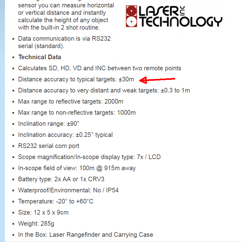
Curious as to what a $900USD rangefinder can do, I found an egregious error in their website literature. Their user manual states it's 30cm, not 30m.
Call me old-fashioned but what about a tape and a clinometer set on a 45 degree angle if the ground is fairly flat? It's not going to be super exact but it's simple and easy and you don't have to follow a swinging power line. Don't forget to add your height to the measured height. Use your RTK or a total station measurement to get a position under the line and record the height in the description or an attribute. You can even adjust your rod height (negative) to make the shot the line elevation. As others have pointed out, record the ambient temp, date, and time. The length and subsequent height of the line vary with temperature.
I wrote up a little story about an incident that happened on one of the transmission line surveys that I was working on in my younger days and thought I would post it in this thread.


