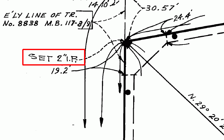
Thats what was written on a lath next to the Tract Corner shown below...
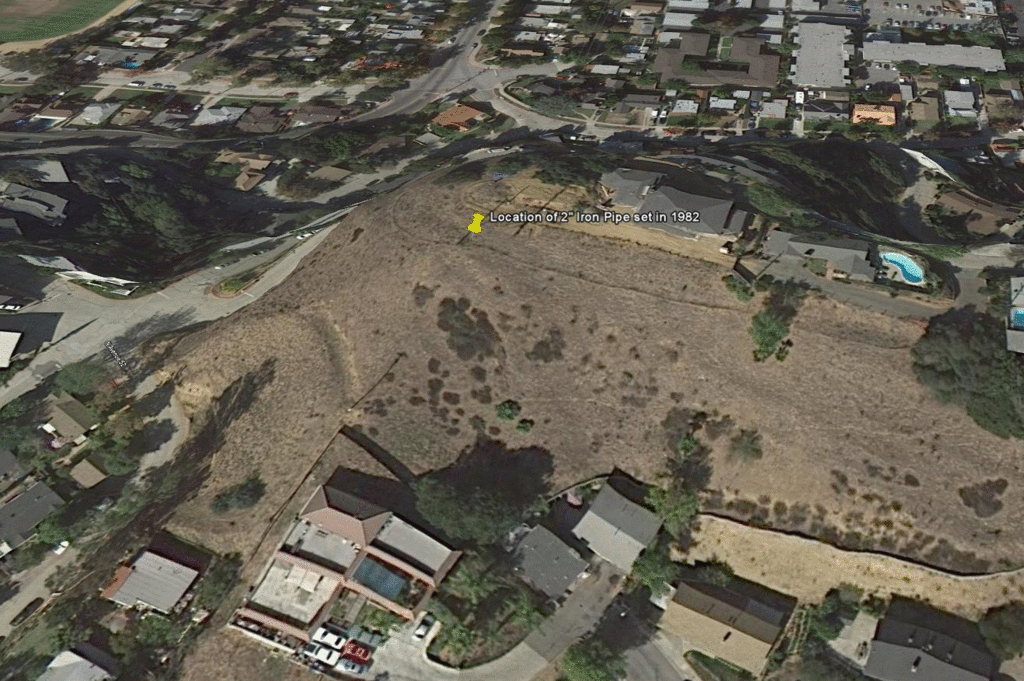
Heres a Google View. When I saw how open and undeveloped this area was I was sure the 2" pipe would be there.
I never did find the "True Corner" so I told the client that the 2" IP was her corner but if she ever does find the "True Corner" to please let me know immediately. She promised that she would.
Paul,
It's always funny that those guys usually do find at least one "true corner". It's usually the one they start calculating from. Strange coincidence.
I never find the true corners either... I seem to always find those pesky witness monuments. I wonder why those original surveyors never set monuments on the true corner? They knew. Those bastards;-)
damn continental drift again. 😉
> Thats what was written on a lath next to the Tract Corner shown below...
Judging by the aerial photo, it looks as if that's a hillside. Is there any reason to think that the sloping areas have shifted since 1982?
whats that "field notes" nah i don't believe it, no one does field notes anymore do they ?? i'm shocked---most surveyors don't even own pencils anymore---tdd
Kent
> Judging by the aerial photo, it looks as if that's a hillside. Is there any reason to think that the sloping areas have shifted since 1982?
The pipe is located on the high ridge line Kent not on a side slope where movement is more likely to happen. It was solid and vertical and also a bit below the natural grade. Back in the day the pipes were usually set 6" below the surface.
My measurements from the original control in the lower street, which is partially shown in the lower right in the photo finds the pipe 0.15 N x 0.16 E of a record position. The author of the lath most likely came from other control, possibly from the street shown on the left. I am pretty sure thats what took place since access to the pipe from my street control would have been blocked by locked gates and dogs.
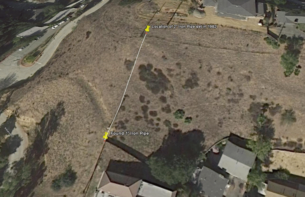
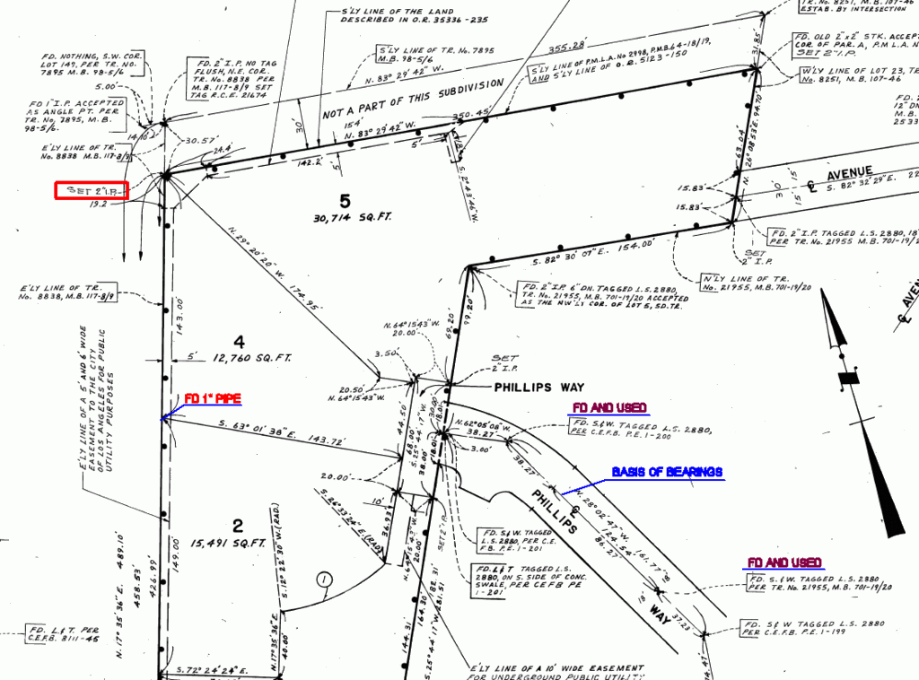
There is a wood fence to the southwest of the 2" pipe, north being up photo, and we found a 1" pipe at that corner. The inverse value from that 1" pipe to the 2" pipe is N 17° 36' 21" E, 143.21' compared to record of N 17° 35' 36" E, 143.00'.
"True Corner" - WTF?
?Really - True Corner??
I guess the good thing is - is that he didn't set a new monument to locate the TRUE CORNER
I guess surveyors are forgetting the theory of honoring existing monuments and the basic premise of what a monument is and what monuments represent
- MY OPINION IS THAT THE GUYS THAT DO THIS TYPE OF THING ARE JACKWAGONS - THEY THINK THEY ARE BETTER SURVEYORS THAN THE ONES BEFORE THEM, ALL THEY ARE DOING IS CREATING PROBLEMS FOR THE CLIENT, THE ADJOINER AND THE PROFESSION.
-------------------------------
Not to hiJack this thread -but- Here is one I was working on last week
Same sort of situation.
-

-
-
FYI - The surveyor that prepared this plat had his license take by the BOR several years ago, but the problems he created will longer on for years and years to come.
-
6th PM
> - MY OPINION IS THAT THE GUYS THAT DO THIS TYPE OF THING ARE JACKWAGONS - THEY THINK THEY ARE BETTER SURVEYORS THAN THE ONES BEFORE THEM, ALL THEY ARE DOING IS CREATING PROBLEMS FOR THE CLIENT, THE ADJOINER AND THE PROFESSION.
I think that a lot of surveyors have a fear of showing values that are not "true record" so they play it safe and call out monuments 0.0x' x 0.0y' from the record position.
If they could only get in in thier brain that "true record" and 'true corners' are fantasies. They have never existed and never will exist.
Kent
I saw one a while back where the survey showed about 20 corners, and all but two of the corners were noted as 0.14N, 0,08'W, or some such thing. This included 4 certified section and 1/4 corners being call "off" by some small amount.
surveyors that do that create more headaches for eveyone
i beg to differ if i didn't i wouldn't be TDD--
THERE IS NO SUCH THING AS A "TRUE CORNER" !!! A CORNER IS A CORNER WHATS THERE IS SOMEONES INTERPRETATION MARKING A LOCATION--
SEEING SOME MEASURERS ARE MORE EXPERT THAN OTHERS CRACKS ME UP, THATS LIKE SAYING MY CLOSURE WAS 1:125,000 AND YOURS WAS ONLY 1:22,000 SO MY SURVEY IS BETTER AND MORE RELIABLE THAN YOURS--HOGWASH !
IF A PIN OR ANY OTHER MONUMENT IS +/- .25 OF A CALCULATED POSITION ITS BEST TO ACCEPT THE MONUMENT PERIOD--THOSE THAT DON'T DO NOT UNDERSTAND SURVEYING !!!!
THE REALITY IS WHEN YOU OR ANYONE ELSE DOES A RESURVEY THEY COME IN RETRAVERSE, AND RERACK THE POOL BALLS AGAIN, THINGS WILL MOVE SLIGHTLY AGAIN MATHEMATICALLY--THAT DOES NOT MATTER IF A PIN IS THERE, "DO YOU ACCEPT OR REJECT THE PIN" ??? THATS THE TRUE QUESTION.. DON'T CLOUD THE ISSUE WITH LEADERS AND ARROWS AND MEASUREMENTS TO THE 0.02 FT--THATS NOTHING BUT SURVEYORS BULLCRAP !!!! TDD
Kent
> The pipe is located on the high ridge line Kent not on a side slope where movement is more likely to happen. It was solid and vertical and also a bit below the natural grade. Back in the day the pipes were usually set 6" below the surface.
>
> My measurements from the original control in the lower street, which is partially shown in the lower right in the photo finds the pipe 0.15 N x 0.16 E of a record position. The author of the lath most likely came from other control, possibly from the street shown on the left. I am pretty sure thats what took place since access to the pipe from my street control would have been blocked by locked gates and dogs.
Well, I may have missed it in the original post, but is the situation that the subdivision was laid out on paper originally, in relation to only a few original monuments? Is the status of the 2" pipe set in 1982 that it was an attempt to locate one of those lot corners that hadn't originally been monumented?
Just out of curiosity, are any of the monuments being used to survey lots in the subdivision today shown on the original subdivision plat?
Kent
> ....Is the status of the 2" pipe set in 1982 that it was an attempt to locate one of those lot corners that hadn't originally been monumented?
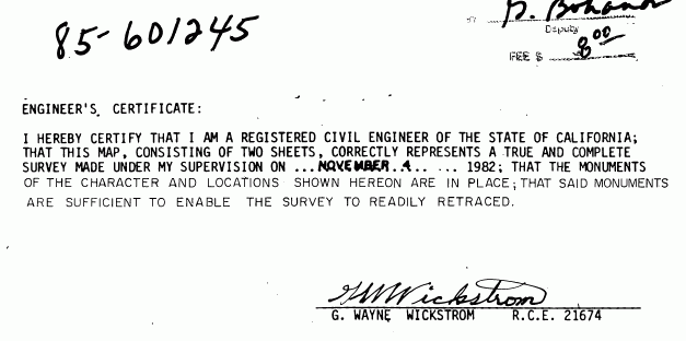
The 2" pipe is the subdivision corner that was set in 1982. The subdivision recorded in 1985. Bit of a lag between monument setting and recording but this is Los Angeles.
> Just out of curiosity, are any of the monuments being used to survey lots in the subdivision today shown on the original subdivision plat?
Yes. Here is a picture that explains it better than I probably could.
We did 14 hrs yesterday (3 jobs) and left that ridge line in the dark. Around 1 PM the heat was so bad that all three of us were wilting, so I decided to leave that area, I was doing two seperate jobs on Phillips Way, and take a break until it cooled down. We went back to the house where the guys relaxed under some AC for about 45 mins and then went to the third site. We got back to the ridge around 6 PM and finished that area up.
I think the 1982 civil that did this subdivision did a very good job in finding previous monuments to establish his subdivision boundary correctly. If you notice, not one of the monuments he found was called off by 0.0x' x 0.0y', he accepted them in position and went on from there.
Teddy Bear
> i beg to differ if i didn't i wouldn't be TDD--
I am at a loss here. What are you differing on?
Kent
> > Just out of curiosity, are any of the monuments being used to survey lots in the subdivision today shown on the original subdivision plat?
>
> Yes. Here is a picture that explains it better than I probably could.
So, the situation is that the 2 in. pipe was supposedly on the line of the tract being subdivided and the resurveyor found that it wasn't actually on the true boundary of the parent tract? If so, that makes a good bit more sense if the 30 ft. strip shown on the subdivision plat had already left the subdivider.
I'll generally accept an undisturbed original monument as marking the corner -- or at least the line -- of a survey of record (though see Steve Gardner's CLSA Thread for a probable exception), but when I come upon an untagged monument of unknown provenance, or a monument of known origin set during a retracement, I'll often call it out of position when it doesn't fit well with other evidence that I deem superior. That "other evidence" may include record dimensions.
> I'll generally accept an undisturbed original monument as marking the corner -- or at least the line -- of a survey of record (though see Steve Gardner's CLSA Thread for a probable exception), but when I come upon an untagged monument of unknown provenance, or a monument of known origin set during a retracement, I'll often call it out of position when it doesn't fit well with other evidence that I deem superior. That "other evidence" may include record dimensions.
In the case of the plat of which Paul posted a detail, it isn't clear how much of the surrounding land the subdivider owned at the time of platting, but it looks as if the 2 in. iron pipe that was set in 1982 wasn't an original monument defining the West line of the tract subdivided. Likewise, it isn't clear whether the 30 ft. wide strip of land along the North side of the subdivision had previously been conveyed or remained in the subdivider. From a Texas perspective, those would both seem relevant facts that would bear upon the question of whether the 2 in. pipe in question was other than possibly a witness to the common line of the lots created in 1982.
Kent
> So, the situation is...
Here we go. You're starting into making stuff up again. The situation IS as I posted.
>that the 2 in. pipe was supposedly on the line of the tract being subdivided and the resurveyor found that it wasn't actually on the true boundary of the parent tract?
No. Not supposedly..it marks the line at that corner and the civil also set a pipe at the the SE corner of the
30 foot strip. Care to tell me what resurveyor found an original tract monument 0.34' south? I sure would like to know the name of this genius, he never did file a record on his work.
I have no idea how you came up with all that crap..unless you are just trying to find fault..are you?
Kent..go find someone else to play games with..like, take your ball and go home.
>but it looks as if the 2 in. iron pipe that was set in 1982 wasn't an original monument defining the West line of the tract subdivided.
Stay in Texas because it's apparent you cannot follow California maps
PS Have a few more glasses of wine, then you will be fully charged to respond.
Kent
Hey, I'm just looking at the map you posted, Paul, which was this:

Now, I realize you're in California, but as I read that subdivision map, the subdivider was laying out Lot 5 along the existing S'ly line of an existing parcel and specifically annotated the 30 ft. wide strip as "NOT A PART OF THIS SUBDIVISION". That suggests that the 30 ft. strip had already been conveyed.
So, if that was in fact the case, the 2 in. iron pipe that the surveyor set to mark the common corner of Lots 4 and 5 couldn't be an original corner of the 30 ft. strip, unless the 1982 surveyor had a time machine. :> And if it is the case that the 2 in. iron pipe misses the S'ly line of whatever parcel the 30 ft. strip is out of, it looks as if the best that can be said for it is that it is a witness to the common line of 4 and 5.


