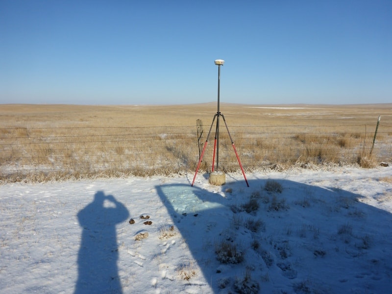
I try to avoid concrete posts except in the south, but sometimes there isn't much else around...
I occupied a benchmark last week that LOOKED suspicious. The original description said it projected 0.4 feet above the ground (1962). The elevation I get now shows it being +0.104 meters higher than published.
I should have measured how much it sticks up now, but I didn't have a tape measure with me. A couple of miles down the road there is an old triangulation station in a wide open pasture with two reference marks, all of which were leveled to. I get +0.052 m, +0.095 m, and +0.065 m difference on those. They also look like they popped up due to frost heave.
The project covered 3900 square miles. There is a CORS along the south edge, Just holding the CORS I get seven other benchmarks under 1 cm and 2 more under 3 cm. I should add that I kind of expected that, this area has a lot of missile sites, I imagine they took massive amounts of gravity data and astro data, all of which would help the geoid model (if the DOD shared that data with NGS).
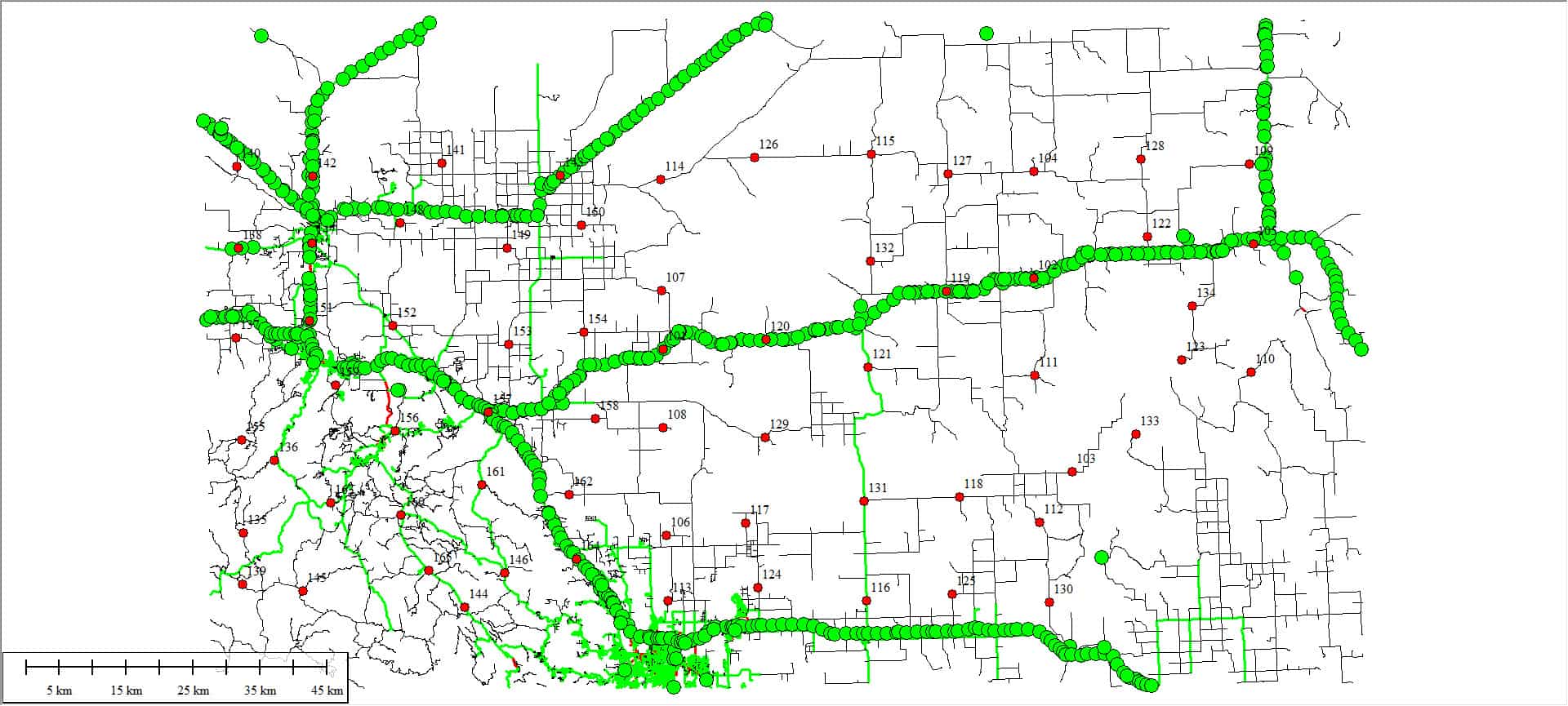
the image below shows the benchmarks reported as GPS occupiable...but almost all are concrete posts...the red dots are what we had to survey
[SARCASM]Do you want me to ship you a box tape? I have about 1/2 dozen rolling around in my truck.
[/SARCASM]
Seriously, this is a very informative post. Thank you.
I should also note that in that image the only paved roads in that entire area are shown as green, almost all of the roads are dirt. And the level lines by NGS sometimes went dross country, where there were no roads. The SW corner where there are no recovered BM's is forested mountains, the rest of it is grasslands. I looked for BM's in that SW area (there weren't many) but didn't find any usable.
I tied 5 different NGS benchmarks on a project I had last year. Only two checked under 0.2 feet. I did an OPUS one of them and checked in about .18 feet. One of the benchmarks was off nearly three feet. Comparing it with the other NGS benchmarks. Checked it with my OPUS elevation and verified it was off nearly three feet. Ever since I do an OPUS to get my elevations. You have a record of how you derived the elevation and it accuracy. I always though NGS was God in the survey world, but I'm not so sure now.
This relates to the Bench Mark Stability thread I started a few days ago. It would be interesting to know how deep that heaved post really was, as I know they weren't all to spec.
It seems to me that the current geoid model has been influenced by the number of concrete posts relied on which have drifted upward over the decades. Around here, at least, there are many posts used because the more stable marks are fewer, too near active railroads, or under trees at streams that required the bridge or culvert.
As for NGS (or back then C&GS) I think their measurement work was as near perfect as could be done at the time. But the monuments are not proof against all the actions of man and nature. The 2022 release should help a lot with future agreement of various measurements. Everyone should be contributing OPUS shares in areas that aren't well covered to help NGS check their work.
Self-education and years of experience has greatly changed the way I look at things. Many of us formulated an idea that the C&GS monuments were infallible and a great many still are, but once you really research everything involved you begin to understand how checks are so important, especially when it comes to vertical marks. Even some of the positions of precise triangulation stations can be up to a meter off due to using short baselines and older practices. I hesitate to call them "wrong" because they were "right" during the era when they were placed.
J. Penry, post: 456814, member: 321 wrote: some of the positions of precise triangulation stations can be up to a meter off
Locally, I've checked a tri-station, a RM for another tri-station, and an intersection station against OPUS points and find them all about a foot off of what you'd expect. That's quite good considering the nearest tri-station that is also a HARN so constrained in the adjustment is 30 or 40 miles away.

