Kent, I was wondering if you got paid by the page or the corners? Or Both?
I find that getting paid for the time and expenses necessary to do a professional job is usually best. :>
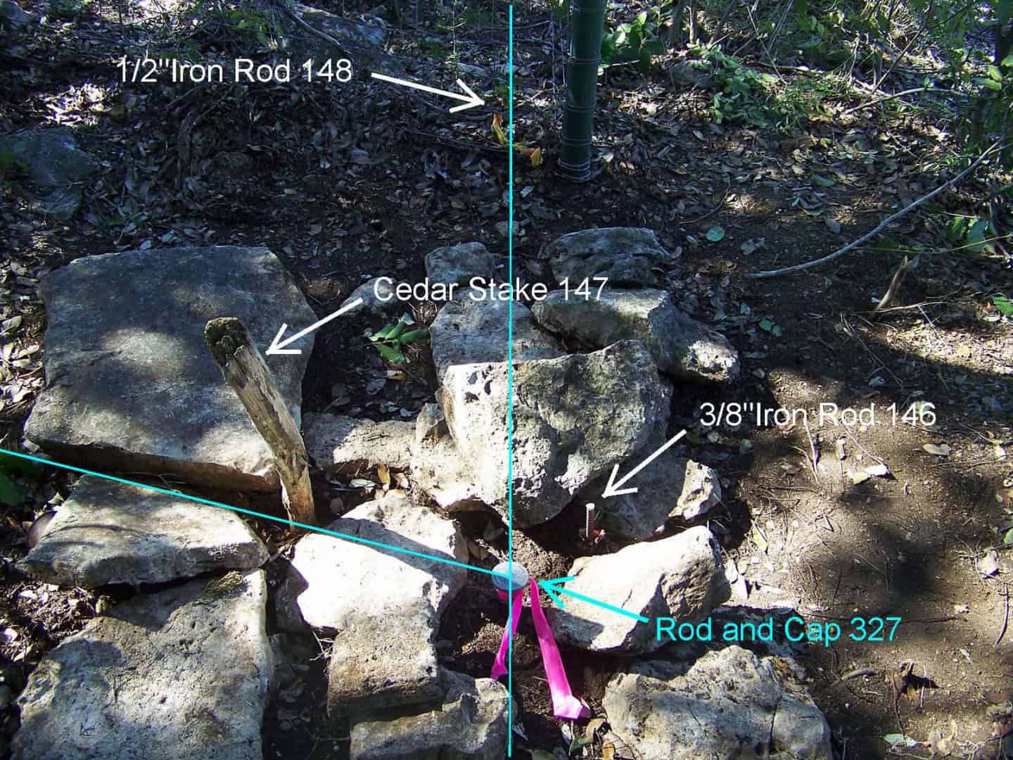
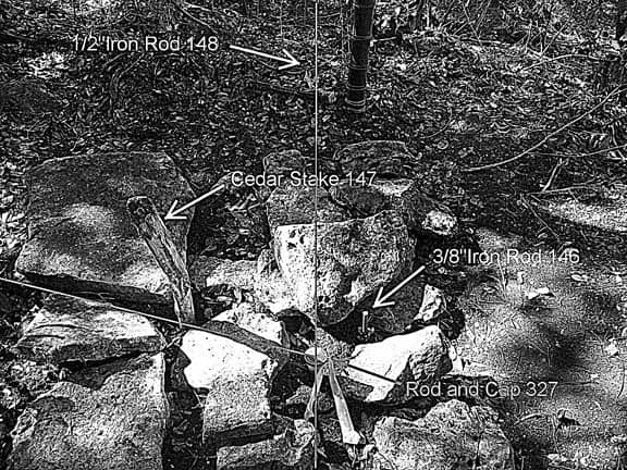
I know we all love photos. Here is what Rod and Cap No.327 looked like with the three other surveyor's marks found in place nearby, each supposedly marking the identical corner. Basically, Rod and Cap No.327 is set to mark the prolongation of a line extended through Cedar Stake No.147 to intersect the true South line of a strip of land conveyed for a highway. I don't think that the surveyor who set Iron Rod No.146 was aware of Cedar Stake No.147 or that the surveyor who set Iron Rod No.148 was aware of either. 
How the situation is documented in the written descritption for the benefit of future surveyors:
Kent McMillan, post: 340580, member: 3 wrote: How the situation is documented in the written descritption for the benefit of future surveyors:
yep, a picture is worth a thousand words. (annotated as you did in your description of course)
In West Virginia we have a 'report of survey' where you put all the additional information with regards to the history and such. It keeps the descriptions pretty simple but provides the additional information if needed to go into more detail about the property.
Good looking description Kent.
That's called "growin' the pin cushion ". What was wrong with simply using the cedar stake?
What was wrong with simply using the cedar stake?
I suppose that if I didn't have:
- a rock drill with the means to set a 5/8 in. x 16 in. rebar into the limestone that began under about 6 inches of topsoil,
- an identifiable aluminum cap to attach to the rebar,
- the desire to set a permanent, stable, and identifiable marker,
- the means to determine where the actual line of the highway was,
and if I didn't want to actually clear up the confusion that I found in place by marking the corner permanently and leaving a record that would give future surveyors a more complete explanation than they were likely to discover, I could have called for some mathematical "point" as the corner, referenced by various objects of lesser permanence and stability. That cedar stake is a very inferior monument in that it is 24 in. long and only set in about 6 inches of soil.
Nice picture, have you ever included them in your legal?
What if the description included an Exhibit drawing? The drawing is automatically copyrighted as a Graphic Work upon its creation - no getting around that- it's Federal law.
BTW - being public record has nothig to do with copyright...
Nice picture, have you ever included them in your legal?
No, the public records aren't set up to handle grey-scale images very well. I suppose it could be rendered in coarse half-tone, but it would take up more room than the more informative words would.
One funny thing about the rock mound that was built around the cedar stake is that one of the rocks has a well-rusted steel beer can under it.
And I'd be willing to bet that the beer can was from the 1949 surveyor who built the mound.
I have found many monuments adorned with beer cans and whiskey bottles, a few were so mentioned in property descriptions and especially in surveyor's field books.
It appears to be some form of a rite of receivership when a new owner is marking their territory.
arctan(x), post: 340384, member: 6795 wrote: Wow. I've actually never seen a description written that way. My descriptions seem pretty bare in comparison. I'm going to give this style a whirl on my next project. Thanks Kent 😀
Oh, as a footnote to this discussion, I'll reveal that I recently prepared a description of a tract of land that completely surrounded another tract. Ordinarily, I'd have written it in the form of two metes and bounds descriptions, one for the total surrounding tract and the other for the SAVE AND EXCEPT tract. However, somewhere in cyberspace I read that other surveyors from the Sovereign State of Elsewhere thought it was better practice, more easily understood by title insurance folks, to write it as one single perimeter traverse, with two of the courses being an identical connecting line between points on the outer and interior boundaries. It seemed plausible in the age of deed plotting software. So, in the interest of newer and better ways of doing things, that was how I wrote it up.
The call for the day was from a fairly good title examiner (and there are so few of them left) who wondered if I could rewrite the description as a two-parter, i.e. exterior with SAVE AND EXCEPT tract separately described. "I'd be glad to do that," I said. "I thought all you title folks just ran these descriptions through a deed plotter program and would prefer the all-in-one form, but I'm thrilled to learn otherwise. If I get that revised description to you tomorrow, will that be soon enough?"
Yes, I can easily believe that chiristening a corner with broken glass or pottery is a tradition that extends into the 19th century.
I've been including them on my corner records. They can be copied from the original at the courthouse so it makes a better doc than the scanned deed records that are available.
The urban Texas counties I'm familiar with have pretty much gone digital. If it can't be scanned, it won't be in the record for all practical purposes.
have they scanned all the records, do you even go to the vault?
MightyMoe, post: 340769, member: 700 wrote: have they scanned all the records, do you even go to the vault?
There is no vault in the County Clerk's office. The records are entirely digital. Even digital filing has become commonplace.
The problem was that the urban counties were just completely overwhelmed by the mountains of paper that normal land transactions were creating as the population grew.


