PS is the same as P except PS stands for "Public Safety" although the only difference is a "Public Safety" sticker on the side of the scanner; the P40 the mere mortal surveyors get doesn't have the sticker. We also have a NIST certified artifact pole with targets 1 meter apart that we are supposed to use in at least one scan to prove our point cloud is scaled correctly. We use control so that is usually self-evident from our redundancy and match between GNSS, S7, and scanner versions of the control.
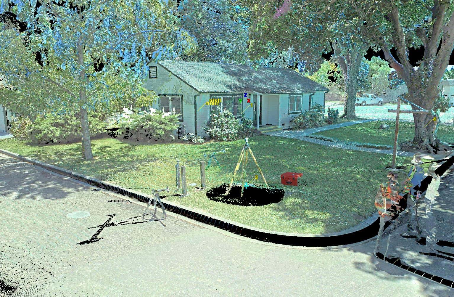
It is amazing. I went with the other crew to do a training scan of the Nursery office in Davis. We learned about things we didn't know yesterday, especially about the camera:
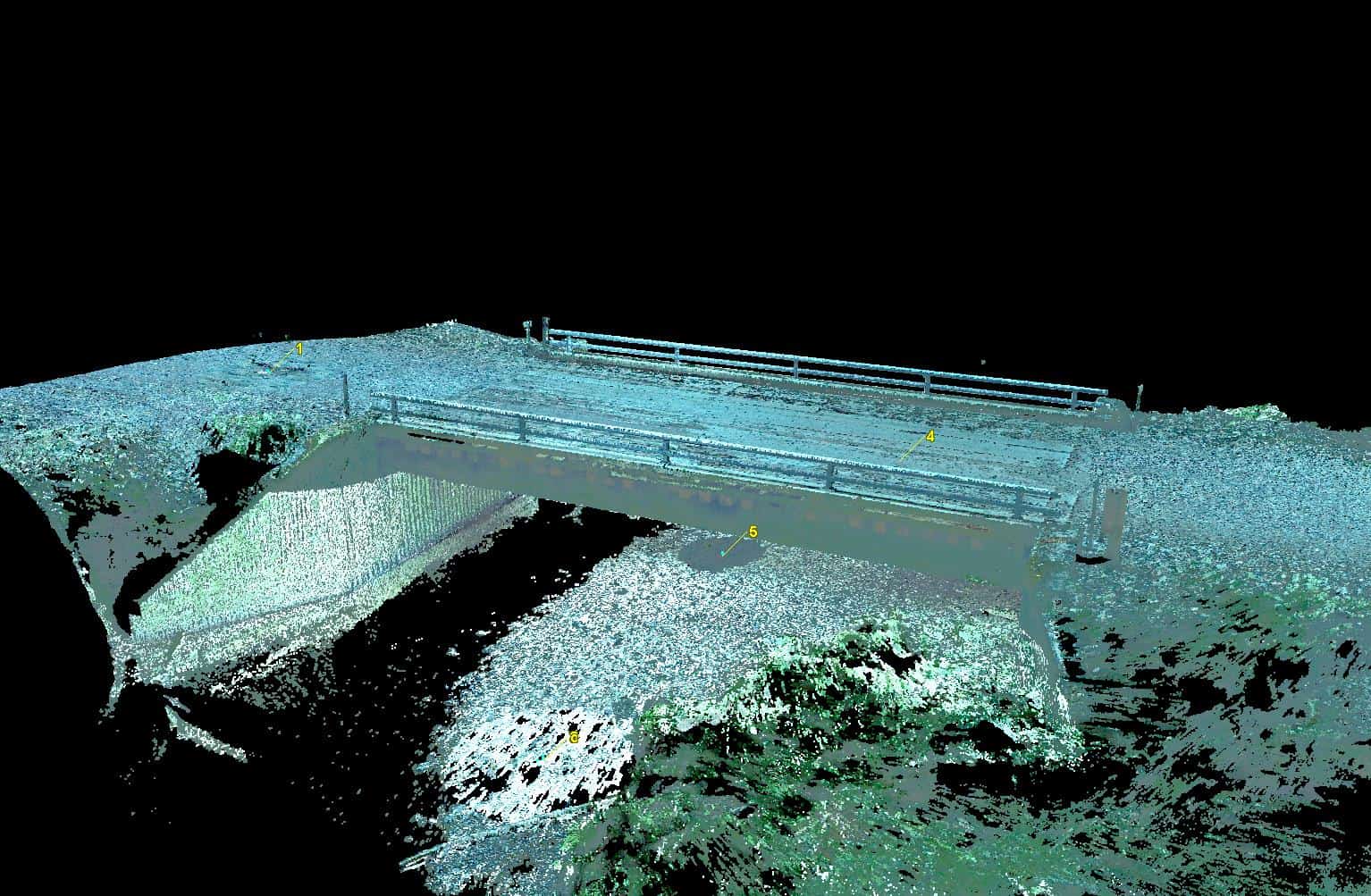
Last week Dan and I scanned two bridges. The color wasn't as good because we didn't exactly know how to operate the camera settings right:

This is a redwood bridge with concrete abutments. The timbers are really 2'x3' redwood logs with new joists and decking. I was under it when the big stake bed truck drove over it, I detected no movement, nothing, no vibration, that bridge is solid.
This is an older bridge, also redwood:
This new scanner makes the C10 seem obsolete. It scans ten times faster; you can see the wood grain on the bridge deck. The photos are the same or slower but they are high resolution and HD, meaning it takes three images and balances them. The office turned out better because we had a better idea what settings to use on the photos.
HI Dave
Collecting the scan data looks like the easy part, probably quite fun and straightforward, when compared to traditional survey topo.
How are you finding get actual cad files or usable vectors out of the scan data that you can use to design on in CAD / Revit or skecthup ?
I am interested in the scan time to office time ratio, say an hours worth of scan data collected in the field, is how many hours in the office to produce a cad file for use in Revit or Autocad, say of the office building in your scan picture.
I have heard figures of 1:5 and 1:10 being thrown about, but have yet to have any num,her ever confirmed from anyone actually doing a full scan to cad job, most of them seem to stop at the registered point cloud data and call it a day. Which to me just appears to be a 3D photo at that point.
I am keen to get into scanning but just can't seem to produce a viable business model to make it work for me, considering I run solo.
pdop 1.0, post: 379110, member: 459 wrote: HI Dave
Collecting the scan data looks like the easy part, probably quite fun and straightforward, when compared to traditional survey topo.
How are you finding get actual cad files or usable vectors out of the scan data that you can use to design on in CAD / Revit or skecthup ?
I am interested in the scan time to office time ratio, say an hours worth of scan data collected in the field, is how many hours in the office to produce a cad file for use in Revit or Autocad, say of the office building in your scan picture.
I have heard figures of 1:5 and 1:10 being thrown about, but have yet to have any num,her ever confirmed from anyone actually doing a full scan to cad job, most of them seem to stop at the registered point cloud data and call it a day. Which to me just appears to be a 3D photo at that point.
I am keen to get into scanning but just can't seem to produce a viable business model to make it work for me, considering I run solo.
I suppose it would depend on what the deliverable was. Personally I wouldn't use scan data for general topo as I think you can get it quicker by robot and I would find it hard to get detail like manholes etc. from scan data. If you were using it to create elevations of buildings it would be considerably faster than traditional methods. BIM is a whole other story. I could not put it into a ratio as each job would have different information to be extracted but I would say that overall scanning reduces field time but increases office time.
Totalsurv, post: 379111, member: 8202 wrote: I suppose it would depend on what the deliverable was. Personally I wouldn't use scan data for general topo as I think you can get it quicker by robot and I would find it hard to get detail like manholes etc. from scan data. If you were using it to create elevations of buildings it would be considerably faster than traditional methods. BIM is a whole other story. I could not put it into a ratio as each job would have different information to be extracted but I would say that overall scanning reduces field time but increases office time.
Hi Jon
Do you think there is a demand or market for supplying the point cloud data only ?
The end user can then extract the data relevant to their interest, be it structural engineers, architects , interior designers etc.
The back office in the form of software, computers needed to support these scanners seems like a big unknown and capital & time intensive.
That said, I am sure the logistics of send 2-10gb point cloud files around must in itself be a challenge.
pdop 1.0, post: 379114, member: 459 wrote: Hi Jon
Do you think there is a demand or market for supplying the point cloud data only ?
The end user can then extract the data relevant to their interest, be it structural engineers, architects , interior designers etc.
The back office in the form of software, computers needed to support these scanners seems like a big unknown and capital & time intensive.
That said, I am sure the logistics of send 2-10gb point cloud files around must in itself be a challenge.
I would say there is a market for point cloud data only. I am relatively new to scanning but I see enormous potential with some of my existing clients. I would suggest you rent a scanner with software and see how it could fit into your workflows. You could use it on a project purely for your own testing and work from there. I am able to view point cloud data on a 4 year old mid range laptop, but that's all I can do on that computer. The better the computer the more you can do with the data.
The scanner is for detail. For basic topo a robot with field to finish is the way to go. We use it because it captures everything.
I would say it's at least 2:1 for a finished topo map.
If your client wants a detailed 3D model then it's great for that. I think there is a market for as built architectural plans. It's great for making an existing structural plan of those bridges.
Hi just finished scanning and modeling 3 bridges on a highway in our northern provinces. I didnt do the scanning but did do the modeling in Revit. Scan time from the field crew depends on bridge type. Road bridges (road crosding another road) takes about 2 hours for control and scanning (done using Faro 120) and registered using cyclone in about 1 hour. Modeling of road bridge took about 8 hours in revit. Mostly due to wingwalls that are oddly sloped and leaning back. Watrr bridges took longer to scan (4 hours) with 2 hour registering and modeling in about 6 hours
So ratio of scan : register : model of bridges are about 2:1:4. Architectural building scans are about 1:0.6:8 and plants are 1:1:8.
Point clouds we work with are sometimes very large. Copper mine in congo second visit the 10mm thinned filtered data us still 680gb. 1st visit was even larger. Massive train station modeling about 6 months ago point cloud was about 100gb total for 600 scans. Data vries by density and area. Final produts (revit or cyclone) are usaully between 10mb-500mb)
Modeling takes alot more time,engineers dont know what a point cloud are,and add ons for software makes a massive difference
Just my 2c
I also hate a faro scan,its messy and needs alot more work. Just use a p40 and stick to it. We use a faro when jobs are small and then remeber why we have a p40 when we start processing
Sent from my D6503 using Tapatalk
So if the project is small does not worth scanner because it has many hours office work..


