

I posted in another thread last week about a setup for a GPSonBM session.?ÿ That session doesn't give usable results (RAPID orbits), with 35% of observations used, 68% ambiguities fixed, and pk-pk up to 0.3 meter. SNR seems reasonable, so the antenna connectors were fully plugged in.
The three solutions from individual CORS, all at reasonable distances, are all inconsistent in about that degree in various directions - it wasn't one bad station.
I ran another session elsewhere under more open sky and got good agreement with previous values, 95% obs used, 100% ambiguities fixed.?ÿ So it wasn't my receiver failing me.
I suspect it had to be multipath.?ÿ Does this leafless tree cover explain it being that bad?
This was set up over the cannon, with all but the tip of the cannon being below the antenna height.?ÿ I usually don't worry about metal below the antenna ground plane (metal tripod works ok).?ÿ Is there something about this setup that would be problematic?
Thanks for any advice.

I can't back it up with science, but when I ran 4000 SSE'S AND SSI'S I avoided places like that like the plague.?ÿ With a single constellation there's just not enough birds available to get good data reliably.
I've had a couple of online discussions this week on the R10-2's & R12's in heavy tree cover.?ÿ We've discovered that we can work in heavy cover on calm days but windy days are much more difficult. Likely this is due to moving branches and tree trunks blocking the signals periodically and making the receiver work harder and sometimes not at all.
Multipath seems like a reasonable explanation to me but I might blame the cannon being seemingly 10 inches away over the leafless trees.

This is exactly why NGS should permit eccentric observations for GPS on Benchmarks.?ÿ
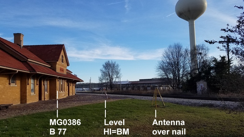
This and all the disks mounted vertically on building faces.?ÿ A lot of holes in the GPSonBM coverage could be filled with one turn of the level.?ÿ
Also consider that most disks along railroads were placed on bridges and culverts, hence likely places to be under trees especially after a rail line was abandoned.
I used this setup to check whether the difference from the geoid model for another mark in the area made sense. Of course I couldn't submit this on to NGS.
When I ran the 4000 series receivers I used GPSurvey and other old school Trimble software.?ÿ It had a feature where you could see a line graph of the data for each satellite for each observation.?ÿ I often had sites where there were high trees on part of the horizon but I'd keep the mask low so as not to block low satellites on the clear parts of the site. When I looked at the data I'd always see that the birds that were playing peek-a-boo through the trees would have broken data.?ÿ Typically the L2 would be dropping out and sometimes I'd lose the whole bird for a bit while something was blocking it.?ÿ Looking at the front screen during the observation I might think I'd pulled 5 birds steady with a couple others coming and going.?ÿ The data in the office would show that the five I thought were good had breaks in data and more positional variance than a cleaner site would have yielded.?ÿ
This is exactly why NGS should permit eccentric observations for GPS on Benchmarks.?ÿ
I argue that we are happy with 1 cm vertical error on the GPS session, and any construction level used with care can transfer elevation with an error of less than 1 mm per turn.?ÿ If they trust me to measure up to the antenna, why don't they trust me to do the level operation?
One hitch is that they would have to alter the OPUS Share software so that it didn't automatically take the horizontal position from the file, and they probably don't want to tinker with that.
?ÿ
Need more info on how long your observation was. There is no physical reason that the antenna could not have been 1 or 2 meters above the mark. If you are using a legacy receiver it pays to do preplanning and block the receiver from even searching for satellites that are not there during your session. That site should have given you 6 to 8 satellites at any time during a 5 hour observation.
Paul in PA
4.5 hours.?ÿ And I don't think shortage of satellites was a problem.
Why would it help to block satellites that it isn't going to receive? I can perhaps see benefit in blocking satellites that it is going to receive but never get above 10?ø so that they don't use up a receiver channel when something better might be visible.?ÿ The 4000sse has 9 channels of L1/L2.
Are you confident that putting the antenna higher would help? What is your reasoning??ÿ If you are sure, I'll work on a taller setup.
I chose 0.5 meter height above the disk to avoid stability problems in a breeze. Starting with the disk so high above the ground, some inventiveness is required to position the antenna solidly. Note that I can't get a pole centered on the disk due to the position of the cannon.

How about a shorty pole and a bipod?
Metal is about the worst source of reflection multipath.
When I have to try to shoot gps with the R12 between the metal hangars at the airport, after I get too close I lose my fixed until I back away from the siding.
?ÿ
Since a pole can't sit on the center of the disk with the cannon in the way, I have to rig something non-standard to center the antenna over it. If I was getting height for my own purposes, I would allow for an offset, but NGS requires it centered.
So whatever I rig up centering and stability are the constraints. Height, stability, and complexity are the tradeoffs.
I worry a lot about metal surfaces that can reflect signals into the antenna from above. I was hoping reflections from below wouldn't be a problem when using the big ground plane.
I can't rule that out, but there are no suspects in plain sight.
To test that, I guess I could simultaneously run my second receiver a few meters to the side and more in the open. If it had similar poor performance it would support that hypothesis.
Older receivers will look for any of the 31 active satellites, not finding one they will look for another PRN number. So PRN 12 may be visible and then goes behind a branch, the receiver will look for the next number in it's search order, PRN 12 may soon reappear from behind the branch but the older receivers may not get around to looking for it for a while. With only 9 channels available if it is tracking 5 sats, it will run through the other 26 on the open 4 channels, one at a time. If you have a 5 hour observation window tell the receiver not to look for 12-18 PRNs that will not be in the sky at all. Therefore the receiver has a shorter list to go through and is more likely to get the next signal sooner. I found I had to do this with my 12 channel Z-12 receivers because they were slow to go through the constellation. My current Z-Xtreme is only 12 channels but it goes through the search routine faster and I have never felt I had to force it to economize. It is slow to get above 8, but generally 8 is enough. Most of my sessions end up with 9 or 10 for the later hours.
No, I am not confident that a higher antenna will cure your problems but I am confident it will not hurt. That "C" type frame is less stable than a stiff box frame 5/8" threads bottom and top around the cannon. I would also bungie cord one three legged bipod legs to the muzzle of that cannon. Then from my assortment of parts use a 2' rod extender section or some of the 1/2 meter ones that came with some old receiver setups. When a lot of surveyors were doing L1 only fast static with an antenna bar to mount a second antenna a fixed difference from the base those antenna offset bars had 5/8" threads at each end, two of those on a short rod may be stiffer than your setup.
Paul in PA
I don't have any direct knowledge of this, there are quiet rumors the gubmint may degrade GPS around sensitive military installations such as that.?ÿ
I mean, if that data were to fall into the wrong hands ...?ÿ ?????ÿ
?ÿ
No military installations that I know of in the area, and this week's test session with no problem was much closer to the major defense contractor.

Maybe cover the cannon with a heavy blanket.
?ÿAs a rule of thumb, anything that wouldn't readily heat up in a microwave oven is nearly transparent to the GPS signal. I think that includes cloth. If water-soaked it might help but I don't know how much.

I'm not sure multi-path would be an issue here.?ÿ From the photos the cannon looks to be mostly lower than the antenna and thus the wayward signal would have to come from below.?ÿ I think the antenna is shielded from the bottom.?ÿ Please feel free to correct me if I'm wrong.
Anyway, if you are going to re-occupy I would suggest you do it soon.?ÿ If the trees are not the culprit, they will be soon.
I raised the antenna to 1.5 m and rigged an additional brace at 90 degrees from the first using a second tripod.
I'm collecting data right now. After starting, I did a little of Paul's suggestion of disabling sats that won't be seen. I misread the list and missed some useful sats for a couple minutes. Oops. Now I need to remember to enable all sats before next session.
Also got 2.5 hours with 2nd receiver out in the open.
We'll see how it turns out, maybe tomorrow. Won't run it past 0000 UTC, which would delay results.