East coast desk jockeys are meddling in midwestern affairs again. How would you determine the disputed center and the trademarked claim?
https://www.nytimes.com/2017/01/25/science/north-america-geographical-center-north-dakota.html?_r=0
How would you determine the disputed center and the trademarked claim?
Hmm. I imagine it could be computed from ITRF coordinates. Eratosthenes would have known how to do it. But one mayor challenging the other to a charity boxing match may just put the math and map projections debate to rest. When is the bout?
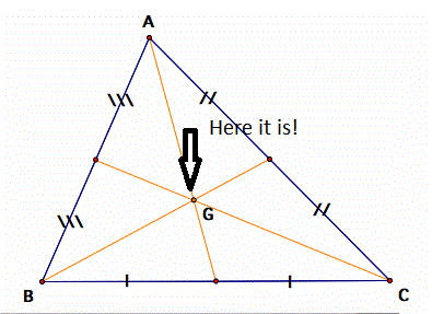
Plot it and find the center of gravity of the plot.
Dishonest elites. Mar-a-Lago is center of our great nation. So sad!!!
#fakegeography
MathTeacher, after reading your post I could only think that they do not have a standard way to compute Geographic Centers.
Now this could be a county or a State or the United States (48 or all 50 ?). After reading Prof. Peter A. Rogerson paper;
"A New Method for Finding Geographic Centers, with Application to U.S. States" I was correct.
Now the Professor states on page 1 of the above paper; "A consequence is that the geographic center is the location that minimizes the sum of squared distances from all points with the region to the center". On page 2 he brings up questions that should be answered, "should one allow a three-dimensional
solution for the center to be at a location under the earth's surface?", Are islands outside of the mainland included?, Are coastal waters included?, Inland lakes?
Just what type of projection system should be used and why?
Some of the people doing this kind of work used a Sphere.
What I would like to see is to use NAD83/WGS84 Ellipsoid and put this into the statement of how you would calculate the problem (see above
statement about minimizes the sum of squared distances).
With the computing power we have today using an Ellipsoid (not a sphere or some map projection) would be the way to go.
Now the Professor does give a statement (Paul in PA might like this one) "A more accurate projection would take into account the fact that the earth's shape is not a perfect spheroid (sphere). Boscoe (Boscoe,F. 2001. A new calculation of the geographic center of Pennsylvania. The Pennsylvania Geographer
39(2):38-47." Now Boscoe (2001 paper) evaluated the sensitivity of the results to this assumption; for a state the size of Pennsylvania,
the location of the geographic center would only change by about 8 meters".
Well 8 meters is 8 meters. Just where would the geographic center of the 48 contiguous States be using an ellipsoid? He gives an answer using his projection system
that he explanes in his work.... N 39.8355 Deg,W 99.0909 (Where is it on an ellipsoid?)
I will have to exchange some e-mails with the Professor and read some of his references.
All in all very interesting subject.
JOHN NOLTON
MathTeacher, post: 410755, member: 7674 wrote: East coast desk jockeys are meddling in midwestern affairs again. How would you determine the disputed center and the trademarked claim?
https://www.nytimes.com/2017/01/25/science/north-america-geographical-center-north-dakota.html?_r=0
People drive me crazy. I hope they have a good heated battle (in which case nobody wins but the lawyers) and by the time they are done the big one will take a chunk out of California or Sea Level will take Florida or some other doom will substantially modify the land mass placing the center Far from the current centers of the continent.
My simple rule of life. Beer is always the answer.
[USER=225]@JOHN NOLTON[/USER], you've given this a lot of thought. Adams and Deetz are personal heros to me, so it was interesting to read their thoughts. I must confess that I didn't read the professor's work until you shared it and your thoughts. The variations in density from coast to coast would seem to confound any exacting center of mass determination. Like the average temperature that climatologists use, it would be based on sample points.
I think that the math is beyond both my mind and my resources. So, a very precise, mathematically sound solution. Is out of my reach. I applaud you for your thought process.
The professor is concerned only with the 48 states and DC, while the mayors and the bar are looking at all of North America. Maybe political success and/or beer broadens one's horizons or leads one to tackle even bigger problems. Hey, y'all, watch this.
For North America, the technique seems to be to create a flat map, convert lat/lon to x,y, calculate the center, and convert x,y to lat/lon. I would do something like [USER=379]@FL/GA PLS.[/USER] Maybe find the intersection of the diagonal from the northeast corner of Maine to the southwest corner of California with the one from the northwest corner of Washington to the southeast corner of Florida. That would get the US, but North America would remain unsolved.
All disagreements would be settled in a bar in North Dakota. Last person conscious has the last say, which he must immediately record on his phone, said recording to be shared with his significant other within 24 hours. No hitting or shooting allowed.
Bring it on, Professor!


