So I was cleaning the kitchen, cooking dinner and watching Cash Cab the other night. Don't know why, but I like that show. I caught part of a question and part of the answer. Something about the 13th step on a State building having an elevation of 5,280 feet above MSL. Denver, "the mile high city" I think- Any of you Colorado boys verified this or know what they are talking about. just curious.
Jerry Penry posted something about this awhile back, on the old POB board.
I think it was about this NGS mark:
KK0358_U.S. NATIONAL GRID SPATIAL ADDRESS: 13SED0078798923(NAD 83)
KK0358_MARKER: DD = SURVEY DISK
KK0358_SETTING: 30 = SET IN A LIGHT STRUCTURE
KK0358_SP_SET: STEPS
KK0358_STAMPING: 5233.25
KK0358_STABILITY: D = MARK OF QUESTIONABLE OR UNKNOWN STABILITY
KK0358_SATELLITE: THE SITE LOCATION WAS REPORTED AS SUITABLE FOR
KK0358+SATELLITE: SATELLITE OBSERVATIONS - June 27, 2009
KK0358
KK0358 HISTORY - Date Condition Report By
KK0358 HISTORY - UNK MONUMENTED COGS
KK0358 HISTORY - 1939 GOOD NGS
KK0358 HISTORY - 20041231 GOOD GEOCAC
KK0358 HISTORY - 20060611 GOOD USPSQD
KK0358 HISTORY - 20090627 GOOD GEOCAC
KK0358 HISTORY - 20100806 GOOD GEOCAC
KK0358
KK0358 STATION DESCRIPTION
KK0358
KK0358'DESCRIBED BY NATIONAL GEODETIC SURVEY 1939
KK0358'AT DENVER.
KK0358'AT DENVER, DENVER COUNTY, ON WEST COLFAX AVENUE, AT THE NORTH
KK0358'MAIN ENTRANCE TO THE CITY AND COUNTY BUILDING, 12 FEET NORTH
KK0358'OF THE NORTH WALL, 5 FEET EAST OF THE CENTER OF THE ENTRANCE,
KK0358'AND IN THE TOP OF THE NORTHEAST END OF THE FIRST STEP. A STATE
KK0358'SURVEY STANDARD DISK, STAMPED 5233.25.
KK0358
KK0358 STATION RECOVERY (2004)
KK0358
KK0358'RECOVERY NOTE BY GEOCACHING 2004 (BMC)
KK0358'MARK RECOVERED IN GOOD CONDITION.
KK0358
KK0358 STATION RECOVERY (2006)
KK0358
KK0358'RECOVERY NOTE BY US POWER SQUADRON 2006
KK0358'RECOVERED IN GOOD CONDITION.
KK0358
KK0358 STATION RECOVERY (2009)
KK0358
KK0358'RECOVERY NOTE BY GEOCACHING 2009 (LPC)
KK0358'RECOVERED IN GOOD CONDITION.
KK0358
KK0358 STATION RECOVERY (2010)
KK0358
KK0358'RECOVERY NOTE BY GEOCACHING 2010 (GAH)
KK0358'UPDATED HH POSITION RESOLVES TO WRONG SIDE OF W COLFAX AND IS NEAR
KK0358'EAST TIP OF GRASSY AREA AROUND BUILDING IN TRIANGLE FORMED BY COLFAX,
KK0358'14TH ST AND COURT PL.
KK0358'LOCATION IS ROUGHLY 133 FEET NORTHEASTERLY OF ACTUAL POSITION.
KK0358'A CLOSER ESTIMATE, THOUGH PERHAPS STILL NOT EXACT DUE TO PROXIMITY OF
KK0358'BUILDING, IS N 39.739860 W 104.990972
KK0358'TEXT DESCRIPTION SHOULD GET YOU TO THIS ONE EASILY.
KK0358'


I like that show too. The double your money video question at the end always seems easy, but it would be tough to risk all you had won.:-O
Cheers,
Radar
Or maybe this one.
KK0360 ***********************************************************************
KK0360 DESIGNATION - W 1
KK0360 PID - KK0360
KK0360 STATE/COUNTY- CO/DENVER
KK0360 USGS QUAD - ENGLEWOOD (1997)
KK0360
KK0360 *CURRENT SURVEY CONTROL
KK0360 ___________________________________________________________________
KK0360* NAD 83(1986) - 39 44 21.18 (N) 104 59 03.44 (W) HD_HELD1
KK0360* NAVD 88 - 1609.486 (meters) 5280.46 (feet) POSTED
KK0360 ___________________________________________________________________
KK0360 GEOID HEIGHT- -17.11 (meters) GEOID03
KK0360 DYNAMIC HT - 1607.950 (meters) 5275.42 (feet) COMP
KK0360 MODELED GRAV- 979,613.9 (mgal) NAVD 88
KK0360
KK0360 VERT ORDER - * POSTED, Code F , SEE BELOW
KK0360
KK0360.The horizontal coordinates were established by differentially corrected
KK0360.hand held GPS obs and have an estimated accuracy of +/- 3 meters.
KK0360
KK0360.The orthometric height was determined by differential leveling
KK0360.and adjusted by the NATIONAL GEODETIC SURVEY in 1992.
KK0360.* This is a POSTED BENCH MARK height. Code F indicates a distribution
KK0360.rate greater than 8.0 mm/km.
KK0360
KK0360.Photographs are available for this station.
KK0360
KK0360.The geoid height was determined by GEOID03.
KK0360
KK0360.The dynamic height is computed by dividing the NAVD 88
KK0360.geopotential number by the normal gravity value computed on the
KK0360.Geodetic Reference System of 1980 (GRS 80) ellipsoid at 45
KK0360.degrees latitude (g = 980.6199 gals.).
KK0360
KK0360.The modeled gravity was interpolated from observed gravity values.
KK0360
KK0360; North East Units Estimated Accuracy
KK0360;SPC CO C - 516,500.2 958,607.1 MT (+/- 3 meters HH1 GPS)
KK0360
KK0360 SUPERSEDED SURVEY CONTROL
KK0360
KK0360 NGVD 29 (??/??/92) 1608.571 (m) 5277.45 (f) ADJ UNCH 1 2
KK0360
KK0360.Superseded values are not recommended for survey control.
KK0360.NGS no longer adjusts projects to the NAD 27 or NGVD 29 datums.
KK0360.See file dsdata.txt to determine how the superseded data were derived.
KK0360
KK0360_U.S. NATIONAL GRID SPATIAL ADDRESS: 13SED0134698814(NAD 83)
KK0360_MARKER: Z = SEE DESCRIPTION
KK0360_SETTING: 30 = SET IN A LIGHT STRUCTURE
KK0360_SP_SET: GRANITE PEDESTAL
KK0360_STABILITY: D = MARK OF QUESTIONABLE OR UNKNOWN STABILITY
KK0360_SATELLITE: THE SITE LOCATION WAS REPORTED AS NOT SUITABLE FOR
KK0360+SATELLITE: SATELLITE OBSERVATIONS - June 27, 2009
KK0360
KK0360 HISTORY - Date Condition Report By
KK0360 HISTORY - UNK MONUMENTED USGS
KK0360 HISTORY - 1939 GOOD NGS
KK0360 HISTORY - 20041231 GOOD GEOCAC
KK0360 HISTORY - 20060611 GOOD USPSQD
KK0360 HISTORY - 20070322 GOOD GEOCAC
KK0360 HISTORY - 20090627 GOOD GEOCAC
KK0360
KK0360 STATION DESCRIPTION
KK0360
KK0360'DESCRIBED BY NATIONAL GEODETIC SURVEY 1939
KK0360'AT DENVER.
KK0360'AT DENVER, DENVER COUNTY, AT THE EAST ENTRANCE TO THE STATE
KK0360'CAPITOL BUILDING, AND AT THE SOUTH END OF THE STEPS. THE TOP
KK0360'OF A GRANITE PEDESTAL IN WHICH ARE CUT THE LETTERS USBM.
KK0360'NOTE-- THIS MARK WAS PREVIOUSLY PUBLISHED AND DESIGNATED AS
KK0360'BM (USGS) = W 1
KK0360
KK0360 STATION RECOVERY (2004)
KK0360
KK0360'RECOVERY NOTE BY GEOCACHING 2004 (BMC)
KK0360'MARK RECOVERED IN GOOD CONDITION.
KK0360
KK0360 STATION RECOVERY (2006)
KK0360
KK0360'RECOVERY NOTE BY US POWER SQUADRON 2006
KK0360'RECOVERED IN GOOD CONDITION.
KK0360
KK0360 STATION RECOVERY (2007)
KK0360
KK0360'RECOVERY NOTE BY GEOCACHING 2007 (TFW)
KK0360'RECOVERED AS DESCRIBED
KK0360
KK0360 STATION RECOVERY (2009)
KK0360
KK0360'RECOVERY NOTE BY GEOCACHING 2009 (LPC)
KK0360'RECOVERED IN GOOD CONDITION.
You're too quick Doug, I was going to suggest KK0360 also.
🙂
Loyal
thanks guys!
We like that show too!
Denver, 2009
Of course no surveyor's trip to Denver would be complete without a stop at the state capitol steps. If you go, head for the westerly side, facing the park and Denver City Hall.
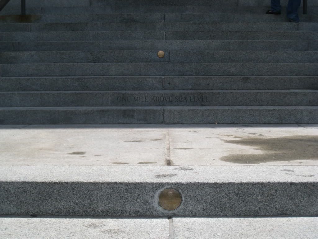
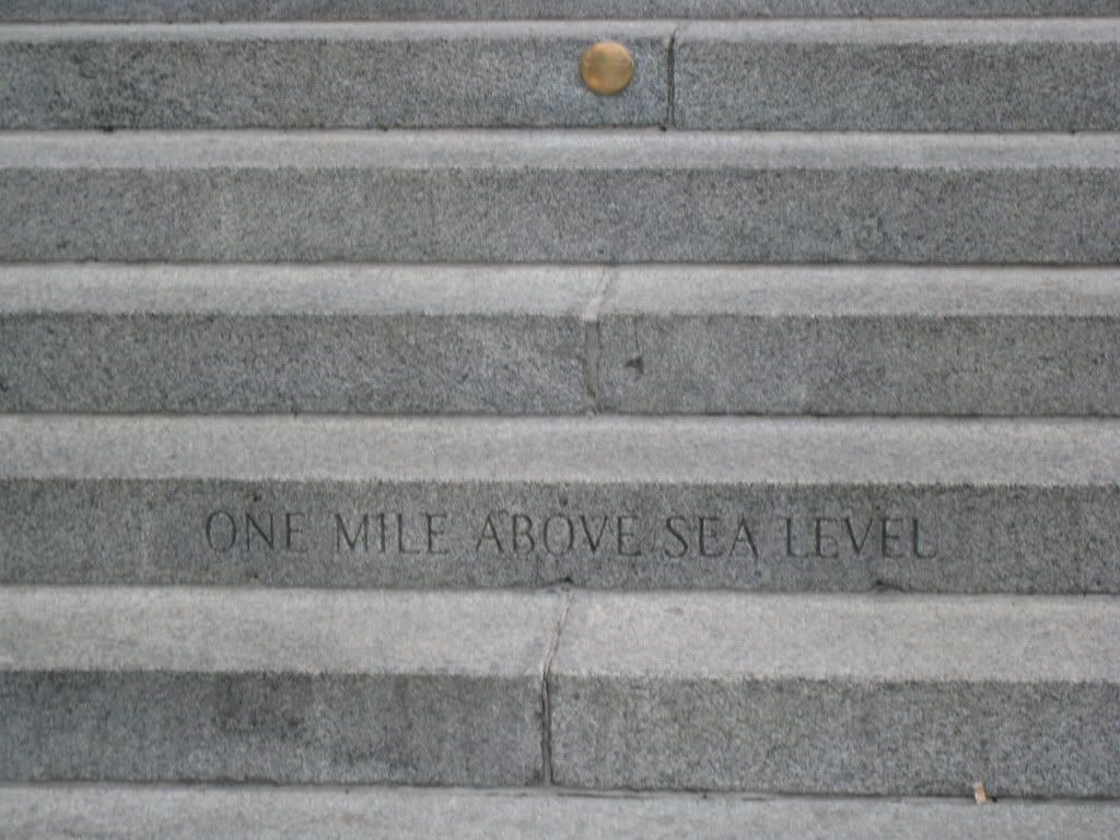
There are presently two disks. The first disk, in the fifteenth step, was set in 1909 and stolen several times, so after WW II, the building superintendent had the words "One Mile Above Sea Level" inscribed instead.
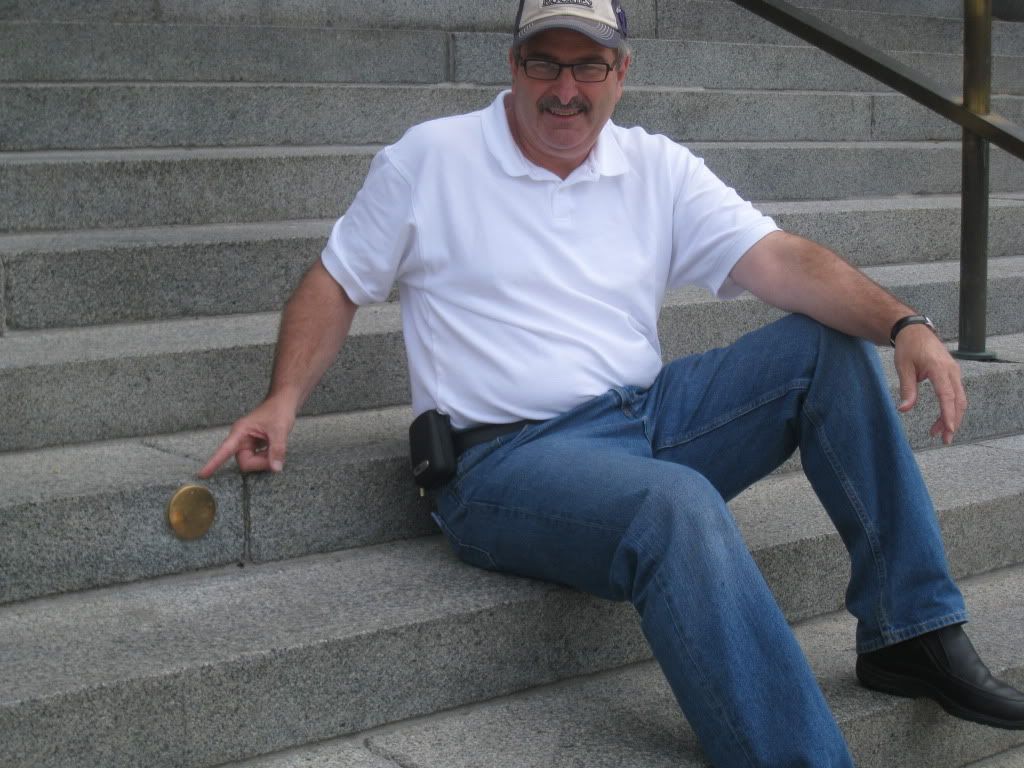
Another disk was set in the 18th step in 1969 when Colorado State University students resurveyed the elevation. In 2003, with a change in datum, a new location had to be marked, and so the 13th step was identified as being one mile high, where a 3rd marker was installed.
FWIW, the interior of the building is very interesting and worth a visit.
Denver, 2003
Here is a couple of pictures taken at the ceremony in 2003. Bill McComber said, on line, that his great-great grandfather would be there, and this is a shot I took of the old man (or so I presumed).
another image of the monument from 2003 immediately after setting.
The crew(s) ran a first-order benchmark to the capitol grounds, and transferred the elevation off of that mark to the steps where they installed the mile-high marker.
It is hard to explain to any laypersons why there are three different steps showing a mile high.


