

Ask A Surveyor
Public Group
Public Group
Active a week ago
If you are a landowner seeking advice from surveyors, please post your questions and issues here.... View more
Public Group
Organizer:
- Organized by
-
Group Description
If you are a landowner seeking advice from surveyors, please post your questions and issues here. DISCLAIMER: All surveying-related questions should be consulted with someone licensed in their jurisdiction and hired for professional services. The answers provided here are not to be construed as official advice from a professional that you would otherwise obtain in your local area.
Questions after a survey disagreement
Questions after a survey disagreement
peter-lothian replied 1 year, 2 months ago 22 Members · 30 Replies

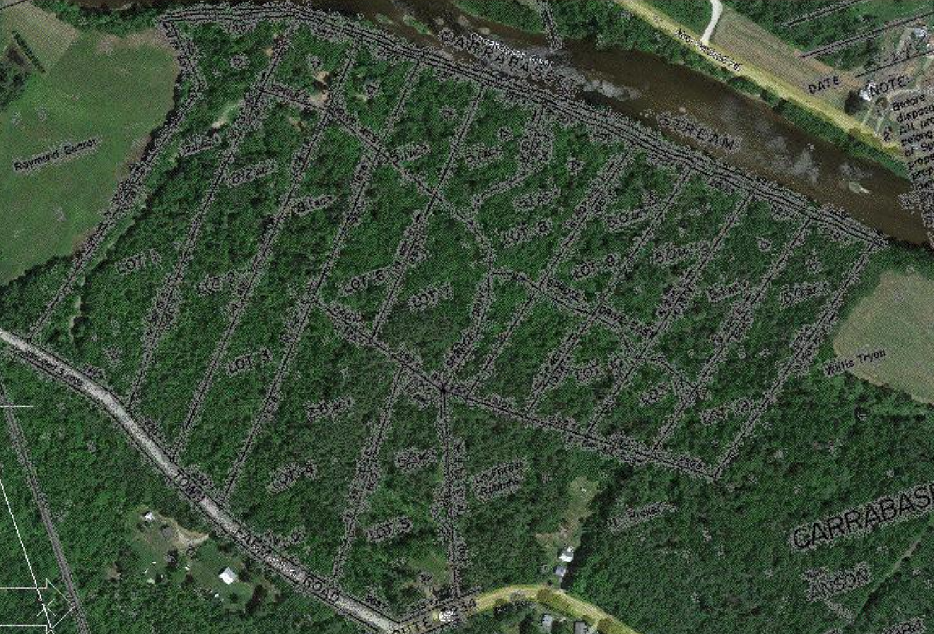
I know the mapping quality is poor, but I had to check. I think when the neighbors got together; they found a corners on the river and corners on East Spruce Drive. The surveyor, thinking this was going to be easy, ran a bearing between two of the corners that was close to the number on the plat. The plat bearings are about 15?øout from True North. The aerial indicates alignment pictorially like the plat line and not like the orange lines. I think the surveyor got it in his mind what the neighbors showed him and never tied enough corners to determine where in the world is Carmen Santiago.

I think the surveyor got it in his mind what the neighbors showed him and never tied enough corners to determine where in the world is Carmen Santiago.
That is certainly a possibility, but we still haven’t actually seen the more recent survey work and have no idea where the orange lines shown on the image the OP posted came from.
It is also possible that the lot owner has it set in his mind exactly what he wants to be his land and therefore sees the line as being different than the drawing without knowing. I know I have had to patiently explain why something someone “knew” did not jive with reality plenty of times.
Too many unknown pieces of information to even provide a suggestion other than to get in touch with the surveyor recently hired and seek a more detailed explanation (and do so trying block off preconceived ‘I’m right your wrong’ ideas).
OR
Hire another surveyor for a second opinion.

I don’t know how anyone can say anything about the state of the lot or the original subdivision. That plat is the only hard piece of evidence that we have seen so far. Absent any other evidence, there’s nothing to analyze.
You are correct, it??s hard to say much with so little evidence, it would be nice if the OP could offer more evidence. Perhaps post a comparison of the original plat and description and the new plat and description. I was only offering an opinion based on the hypothetical scenario the OP gave which is only one side of the story. We really can??t tell if the original and new survey are different until we compare them side by side or until we see it staked on the ground.
Asking who drew the orange lines would be a good question.
Historic Boundaries and Conservation EffortsOpps, lost the map.

In a subdivsion, every tract is related to every other tract. You cannot modify one without modifying all. You don’t get to pick and choose.

I have found things similar to this on rare occasion from surveys done in the 50’s around certain lakes. They would run a traverse line around the lake and close that loop and then run a spur line into the middle of the subdivision. Distances all match along the road. Distances match along the lake but the angles do not match. Again I do want to say that it is rare.

Sounds like you’ve worked around Barkley Lake where that’s not rare at all. Except the boundary is just copied from the Corps of Engineers survey and the rest of it is done with a compass and wheel through the hills and hollers not tied to the boundary in any particular way.
I have seen things like that in a couple of subdivisions along Rough River Lake. Although I would assume it has happened along many of the lakes built in that same era.

I’m wondering if the original poster hired an actual registered land surveyor, or just somebody with a few tools and enough know-how to look competent while buggering the job up. The “less-expensive” option, as it’s called.

Log in to reply.