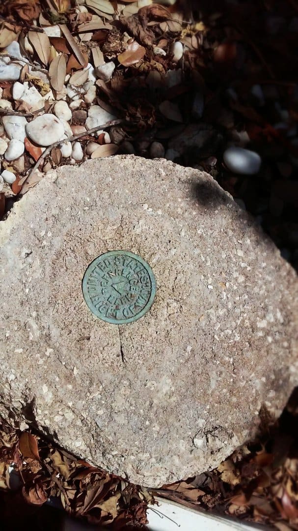
Interesting. Something I've never ran into.
Around here we do have plenty of Federal Lands, we even have National Park Property and Sovereign Native Nations...but never seen anything like that.
The term "Right of Way" makes me think the monument is from a bygone era. Most Federal bounds nowadays are placarded "NO TRESSPASSING - USE OF DEADLY FORCE IS AUTHORIZED".
I'd be interested to hear what you find.
I should add that this monument has the blue/green hue to it due to it's proximity to salt water, and the fact that it is rather blue/green would suggest that it is starting to corrode furthering paden's theory that it is from a bygone era. I should also add that it fits the block being surveyed by +/- .50 to the control in the road. There is a section corner about 500' from it that has been paved over and chipped up and paved over and chipped up so the control in the area is questionable, though the centerline stuff has been there a while. From what I found today, the used corners fit the centerline stuff pretty well. I take it the control on the block has been re-established and this monument has been perpetuated merely because it says "United States" on it. You don't mess with the eagle. Not to say that the whole block may be off the +/- .50 I found this one to be, if you were to hold it it's location.
it's a shame it's just gonna keep eroding away till its gone!!
Brian McEachern, post: 370800, member: 9299 wrote: Found an interesting monument today with wording I haven't seen. This monument is on the Intercoastal Waterway control line. I'm not sure of it's origins but will see what I can find. "United States Right of Way - Reference Marker"


The Intracoastal Waterway was first enacted in 1824 "General Survey Act" and construction continued into WW II.
I believe I would hold it over control in the road.
Paul in PA
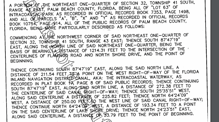
My search has revealed no useful information other than the adjoining deed calling for a "point on the inland navigational district right of way." 
Here is the plat noted in the description above. The plat is not complete and does not show the block where the monument is located. The monument is 70' east the bottom road "Flamingo" running north.
Paul in PA, post: 370849, member: 236 wrote: The Intracoastal Waterway was first enacted in 1824 "General Survey Act" and construction continued into WW II.
I believe I would hold it over control in the road.
Paul in PA
Would you hold it if owners on the line have used other monuments to run their fences and seawalls? If there was another that agreed I would agree with you, but because I found only one I would have to stick with what is being used.
I just noticed a "77" in the center of the tablet. Anybody else see that?
I do now! Addition to the mystery.
I believe it's under the "Navigable Waters of the United States", which the intercostal is surely governed by. And it's high in the pecking order of rights of way.
https://www.gpo.gov/fdsys/pkg/CFR-2011-title33-vol3/pdf/CFR-2011-title33-vol3-part329.pdf
http://legal-dictionary.thefreedictionary.com/Navigable+Waters
paden cash, post: 370903, member: 20 wrote: I just noticed a "77" in the center of the tablet. Anybody else see that?
It also says "reference mark". That may indicate that it is a witness to the real point nearby.
Brian McEachern, post: 370853, member: 9299 wrote: Would you hold it if owners on the line have used other monuments to run their fences and seawalls? If there was another that agreed I would agree with you, but because I found only one I would have to stick with what is being used.
It is boundary monument for a "Taking", so I definitely would not encroach past it. Any other claims may come up short.
It would behoove you to find the original coastal plans. In PA a PennDOT Plan is the official taking document and no deed document may have been filed, state or federal routes.
Paul in PA
Did you look for the other monument on the back of lot 4 South shore drive?
If you go to the Army Corp website, they have KMZ files with monuments and line work for the waterway. It took me awhile to find the right page, but was worth it. As with any large scale project, I am sure the accuracy of the surveying is subject to variable factors, but the area I just finished up was extremely tight.....and all the monuments were in once the search ties were computed up.
Terminus-NC, post: 371018, member: 11581 wrote: Did you look for the other monument on the back of lot 4 South shore drive?
If you go to the Army Corp website, they have KMZ files with monuments and line work for the waterway. It took me awhile to find the right page, but was worth it. As with any large scale project, I am sure the accuracy of the surveying is subject to variable factors, but the area I just finished up was extremely tight.....and all the monuments were in once the search ties were computed up.
Any chance you could post the link to the KMZ?
I might have used the wrong acronym (might be KML) but I will look tomorrow. It should be in my notes at the office.
Brian,
This is the link to the Wilmington NC area....You will need to look around a bit to find the area you are in.


