But what about the Consumer?
"I saw the monument, it was bent over..."
(surveyors are Not consumers)
Robert Hill, post: 436069, member: 378 wrote: There is no 'mound' just a bunch of rocks strewn upon the ground. Rock rubble. So various archaeo-cadastral experts have placed pipes etc. as to the center of the debris as defined by whatevers.
It isn't a stretch to say that it is the remains of a rock mound in that some of the rocks most likely remain in the same positions they were laid when the mound was built in the 1880s. The problem is that enough of the rocks forming the base of the mound are not in place that the outline of the original mound cannot be reconstructed with great certainty.
Were there no axle in place, I'd apply myself to the problem and would be relatively certain that I'd marked the center of the original mound within less than 1.0 ft. That's the native uncertainty of the problem that adopting the axle sidesteps for good reason.
I think I've previously posted about a scattered mound that had been built in 1853 that had two bearing trees nearby, large live oaks that initially struck me as an unlikely basis to replace the corner with less uncertainty than choosing the center of the mound based upon the scatter. After some more analysis of the live oaks, though, I realized that they actually provided a way to replace the corner with very little uncertainty. The position of the corner computed from the live oaks and another corner about 1800 ft. away was 1.23 ft. distant from the center of the scatter. As the mound loses its pattern, that form of real uncertainty increases
Peter Ehlert, post: 436103, member: 60 wrote: But what about the Consumer?
"I saw the monument, it was bent over..."(surveyors are Not consumers)
I have yet to meet a landowner who would give a leaning axle flagged up with surveyor's ribbon a second thought, particularly on in the remote location where that one is.
Kent McMillan, post: 436053, member: 3 wrote: Well, it's impossible to idiot-proof the world, but in this case, considering the mechanics of how the axle will actually get tied in future resurveys, I'd always bet on easiest method. Expecting some survey party to do a meticulous job of locating the center of a leaning axle some measured distance below the top would be a losing bet, particularly given the remote location where that rock mound and axle falls.
Another reason to carry a plumb bob
What if the top of the axle were to be leaning even further over so that a rod tip would not rest on it while using the bipod. Would you still hold the top?
roger_LS, post: 436111, member: 11550 wrote: What if the top of the axle were to be leaning even further over so that a rod tip would not rest on it while using the bipod. Would you still hold the top?
That would no longer be a practical reference point for present day surveying methods. So the advantage of using the axle as found would no longer exist. In the days of transit and tape methods, some types of marks were used that are not very well suited to modern methods.
An extreme example is a rebar that i found one time that had been driven horizontally into a bank of weathered limestone. The exposed end of the bar marked a corner that fell on the bank where it could not be marked very well by any method. The end was not particularly easy to tie, but was probably the best option among those available.
paden cash, post: 436109, member: 20 wrote: Kent always carries a plumb bob..see attached referenced diagram:
I actually do carry a plumb bob, but in the bag where I carry the 3/8-inch spikes because that's when I need it, i.e. when I'm setting offset spikes in line with some feature like a fence post or mark on a bearing tree.
Kent McMillan, post: 436112, member: 3 wrote: That would no longer be a practical reference point for present day surveying methods. So the advantage of using the axle as found would no longer exist. In the days of transit and tape methods, some types of marks were used that are not very well suited to modern methods.
Ok, interesting. So that's the test of whether to hold top or base. If the rod tip can balance, hold top, if it slips, hold base. Very scientific.
roger_LS, post: 436135, member: 11550 wrote: Ok, interesting. So that's the test of whether to hold top or base. If the rod tip can balance, hold top, if it slips, hold base. Very scientific.
Yes, as professionals we must implement the law/adjust our methods to accommodate the Products available at the Big Box Stores. Make America Great Again.
---
we used what I call a Mud Foot or Snow Shoe. (sticking with Products available at the Big Box Stores). It screwed on the rod, but had a big blunt end so it would not sink into the mud while doing topo. I found they were super handy for Boundary work too... no slipping off the point.
BONUS: they last and last forever... and hold their length (for that vertical work).
I suppose it would be rather simple to get a common bolt/screw and use that
roger_LS, post: 436135, member: 11550 wrote: Ok, interesting. So that's the test of whether to hold top or base. If the rod tip can balance, hold top, if it slips, hold base. Very scientific.
No, if the axle is so slanted that the top is unusable as a mark, remove the axle and set a new marker that is functional. In that case, the axle marks no point at all so I would feel free to revisit the question of the location of the center of the mound de novo.
Some point at some arbitrary distance along the axle from the top is going to be more of a smudge than a marker, so it won't do. Practical tests aren't really as Rocket Scientific as you might imagine, but if you want to have stable boundaries, that requires actual monuments with definite, well-defined positions.
Peter Ehlert, post: 436139, member: 60 wrote: Yes, as professionals we must implement the law/adjust our methods to accommodate the Products available at the Big Box Stores. Make America Great Again.
we used what I call a Mud Foot or Snow Shoe. (sticking with Products available at the Big Box Stores). It screwed on the rod, but had a big blunt end so it would not sink into the mud while doing topo. I found they were super handy for Boundary work too... no slipping off the point.
BONUS: they last and last forever... and hold their length (for that vertical work).
I suppose it would be rather simple to get a common bolt/screw and use that
Obviously, I see the problem along more practical lines than expecting a survey party doing a boundary survey in some remote location to be carrying something that would be left in the truck 363 days of the year. The situation as posed is that the axle is leaning so steeply that it would not have even made a good mark to center a transit over using a plumb bob. Given that premise, the assumption that a surveyor, traversing with a transit, set the axle in its present position to mark the center of a rock mound no longer holds up since the axle is completely outside the expected range of what the responsible surveyor set in similar situations and there is no note otherwise in his private record of his work.
For example, here's one of his other axles marking the center of another rock mound [trigger alert: there is a fence corner post about 2.0 ft. away from the axle]. This rock mound most likely dates from 1857 based upon the evidence I've uncovered so far.
And here's another corner of the 1857 survey about 1100 varas away, a rock mound (found buried) with another axle set in 1965 to mark its center.
29 out of 72 so far.
Holy Cow, post: 436157, member: 50 wrote: 29 out of 72 so far.
That's the best you can expect at the drive-through window when there are so many surly customers who want to order something that isn't on the menu.
Kent McMillan, post: 436143, member: 3 wrote: Practical tests aren't really as Rocket Scientific as you might imagine, .
Apparently not. But how do you keep surveyors from disagreeing with this very unscientific test? Varying rod points thicknesses, weight of rod with bipod, these could produce very different results. The fall-out could be catastrophic with the land values in Texas where they are!
roger_LS, post: 436169, member: 11550 wrote: Apparently not. But how do you keep surveyors from disagreeing with this very unscientific test? Varying rod points thicknesses, weight of rod with bipod, these could produce very different results. The fall-out could be catastrophic with the land values in Texas where they are!
How do you keep Registered Professional Land Surveyors from using methods that place the center of a prism or GPS antenna in locations over the nominal center of the axle that differ by as much as 2mm? Oddly, that prospect won't keep me or any surveyor I know awake at night.
Peter Ehlert, post: 435907, member: 60 wrote: It was a very good year for city girls who lived up the stair
So now you're paraphrasing Ervin Drake? Niiice.
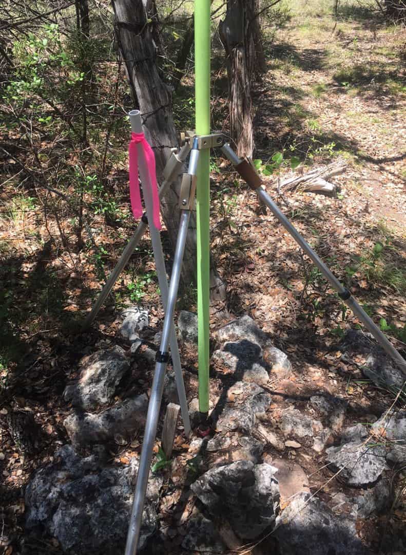
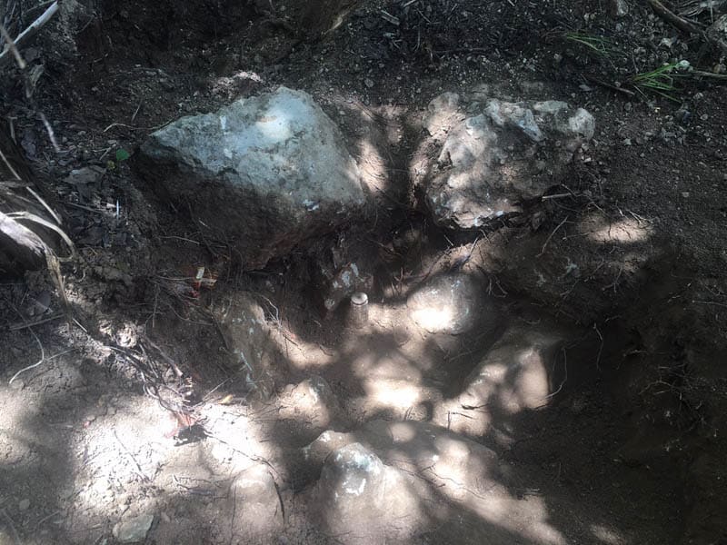
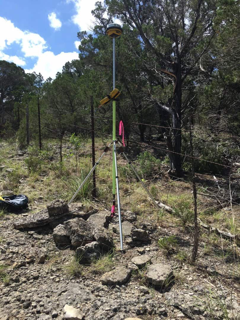
Kent McMillan, post: 435959, member: 3 wrote: In this particular case, the axle merely provides a reference point for the rock mound that was found in place and that still exists, somewhat scattered, around the axle. So the question would be the practical one of whether the machined center on the top of the axle as driven or the center of the axle at some point approximately where it disappears into the rock fissure will be the more definite and permanent. Here's a photo showing what's left of the rock mound:
Kent, as a practice, do you rebuild the mounds?
Jack Chiles, post: 436187, member: 24 wrote: Kent, as a practice, do you rebuild the mounds?
As a general rule, I don't because it tends to destroy the evidences of the age of the mound and to produce something that looks to be of more recent origin.
The exception to that rule is the case where the location of the corner can be determined with little uncertainty from bearing trees or some other similar evidence and where the mound is so scattered that it doesn't provide a basis for locating the corner. In that situation, I have rebuilt the mound around a new rod and cap marker at the corner and have noted that fact in the written description. With some care, you can leave the patinates surfaces of the rocks exposed so that the mound doesn't look newly made.
Building rock mounds is a useful exercise as a way to discover what sort of configuration works best given the material available in a particular location if the objectives are making the most obvious, stable mark for the least effort, which the 19th and early 20th-century surveyors seem generally to have had in mind. Some of the rock mounds that surveyors built were fairly tall stacks of flat rocks that were chosen to be obvious, rather than stable over the long term. Those are more typical of West Texas than Central Texas, where marked lines through the timber were typical. In both cases, an artificial appearance was the constant objective.


