from Trabucco v. Sorrels, 113 Cal. App. 401 (1931):
The witness C. A. Robinson, called on behalf of the plaintiffs, testified that he was a licensed surveyor in the state of California, and had been such since the year 1895; that at one time he was county surveyor of Mariposa County, and also of Merced County; had at different times been a United States deputy surveyor, located in California. This witness testified that he found the north quarter corner between sections 12 and 13, being the north quarter corner of the premises claimed by the plaintiffs. The testimony shows that one of the stones in this corner bore the inscription "1/4 corner". The location of this corner, as testified to by this witness, does not appear to be controverted. After finding this corner, the witness Robinson stated that a little later on he found the south quarter corner, being the south quarter corner between sections 13 and 24. The testimony of the witness, as to the location of this corner and the rocks constituting the same, appears in the transcript as follows: "I found the rocks constituting this corner; they are situate in the narrow crest of the ridge in what has been called a swag but which is the crest of a little ridge, that is in the field notes in the southeast corner of section 13, as well as that at the corner one-half mile west. There is a very dense amount of brush there; it is on the saddle where the corner is of the ridge, because it goes up hill. The monument is on the top of the ridge. This ridge makes a little elbow around in this direction and is rather regular until it comes to a turn where this swag commences -- a saddle is what I would call it. I found stones in a circular position well filled with soil on the uphill side, and at that time the entire belt was covered with dense brush which was burned out last summer so it makes it appear a little different now, and I was standing with my transit within six feet of it, but I could not see it for the reason that the soil has filled in on this up-hill side of this rock, a big rock; on the lower edge the end of the monument was exposed. I knew in my own way as surveyor that there should be a corner there, because I had always had success in recovering corners set by Herman, so I searched everything for two days. Herman's monuments were always substantial; I never failed to get one, and I have worked in Mariposa County and in the Whitlock country; I have been in there for years and I never failed to find a corner of Herman's. I knew the old monument was there; that monument had to check then and we called in an outside man to check with it. In my opinion it is the monument of the originalsurvey by Herman." This witness then went on to state that the corner checked with the field-notes of the Herman survey.
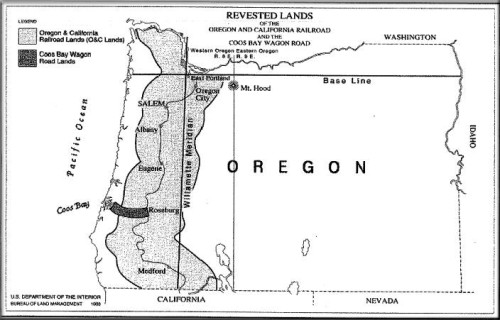
Thankfully, your Deputy Herman[n] was not the Oregon Congressman and attorney appointed by McKinley in 1897 to serve as GLO Commissioner. The Hon. Commissioner Binger Hermann thought the pretty maps in his D.C. office were superior to stones on the ground!
Later in the opinion:
"Mr. Bertken, a witness called on behalf of the plaintiffs, testified that he acted as flagman with A. G. Herman, United States deputy mineral surveyor, when a township plat was made of township 4 south, range 18 east, and during the survey they camped on Pete Trabucco's homestead; that while he did not assist in locating the quarter corner of the south line of section 13, between sections 13 and 14, he was there when it was located; that he saw the men working in marking the corner; saw them establishing the monument; that they used rocks in making the monument; that he had visited the property, off and on, for thirty years; that he visited the place recently and pointed out where it was. This witness also described the topography of the country where the monument was located, and where it was established by the United States surveyor; that he was up there the day preceding the trial; had no difficulty in locating the monument; that it was the quarter section corner on the south line of section 13. The witness Robinson to whom we have heretofore referred further testified as to the topography of the country; also recognized the photograph of the place where the monument is located; that he had no difficulty in finding the corner; that the monument he found there was, in his opinion, the original monument established when the Herman survey was made."
Plat says A.T. Hermann A=Aldolph. Santa Clara County Surveyor has a lot of his actual original field notes.
T4S, R18E, MDM.
Gene Kooper, post: 353776, member: 9850 wrote: Commissioner Binger Hermann thought the pretty maps in his D.C. office were superior to stones on the ground!
If you exchange pretty maps with expert measurements and D.C. office with his office; I could introduce you to a few of his relatives...LOL

There were some pretty maps; though...


