If the bearings quoted in the OP as N78-1/2?øW and N8?øW were as they appear in some earlier conveyance of the land, then they would be consistent with the hypothesis that the record bearings referred to magnetic North at some earlier date and would fit the declination estimates for the 1860s in that locality.
One item is missing. That "surveyor" that you hired, BUST HIM! BUST HIM GOOD!! He's not familiar with magnetic north? Really. Take all of the info you listed in your initial post and send it to your local State Board of Registration. I'm getting the feeling that this guy is NOT a registered Land Surveyor, and if so, he needs to be shut down.
A survey is indeed legally bindi8ng and there is a butt load of liability that goes with that.
While some do not like Title Insurance and t5hink it is worthless, I would never buy any property without it. If your realtor sold the property with title insurance, the least it should do is pay the costs to get this straightened out. ALL costs, from another survey to court costs and whatever it takes to make tou "whole" again.
The time ha come for you to hold somebody's feet to the fire. That guy that screwed up the split years ago? In my area he would still be held responsible for his error. If he is retired, too bad, he still is li8able. If he is dead, his "estate" is looking at a problem.
You have gotten some sound advice here, but by no means take it as a "suck it up Buttercup moment". You initial "surveyor" would indeed be hearing from my attorney as to what he plans to do to provide a professional survey of your property. (This is why many people now focus on government jobs and drone "surveys". The liability and heartburn are getting worse every day.)
It sounds like you got stuck with what we used to call "Shade Tree Surveyors". No license involved, but "we can fix your survey, be we won't guarantee it."
You've been had my friend. Now you have to decide what you are going to do about it.
Look at the caliber of surveying and advice that you are getting for free remotely. This shouldn't have to be outsourced.
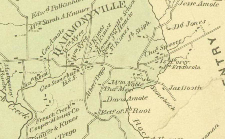
There are more than a few resources available on line. In the course of looking for 19th-century atlas maps showing Harmonyville, I turned up this map ca. 1873 at the link below. Note that Schoolhouse Road had not yet apparently been opened, although a school house is noted on the map on the other side of what is now known as South Hill Camp Road.
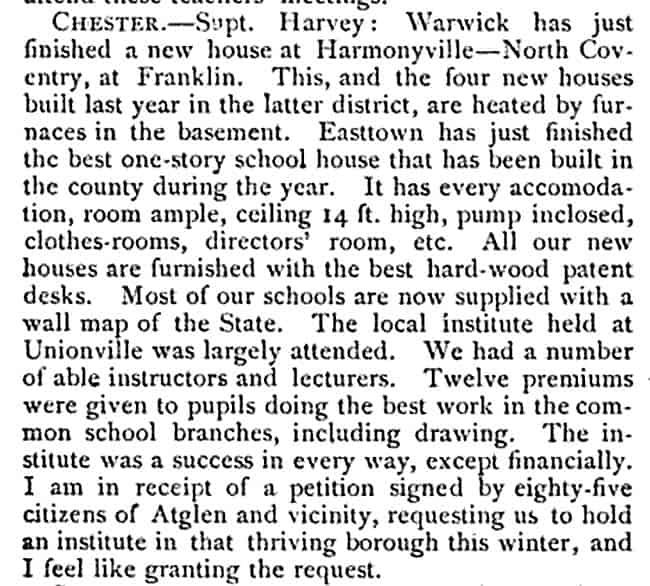
It wouldn't be a bad idea to try a title search with the name of the landowner, George Stoneback, noted on the 1873 map if a new school house was built in 1882, presumably on land conveyed for that purpose.
https://www.philageohistory.org/rdic-images/view-image.cfm/ARW1873.ChesterCounty.059.Plate55_Warwick
[USER=3]@Kent McMillan[/USER] Wow! some awesome research, Kent.
Tom Adams, post: 444708, member: 7285 wrote: [USER=3]@Kent McMillan[/USER] Wow! some awesome research, Kent.
Just an average day in the life of a colonial lands surveyor 😉
Tom Adams, post: 444708, member: 7285 wrote: [USER=3]@Kent McMillan[/USER] Wow! some awesome research, Kent.
If the deeds in the poster's chain of title don't refer to the sources of successive grantors' titles, the research may just go back to a school when the school property was sold, with no clue as to how some predecessor of the school acquired the property or when. A good title company should have plant resources to clear that one up, but you never know. So having an approximate date for when the land was first conveyed to a school and some names of possible grantors can be very useful (unless it turns out not to be).
For the record, my final guess as to what the true bearing of the West line of the tract will turn out to be is N13?ø38'W, which would fit a line originally run in about 1880 and reported as having a bearing of N8?øW in relation to magnetic North pretty well if the US Historical Declination estimates for the locality are as good as they are in Central Texas.
All this talk about stones, bearings along with old aerial photos is all well and good. The real issue is that you have a neighbor that "really knows where HIS property line is". If any of the above solutions do not meet "his expectations" you are going to have MAJOR issues!! = Hatfield and McCoy
I wish:
Somebody'd go over to this neighbor, with a piece of paper, with a link to this thread, and that they'd chime in.
It'd be interesting!
Ya know, i bet with all the info here, on this thread, there's enough info to call them!
N
What state are you in?
I enjoy problem boundaries and contrary to many of my peers enjoy solving boundary disputes, I mean that is one of our primary jobs. I do have a huge caveat when I take on a boundary dispute, BOTH PARTIES MUST BE WILLING TO RESOLVE THE ISSUE. I refuse to work with people who just want to be belligerent and hostile. I have more important things to do than be disrespected and mistreated. If both parties are willing discuss the issue and commit to resolving it then I am willing to help.
The worst thing you can do is hire a lawyer as your first act. Lawyers don't know a damned thing about surveying or boundaries and neither do judges. The surveying fees for resolving a boundary dispute can be high but it is nothing compared to attorney fees and court costs.
I also refuse to work with liars and thieves but that is a whole different topic of discussion.
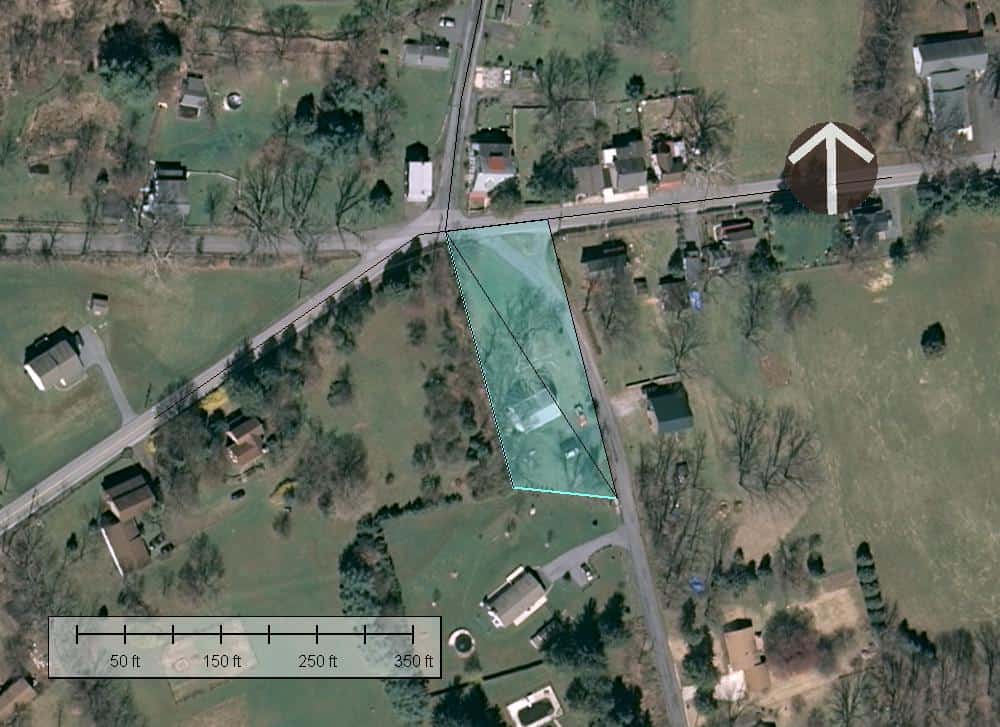
As the whole picture starts to emerge, some of the details make a bit more sense. Here is a sketch of the two triangles of land mentioned by the original poster. The true bearing of the paved road running East and West scales as about N84?ø20'E in modern georeferenced aerial orthophotos. This would be the same line that was described as having a bearing of N87?ø45'E in the OP. So the bearing basis of Triangle B would appear to be a "North" direction with a true azimuth of N3?ø25'W. That would give the hypoteneuse of Triangle B a true bearing of N32?ø25'W, which is within a few minutes of what one would estimate for the true bearing of the same side of Triangle A
One odd feature of the improvements on the site is the angle at which the structure is sited. However, it appears to be all on Triangle A and roughly perpendicular to the hypoteneuse.
The 1873 map of Warwick Township shows the segment of S Hill Camp Road running across Triangles A and B as straight. While that may be an artifact of map drawing, if in fact the road record showed the road as running straight for about 20 rods on a given bearing, then that might also explain why the bearing basis used in Triangle B is one that one would expect for magnetic bearings from the 1840s instead of a time nearer to 1882.
This is a case where the road records would probably contain some very useful information.
BTW, the difference between the property as represented on the county GIS (the red outline) and as where I strongly suspect it is actually located (the blue-shaded figure) is a textbook example of why tax maps are full of unhappy surprises for those who rely upon them when purchasing land or conducting boundary disputes.


