Rich., post: 355446, member: 10450 wrote: So my question, from a colonial state surveyor, would be....
If "surveyors today wouldn't notice a marked stone if they saw one" and "most" surveyors would just see the pipe with cap and use that as the monument....
Why not replace the hard to recognize stone with an actual monument, or a pipe with cap, and record it. This way future surveyors won't have to notice the hard to tell stones and things won't get as messed up like people complain they do.
This isn't 1890 anymore. We aren't traversing around the wilderness using stones, pits, and cairns any longer. So why not modernize and replace the stones in the same spot with something that will make the future easier... isn't that what it's about? Perpetuation, making things easier? And to me making things less prone to error is protecting the public.
Thats exactly what the GLO was attempting to do here. They were not expexting GPS weilding surveyors agruing about 1 link.
Is the difference between the stone and the pipe material to the use of the property?
If not, then only Surveyors care to split hairs.
Loyal, post: 355220, member: 228 wrote: Looking at a possible retracement this coming Spring, so I have been reading the Field Notes around the Section in question.
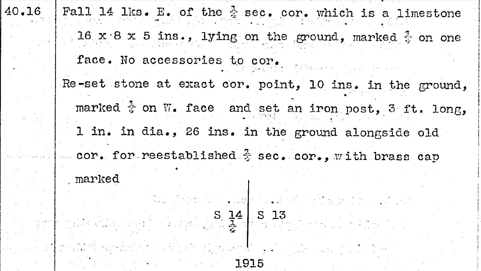
Four of the Seven Corners That I need to find/tie/whatever, have similar "1915 Cap alongside 1871 Stone."
OLD Pin-Cushion!
Loyal
If that is Salt Lake Meridian you're almost in my territory. Looking at where that is doesn't look like much is there, a foot or so probably doesn't matter that much. I think they stopped that practice about 1930 or so.
[QUOTE="Gene Kooper, post: 355254, member: 9850"]Just to be a contrarian, I disagree with you Loyal. The field notes do not leave me with the impression that the stone is OBVIOUSLY the corner. The stone is the [sarcasm]OLD[/sarcasm] cor.
The field notes state:
Set an iron post [skip the dimensions] alongside old cor. for reestablished cor. of secs. 22, 23, 26 and 27, with brass cap.
I wholeheartedly agree with you that the stone is the corner, but the 1915 GLO surveyor didn't (at least the way I read his notes). The shiny new brass cap is the [sarcasm]reestablished[/sarcasm] corner to him.
After finding the plats involved, I would say , that the scenario, that I was suggesting does not apply !
One thing that I wonder about is what does 'Res.' stand for, on the 1917 plat of the 1915 survey??
99% of the stones I've found in NE Texas are iron ore rock of different densities.
I usually drill a hole thru them and and insert a 1/2in rebar
Most of the others are rock mounds of varying size made of iron ore from the size of a baseball to no larger than a bowling ball and usually covered with dirt and sod and a mass of root growth.
Others are of the flat rock variety that may be no more than 2in thick with one that in the middle and set on its side with others laid flat around it.


