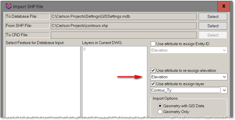
I imported a contour shape file tonight into a new drawing and everything is at zero elevation.
Is there some setting that might have changed?
How do I check a shape file before importing to determine if z values are present?
Paul in PA
You can open a shapefile in ArcMap or another software like QGIS to view whether or not the Z value is toggled on. If it is a contour shapefile I would think it is more likely that there is a setting in your Carlson software that may need to be changed.
Paul in PA, post: 385556, member: 236 wrote: I imported a contour shape file tonight into a new drawing and everything is at zero elevation.
Is there some setting that might have changed?
How do I check a shape file before importing to determine if z values are present?
Paul in PA
Presuming there is an elevation field within the SHP file, current versions of Carlson Survey have the ability to let you select the field as illustrated below. I hope this information helps.


