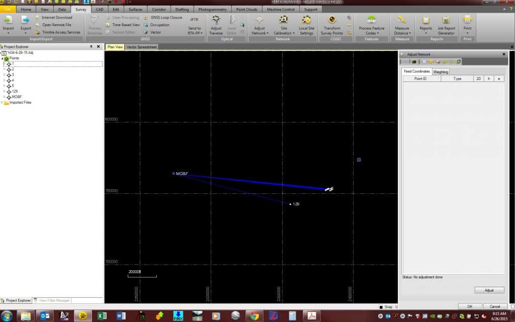
So I have a TBC project with GNSS data where I have 7 points and vectors from a CORS station. These points were all shot on two different days and I have a total of 3 vectors to each point. I am trying to adjust the network to hold the CORS station as fixed. However the points were shot as "topo" points and they are not categorized as Control and are not showing up in the list of control points.
Can I change the category of the points to Control? They were shot with Survey Pro 5.XX and not Survey Controller. I know how to check the box with the survey controller but I don't know what I can do now?
Any thoughts, suggestions?
Yes. You have to open the point manager thingy, select the CORS station point, and THEN in the upper right, add coordinate and you can then click on all of the triangle things and select "Control" and it should work.
Yes, I know that's a crapload of stuff just to do but it's Trimble and it took me forever to figure it out. If you don't make it a control point, it WILL adjust the value on the CORS station when you process it.
Cool, that worked. The CORS station is now "fixed", but the three different vectors to each of the control points are not being recognized as redundant observations. I must be doing something wrong....Each point was observed at a different time, stored under the same point number and the observations were stored as "store another" in the collector.
Well, since they are static, it would be hard to not have them as independent.
Under your survey setup thingy, there is a checkbox for "Weighted Mean of Like Observations". Make sure that is checked and then select those three baselines and process them all at the same time and it "SHOULD" process and average them.
Okay, beer thirty-five, I'm late! Ill report back on Monday. Thanks again
Kris,
I tried your suggestions and I was able to change the classification of the topo point to control. I switched the project properties to weighted means of like observations but no luck on processing them to get them to average. I am a little confused. There must be a setting somewhere I am missing. Thanks for your help.
StLSurveyor, post: 325111, member: 7070 wrote: Kris,
I tried your suggestions and I was able to change the classification of the topo point to control. I switched the project properties to weighted means of like observations but no luck on processing them to get them to average. I am a little confused. There must be a setting somewhere I am missing. Thanks for your help.
The points you want to process, must have a "topo or mapping" value, otherwise TBC wants to hold it as fixed.
I remember it this way, anything I don't want it's value to change to is control, everything else is topo. What you may also have is a baseline failure. It will only AVERAGE like observations so, if one fails due to whatever, and the others work, then it won't average them. Try processing independently to see if one fails or if you need to open the session editor and trim a cycle slip or something.


